Çakaristan
| Çakar Empire شاهنشاهی چاکار | |||
| |||
| Motto: صلح ثمره عدالت است Peace is the fruit of justice | |||
| Anthem: Azeem-o-shaan shahenshah अज़ीम-ओ-शान शहंशाह O majestic and noble emperor | |||
| |||
| Map versions | 17.0.3 - 17.3.1 as Ultimate Çakar Sultanate 17.3.2 - 17.4.8 as Great Apollonian Empire 17.4.9 - present as Çakar Empire | ||
| Capital | Agra Al-Hamra summer capital | ||
| Largest city | Manbai | ||
| Official language(s) | Babkhi Adarani Arboric Common tongue | ||
| Official religion(s) | Craitism | ||
| Demonym | Çakari | ||
| - Adjective | Çakar | ||
| Government | Hereditary monarchy and parliamentary democracy | ||
| - Shahanshah |  Xunpadshahan | ||
| - Grand Vizier |  Talal Sayfasad | ||
| - Legislature | Çakari Congress | ||
| Establishment | 1687 AN as Ultimate Çakar Sultanate 1698 AN as Great Apollonian Empire 1704 AN as Çakar Empire | ||
| Area | 18,416,602 km2 (7,110,682 mi2) | ||
| Population | 1,580,782,031 (census of 1750 AN) | ||
| Currency | Muhar (₼) | ||
| Abbreviation | CKR, CK | ||
| Mains electricity | 230/400 V - 50 Hz | ||
| Driving side | Mixed, see here | ||
| Track gauge | Mountain railways: 610 mm (2 ft) and 762 mm (2 ft 6 in) Apollonian Express routes: 1,435 mm (4 ft 8 1⁄2 in) Other railways: 1,676 mm (5 ft 6 in) | ||
| Calendar | Norton calendar | ||
| Time zone(s) | Multiple, see here | ||
| National website | Nation portal Youtube channel | ||
| National forum | none | ||
| National animal | Hoopoe (Upupa epops) | ||
| National food | Pilav | ||
| National drink | Tea | ||
| National tree | Monalan cedar (Cedrus deodara) | ||
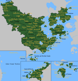
Çakaristan (/t͡ʃɑːˈkɑːɾi:stɑːn/), officially the Çakar Empire (Babhki: شاهنشاهی چاکار Shahanshahi-ye Çakar), is the continuation of the Great Apollonian Empire in the middle on the continent of Apollonia. It is the most populous country on Micras. Çakaristan is situated in the triangle of the Northern Sea, Orange Sea and the Strait of Pearls. The nation also includes the overseas territories of Sri Pashana, located on the island of Duras, Beneluccas and Lija, parts of the Skerry Isles and the Wilhelm Isles. Çakaristan covers an area of 18.4 million km2 (over 7 million mi2), with a population of almost 1.6 billion within 13 riyasats (princely states), 7 subahs (provinces), 5 governorates and 4 sarkars (districts). It shares land borders with Shireroth and Floria to the west, Hurmu and Lac Glacei to the north, New Alexandrian colony of Ijubicastagrad and International Mandate located on the Jaris Strait. The capital is Agra, the summer capital is Al-Hamra and the largest city is Manbai.
As a state, Çakaristan started after the Sylvanian National Awakening (1687 - 1688). Since there was no agreement on a constitution, only a sultan was elected: Abu Çakar. He was given the crown name "Akbar". Under his inspiring leadership, the sultanate expanded, formed its own unique culture and introduced democracy. In 1698 AN, Çakaristan has been unionised with Jingdao into the Great Apollonian Empire. But in 1704 AN the Second Kildarian Revolution occurred, leaving only the eastern part of the empire. This continued under the new name of Çakar Empire. Because of the assassination of Akbar, the Tobu Emperor, the Çakari succession crisis arose. As with the foundation of Çakaristan, a new Shahanshah was elected at a Grand Assembly: Hakim bin Alsalam. Therefore is the official name of the nation styled in Babkhi.
The nation sees itself as a continuation of the Great Apollonian Empire. Because of this, many consider the parts of that Empire that are no longer under the Shahanshah to be apostate. The official policy is to maintain the status of "Pax Apollonia" (Peace on Apollonia). Nevertheless, the Shahanshah holds the title "Padishah-i sharq-u gharb" (Babkhi: پادیشاه شرق و غرب): Master King of the East and the West. Thus, the Çakar Empire is also referred to as "Eastern Empire", but also as "Far Eastern Empire" because of the historical indication that the Apollonian Republic, a predecessor of the Great Apollonian Empire, was referred to as "Eastern Empire", which at that time included only the western part of the Empire.
Çakaristan is a member of the Apollonian–Benacian Community (ABC) and the Micras Treaty Organisation (MTO).
Etymology
The formal name is styled in Babkhi Shahanshahi-ye Çakar (a transliteration of شاهنشاهی چاکار). The name "Çakar" is derived from the family name of the first ruler, Abu (Akbar) Çakar. This Hasani name means "flashes", a possible reference to lightning. The short name has the suffix ـستان (transliterated in the Common tongue as -stan), which means "a place abounding in" or "a place where anything abounds" in Babkhi.
The name of Çakaristan in several languages:
| Language | Status | Short form | Long form | Transliteration |
|---|---|---|---|---|
| Babkhi | Official | چاکارستان | شاهنشاهی چاکار | Shahanshahi-ye Çakar |
| Adarani | Official | चमकतास्टेन | शाही चक्र | shaahee chakr |
| Arboric | Official | شاكارستان | الامبراطوري شكار | aliambiraturiu shakar |
| Common tongue | Official | Çakaristan | Çakar Empire | |
| Batavian | Regional | Tjakaristan | Tjakar Rijk | |
| Hasani | Regional | چاکاریستان | چاکار امپراتورلوقی | Çakar İmparatorluğu |
| Horjinic | Regional | 𐑕𐑩𐑯𐑥𐑜𐑒𐑦𐑑𐑘𐑙𐑒 | 𐑓𐑕𐑕𐑐 𐑙𐑥𐑧𐑨𐑒 | jakar empair |
| Jaihalam | Regional | ചകാരിസ്ഥാൻ | ചകർ സാമ്രാജ്യം | chakar saamrajyam |
| Kantic | Regional | ଚାକାରିସ୍ତାନ୍ | ଚାକାର୍ ଇମ୍ପାୟାର୍ | |
| Koriya | Regional | Чакаристан | Чакар Импери | |
| Nogani | Regional | Çakarstan | Çakar İmperiyası | |
| Qyzylqay | Regional | Çakaristan | Çakar Imperiýasy | |
| Samsrumukhat | Regional | चकरिस्तान | चकार एम्पिरे | chakaar saamraajy |
| Slavonjan | Regional | Čakaristan | Čakar Carstvo | |
| Thraci | Regional | Çakaristan | Çakar Empırı | |
| Catologian | Ecclesiastical | Çakaristan | Çakar Imperium | |
| Classical Kaikian | Ecclesiastical | Τσάκαρσταν | Αυτοκρατορία Τσάκαρ | Autokratoria Tsakar |
| Calbic | Foreign | Sacaristach | ||
| Jingdaoese | Foreign | 查卡帝国 | 查卡爾賈 | |
| Sanpogo | Foreign | チャカー帝国 | チャカリスタン | chakarisutān |
| Senyan | Foreign | Čakarëa |
History
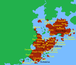
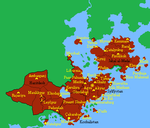
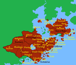
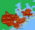
It is difficult to classify the period after 1440 AN to the foundation of the sultanate under one denominator. But because of the major changes not to assign it to an important period and the corresponding denominator.
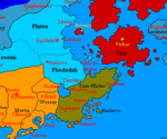
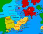
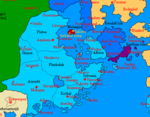
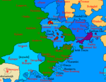
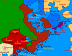
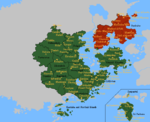
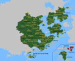
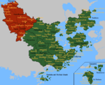
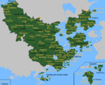
The first mention of habitation in the territory of the present sultanate is under the flag of the Free Republic. In 1468 AN, the Republic of Baracão was established, its territory being referred to as Red Island. Shortly this republic was replaced by Freenesia. After the fall of the latter nation, the territory was reduced to The Green. At the end of the 15th century the area came under the flag of Emirate of Baatharz, shortly before this nation was taken over by the Kingdom of Babkha. The north of the sultanate was under the flag of Dinarchy of Antica with the name Phedodah.
In 1498 AN the Babkhan territory on Apollonia briefly came under the flag of Crusader State of Eblis. At the beginning of the 15th century Antica was incorporated into Imperial Republic of Shireroth, as a result of which Phedodah bordered on the Babkhaan province Terre d'Riches. Until the Republic of Antica regained its independence in the second decade of the 16th century. The areas of Phedodah and Terre d'Riches came under the Antican flag, except for the coastal islands which remained under Babkhaan flag. Between 1514 and 1519 the peninsula and the coastal islands were abandoned. In 1519 the earlier Terre d'Riches again came under the Antican flag and became part of Lower Phedodah.
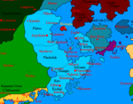
In 1597 AN the territory of the empire was abandoned except for a few border areas, the Empire of Aryasht came into being. Not much later the coastal islands were reclaimed. In 1607 AN Aryasht became part of Shireroth. In the same year a large part of the territory of present-day Çakaristan became a nation: Jingdao. This nation left the area in 1613 AN.
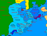
In 1619 AN Aryasht became part of the Apollonian Republic of Shireroth's East, which became the Empire of the Great Jing. Jingdao also claimed the peninsula in 1630 AN and retained the area for two Norton years. On a few exclaves the area was left to the green. This remained until 1650 AN with the foundation of the Khanate of Krasnarus. The western boundary of the khanate still determines the subdivision of the sultanate. In 1691 AN, Krasnarus founded the Kingdom of Krasnocoria together with the neighbouring Kingdom of Coria.
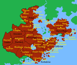
-
15th century
-
1498 AN
-
1534 AN
-
1551 AN
-
1567 AN
-
1589 AN
-
1605 AN
-
1608 AN
-
1621 AN
-
1631 AN
-
1667 AN
-
1684 AN
Between 1680 and 1685 a civil war raged on the peninsula, the Hasani War. This civil war is seen by many as a prelude to the later Sylvanian National Awakening.
First Çakari Era
On the eve of the collapse of Krasnocoria, unrest arose in Krasnarus between the different population groups. Representatives of the Coriaks, Hasanis and Nogans united to fight for independence. There was also support from the green and from the Emirate of Arbor. This uprising was called the Sylvanian National Awakening. On 4.XIII.1688 AN the uprising was officially ended and the sultanate proclaimed. Since there was no agreement on a constitution, only a sultan was elected: Abu Çakar. He was given the crown name "Akbar".
Less than an hour after his coronation as Sultan, an assassination attempt was made on Akbar. Fortunately, the sultan survived the attack, but a Grand Vizier was appointed to start the government of the nation.
At the second major meeting in Red Fortress, it was decided to establish the name of the nation. Until then, "Sylvania" was used, a name for the area from the Antican period. That name means "from the forest" in Catologian, referring to the streams and rivers that flow from the densely forested highlands. The name of the nation was chosen: Çakaristan. The first parliamentary elections were held in 1691 AN, with which a new Grand Vizier was also elected.
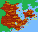
-
1688 AN
-
1689 AN
-
1690 AN
-
1691 AN
-
1692 AN
-
1693 AN
-
1694 AN
-
1695 AN
Great Apollonian Era

In 1698 AN unionised Çakaristan with Jingdao to form the Great Apollonian Empire. The Sultan became Emperor of Apollonia with the titular name Tobu Emperor. Attempts to turn the Empire into a stable power with a democratic basis failed. After six Nortonyears, the Second Kildarian Revolution occurred and resulted in the division of the Empire. The Emperor was assassinated and the Çakari succession crisis occurred because the succession had not been arranged.
Second Çakari Era
To stabilise the remaining empire, a triumvirate was set up. This made it possible to organise another Grand Assembly, at which a new ruler was appointed. The elected ruler became Hakim bin Alsalam. As a compromise, called the Pilav Compromise, the royal title was styled in Babkhi. This also changed the name of the empire. Then they worked on a constitution, based on the so-called Akbar Papers. Notes that Akbar had made to write the constitution for the Great Apollonian Empire.
The new constitution, the Akbar constitution, was adopted, on the basis of which the state was further structured. The constitution lists the fundamental rights, regulates the succession and establishes the other state institutions. Staged elections to the partly new Çakari Congress were held in 1705 AN, beginning the constitutional cycle of elections. At the elections for the Grand Vizier two years later, the appointed Grand Vizier, Jayanti Sinha, was elected for another four-year term.
Among the elite in particular, there is a great desire for a grand empire. The fall of the Great Apollonian Empire is seen by them as a great loss. There is less of this sentiment among the population, but there is great support for the recent empire expansions:
-
Sunehra and Tartaristan
-
Kantisha and Northak Islands
-
Barikalus
-
Beneluccas
-
Jaguda, Kyazilkai, Nuristan, Vashigol, West Pathaardesh and West Tartaristan
-
Kadim and Taka'atui
-
Rouge, Wayfarer Atoll and Tarria
-
Lija, West Sandwich Island and West Duras
-
Jazirat Al-Borani
-
Jaihabar
-
Northeastern Jaihabar
-
Jazirat Hintar
-
Çexit: Leaving Corum, dismantling of Jaihabar
-
Sanpantul independency
-
Naudia'Diva
After the Arboric Civil War, which raged between 1701 AN and 1704 AN, Çakaristan was the chief peacemaker in that country. Therefore, the largest area was occupied by Çakaristan. After the completion of the Dasil Agreement and a referendum, Barikalus became part of the Empire. In 1711 AN, Qyzylqaystan joined the Empire. In 1697 AN, Çakaristan had already invaded this area to stabilise that part of Jingdao at the outbreak of the Post-Chidao Troubles. As well as the terrorist attacks in Fatehpur and Manbai, committed by Seishi rebels. Although the Çakari left during the period of Great Apollonia, the Qyzyl retained their hearts for the Çakari, choosing to join the empire.
Çakaristan had been at war with the former unincorporated territory of Sanpantul between 1716 and 1720 AN. In the process, parts of Beneluccas and Sri Pashana are occupied by Sanpantul and no longer under the control of Çakaristan. In 1718 AN, West Sandwich Island was ceded to Çakaristan by Nouvelle Alexandrie and Passas' territories in the region were also ceded to Çakaristan. This changed the position of Çakaristan and the course of the war. In 1720 AN, the war ended and, through the Cenfae Accord, Sanpantul was incorporated as a princely state. In 1728 AN, Sanpantul became an unincorporated territory again. Finally, Sanpantul became independent in 1745 AN after a referendum.
Between 1719 and 1739 AN, Çakaristan also had territory on the continent of Corum. A princely state called Jaihabar had been founded there, which was abandoned after a short conflict. In 1745 AN, the Isle of Naudia'Diva became part of the Empire. It formally became a governorate, but with a special status of “cultural reservation”.
Story series

An important part of the history is told in different story series. The foundation of Çakaristan is recounted in the Sylvanian National Awakening. This was followed by the Chronicles of Akbar, simultaneously with the mission stories of the brothers of Akbar. The later annexed Barikalus also had its own story series, The Micras Chessboard.
There are single story series for state visits. Mainly story series were written for each ruler, the Jaaguzannama and the Xunpadshahannama, each several parts. The current story series is the Blossoming of the Dragon.
Timeline
All the main events are listed chronologically in a timeline. This gives a good overview of the developments of the nation from 1680 AN onwards.
Geography
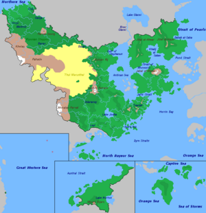


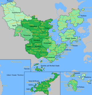
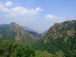
The south-western border is dominated by the Monalan Parvat (Monlan Mountains). The outflowing rivers to the east form a widespread floodplain. The main rivers are the Adaraney and Leyl, which drain into the North Raynor Sea. The Leyl River is the only outflowing river of Lake Jodha, the fourth largest freshwater lake on the continent of Apollonia.
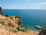
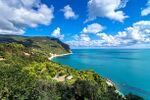
Surrounding the lake is a relatively flat land, which gradually rises to the south to the ridge where several small streams originate. From the west, the southern coast begins with a marshy area, protected by the coastal island of Rulak. On and in North Raynor Sea are some areas: the peninsula with the city of Fatehpur, Kantisha Island and the Northak Islands as part of the Norfolk Isles. The continental coast to the east is characterised by cliff rocks up to the Azure Sea where the Dyre Islands are located. The coast around the sea is referred to as the Çakari Riviera. The Silsilat Jibal Silfanyan (Sylvanian mountain range) lies between the Antican Sea, Dyre Straits and Herrin Bay. The northern spur of that ridge separates the Antican Sea and Lake Jodha. This ridge ends in front of the Saphed Pahade. This mountain formation forms together with the Bulqan Rij a natural wall against the Thul Marusthal (Thul desert) west of it. This natural wall ends at the Barax river, which flows into the Antican Sea.
Kendall Isle is surrounded by the Antican Sea, Strait of Monemici, Pond Strait, Herrin Bay and Jaris Strait. The island is dominated by the Jabal al-Mada', the major provider of several streams that wet the island. The main island is surrounded by several coastal islands.
The land mass of Barikalus can be roughly divided into two peninsulas, separated by the Khalij al-Salam. The western peninsula is dominated by the Jibal al-Ahmar (Arboric: جبال الأحمر): the Red Mountains. Between these mountains and the River Glacei lies a watery lowland. Along the west coast lies a fertile coastal strip called: Qitae al-Bahr (Arboric: قطاع البحر): Sea strip. The southern coast along the Strait of Monemici is dominated by rocky cliffs and coves with sandy beaches. Between the two peninsulas lies the Khalij al-Salam (Arboric: خليج السلام), which is surrounded by a lowland. North of the gulf is the Maerifa Plain, which rises up to the northern border. The eastern peninsula is dominated by the Jibal al-Hajar (Arboric: جبال الحجر): the Stone Mountains. The area between the mountains and the coast on the south and east sides is characterised by many streams and brooks, coming from the mountains and flowing into the sea. The largest island off the coast, Mayurqa, is characterised by woodlands, almond trees, fertile plains and often dramatic coastlines with sandy coves separated by craggy cliffs. The waters around the island contain many coral reefs.
The Barax River upstream is the north-eastern green boundary of the Thul Marusthal. The river has its source in the Khelaq Pahade (Khelaq Mountains), a natural south-western boundary of the Voreliya Pathaar (Vorelia Plateau). In the middle of this plateau stands the Parvat Seeng (Mount Horn), from which several streams and river originate, including the border river Ganja. These and other rivers flow into the Northern Sea.
Duras Island is the largest island in the Skerry Isles. The island is dominated by the Paryan mountain range, which is surrounded by three coastal plains. Bell Rock is the third largest island off the coast of Duras. To the northeast lies the archipelago of Beneluccas. This group of islands is surrounded by reefs. The islands themselves are mainly flat, with the exception of April Island which has a significant elevation. East of the Beneluccas are the Wilhelm Isles located, of which the island of Lija belongs to Çakaristan, that island is hilly.
-
Antican Sea
-
Çakari Riviera
-
Silsilat Jibal Silfanyan
-
Thul Marusthal
Climate
Because of Çakaristan's large area, the climate is diverse. In general, the climate is warm due to its location near the equator. In the north, the climate is cooler, despite the desert-like landscape. In the south, there is mainly a tropical monsoon climate. On the coast around the Antican Sea, it is more temperate, while the interior can get hot. The monsoon begins in mid-summer in the southeast and moves northwest. Winter arrives from the Strait of Pearls via a north-easterly wind current. The north-west has a steppe-desert climate, where in winter the landscape is battered by cold from the north.
Prime Meridian, antimeridian and Equator
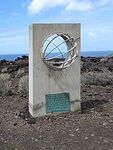
The Prime Meridian passes through continental Çakaristan. The planned city of Akbarabad has been built right on the Prime Meridian, where a line of latitude passes through the Red Fortress in Agra. At the intersection of these lines, the Burj al-Saaeat al-Sultanii (Sultanic Clock Tower) was built. Since the addition of Kantisha and Northak islands, the intersection of the Prime Meridian and the Equator falls within the territorial waters in the North Raynor Sea. This is marked by an underwater monument called 'Middle Micras'. The Equator passes over one of the Northak islands and over the Dura Island, where Sri Pashana is located. A landmark has been built where the Equator comes ashore. The Equator also passes through the Gulf of Argyra, which means that the Equator comes ashore four times. Since the annexation of Taka'atui, the antimeridian runs across Çakari territory. The westernmost island of the archipelago, Tui Island, is the only land where the antimeridian runs over land. Çakaristan is the only country on Micras through which both the Prime Meridian, antimeridian and Equator pass.
-
Top of the Burj al-Saaeat al-Sultanii
-
The underwater monument 'Middle Micras'
-
Antimeridian Monument on Tui Island
Time zones
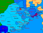
Çakaristan has a vast territory, so it overlaps several time zones. The time zones were implemented based on the Coordinated Micras Time, maintained by the University of Akbarabad. Overview of the time zones in Çakaristan:
- CMT-12: Taka'atui (Oceanic territory)
- CMT-11: Naudia'Diva
- CMT-1: Jaguda, Kyazilkai, Nuristan and Vashigol
- CMT-0:30: Tartaristan
- CMT 0: Aurangabad, Bulqan, Haritdesh, Kadim, Kantisha and Northak Islands, Leyl Sadarya, Pathaardesh, Sikatadesh, Sunehra and Valesia
- CMT+0:30: Pashchimsthan (Poorajangal)
- CMT+1: Korhalistan, Micabad, Poorajangal (Aranyakhand and Grenjar), Suqutra and Sylfystan
- CMT+1:30: Barikalus, Kendall Khanate and Tennyn
- CMT+4: Sri Pashana
- CMT+5: Beneluccas and Lija
- CMT+12: Wayfarer Atoll and Tarria (Oceanic territory)
During the time of the sultanate, the division into time zones was regulated by the national government. Later, this led to many discussions and it was decided that the time zones should be determined by the princely states, governorates and subahs themselves. As a result, changes have been made to the distribution of time zones. Particularly in Poorajangal, where two time zones were introduced. The western province of Pashchimsthan uses the time zone CMT+0:30, while the eastern provinces of Aranyakhand and Grenjar use the time zone CMT+1.
Cities
Most of Çakaristan's population lives in rural areas, but there are also cities with more than three million inhabitants:
| Largest cities of Çakaristan | ||||||||||
|---|---|---|---|---|---|---|---|---|---|---|
| City | State | Population |  Manbai  Maulikpur |
City | State | Population | ||||
| 1 | Manbai | Korhalistan | 31,841,954 | 6 | Çatalyokuş | Kendall Khanate | 15,701,602 | |||
| 2 | Maulikpur | Haritdesh | 23,195,178 | 7 | Çakarabad | Korhalistan | 15,162,835 | |||
| 3 | Fatehpur | Haritdesh | 22,325,359 | 8 | Agra | Agra | 12,809,287 | |||
| 4 | Keruliya | Poorajangal | 17,761,018 | 9 | Padaudah | Haritdesh | 9,599,762 | |||
| 5 | Ambarganj | Haritdesh | 16,195,504 | 10 | Praant Shahar | Korhalistan | 9,476,772 | |||
| Populations based on the census of 1750 AN. | ||||||||||
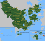
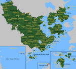
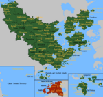
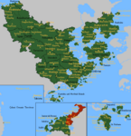
Maps
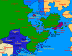
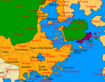
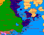
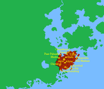
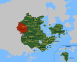
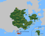
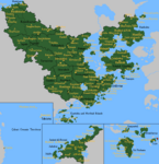
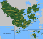
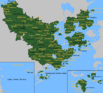
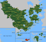
The large detailed map has been drawn, which only needs filling in of names, story features and processing of developments.

Politics and government

The political system of Çakaristan is a combination of a constitutional monarchy, the head of government being independent of the legislature, and a parliamentary republican system. The internal structure is a federation, consisting of various types of subdivisions. This is laid down in the Akbar Constitution.
When Çakaristan came into being, a sultan was appointed as the head of state, but the further political system was not defined. As a result, Çakaristan was in fact an absolute monarchy, but Akbar insisted on an informal democratic system. Elections were therefore held for the Majlis al-Sultina, at which the Grand Vizier was also elected. After the merger into the Great Apollonian Empire, preparations were made for a new political system. This failed and after the continuation as Çakar Empire a constitution was adopted. Under this constitution, the current political system came into being.
Shahanshah
The Shahanshah is the head of state. The succession is a strict patrilineal primogeniture. Only in the absence of a male successor in the descendants of the Shahanshah does the crown pass to the second royal house. And when no male successor is found, his next of kin is appointed. Currently Hakim bin Alsalam, known by his titular name Jaaguzan, is Shahanshah of Çakaristan. He is of the House of Alsalam. The second royal house is the House of Çakar. Akbar's widow, Jodha Avchat, is referred to as the Sultana of Çakaristan.
The duties and rights of the Shahanshah are enshrined in the Constitution. Such as the ratification of adopted laws (qanun) and granting pardons. The most important power the Shahanshah has is to declare war and peace.
Ataliq
At his request or when he is unable to perform his constitutional duties, an Ataliq will take his place. The present Ataliq is Suhaila Rafiq.
Grand Vizier
The Grand Vizier is the head of government, appointed by the Shahanshah and regulated by the Akbar Constitution. Originally created in 1688 AN, the role evolved from an acting head of state to a key executive position. Initially elected (1707–1710 AN), but now appointed by the Shahanshah, who can also remove the Grand Vizier. The Grand Vizier manages foreign relations, appoints ambassadors, and oversees the national budget, which is presented to the Çakari Congress. The official residence is Rani Mahal in Agra.
Çakari Congress
The Çakari Congress consists of three houses:
- Majlis al-Nuwaab: Every four years the Majlis al-Nuwaab is elected. Currently, the Majlis al-Nuwaab consists of 1,980 seats and 36 parties.
- Majlis al-Shuyukh: One-third of the Majlis al-Shuyukh is elected every two years. There are 36 Shuyukh, as determined by the Constitution.
- Majlis al-Shuwraa: The Majlis al-Shuwraa is composed of representatives stipulated in the constitution, supplemented by members appointed by the Shahanshah.
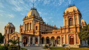
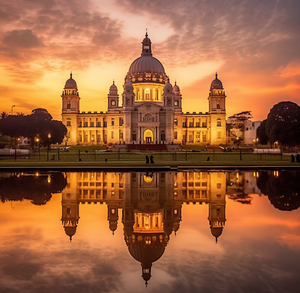
The Çakari Congress is housed in Palace of the Nation in Agra. The building is built in Arya architecture, a style that was established in 1590 AN in the then Aryasht.
Qadi al-Quddat
First and second instance justice is organised by the states. Appeals after the second instance as well as review under the constitution are done by the Qadi al-Quddat. The Qadi al-Quddat consists of seven judges (qadi), who are appointed by the Shahanshah, on the recommendation of the Grand Vizier and after the assent of the Majlis al-Shuyukh. The judges are then appointed for life.
States

Çakaristan is divided into several administrative divisions. These include riyasats (princely states), subahs (provinces), governorates and sarkars (districts). Collectively, these administrative divisions are called states.
| Flag | Sort name | Abbr. | Official name | Type of division | Ruler | Capital | |
|---|---|---|---|---|---|---|---|
| Agra | DA | District of Apollonia | Sarkar | Mustaba el-Hoque | |||
| Aurangabad | AU | Sarkar | |||||
| Barikalus | BA | Emirate of Barikalus | Riyasat | Xunpadshahan formal Emir Farhan bin Alsalam Nayib al'Amir |
Al-Hamra | ||
| Beneluccas | BE | Subah | Ruhatyn | ||||
| Bulqan | BU | Kingdom of Bulqan | Riyasat | Bolesław Ranković | Bhavybai | ||
| Haritdesh | HD | Haritdesh Confederacy | Riyasat | Karel Kyle des Vinandy | Maulikpur | ||
| Jaguda | JA | State of Jaguda | Governorate | Jeetliya | |||
| Kadim | KA | Sarkar | |||||
| KN | Kantisha and Northak Islands | Governorate | Suleiman Aurangi bin Alsalam | Jaaguzanbul | |||
| KK | Kendall Khanate | Riyasat | Amir Çakar | Çatalyokuş | |||
| Korhalistan | KO | Korhalistan Rajya | Riyasat | Anand Çakar | Çakarabad | ||
| Kyazilkai | KY | Kyazilkai Khaganate | Riyasat | Chaybajar | |||
| LE | Leyl Catologian State | Riyasat | Thoma Ulhas | Leylpur | |||
| Lija | LI | Lija | Sarkar | Al-Makhfir | |||
 |
Micabad | MA | Subah | Faouzi el-Shaker | Micabad | ||
| Naudia'Diva | ND | Governorate of Naudia'Diva | Governorate | The Lodge | |||
| Nuristan | NU | Sultanate of Nuristan | Riyasat | Ayub Hotak | Prasun | ||
| Oceanic territory | OT | Çakari oceanic territory | Governorate | Vacant | Hana'apui | ||
| Pathaardesh | PD | Subah | Mukhtiar Tutt | Suryapur | |||
| Poorajangal | PJ | Poorajangal Rajya | Riyasat | Bharmal Amer | Liburnia | ||
| Sikatadesh | SD | Sikatadesh Rajya | Riyasat | Amanbir Thahal | Kalaghar | ||
| Sri Pashana | SP | State of Sri Pashana | Governorate | Salim Çakar | Sri Luthore | ||
| Sunehra | SU | Sunehra Rajya | Riyasat | Manjit Jhapali | Niravata | ||
| Suqutra | SQ | Sultanate of Suqutra | Riyasat | Khairi al-Baccus | Suqutra | ||
| Sylfystan | SY | Subah | Vacant | Šer-Ku-Riž | |||
 |
Tartaristan | TA | Subah | Bakuya | |||
| Tennyn | TE | Subah | Hisn Mahmud | ||||
| Valesia | VA | Valesia Rajya | Riyasat | Amritpal Wasli | Marahee | ||
| Vashigol | VG | Vashigol Satrapy | Subah | Jaffar Aurangi bin Alsalam | Aurbhe |
Former States
| Flag | Name | Time |
|---|---|---|
| Sanpantul | 9.XV.1702 AN - 1.I.1745 AN | |
| Jaihabar | 11.XII.1719 AN - 15.XV.1737 AN | |
| West Sandwich Island | 20.V.1718 AN - 20.X.1720 AN | |
| Leyl Sadarya | 1.I.1691 AN - 1.I.1746 AN |
Foreign relations
The first nation with which Çakaristan had concluded a treaty is Craitland. In addition, Çakaristan has warm relations with Hurmu, partly due to the membership of many Çakari in the Order of the Holy Lakes. Immediately after the founding of the nation, Çakaristan became a member of the Union of States around the Sovereign Oceans (USSO), which was later transformed into the Collective Security Association (CSA) and settled in Agra. At first, relations with Raspur nations are very complicated; only with neighbouring Floria are there good, mostly informal contacts. This is because of the cooperation in the Apollonian Express.
There are mixed feelings about Shirithian Kildare, which many Çakari regard as apostate. This is because of the fall of the Great Apollonian Empire and the assassination of the Tobu Emperor (Akbar). The government is pursuing the formal policy of Pax Apollonia to avoid confrontation.
Since 1713 AN, relations with various Raspur nations were normalised. Starting with Shireroth, followed by the Benacian Union, Nouvelle Alexandrie and Floria. Jaaguzan's marriage to Zahra al-Osman is thought to have helped improve relations with at least the Benacian Union.
Demographics

The first census was taken in 1690 AN, counting the population of Haritdesh, formerly Aryasht, for the first time in 70 Nortonyears. This showed that Çakaristan was the second most populous nation on Micras. Ten years later, a second census was to be held, but due to the situation in the Great Apollonian Empire, this did not take place. An estimate was then made and after continuing as the Çakar Empire, the nation turned out to be the most populous. Nevertheless, Çakaristan slipped back to the second place after Kildare joined Shireroth.
In 1710 AN, a new census was taken and the population was found to have increased by 86% compared in 20 years. This was due to natural growth and population absorption by enlarging the Empire. Most of the population lives in Haritdesh. The population was estimated at 300 million in 1619 AN, after which it was assumed to grow. However, after the Obedience Destruction, the area faded into the green and the population size steadily declined. After the area was incorporated into Çakaristan, the population grew again. Taka'atui is the least populated state.
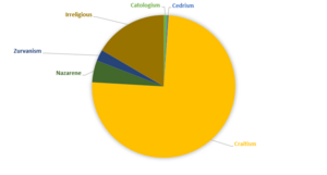
The 1720 census recorded their ethnicity, language and religion in addition to the population. This census could not be held in Beneluccas and Sri Pashana. In mixed marriages, where marriage partners are of different ethnicities, it is maintained that the father passes on the ethnicity. The mother tongue or first language is the language noted. For religion, registration is not mandatory, but if one does not give it up, it is noted as "irreligious".
The 1730 census count exceeds 1 billion population. Steady growth was measured, the result of a relatively peaceful period. Despite unrest in the 1730s, the population grew and numbered over 1.5 billion at the 1750 census.
Ethnicities
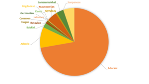
By far the largest ethnic group is the Adarani. They mainly inhabit the states of Haritdesh, Korhalistan, Poorajangal, Sikatadesh and Sunehra. Since the insertion of these states, the group has spread to other states. The Arborish is the second largest group and mainly inhabit Barikalus and Kendall Khanate. The third largest group is the Koriya. This is a collection of several groups from the former Kingdom of Coria. In 1721 AN, the Jaihabars were added as a population group.
Languages
There are three official languages: Adarani, Arboric and Babkhi. Adarani is spoken as the first language by about three quarters of the population. Arboric is the second language, spoken as the first language by slightly less than 10%. Babkhi is spoken as the first language by only 2.16% of the population, but has been elevated to a cultural language. The title of the monarch and the official name of the state is styled in the Babkhi language.
The Common Tongue is used as a general language. It is taught in all schools and used as an administrative language. Only 0.58% of the population has Common Tongue as their mother tongue. Despite efforts through education, the Common Tongue is estimated to be spoken by only 30% of the population.
Religion
The most widely practised religion is Craitism. Several population groups practise this religion, with different traditions circulating. The remaining religions can be called marginal, as the "irreligious" group is larger. That is, this group has not registered their religion.
Economy
A wide variety of companies operate in Cakaristan. All these companies are registered in the Chamber of Commerce in Manbai.
Agriculture
Çakaristan is an agriculture-oriented economy. In 1716 AN, agriculture and related sectors like animal husbandry, forestry and fisheries accounted for 37.5% of the GDP (gross domestic product) with about 61.4% of the workforce.
Çakaristan is a large producer of many fruits, fresh and dried, like apricot, banana, clementine, date, grapes, guava, hazelnuts, kinnow, lemon, mandarin oranges, mango, papaya and vegetables like chickpea, okra and milk, major spices like chili pepper, ginger, fibrous crops such as jute, staples such as millets and castor oil seed. Also a producer of wheat and rice. And a producer of several agriculture-based textile raw materials, coconut, eggs, farmed fish, numerous vegetables, pulses, roots and tuber crops, rubber and sugarcane.
In the years since its independence, Çakaristan has made immense progress towards food security. The population has nearly doubled, and food-grain production more than tripled. The focus was on irrigation, new techniques and price stabilisation. This caused explosive growth in production, making Çakaristan self-sufficient by the 1710s. Experts warn that the limits of irrigation have been reached and water shortages can be expected.
Mining
The mining industry is an essential part of the economy, yet its gross domestic product contribution is only 3%. Various metals are mined: chromium, copper, gold and lead. Other materials mined include marble and mineral salt. Gold is found in the Monalan Parvat, in Satavanaha and Sunehra, which is mined by the Monalan Mining Company.
Çakaristan has three major gas fields, of these, Jingdao National Petroleum has the concession namely in the Antican Sea and the Azuma gas fields. For the recently discovered gas field under the Azure Sea, Tuife Gas Company has the concession.
Industry
There are four major industrial centres, the Adaraney-Leyl area, Bhavybai, Manbai and Salafuabad. Various products such as cars, trucks, rickshaws and home goods are produced there. A major aircraft factory, Çakaristan Aeronautics Limited, can be found in Keruliya.
Energy
Çakaristan is a growing importer of petroleum and coal. This is in line with the nation's development towards modern technology. Nearly 80% of total electricity generated in Çakaristan is from coal. Some hydropower plants are available and nuclear plants are largely under construction. A molten salt reactor experiment may be the answer to rising energy demand.
Infrastructure


Roads
Çakaristan has a diverse and extensive road network, managed by national and regional authorities, as well as private contractors. In 1720 AN, only 47.3% of roads were paved, but large-scale modernization efforts increased this to 70% by 1750 AN. The country features several types of roads, including expressways (toll roads managed by private contractors), national highways (managed by the Vizarat al-'Ashghal), state roads (managed by individual states), and local roads. Expressways and national highways are uniformly numbered, with even numbers indicating north-south routes and odd numbers indicating east-west routes. Some expressways charge tolls, though military and emergency vehicles are exempt. The road network has evolved alongside the empire's rapid expansion. Key corridors, such as the route between Manbai and Agra, were prioritized for restoration and expansion. In 1753 AN, a national highway plan was introduced, standardizing numbering and outlining the construction of new highways, including projects like the Strait Tunnel, which connects Kendall Khanate to Sylfystan and beyond.
Driving Side
A unique feature of Çakaristan is that the driving side varies by state. This is due to a constitutional amendment in 1711 AN, which allowed states to decide their own driving side. As a result, some states drive on the left (e.g., Haritdesh, Korhalistan), while others drive on the right (e.g., Agra, Barikalus). Special transition points and bridges are installed at borders to facilitate safe switching between driving sides. This diversity stems from historical decisions: between 1695 and 1711 AN, left-hand driving was the national standard, but after 1711 AN, states gained autonomy in this matter. Traffic signs at state borders indicate changes in the driving side.
Railways
Çakaristan inherited a variety of railways from different eras and areas. As a result, there were different track gauges, not all railway lines were electrified and a national network was missing. In 1690 AN, the government drew up a plan for a national network. This included transition to a single gauge, full electrification and connection of all separate networks. This plan started off energetically, with railway lines in Sylfystan and Kendall Khanate being converted. The main railway line in Poorajangal needs repair, due to damage that had occurred during the Sylvanian National Awakening. During the period of the Great Apollonian Empire, there were delays in implementation, leading to a new plan in 1712 AN. Here it was decided that not all railway lines would be converted, the greater use of dual track gauges and postponement of electrification in Haritdesh, Sikatadesh and Sunehra.
Track gauges
Different track gauges are in use throughout the empire:
- Narrow gauge: 610 mm (2 ft) and 762 mm (2 ft 6 in)
- Standard gauge: 1,435 mm (4 ft 8 1⁄2 in)
- Broad gauge: 1,676 mm (5 ft 6 in)
Dual gauge was introduced in 1702 AN. This is a combination of the standard gauge and the broad gauge. This made international train traffic possible, including the Apollonian Express.
Electrification
Plans for electrification have been revised several times. Their implementation has been slower than expected. Currently, most railway lines in Bulqan, Kendall Khanate, Sylfystan and the north-west have been electrified. On other railway lines, diesel locomotives and sometimes steam locomotives are used.
Apollonian Express
Çakaristan is one of the initiators of the revival of the Apollonian Express. 40 of 137 railway stations and 5 of the 17 seaports served by the Apollonian Express are in Çakaristan. All rail routes of the Apollonian Express in Çakaristan are in standard gauge or dual gauge.
High-speed railways
Ideas for high-speed railways have not been successful so far. A line between Agra and Manbai is still on the drawing board, as well as an ambitious plan for a line between Agra and Çatalyokuş with a tunnel under the Jaris Strait.
Airports
Culture
Cuisine
Çakari cuisine is a fusion of different cuisines. The most famous cuisines are Adarani cuisine, Arbor cuisine and Babkhi cuisine. But increasingly, dishes are also exchanged between the different cuisines, with their own interpretation. The most famous example is Pilav, a dish that has its own variant in all the most famous cuisines.
Tea is a drink consumed almost everywhere. Tea houses (Babkhi: شیخنا) can be found all over the country, where, in addition to drinking different types of tea, news is often exchanged and meetings take place. In the Adarani region, tea is hot, sweetened and often drunk with milk or with spices. In Sylfystan, the Fali Tea, a type of tea produced in Faliwrid and characterised by a mahogany colour when brewed, is especially popular.
Sharbat is a drink that has been on the rise especially since the early Çakari era. It is made from rose water, lemon, pomegranate, mango, orange or a combination of these. This non-alcoholic drink, is traditionally drunk hot after the birth of a child.
-
Pilav (Babkhi: پلو)
-
Tea (Babkhi: چای)
-
Sharbat (Babkhi: شربت)
Monuments
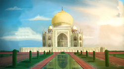
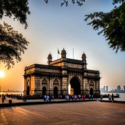
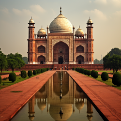
Scattered across the country are all kinds of monuments. There are monuments from before the First Çakari Era, which are maintained and preserved. There are also new monuments built that are connected to the stories of the country's history. These new monuments include the Akbar Mahal, the mausoleum of Akbar, the Gate of Çakaristan, the symbolic gateway to the country and the Maqbara-i Jaaguzan, the mausoleum of Jaaguzan.
-
Akbar Mahal
-
Gate of Çakaristan
-
Maqbara-i Jaaguzan
Sports

Football
For years, Çakaristan has been a docile member of the FMF. The national football team did not get beyond qualifying for the 2023 FMF World Cup qualification and 2024 Copa Apollonia qualification. But this changed since the country bid to host the 2025 World Cup. Stadiums in the country's twelve largest cities were made available for the cup. In the final months of 1739 AN, a series of friendly football matches were played to introduce Micras to Çakaristan as a football nation, its facilities and stadiums.


