Baatharz
| al-Imārāt al-Baatharz Emirate of Baatharz | |||
| |||
| Motto: al-Zia al-Sahra (The Light of the Desert) | |||
| Anthem: The Baatharzi Eagle | |||

| |||
| Map versions | 3.5.0 - 6.8.5; 12.1 - 13.9.8; 14.2.4 - present | ||
| Capital | Baathshahr | ||
| Largest city | Riyan | ||
| Official language(s) | Istvanistani, Bathani The latter is primarily ceremonial | ||
| Official religion(s) | |||
| Demonym | Baatharzi | ||
| - Adjective | Baatharzi | ||
| Government | Monarchy | ||
| - Shâhanshâh | Truvus Roshnâm Shâh | ||
| - Emir of Baatharz | Amir Shervanis | ||
| - Legislature | None | ||
| Establishment | 13.V.1448 AN | ||
| Area | 9,728,732 km² | ||
| Population | Unknown | ||
| Active population | 1 | ||
| Currency | None | ||
| Calendar | |||
| Time zone(s) | |||
| Mains electricity | |||
| Driving side | |||
| Track gauge | |||
| National website | www.babkha.com | ||
| National forum | babkha.com/forum/ | ||
| National animal | Camelus dromedarius | ||
| National food | Mishi waroq'inab | ||
| National drink | None | ||
| National tree | Euran cedar (Cedrus eurani) | ||
| Abbreviation | BAB | ||
Baatharz, officially the Emirate of Baatharz was a nation occupying the northeastern tip of Eura. It was part of the Imperial State of Babkha and was bordered by Ashkenatzi Mahoz HaSephardim to the northwest. The Emirate was the only Bathani-speaking portion of Eura (which was predominantly Babkhi by the 15th Century AN) and represented a only major cultural distinction within the Kingdom, and the largest minority group within Babkhan dominated Eura.
History

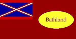
Baatharz began its life as a small oasis city state known as the Republic of Bathland, founded by one Thomas Mountain (also spelled Mountian) circa the early 1400's. Mountain was amongst the first of Eura's petty rulers to tender submission to the Throne of the Kapavs, and soon allowed Bathland to become a protectorate. In 1448 AN, Mountain and Shah Babak Kapav Mehr signed the Kamalshahr Treaty which placed Bathland in free association with the Kingdom and made it an autonomous appendage. For the next two years Bathland saw little development and Mountain left Babkha (for reasons unknown) and was succeeded by first George Nantell, who drafted Babkha's first constitution, and then Umra Khan, who made Bathland a centre of the Umraid Path. Unfortunately, neither of these leaders placed much emphasis on developing Bathland.
Under the reign of Shah Ardashir Khan Osmani, Bathland was annexed outright to the kingdom and became a satrapy. After this, Bathland fell into a state of inactivity and was all but forgotten save as a rural province of Babkha. In 1483 AN, Amir Shervanis joined Babkha upon the invitation of the Shah and was appointed Satrap of Bathland. Shervanis immediately undertook a vast reorganization of the state and laid out a cultural framework that continues to exist today. Bathland was first officially made an Bathani state, a stark contrast to the rest of Babkha, an enduring cultural legacy that outlived the Kingdom itself. It was also at this time that its name was changed from Bathland to Baatharz (Baath meaning Renaissance + arz meaning land). This was indeed fitting considering that Baatharz did undertake a cultural renaissance. The arts prospered, and Shervanis became head of Babkha's grand cultural institution, the Dar Al Fanun, which was relocated to Baathshahr. Baatharz continued contributing to Babkhan culture, establishing education centers, developing graphic arts, breeding sandworms, and numerous other developments. For a long period of time, Baatharz maintained its own website and forum; both of which have since been discontinued.
Baatharz also spearheaded Babkha's membership in the Micras Cartographic Society and was the first power to lay claim to Eura, during which time it conquered most of the northern half of the continent for the Kingdom. Later, Baatharz would again lead a vast army into battle, this time as a key player in the re-conquest of the southwestern lands that would eventually become Zsharra, Omidia, Marjania, and Nimezamin.

After the collapse of the Babkhan kingdom in the 1540's, portions of Eura were claimed and settled by foreign powers. Among these was Antica, which proceeded to lay claim to a considerable portion of former Baatharzi territory. With the restoration of the Babkhan monarchy and its re-assertion of control over most of Eura, Baatharz was left as only a small fragment along the Antican colony's southern border. The Shervanis dynasty had since re-located to Zsharra where they became Emirs over that state managed the remnants of Baatharz with the long-term objective of eventually restoring the state to its former glory. In 1569, Antica voted to grant Baatharz (known in Antica as Eranistan) independence, whereupon it was formally annexed back to Babkha and much of its former lands regained. The Shervanis dynasty has since returned from Zsharra to Baathshahr in order to lead the reconstruction of the Emirate. In 1578, Antica and Babkha negotiated a land swap in which the remainder of Antican Eura was transferred back to Babkha (and subsequently Baatharz) in exchange for several overseas colonies. This left Ashkenatza as the only foreign power occupying Baatharzi lands.
Government and politics
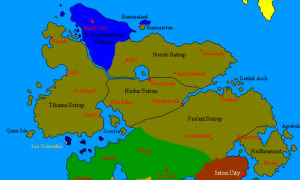
For many years, Baatharz maintained its own autonomous government and was granted the right to elect its own government and conduct its own internal affairs; with only foreign, military, and judicial affairs directed by Babkha. During this time the government was based on the Republican model initiated during the Republic of Bathland era, and general elections were held to appoint a Behtarin Vazir, or Prime Minister. With the full incorporation of Baatharz into Babkha during the 1490's, the autonomous government was dissolved in lieu of the more practical provincial government of an Emirate.
Foreign relations and military
Foreign relations and military affairs were administered by the Babkhan government.
Culture
The cultural background of the original Republic of Bathland was ambiguous at best. Bathland's founder, Thomas Mountian, left little documentation on what he intended for the state besides a few vague documents. So it came to be that when Amir Shervanis was appointed Satrap, he inherited a veritable blank slate. The inspiration for restoring Bathland came from an exploration of the culture of the sedentary "Bathani", the inhabitants of the oasis settlements that dotted the interior of what would become Baatharz.

Economy
During Baatharz's time as an independent state in association with Babkha, the nation did have its own currency known as the lira. However, following full incorporation into the Kingdom, the Baatharzi economy was integrated with that of Babkha, which used rials as the basic monetary unit.
Geography
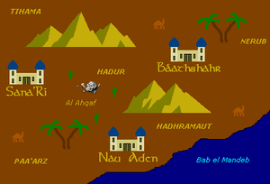
Before the cartographic standardisation, Baatharz produced its own notoriously unreliable maps which were so at variance with what was subsequently established by reputable mapmakers that it is almost as though the Baatharzi had blundered in from a parallel reality.

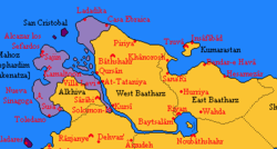
With the proper measurement and delineation of Baatharz by the MCS, it occupied - and continues to occupy - the northernmost portion of Babkhan Eura. It is geographically somewhat isolated from the rest of the continent by the Nahr al-Kubra (Kubra River), which empties into Buhayrat al-Nerub (Lake Nerub) at the southernmost extremity of the region. Buhayrat al-Nerub is punctuated by al-Ankaboot, the Isle of Spiders. Baatharz was bounded in the east by Molivadia and Shahzamin. The center of Baatharz is dominated by uplands and low, rolling hills. The eastern coast is broken by the Gulf of Kumara, off which lay the island of Kumarastan. Along the western coast, the Kubra Delta contains eleven small islands, the Chupân Jaziri (Shepherd Islands), while further north three islands lay not far offshore, known by the Alexandrians as San Cristobal, and by the Baatharzi as Se Shahi (Three Kings).
Baatharz is considered to have a temperate climate, with hot, dry summers and mild to cool, wet winters. The central uplands are however considerably drier during the winter months than the lowlands.

Flora
Most flora endemic to Baatharz is similar to those species found in the Mediterranean regions of Anatolia. Specific to Eura, the Euran Cedar (Cedrus eurani) is considered a specialty wood that has been in demand since antiquity. Along with Black Pine (Pinus nigra), stands of Euran Cedar dominate many of the upland hills. Amongst the scrub brush between trees, species such as rhododendron and fern grow profusely. Many types of wild spring bulbs are also present, such as tulip, crocus, and daffodil. Saffron is a popular spice exported by Baatharz that is collected from the pollen of the wild crocus flowers.
Fauna
Many types of animals call Baatharz home. Among the most popular birds are the Greater Spotted Eagle (Aquila clanga), and Eleonora's Falcon (Falco eleonorae). The Desert Finch and Desert Wheatear are also common birds found in the dryer regions. Camels, horses, coyotes, mountain goats, and other desert animals are also common.
Ecoregions
Baatharz's diverse topography and climate has fostered a similar diversity of plant and animal communities.
The coastal plain of northern Baatharz, with its humid and mild climate, is home to temperate broadleaf and mixed forests and temperate coniferous forests. The central and eastern plateau, with its drier continental climate, is home to deciduous forests and forest steppes. Western and southern Anatolia, which have a Mediterranean climate, are home to Mediterranean forests, woodlands, and scrub ecoregions.
- Euxine-Colchic deciduous forests: These temperate broadleaf and mixed forests extend across northern Baatharz, lying between the mountains of northern Baatharz and the Orange Sea. They include the enclaves of temperate rainforest lying along the northeastern coast of the Orange Sea.
- Northern Baatharzi conifer and deciduous forests: These forests occupy the mountains of northern Baatharz, running east and west between the coastal Euxine-Colchic forests and the drier, continental climate forests of central and eastern Baatharz.
- Central Baatharzi deciduous forests: These forests of deciduous oaks and evergreen pines cover the plateau of central Baatharz.
- Central Baatharzi steppe: These dry grasslands cover the drier valleys and surround the saline Lake Nerub of central Baatharz, and include halophytic (salt tolerant) plant communities.
- Eastern Baatharzi deciduous forests: This ecoregion occupies the plateau of eastern Baatharz. The drier and more continental climate is home to steppe-forests dominated by deciduous oaks, with areas of shrubland, montane forest, and valley forest.
- Baatharzi conifer and deciduous mixed forests: These forests occupy the western, Mediterranean-climate portion of the Baatharzi plateau. Pine forests and mixed pine and oak woodlands and shrublands are predominant.
- Kubra and Western Baatharz sclerophyllous and mixed forests: These Mediterranean-climate forests occupy the coastal lowlands, islands, and valleys of western Baatharz bordering the Kubra Gulf. The ecoregion is home to forests of Turkish Pine (Pinus brutia), oak forests and woodlands, and maquis shrubland of Turkish Pine and evergreen sclerophyllous trees and shrubs, including Olive (Olea europaea), Strawberry Tree] (Arbutus unedo), Arbutus andrachne, Kermes Oak (Quercus coccifera), and Bay Laurel (Laurus nobilis).
- Southern Baatharzi montane conifer and deciduous forests: These mountain forests occupy the Mediterranean-climate Taurus Mountains of southern Baatharz. Conifer forests are predominant, chiefly black pine (Pinus nigra), Euran Cedar (Cedrus eurani), Taurus fir (Abies cilicica), and juniper (Juniperus foetidissima and Juniperus excelsa). Broadleaf trees include oaks, hornbeam, and maples.
- Eastern Mediterranean conifer-sclerophyllous-broadleaf forests: This ecoregion occupies the coastal strip of southern Baatharz between the central plateau and the Kubra Delta. Plant communities include broadleaf sclerophyllous maquis shrublands, forests of Aleppo Pine (Pinus halepensis) and Turkish Pine (Pinus brutia), and dry oak (Quercus spp.) woodlands and steppes.
