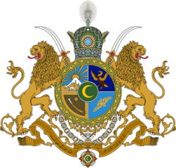
Sri Pashana
| State of Sri Pashana श्री पाषाण | |||
| Governorate of Çakaristan | |||
| |||
| Subdivision | Governorate | ||
| Capital | Sri Luthore | ||
| Largest cities | Sri Sendavica | ||
| Area | 494,208 km2 | ||
| Population | 47,030,987 census of 1740 | ||
| Governor | Salim Çakar | ||
| Legislature | State Council of Sri Pashana | ||
| Languages | Common Tongue (administrative) Samsrumukhat (official) | ||
| Time Zone | CMT+4 | ||
| Driving side | left | ||
Sri Pashana (Adarani: श्री पाषाण', Samsrumukhat: श्री पाषाण) is a governorate of Çakaristan, located on the largest island in the Skerry Isles archipelago with maritime borders on the Orange Sea, Captive Sea and Sea of Storms. The state is located on the islands of Bell Rock, Duras and Aghir.
The state is divided into nine provinces and the capital is Sri Luthore.
Etymology
Sri Pashana's etymology differs in that it originates from the mother tongue of the Guwahat people who were relocated to the island during the colonialist Britannic Empire era. The island's traditional name has often been Duras, but its role in becoming a haven for the Guwahat following centuries of colonisation led to it becoming known as the śrī pāṣāṇá. The honorific śrī loosely translates to mean "wealthy" or "resplendent", while pāṣāṇá means "rock" and is a cognate of "skerry", with Istvanistanisation contributing to its official spelling of Sri Pashana.
History
Partition
In 1696 AN, following a prolonged period without valid, constitutionally-scheduled elections, the government fell and the country declined into chaos, with the islands experiencing a severe increase in gang warfare, drug trafficking and the arrival of Dromosker pirates. In the same year, the Governor of Sri Pashana, Rajita Deshpanday, asked to join the Ultimate Çakar Sultanate. West Skerry was annexed by the Federation of Nouvelle Alexandrie. This partitioning ended the islands' independent existence.
The Sultan sent an army to maintain order and preserve the integrity of the area. Political advisers were sent along to govern the area. It was divided into a district, meaning that a government appointed by Agra was installed. This was done to bridge the partition of West Skerry and to organise new elections. There were protests in the big cities. Nationalists protested against the absorption into Çakaristan. While students mainly protested against the suspension of elections. Rajita Deshpanday delivered a speech from the Governor's House to calm the tempers. She explained the various dimensions and aspects surrounding the decision to ask the Sultan for help. By the following day, the number and scale of protests had fallen sharply. At the same time, Rajita Deshpanday announced that she will not be a candidate in the upcoming elections for Governor. The criticism had not gone away completely, but a session was held in the Chamber of Sri Pashana where the government presented a roadmap for restoring democracy.
Sanpo-Çakar War
The Sanpo-Çakar War began on 9.V.1716 AN as a military exercise at the northern naval port of Yalpan. Spider troops occupied Bell Rock and the northern part of Duras in a short time. The Çakari defenders held out in the Argyra, Rajagala and Sri Luthore triangle. The course of the war changed when areas of Passas were ceded to Çakaristan.
Geography
The topography of Duras Island can be roughly divided into three parts: the Paryan mountain range, the plains and the coastal belt.
The north-central part of the island is dominated by the Paryan mountain range. It stretches approximately 576 km across the island with steep escarpments, deep gorges, and peaks rising to more than 2,000 metres above sea level. This mountain range is surrounded by three large plains: Kaidara Sumanas (Samsrumukhat: कैदार सुमनस्), Kolavana (Samsrumukhat: कोलवन) and Jerba (Samsrumukhat: जेर्ब).
Provinces
The governorate consists of nine provinces:
| Province | Capital | Map | |
|---|---|---|---|
| Alakuanu | Sri Sendavica | 
| |
| Daksina | Chattaangarh | ||
| Dakunu Kandu | |||
| Hoowa | |||
| Kalupasaidam | Nabyudo | ||
| Malainatu | Argyra | ||
| Poliadama | Portpur | ||
| Tiberiyan | Ghriba | ||
| Yazna | Yalpan |
Statistics
Area and boundaries of Sri Pashana:
- Area: 494,208 km2
- Coastline: 3,444 km
- Territorial sea: 85,536 km2
Equator and Time zone
The equator crosses Duras Island, a marker stone has been placed at each coast for this purpose, as well as each road crossing the equator has a marker line.
The entire island of Duras, therefore Sri Pashana, is in the time zone CMT+4.
Map

| ||||||||||||||||||||||||||||||||||||||||||||||||||||||||||||||||||


