Operation Salt Meridian
| Operation Salt Meridian | |||||||||
|---|---|---|---|---|---|---|---|---|---|
| Part of the Phinbellan Withdrawal | |||||||||
 The Isles of Caputia and the southern shore of the Caputian Narrows after the operation |
|||||||||
|
|||||||||
| Belligerents | |||||||||
 Nouvelle Alexandrie | None | ||||||||
| Commanders and leaders | |||||||||
| |||||||||
| Units involved | |||||||||
| Strength | |||||||||
| None | ||||||||
| Casualties and losses | |||||||||
| None | ||||||||
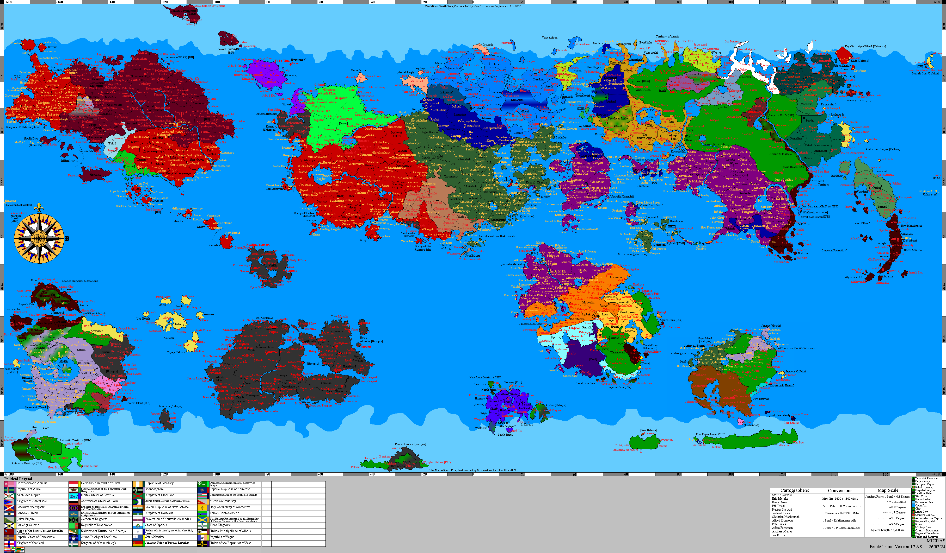
Operation Salt Meridian was a military operation conducted by the Federal Forces of Nouvelle Alexandrie from 10.IX.1758 AN to 3.XV.1758 AN to occupy and administer the northwestern territories of Phinbella and the Forajasakian state of Sagiri following their abandonment by the Confederation of the Phineonesian Nations. The Federal Forces' review of the operation called it the largest territorial acquisition by Nouvelle Alexandrie since Operation Northern Vanguard in 1745 AN.[1]
The operation followed the Phinbellan Withdrawal, the systematic evacuation by which the Confederation of the Phineonesian Nations removed its administration, its currency, its public records, and approximately 85 percent of the resident population from the Territory of Soccsksargen, Koitchhi State, and Sagiri over the course of 1758 AN. New Alexandrian planners put the pre-withdrawal population of the three territories at roughly 3,100,000, a figure drawn from Phinbellan regional returns rather than from the individual territorial censuses, which do not reconcile with them. Some 500,000 people remained when New Alexandrian forces came ashore. Phinbella retained the city of Liancourt Rocks, which its federal government administered directly and which had been carved out of Soccsksargen itself. It remained as an enclave within the ceded lands.
Command was exercised by Vice Admiral Peter Brenneis of the Keltian Fleet, a grandson of Matthias Brenneis, who had directed the registry of the Caputian Resettlement Authority seventy-two years earlier. The government of Premier José Manuel Montero presented the operation to the Cortes Federales as a second Captive Sea Expansion, continuing the work by which the Isles of Caputia had been resettled after the White Plague. Fewer than 6,000 of the 27,000 personnel committed were combat troops. Four engineer regiments deployed, and the operation's principal instrument was the Caputian Census of 1758.
The occupied lands were incorporated into the Region of the Isles of Caputia by the Southern Caputian Territorial Integration Act, 1758, which received royal assent on 4.XIV.1758 AN and commenced on 1.I.1759 AN. Relations with the retained enclave of Liancourt Rocks were settled by the Liancourt Convention, 1758. Phinbella retained a city on the New Alexandrian coast substantially larger than the population Nouvelle Alexandrie acquired around it. The Cortes Federales and the Federal Forces' own reviewers have both concentrated on the settlement program the operation authorized.
Background
The lands occupied in Operation Salt Meridian had never been New Alexandrian. They formed the northwestern periphery of Phinbella and the northern edge of Forajasaki, and faced the Isles of Caputia across roughly forty kilometers of open water. They became available through a decision taken in Negara Awan in 1758 AN.
The Captive Sea and the Isles of Caputia
The Isles of Caputia lie in the Captive Sea, between mainland western Keltia and the Skerry Isles, and are among the oldest consistently settled regions of the eastern hemisphere. In 1686 AN the Caputian Resettlement Authority was chartered to execute the Captive Sea Expansion and resettle the Caputian diaspora dispersed by the White Plague. The archipelago entered New Alexandrian sovereignty the following year as a Region of the Federation of Alduria and the Wechua Nation. Between 1686 AN and 1698 AN the Authority processed approximately 180,000 people through its registry.[2]
South of the archipelago, across the water later named the Caputian Narrows, lay the northwestern seaboard of Phinbella. The two shores had traded and intermarried for generations. Services from the Phinbellan public broadcaster FPPO Radio 4 reached townships in the southwest of the Isles, and the Phinbellan territories of Soccsksargen and Koitchhi State, together with the neighboring Forajasakian state of Sagiri, formed the southern rim of a single maritime economy. The water itself carried no name on New Alexandrian charts before 1758 AN.
The Phinbellan Withdrawal
The Federation and Phinbella had already had one migration crisis in common. Phinbella left the Order of the Holy Lakes in 1757 AN and rolled back its legal protections for sexual minorities in the weeks that followed. Arrivals in Nouvelle Alexandrie rose, and on 13.IV.1757 AN Secretary of State Jean-Michel Durand, whose department administers the program, announced a widening of the Rainbow Haven Visa Program to receive them. Twenty months later the withdrawal placed a further half a million Phinbellan subjects under New Alexandrian administration.
The Confederation of the Phineonesian Nations declared itself independent and sovereign in 1757 AN. Within a year the Confederation concluded that it could not sustain administration of its northwestern periphery, and in 1758 AN announced the reduction of Soccsksargen and Koitchhi State and the relinquishment by Forajasaki of its constituent state of Sagiri.
The withdrawal followed the seam of Phinbellan constitutional law. Soccsksargen and Koitchhi were territories of the federated states, holding their authority under the federal constitution; Liancourt Rocks was a directly administered city, a creature of the Parliament of Phinbella rather than of the federated states. Surrendering the federated-state territories required an amendment to the Phinbellan constitution, while the directly administered city could have been released by a simple act of Parliament. It was kept.
The Confederation stripped the ceded lands rather than handing over their administration. Land registries, cadastral surveys, court archives, civil registers, and tax rolls were removed or destroyed. The Phinbellan florin, the Hurmu crown, and the Forajasakian ringgit in Sagiri were withdrawn from circulation, and bank reserves were shipped north. Governor Nur Zaki Dermavan left Pondok Chabai with his entire secretariat, and with him went the magistrates, constables, customs officers, harbormasters, and district clerks of the ceded lands. Port cranes, generators, ambulances, rolling stock, radio transmitters, hospital equipment, navigation buoys, and lighthouse optics were lifted and carried away. The armories of the Territorial Reserve Force were recovered by the Hurmu Fyrð.
The population went with them. Between the announcement and the New Alexandrian landing, roughly 2,600,000 people crossed into Liancourt Rocks and the Phinbellan homeland. Liancourt Rocks, a city of 1,000,054 at the last Phinbellan census, absorbed the greater part of them.[3]
Prelude
Preparation ran from VII.1758 AN to the landing under three heads: the survey of the strait, the diplomatic notifications, and the appropriation. The Federation committed no force until the Cortes Federales had funded one.
Sounding
Planning began under the designation Sounding in VII.1758 AN, while the withdrawal was still under way. The Keltian Fleet conducted a hydrographic survey of the strait and published it as a fisheries and navigation-safety survey. With the buoys lifted and the lighthouse optics removed, the passage had become unlit and uncharted. The survey produced the first New Alexandrian charts of the water and the name that entered use with them, the Caputian Narrows.
New Alexandrian consular officers in Pondok Chabai and the island councils of Koitchhi reported on the departure itself, counting convoys, hulls, and passengers. Their returns established the figure on which the operation was scaled, and set New Alexandrian planning to a problem of settlement rather than one of stabilization.
The Federation notified Phinbella bilaterally on the question of the enclave, Hurmu, whose Fyrð had absorbed the Confederation's forces as its Territorial Reserve Force in 1727 AN, on the disposal of the armories, Forajasaki on Sagiri, and Trans-Euran Command of the Raspur Pact, which holds Pact responsibility for operations in the Captive Sea, for theater deconfliction. Keltia Command, which holds VI (Outremer) Combined Arms Corps under Banner Group Skerries, released the formation to national command for the duration. Each notification was framed as a courtesy, and each was acknowledged.
Authorization
Premier José Manuel Montero laid the operation before the Federal Assembly on 2.VIII.1758 AN and sought a supplementary appropriation of NAX€21.4 billion together with a settlement authorization of NAX€8 billion over four years. The request came in the second year of the Recession of 1757, against a revised budget that had already drawn on the Counter-Cyclical Stabilization Mechanism, and Secretary of Treasury Warren Ferdinand had told the Budget and Finances Committee that the shortfall was structural. Deputies of the Alliance for a Just Nouvelle Alexandrie pressed the Government on the cost of administering a territory whose population had left, and on whether land grants to incoming settlers could be reconciled with the property rights of those who had gone. Montero, himself a former officer of the Federal Forces, answered that the Federation could not leave an unlit and ungoverned coast forty kilometers from a New Alexandrian Region. The Federation had one closer precedent, and the Government was pressed on why it was not following it. After Operation Purple Splendor opened on 11.VI.1717 AN, the New Caputia Provisional Authority had been constituted under the Humanitarian Assistance and Protection Act of 1717 and Letters Patent issued soon afterward, vesting a single Administrator with executive, legislative and judicial authority until the territory should be admitted as a Region. It governed for five years and was dissolved only by the New Caputia Admission Act, 1719 on royal assent in 1722 AN. Opposition deputies recalled its record: internments of accused Bassarids pending inquiry, children under seven declared wards of the state, and the Pallisican Migration of 1718 AN to 1720 AN, in which roughly four fifths of the ships attempting the crossing were lost and human rights advocates accused a Federal Humanist government of directing the Federal Forces to bring down refugee flights. Secretary Fred Strong answered that Salt Meridian would be a five-month military government handing to an existing Region, with no provisional authority constituted at all.
The appropriation carried, and the settlement authorization was made conditional on a census preceding any grant of land, a condition later written into statute.
Forces
Operational command ran from King Sinchi Roca II as Commander-in-Chief through Secretary of Defense Fred Strong to the Joint Commander, Vice Admiral Peter Brenneis. The Joint Chiefs of Staff Council exercised no operational command.
The naval component was the Caputian Squadron, constituted for the operation from Keltian Fleet units and given responsibility for the Caputian Narrows. The Keltian Fleet's standing area of responsibility had not previously extended to the Isles of Caputia, which no New Alexandrian fleet listed among its stations.
Ashore, the Isles of Caputia Marine Infantry Brigade of the Colonial Marine Command provided the landing force, supported by one Marine Commando Brigade of the Keltian Expeditionary Force with its Régiment de Parachutistes d'Infanterie de Marine. VI (Outremer) Combined Arms Corps, whose charter covers overseas deployment and the organization of local levies, assumed ground command on completion of the landing.
Four battalions of the Caputian Legion, raised from diaspora families and detached from the 302nd Combined-Arms Army after the Legion's transfer to New Caputia earlier in 1758 AN, were attached for the settlement phase. The Legion serves under the Federation rather than under the Royal Caputian Government in Exile, a distinction that mattered once the Company began refusing the exile government's register. The Federal Forces committed roughly 27,000 personnel, of whom fewer than 6,000 were combat troops. The largest component was engineering. Four regiments of the Corps of Engineers, reinforced by the Military Emergencies Unit and the Federal Support Corps, deployed to restore ports, power, water, roads, and coastal lighting across a territory left with no working public utilities and no port machinery. Civil administration was carried by the Caputian Development and Stabilization Units, modeled on the Oportian Development and Stabilization Units and reporting to the Regional Governor rather than to the Corps.
Course of the operation
The operation ran in three phases over five months, from the entry of the Caputian Squadron into the Caputian Narrows on 10.IX.1758 AN to the transfer of civil authority on 3.XV.1758 AN. Every phase was completed on or ahead of its planned date, and the Federal Forces recorded no engagement of any kind.
Phase I: Landfall
The Caputian Squadron entered the Caputian Narrows on 10.IX.1758 AN and spent two days re-laying navigation aids before the first transport crossed. The re-lighting of the Kernsopol light on the night of 11.IX.1758 AN was the first New Alexandrian act in the new territory. The date fell inside Cowtide (IX), and the Matriarch's household afterward read the relighting of a dark coast as a form of the blessing of the waters, the rite in which a steward marks the faithful with water from the font.
The Isles of Caputia Marine Infantry Brigade came ashore at four harbors on the north coast of Soccsksargen on 12.IX.1758 AN. Quays and warehouses stood undamaged, the cranes had been removed, and no harbormaster remained at any of the four. Each landing party was led by a Caputian Development and Stabilization Unit carrying a proclamation printed in Malay, Alexandrian, and Martino, a consignment of coin, and rations. A Tide Ambassador of the Melusinian Faith accompanied each of the four, sent by the Matriarch of New Zalae and not by the Government, a distinction the faith insisted upon at the time and has maintained since. Food distribution points and water purification plants opened at all four harbors on the first day, and census tables on the second. The Society of the Harmonious Current, the Melusinian lay order charged with the care of the poor, the sick, and the newcomer, assumed the running of the distribution points from the engineers in X.1758 AN and held them through the following year.
Phase II: Reach
The Régiment de Parachutistes d'Infanterie de Marine conducted an air assault on Pondok Chabai, the administrative center of Soccsksargen, on 19.IX.1758 AN, under Escorted Vertical Envelopment, the Federal Forces' doctrine for air assault behind a standing escort screen. Its objectives were the territorial registry, the treasury, and the courthouse. All three stood empty, and fewer than four hundred people remained in the town around them. The Federal Forces' review of the operation records the seizure as complete within forty minutes and unopposed.
New Alexandrian forces entered Kuala Sagiri on 26.IX.1758 AN. Sultan Hussamuddin Yaacub Shah, Crown Prince Abu Ahmad bin Hussamuddin Yaacub Shah, and the court had withdrawn with Forajasaki, taking the treasury and the regalia. The palace was found open and the state archives gone. Of a population recorded at 2,001,329 in the last Forajasakian count,[4] approximately 240,000 people remained, distributed across the countryside with no government of any kind.
Small detachments of marines and naval infantry worked the Koitchhi island chain, island by island, through IX and X.1758 AN. Their work was surveying, registering the remaining islanders, and restoring radio links. VI (Outremer) Combined Arms Corps assumed ground command on 1.X.1758 AN and began garrisoning every district seat in the occupied lands, including those with no remaining inhabitants. It raised a Soccsksargen constabulary and a Koitchhi maritime auxiliary from the remaining population, the territory having no other police.
Garrison duty across the occupied lands was mostly not military. Of the thirty-one district seats the Corps occupied, nineteen had no remaining inhabitants at all, and their garrisons spent the five months securing empty public buildings against weather and salvage, restarting water and power where the plant survived, and maintaining the roads between them. In the twelve inhabited seats, detachments reopened schools without teachers as distribution points, carried mail, and ran the only motor transport in their districts. The Corps recorded no arrest for an offense against Federal Forces personnel during the operation, and its heaviest sustained commitment was the repair of the coastal road east of Pondok Chabai, washed out in XI.1758 AN and reopened in I.1759 AN.[1]
Phase III: Lines and the census
The Federal Border Guard established the land frontier with Phinbella and the boundary of the Liancourt Rocks enclave during X and XI.1758 AN, and the Coast Guard assumed the maritime customs line. Unattended machinery across the empty territory drew salvage parties from ports around the Captive Sea, and patrols against them continued into XII.1758 AN. ESB Reclamation Services (Keltia), whose parent Keltian Directorate is resident at Seydlitz in the Isles of Caputia, applied in XI.1758 AN for commercial salvage rights over the stripped plant. Vice Admiral Peter Brenneis refused the application pending completion of the census, on the ground that no property in the territory could be disposed of before its ownership had been established.
The Caputian Census of 1758 ran from 1.XI.1758 AN to 20.XII.1758 AN. Its opening date was the Day of Melusine, the principal feast of the Melusinian Faith. The Federal Assembly was later told the date had been set by the enumerators' readiness and not by the calendar. It counted 498,206 residents: 201,884 in Soccsksargen, 57,910 in Koitchhi, and 238,412 in Sagiri.[5] Its second instrument was a survey of abandoned property, recording which settlements stood empty, which holdings were unworked, and which titles had no surviving claimant. With no cadastral record remaining, a provisional land registry was assembled from declaration and the testimony of neighbors, and contested holdings were referred to a Property Restoration Tribunal sitting at Pondok Chabai and Kuala Sagiri. The Tribunal was constituted separately from the Caputian Narrows Company, on the precedent of the Keltian Frontier Development Corporation and the tribunal raised alongside it after Operation Northern Vanguard, so that the adjudication of title stood clear of any commercial interest in redevelopment. The Brenneis Foundation at Brenneishof in Salzstein, whose archive holds over 340,000 files on the Caputian displacement,[6] seconded fourteen archivists to the registry. The secondment was signed by Lorenz Brenneis, 3rd Baron of Salzstein, the Joint Commander's cousin and the head of the house that Matthias Brenneis had founded on the same work.
The Tribunal opened at Pondok Chabai on 4.XII.1758 AN and at Kuala Sagiri eleven days later. It received 11,402 claims in its first year, of which it confirmed 7,318, rejected 341, and adjourned the remainder pending the Phinbellan registers promised under the Liancourt Convention, 1758. The adjourned files, roughly a third of the caseload, were concentrated in the districts nearest Liancourt Rocks, where the departing population had been densest. The Tribunal sat continuously through 1759 AN, and its president told the Congress of the Isles that the adjourned files would take a decade to clear.[7]
The ceded districts left the Hurmu Customs Area on the same date. The Hurmu Fyrð confirmed in XI.1758 AN that it held no installation within them, the sovereign properties of the Order of the Holy Lakes in the Confederation lying elsewhere, and relinquished its treaty right of access to their harbors. The census also produced the occupation's first account of who had stayed. Enumerators recorded a population weighted toward the old, the landholding, and the rural: the districts around Pondok Chabai had lost most of their salaried and professional households to the evacuation, while inland farming collectivities in Sagiri were substantially intact. Village headmen and mosque committees in Sagiri, and the island councils of Koitchhi, were in most districts the only surviving authority, and VI (Outremer) Combined Arms Corps recognized them as interim local government rather than replacing them. Fourteen villages in eastern Sagiri refused enumeration, and the Corps left them to a second approach in 1759 AN.
Substitution of the New Alexandrian écu for the withdrawn Phinbellan florin, Hurmu crown, and Forajasakian ringgit was completed on 28.XII.1758 AN.
Casualties
Six members of the Federal Forces died during the operation, none of them by hostile action. A naval helicopter crew of four was lost in weather over the Caputian Narrows on 22.IX.1758 AN; an engineer of the 4th Engineer Regiment drowned in the harbor at Pondok Chabai on 8.X.1758 AN; and a sapper was killed clearing a stripped generating station outside Kuala Sagiri on 19.XI.1758 AN. Thirty-one personnel were injured.[1] No civilian death was attributed to Federal Forces action, and no shot was fired during the operation.
Aftermath
Three instruments closed the operation: the Liancourt Convention, 1758 with Phinbella, the Southern Caputian Territorial Integration Act, 1758 in the Cortes Federales, and the charter of the Caputian Narrows Company. All three were concluded within six months of the landing.
Liancourt Convention
Negotiations with Phinbella opened at Gotfriedplatz in X.1758 AN and concluded in the Liancourt Convention, 1758, signed on 11.XIII.1758 AN. The Convention guaranteed a marked land corridor and an unrestricted sea lane to Liancourt Rocks, free of transit duty and under New Alexandrian customs supervision. Nouvelle Alexandrie undertook to maintain water, power, and telecommunications to Liancourt Rocks across ground that had become New Alexandrian, in exchange for overflight and cable landing rights. The corridor was placed under joint patrol, with no New Alexandrian arms permitted inside the enclave and no Phinbellan arms outside it. Any former resident of the ceded districts was granted the right to return, be counted, and claim title. The Convention is subject to review at five-year intervals.[8]
The article longest under negotiation, and the last agreed, was the restitution of records. Phinbella undertook to supply certified copies of the civil and land registers of the ceded districts. Delivery was still incomplete as of 1759 AN.
Territorial integration
The Southern Caputian Territorial Integration Act, 1758 passed the Cortes Federales and received royal assent on 4.XIV.1758 AN, commencing on 1.I.1759 AN. The Act constituted Soccsksargen, Koitchhi, and Sagiri as States within the Region of the Isles of Caputia, raising the Region from four States to seven and adding 498,206 people to a population of roughly sixteen million, confirmed the Caputian Census of 1758 and the provisional land registry, and guaranteed confirmed title and full New Alexandrian citizenship to every resident recorded in the census. It further enacted the Sagiri Religious and Customary Guarantees, protecting the religious institutions and customary law of Sagiri by statute in the absence of any treaty. Melusinian deputies were among the Guarantees' strongest supporters, invoking the Melusianization, the period of compelled conversion that the faith records as a wound on its own history and answers with the principle that belief cannot be compelled. The same Act chartered the Caputian Narrows Company to conduct settlement.[9]
Vice Admiral Peter Brenneis transferred civil authority to Regional Governor Heinrich von Staufen and the Congress of the Isles on 3.XV.1758 AN. The handover fell in the days of the Feast of the Returning Tide, the Melusinian night vigil kept by the water for the dead, and the six names of the operation were read by a burial society of the Society of the Harmonious Current at the Brenneis Memorial Gardens in Gotfriedplatz. Federal Forces drew down to a permanent garrison and an expanded Colonial Marine establishment.
Settlement
The Caputian Narrows Company was chartered under the Act as the successor to the Caputian Resettlement Authority of 1686 AN, with authority to issue land grants drawn from the abandoned-property survey and to transport settlers from the Isles of Caputia and the wider Caputian diaspora. Settlers entered under the graces of the Proclamation of Punta Santiago, which entitles any person able to prove Wechua, Alexandrian or Caputian descent to New Alexandrian citizenship. The Company drew its rolls from the New Alexandrian census of 1718 AN, which recorded 63,849,610 Caputians resident in the Federation,[10] and declined to treat the claimant register maintained at Nivardom by the Royal Caputian Government in Exile as conclusive proof for a grant, on the ground that a foreign register could not settle a New Alexandrian title. The exile register recorded 89,533,376 claimants against the Federation's own count of 63,849,610. The two rest on different bases and cannot be reconciled: the exile census records a documented inheritance, counting descendants born long after the kingdom fell, while the New Alexandrian figure is a classification of residents made by the receiving state. The exile government had issued its instrument of recognition of the Rothborne Settlement three months before the landing, and made no claim on the territory. The Caputian Development Consortium took a reserved minority holding of 35 percent, the arrangement it held in the Keltian Frontier Development Corporation, tying the Company's returns to the settlement of returning Caputian populations. The holding carried board representation proportionate to the stake and a consultative role in resettlement policy.[11] No grant could be issued to an incomer until the census-recorded titles were confirmed. The first settler cohorts sailed from Port Karsten and Gotfriedplatz in II.1759 AN. They were not religiously uniform. The diaspora had carried out of the fallen kingdom the composition recorded in its census of 1664 AN, roughly seventy-three parts Melusinian to fifteen Bovinist, six of the Church of Alexandria and four of the Faith of Inti, with the small remainder distributed among other bodies including the Reformed Catologian Church, and the Company's manifests reproduced it in outline.[12]
Assessment
Because Federal Forces met no armed opposition, assessment of Operation Salt Meridian has concentrated on its administration rather than its conduct. The Federal Forces' own review, published in 1759 AN, identified the re-lighting of the coast and the pre-positioning of coin and rations before the landing as the decisions that determined the operation's course, and judged the ratio of engineers and administrators to combat troops, close to four to one, appropriate to the task.[1]
Deputies of the Alliance for a Just Nouvelle Alexandrie argued through 1759 AN that a land registry assembled from declaration and neighbor testimony could not reliably distinguish abandoned holdings from those whose owners intended to return under the Liancourt Convention, 1758, and that every grant issued before the Phinbellan registers arrived risked dispossessing an absent claimant. The Government replied that the statutory priority of census-recorded residents met the objection and that delay would leave the territory empty.
A second line of criticism concerned apportionment. Deputies of the Alliance for a Just Nouvelle Alexandrie cited New Caputia, which the Federal Humanist Party had carried by three tenths of a point at its first vote in 1723 AN and lost outright to the Federal Consensus Party in 1734 AN, and which after a generation of diaspora settlement returned 70.87 percent for the Federal Humanists in 1749 AN.[13] Seats in the Federal Assembly are apportioned to Regions by population, and the deputies argued that settling a diaspora population into the Isles of Caputia before the general election due in 1759 AN would add Federal Humanist weight to the Region's delegation whatever the merits of the program. Secretary of Treasury Warren Ferdinand replied that the next apportionment would follow the federal census and not the Company's manifests.
The Sagiri guarantees have attracted separate scrutiny. Because the Sultanate departed rather than negotiated, the religious and customary protections rest on New Alexandrian statute alone, with no counterparty entitled to enforce them. The House of Hussamuddin, in exile in Forajasaki, maintained its claim as of 1759 AN and describes the settlement as a deposition; New Alexandrian official histories record it as an abandonment.
Legacy
Operation Salt Meridian gave the Isles of Caputia a mainland frontier for the first time since the Region's admission to the Federation in 1687 AN, and gave the Federal Navy a standing squadron in a sea where it had previously held none. The Caputian Narrows entered New Alexandrian charts under that name, while Phinbellan usage kept its own.
Liancourt Rocks, enlarged by the withdrawal, holds a population several times that of the New Alexandrian territory surrounding it, and retains the archives of lands it no longer governs. It is reachable only across New Alexandrian ground and water. The relationship established by the Liancourt Convention, 1758 has governed the southern frontier of the Federation since, and stood unamended as of 1759 AN. Montero's government had adopted the phrase second Captive Sea Expansion before the landing, and the Caputian Narrows Company carried it into its charter.
See also
- NBC Newsfeed/1758
- Administrative divisions of Nouvelle Alexandrie
- New Caputia Provisional Authority
- Operation Purple Splendor
- Regions of Phinbella
References
- ^ a b c d Federal Forces of Nouvelle Alexandrie, Review of Operation Salt Meridian, 1759 AN.
- ^ Caputian Resettlement Authority, final registry return, 1698 AN.
- ^ Federal census of Phinbella, returns for the directly administered cities.
- ^ Territorial census of Forajasaki, returns for the state of Sagiri.
- ^ Caputian Census of 1758, final return, 20.XII.1758 AN.
- ^ Brenneis Foundation, catalog of collections.
- ^ Southern Caputian Property Restoration Tribunal, first annual return, 1759 AN.
- ^ Liancourt Convention, 1758, articles 2 to 9.
- ^ Southern Caputian Territorial Integration Act, 1758, sections 3, 7, and 11.
- ^ New Alexandrian federal census, 1718 AN.
- ^ Keltian Frontier Development Corporation, charter of 1745 AN.
- ^ Census of the Kingdom of Caputia, 1664 AN.
- ^ New Alexandrian general election, 1749, regional returns for New Caputia.