Sensaisøerne Archipelago: Difference between revisions
From MicrasWiki
Jump to navigationJump to search
No edit summary |
No edit summary |
||
| (One intermediate revision by the same user not shown) | |||
| Line 6: | Line 6: | ||
---- | ---- | ||
'''Proposed [[Federal directly-administered territories of Phinbella|directly-administered territory]] of [[Phinbella]]''' | '''Proposed [[Federal directly-administered territories of Phinbella|directly-administered territory]] of [[Phinbella]]''' | ||
| official_name = Territory of the Sensaisøerne Archipelago<br />{{nobold|Wilayah Kepulauan Sensaisøerne}}<br />{{nobold|{{lang|es|Wilayɒh Kepulawé Sensaisøerne}} ([[Sensaisøerne Phineaner|Sensaisøerne]])}}<br />{{nobold|''Sensaisøernes Øhavsområde'' ([[Shandānø'kaílander language|Shandānø'kaílander]])}} | | official_name = Territory of the Sensaisøerne Archipelago<br />{{nobold|Wilayah Kepulauan Sensaisøerne}}<br />{{nobold|{{lang|es|Wilayɒh Kepulawé Sensaisøerne}} ([[Sensaisøerne Phineaner|Sensaisøerne]])}}<br />{{nobold|''Sensaisøernes Øhavsområde'' ([[Shandānø'kaílander language|Shandānø'kaílander]])}}<br />{{nobold|センサスオーネ諸島準州 ([[wikipedia:Japanese language|Sangunese]])}} | ||
| image_flag = | | image_flag = | ||
| image_skyline = | | image_skyline = | ||
| Line 81: | Line 81: | ||
| GDP_nominal = | | GDP_nominal = | ||
| GDP_nominal_per_capita = | | GDP_nominal_per_capita = | ||
}} | }}The '''Sensaisøerne Archipelago''' is an [[Wikipedia:Archipelago|archipelago]], an [[Unincorporated area of Shandānø'kaí|unincorporated area]] of [[Shandānø'kaí]] and also a proposed [[Federal directly-administered territories of Phinbella|directly-administered territory]] of [[Phinbella]] located east of [[Eura]], mainly on the north side of the [[Austral Strait]]. It is located about 350~400 kilometers northeast from the city of [[Heijō]] and also about 250 kilometers from [[Béihagh]], it is also located further away from the mainland of Shandānø'kaí. These islands consist of a main island and as many as 420 small islands that surround it with an area of 3,478.92 square kilometers, and it has a population of 3.2 million people.{{Territories and SATs of Phinbella nav}} | ||
{{Territories and SATs of Phinbella nav}} | |||
Latest revision as of 15:33, 28 July 2024

|
This article or section is a work in progress. The information below may be incomplete, outdated, or subject to change. |
| Sensaisøerne Archipelago Sensaisøerne Kepulauan Sensaisøerne |
|
|---|---|
| Unincorporated area of Shandānø'kaí
Proposed directly-administered territory of Phinbella |
|
| Territory of the Sensaisøerne Archipelago Wilayah Kepulauan Sensaisøerne Wilayɒh Kepulawé Sensaisøerne (Sensaisøerne) Sensaisøernes Øhavsområde (Shandānø'kaílander) センサスオーネ諸島準州 (Sangunese) |
|
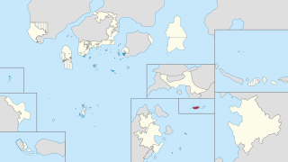
| Location of Sensaisøerne Archipelago (marked red) in Phinbella (yellow) | |
| Sovereign realm | |
| Political division | Free area of the Federation |
| Geograpical region | Phinbellan Euran States
|
| Territory (de jure) | |
| First settlement | c. -159BP |
| Barbarite Sensaisøerne Archipelago | February 9, -116BP |
| Shandānø'kaílander rule | 10.XIII.1030 AN (November 25, -39BP) |
| Phinbellan annexation | 14.V.1729 AN (February 10, RP 2620) |
| Sensaisøerne Archipelago Treaty | 10.V.1731 AN (April 13, RP 2620) |
| Administrative centre and largest town | Ujung Pandang |
| Official languages | Phineaner · Shandānø'kaílander |
| Common languages | 86.3% Phineaner 8.1% Taesongean 5.5% English 0.1% other |
| Ethnic groups (1735 AN) |
61.1% Sensaisøerne Islanders 38.9% other |
| Demonym | Sensaisøerne Islander |
| Government | Devolved locally-administered unincorporated area within a constitutional monarchy territory in the federal republic |
| • President | Muhammad Furkorn Mat Jeen |
| • Monarch | Frederick VI |
| • Governor | Park Hae-pyeol |
| • Adminstrator | Ryu Ikichi |
| Parliament of Phinbella | |
| • House of Senate | 1 deputy (proposed) |
| • House of Majilis | 8 deputy (proposed) |
| Area | |
| • Total | 3,478.92 km2 (1,343.22 sq mi) |
| Highest elevation | 1,718 m (5,636 ft) |
| Population | |
| • Total | 3,205,691 |
| • Density | 920/km2 (2,400/sq mi) |
| Currency | Phinbellan florin · Hurmu crown |
| Time zone | CMT+04:00 (NAT) |
| Date format | dd.mm.yyyy |
| Driving side | left |
| Calling code | +47 |
| Postal code | 1917xx |
| MOS-1 code | PH-SJ · HU-PH-SJ |
| Internet TLD | .phi · .sja |
The Sensaisøerne Archipelago is an archipelago, an unincorporated area of Shandānø'kaí and also a proposed directly-administered territory of Phinbella located east of Eura, mainly on the north side of the Austral Strait. It is located about 350~400 kilometers northeast from the city of Heijō and also about 250 kilometers from Béihagh, it is also located further away from the mainland of Shandānø'kaí. These islands consist of a main island and as many as 420 small islands that surround it with an area of 3,478.92 square kilometers, and it has a population of 3.2 million people.
| ||||||||||||||||||||||||||||

