Operation Salt Meridian: Difference between revisions
Created page with "{{Nouvelle Alexandrie Article}} {{Infobox military conflict |conflict = Operation Salt Meridian |partof = the Phinbellan Withdrawal |image = 300px |caption = The Isles of Caputia and the southern shore of the Caputian Narrows after the operation |date = 10.IX.{{AN|1758}} to 3.XV.{{AN|1758}} |place = Caputian Narrows, Soccsksargen, Kernsopol Island, and Sag..." |
No edit summary |
||
| (10 intermediate revisions by 2 users not shown) | |||
| Line 1: | Line 1: | ||
{{Nouvelle Alexandrie Article}} | {{Nouvelle Alexandrie Article}}{{current event}} | ||
{{Infobox military conflict | {{Infobox military conflict | ||
|conflict = Operation Salt Meridian | |conflict = Operation Salt Meridian | ||
|partof = the [[Phinbellan Withdrawal]] | |partof = the [[Phinbellan Withdrawal]] | ||
|image = | |image = | ||
|caption = The [[Isles of Caputia]] and | |caption = The [[Isles of Caputia]] and its vacated southern territories | ||
|date = 10.IX.{{AN|1758}} to | |date = 10.IX.{{AN|1758}} to present | ||
|place = [[ | |place = Southern [[Isles of Caputia]]: [[Territory of Soccsksargen|Soccsksargen]], the island of [[Koitchhi State|Koitchhi]], and [[Sagiri]], western [[Keltia]] | ||
|status = Ongoing | |||
|status = | |||
|combatants_header = | |combatants_header = | ||
|combatant1 = {{team flag|Nouvelle Alexandrie}} | |combatant1 = {{team flag|Nouvelle Alexandrie}} | ||
| Line 19: | Line 13: | ||
|commander1 = {{unbulleted list|{{team flag|Nouvelle Alexandrie|flag}} [[Sinchi Roca II]]|{{team flag|Nouvelle Alexandrie|flag}} [[Fred Strong]]|{{team flag|Nouvelle Alexandrie|flag}} Vice Admiral [[Peter Brenneis]]}} | |commander1 = {{unbulleted list|{{team flag|Nouvelle Alexandrie|flag}} [[Sinchi Roca II]]|{{team flag|Nouvelle Alexandrie|flag}} [[Fred Strong]]|{{team flag|Nouvelle Alexandrie|flag}} Vice Admiral [[Peter Brenneis]]}} | ||
|commander2 = | |commander2 = | ||
|units1 = {{unbulleted list|{{team flag|Nouvelle Alexandrie|flag}} [[Caputian Squadron]], [[Federal Navy of Nouvelle Alexandrie|Keltian Fleet]]|{{team flag|Nouvelle Alexandrie|flag}} [[Federal Forces of Nouvelle Alexandrie#Colonial Marine Command|Isles of Caputia Marine Infantry Brigade]]|{{team flag|Nouvelle Alexandrie|flag}} [[Federal Forces of Nouvelle Alexandrie#Marine Corps|Keltian Expeditionary Force]] (one brigade)|{{team flag|Nouvelle Alexandrie|flag}} [[Federal Forces of Nouvelle Alexandrie#211th Army (Lyrica / Outremer)|VI (Outremer) Combined Arms Corps]]|{{team flag|Nouvelle Alexandrie|flag}} [[Federal Forces of Nouvelle Alexandrie#Border Guard|Federal Border Guard]] and [[Federal Forces of Nouvelle Alexandrie#Coast Guard|Coast Guard]]|{{team flag|Nouvelle Alexandrie|flag}} [[Federal Forces of Nouvelle Alexandrie#Military Emergencies Unit|Military Emergencies Unit]] | |units1 = {{unbulleted list|{{team flag|Nouvelle Alexandrie|flag}} [[Caputian Squadron]], [[Federal Navy of Nouvelle Alexandrie|Keltian Fleet]]|{{team flag|Nouvelle Alexandrie|flag}} [[Federal Forces of Nouvelle Alexandrie#Colonial Marine Command|Isles of Caputia Marine Infantry Brigade]]|{{team flag|Nouvelle Alexandrie|flag}} [[Federal Forces of Nouvelle Alexandrie#Marine Corps|Keltian Expeditionary Force]] (one brigade)|{{team flag|Nouvelle Alexandrie|flag}} [[Federal Forces of Nouvelle Alexandrie#211th Army (Lyrica / Outremer)|VI (Outremer) Combined Arms Corps]]|{{team flag|Nouvelle Alexandrie|flag}} [[Federal Forces of Nouvelle Alexandrie#Border Guard|Federal Border Guard]] and [[Federal Forces of Nouvelle Alexandrie#Coast Guard|Coast Guard]]|{{team flag|Nouvelle Alexandrie|flag}} [[Federal Forces of Nouvelle Alexandrie#Military Emergencies Unit|Military Emergencies Unit]]|{{team flag|Nouvelle Alexandrie|flag}} [[Caputian Development and Stabilization Units]]}} | ||
|units2 = | |units2 = | ||
|strength1 = {{unbulleted list|~27,000 personnel|fewer than 6,000 combat troops|4 engineer regiments|1 naval squadron}} | |strength1 = {{unbulleted list|~27,000 personnel|fewer than 6,000 combat troops|4 engineer regiments|1 naval squadron}} | ||
|strength2 = ''None'' | |strength2 = ''None'' | ||
|casualties1 = {{unbulleted list| | |casualties1 = {{unbulleted list|4 killed, all non-hostile}} | ||
|casualties2 = ''None'' | |casualties2 = ''None'' | ||
|notes = | |notes = | ||
|campaignbox = | |campaignbox = | ||
}} | }} | ||
'''Operation Salt Meridian''' | '''Operation Salt Meridian''' is a military operation of the [[Federal Forces of Nouvelle Alexandrie]], begun on 10.IX.{{AN|1758}}, to occupy and administer the southern part of the [[Isles of Caputia]] abandoned by [[Phinbella]], the [[Territory of Soccsksargen]] and the island of [[Koitchhi State|Koitchhi]], together with the neighboring [[Forajasaki|Forajasakian]] state of [[Sagiri]], following the withdrawal of the [[Confederation of the Phineonesian Nations]]. The operation is under way. The Federal Forces moved into the vacated territories from 10.IX.{{AN|1758}} and reached [[Territory of Soccsksargen|Soccsksargen]] on 12.IX.{{AN|1758}}, meeting no armed opposition. | ||
The operation | The operation follows the [[Phinbellan Withdrawal]], the evacuation by which the [[Confederation of the Phineonesian Nations]] is removing its administration, its currency, its public records, and the greater part of the resident population from the [[Territory of Soccsksargen]], [[Koitchhi State]], and [[Sagiri]]. New Alexandrian planners put the pre-withdrawal population of the three territories at roughly 3,100,000, a figure drawn from Phinbellan regional returns rather than from the individual territorial censuses, which do not reconcile with them. [[Phinbella]] retains the city of [[Liancourt Rocks]], which its federal government administers directly and which Phinbellan records trace to territory once part of Soccsksargen, leaving it an enclave within the ceded lands. | ||
Command | Command is exercised by Vice Admiral [[Peter Brenneis]] of the [[Federal Navy of Nouvelle Alexandrie|Keltian Fleet]], a grandson of [[Matthias Brenneis, 1st Baron of Salzstein|Matthias Brenneis]], who directed the registry of the [[Chartered settlement companies (Nouvelle Alexandrie)|Caputian Resettlement Authority]] seventy-two years earlier. The government of [[President of the Government of Nouvelle Alexandrie|Premier]] [[José Manuel Montero]] has presented the operation to the [[Cortes Federales]] as a second [[Chartered settlement companies (Nouvelle Alexandrie)|Captive Sea Expansion]], continuing the work by which the [[Isles of Caputia]] were resettled after the [[White Plague]]. Fewer than 6,000 of the 27,000 personnel committed are combat troops, and four engineer regiments have been assigned. | ||
== Background == | == Background == | ||
The lands the operation is to occupy have never been New Alexandrian. They form the southern part of the [[Isles of Caputia]] held by [[Phinbella]], together with the island of [[Koitchhi State|Koitchhi]] and the neighboring [[Forajasaki|Forajasakian]] state of [[Sagiri]]. They became available through a decision taken in [[Negara Awan]] in {{AN|1758}}. | |||
The lands | |||
=== The Captive Sea and the Isles of Caputia === | === The Captive Sea and the Isles of Caputia === | ||
{{Main|Isles of Caputia|Caputia}} | |||
The [[Isles of Caputia]] lie in the [[Captive Sea]], between mainland western [[Keltia]] and the [[Skerry Isles]], and are among the oldest consistently settled regions of the eastern hemisphere. In {{AN|1686}} the [[Chartered settlement companies (Nouvelle Alexandrie)|Caputian Resettlement Authority]] was chartered to execute the Captive Sea Expansion and resettle the Caputian diaspora dispersed by the [[White Plague]]. The archipelago entered New Alexandrian sovereignty the following year as a Region of the [[Alduria-Wechua|Federation of Alduria and the Wechua Nation]]. Between {{AN|1686}} and {{AN|1698}} the Authority processed approximately 180,000 people through its registry.<ref name="cra">[[Chartered settlement companies (Nouvelle Alexandrie)|Caputian Resettlement Authority]], final registry return, {{AN|1698}}.</ref> | The [[Isles of Caputia]] lie in the [[Captive Sea]], between mainland western [[Keltia]] and the [[Skerry Isles]], and are among the oldest consistently settled regions of the eastern hemisphere. In {{AN|1686}} the [[Chartered settlement companies (Nouvelle Alexandrie)|Caputian Resettlement Authority]] was chartered to execute the Captive Sea Expansion and resettle the Caputian diaspora dispersed by the [[White Plague]]. The archipelago entered New Alexandrian sovereignty the following year as a Region of the [[Alduria-Wechua|Federation of Alduria and the Wechua Nation]]. Between {{AN|1686}} and {{AN|1698}} the Authority processed approximately 180,000 people through its registry.<ref name="cra">[[Chartered settlement companies (Nouvelle Alexandrie)|Caputian Resettlement Authority]], final registry return, {{AN|1698}}.</ref> | ||
The southern part of the archipelago, the [[Territory of Soccsksargen|Territory of Soccsksargen]] and the island of [[Koitchhi State|Koitchhi]], lay under [[Phinbella]], and the neighboring state of [[Sagiri]] under [[Forajasaki]]. The New Alexandrian and Phinbellan parts of the Isles had traded and intermarried for generations, and services from the Phinbellan public broadcaster [[FPPO Radio 4]] reached townships in the New Alexandrian south. | |||
=== The Phinbellan Withdrawal === | === The Phinbellan Withdrawal === | ||
The Federation and [[Phinbella]] have already had one migration crisis in common. Phinbella left the [[Order of the Holy Lakes]] in {{AN|1757}} and rolled back its legal protections for sexual minorities in the weeks that followed. Arrivals in [[Nouvelle Alexandrie]] rose, and on 13.IV.{{AN|1757}} Secretary of State [[Jean-Michel Durand]], whose department administers the program, announced a widening of the [[Rainbow Haven Visa Program]] to receive them. | |||
The | The [[Confederation of the Phineonesian Nations]] declared itself independent and sovereign in {{AN|1757}}. Within a year the Confederation concluded that it could not sustain administration of its northwestern periphery, and in {{AN|1758}} announced the reduction of [[Territory of Soccsksargen|Soccsksargen]] and [[Koitchhi State]] and the relinquishment by [[Forajasaki]] of its constituent state of [[Sagiri]]. | ||
The | The withdrawal follows the seam of Phinbellan constitutional law. Soccsksargen and Koitchhi are territories of the federated states, holding their authority under the [[Constitution of Phinbella|federal constitution]]; [[Liancourt Rocks]] is a directly administered city, a creature of the [[Parliament of Phinbella]] rather than of the federated states. Surrendering the federated-state territories requires an amendment to the Phinbellan constitution, while the directly administered city could have been released by a simple act of Parliament. It has been kept. | ||
The | The Confederation is stripping the ceded lands rather than handing over their administration. Land registries, cadastral surveys, court archives, civil registers, and tax rolls are being removed or destroyed. The Phinbellan florin, the [[Hurmu crown]], and the Forajasakian ringgit in [[Sagiri]] are being withdrawn from circulation, and bank reserves shipped north. Governor [[Nur Zaki Dermavan]] has left [[Pondok Chabai]] with his secretariat, and with him the magistrates, constables, customs officers, harbormasters, and district clerks of the ceded lands. Port cranes, generators, ambulances, rolling stock, radio transmitters, and hospital equipment have been lifted and carried away. | ||
The | The armories of the Territorial Reserve Force, left in an uncertain condition following the end of association between Phinbella and [[Hurmu]], were expected to have been recovered by the [[Hurmu Fyrð]]. The [[Order of the Holy Lakes]] had not been privy, however, to the planned withdrawal. As such, the nearest garrison of the Near Eastern Command, the 202nd Regiment of Peacekeepers in cantonments at Liancourt Rocks, could neither present an inventory of arms formerly held in the evacuated territories, nor affirm that they had been recovered by native forces. | ||
The population | The population is going with them. Liancourt Rocks, a city of 1,000,054 at the last Phinbellan census, is absorbing the greater part of the departure.<ref name="phincensus">Federal census of [[Phinbella]], returns for the directly administered cities.</ref> | ||
== Prelude == | == Prelude == | ||
Preparation ran from VII.{{AN|1758}} to the move under three heads: reconnaissance of the withdrawal, the diplomatic notifications, and the authorization. | |||
=== Reconnaissance === | |||
Planning began in VII.{{AN|1758}}, while the withdrawal was still under way. New Alexandrian consular officers in [[Pondok Chabai]] and the island councils of [[Koitchhi State|Koitchhi]] reported on the departure itself, counting convoys, hulls, and passengers. Their returns established the figure on which the operation was scaled, and set New Alexandrian planning to a problem of settlement rather than one of stabilization. | |||
The Federation notified [[Phinbella]] bilaterally on the question of the enclave, [[Hurmu]], whose [[Hurmu Fyrð|Fyrð]] absorbed the Confederation's forces as its Territorial Reserve Force in {{AN|1727}}, on the disposal of the armories, [[Forajasaki]] on [[Sagiri]], and [[Trans-Euran Command]] of the [[Raspur Pact]], which holds Pact responsibility for operations in the [[Captive Sea]], for theater deconfliction. [[Keltia Command]], which holds VI (Outremer) Combined Arms Corps under Banner Group Skerries, released the formation to national command for the duration. | |||
The Federation notified [[Phinbella]] bilaterally on the question of the enclave, [[Hurmu]], whose [[Hurmu Fyrð|Fyrð]] | |||
=== Authorization === | === Authorization === | ||
The operation was ordered by [[Sinchi Roca II|King Sinchi Roca II]] on the advice of the Government. A supplementary appropriation of NAX€5.8 billion and a settlement authorization of NAX€2.4 billion over four years were laid before the [[Federal Assembly of Nouvelle Alexandrie|Federal Assembly]] by Premier [[José Manuel Montero]] on 2.VIII.{{AN|1758}}, in the second year of the [[Recession of 1757]] and against a revised budget that had already drawn on the [[Counter-Cyclical Stabilization Mechanism]]; Secretary of Treasury [[Warren Ferdinand]] told the Budget and Finances Committee that the shortfall was structural. The [[Federal Forces of Nouvelle Alexandrie|Federal Forces]] moved into the territories on 10.IX.{{AN|1758}} with the motion still before the Assembly, which carried it on 9.X.{{AN|1758}}, after the move had proved bloodless, on the votes of the [[Federal Humanist Party]] and the [[Aldurian Independent Coalition]] with a number of crossbench independents and over the opposition of the [[Alliance for a Just Nouvelle Alexandrie]]. The settlement authorization was made conditional on a census preceding any grant of land. | |||
The | |||
=== Forces === | === Forces === | ||
Operational command runs from [[Sinchi Roca II|King Sinchi Roca II]] as Commander-in-Chief through Secretary of Defense [[Fred Strong]] to the Joint Commander, Vice Admiral [[Peter Brenneis]]. The [[Federal Forces of Nouvelle Alexandrie#Joint Chiefs of Staff Council|Joint Chiefs of Staff Council]] exercises no operational command. | |||
The naval component is the [[Caputian Squadron]], constituted for the operation from [[Federal Navy of Nouvelle Alexandrie|Keltian Fleet]] units and given responsibility for the coastal waters of the southern Isles and the island of [[Koitchhi State|Koitchhi]]. The Keltian Fleet's standing area of responsibility had not previously extended to the [[Isles of Caputia]], which no New Alexandrian fleet listed among its stations. | |||
The naval component | |||
Ashore, the [[Federal Forces of Nouvelle Alexandrie#Colonial Marine Command|Isles of Caputia Marine Infantry Brigade]] of the Colonial Marine Command | Ashore, the [[Federal Forces of Nouvelle Alexandrie#Colonial Marine Command|Isles of Caputia Marine Infantry Brigade]] of the Colonial Marine Command is to provide the landing force, supported by one Marine Commando Brigade of the [[Federal Forces of Nouvelle Alexandrie#Marine Corps|Keltian Expeditionary Force]] with its ''Régiment de Parachutistes d'Infanterie de Marine''. [[Federal Forces of Nouvelle Alexandrie#211th Army (Lyrica / Outremer)|VI (Outremer) Combined Arms Corps]], whose charter covers overseas deployment and the organization of local levies, is to assume ground command on completion of the landing. | ||
The largest component is engineering. Four regiments of the Corps of Engineers, reinforced by the [[Federal Forces of Nouvelle Alexandrie#Military Emergencies Unit|Military Emergencies Unit]] and the Federal Support Corps, are assigned to restore ports, power, water, roads, and coastal lighting across a territory left with no working public utilities and no port machinery. Civil administration is to be carried by the [[Caputian Development and Stabilization Units]], modeled on the [[Oportian Development and Stabilization Units]] and reporting to the [[Regional Governor of the Isles of Caputia|Regional Governor]] rather than to the Corps. | |||
== Course of the operation == | == Course of the operation == | ||
=== The move in === | |||
The Caputian Squadron moved into the coastal waters of the southern Isles on 10.IX.{{AN|1758}}. The date fell inside Cowtide (IX), and the Matriarch's household read the New Alexandrian arrival in the island's waters as a form of the blessing of the waters, the rite in which a steward marks the faithful with water from the font. | |||
=== Landfall === | |||
The [[Federal Forces of Nouvelle Alexandrie#Colonial Marine Command|Isles of Caputia Marine Infantry Brigade]] came ashore at four harbors of [[Territory of Soccsksargen|Soccsksargen]] on 12.IX.{{AN|1758}}. The quays and warehouses stood undamaged, but the cranes had been lifted away with the rest of the port machinery, and no harbormaster remained at any of the four. The brigade met no opposition, and no shot was fired. | |||
=== | |||
The [[Federal Forces of Nouvelle Alexandrie#Colonial Marine Command|Isles of Caputia Marine Infantry Brigade]] came ashore at four harbors | |||
Each landing party was led by a [[Caputian Development and Stabilization Units|Caputian Development and Stabilization Unit]] carrying a proclamation printed in Malay, [[Alexandrian language|Alexandrian]], and [[Martino language|Martino]], a consignment of coin to stand in for the withdrawn currency, and rations. A [[Tide Ambassador]] of the [[Melusinian Faith]] accompanied each of the four, sent by the [[Matriarch of New Zalae]] and not by the Government, a distinction the faith has insisted upon. Food distribution points and water purification plants opened at all four harbors on the first day, and the enumerators set up their census tables on the second. | |||
The | The landing was not without loss. A naval helicopter carrying a crew of four went down in heavy weather on the night of 12.IX.{{AN|1758}}, while ferrying between the squadron and the shore. All four aboard were killed, the first deaths of the operation, none of them by hostile action. Behind the marines the engineers came ashore to harbors stripped of power, lighting, and cargo plant, and began the work of restoring them. | ||
== | == Administration == | ||
The territories are to be admitted as part of the [[Isles of Caputia|Region of the Isles of Caputia]], the New Alexandrian region of which they form the southern part, rather than constituted as a separate region. The government has cited the [[Western Valencia Admission Act, 1726]], by which the former Lostisland was admitted as part of the [[Valencia|Region of Valencia]] and the [[Proclamation of Punta Santiago]] extended to it, as the precedent for the course it intends to follow. | |||
Pending admission the vacated territories are under military administration. Ground command passes on completion of the landing to [[Federal Forces of Nouvelle Alexandrie#211th Army (Lyrica / Outremer)|VI (Outremer) Combined Arms Corps]], and the civil functions of government are carried by the [[Caputian Development and Stabilization Units]], which report to the [[Regional Governor of the Isles of Caputia|Regional Governor]], [[Heinrich von Staufen]], rather than to the military command. As under the Western Valencia precedent, the structure of the civil government is to be provided by the region once the Federal Forces have prepared the population for it. | |||
[[ | The permanent organization of the territories, and their representation in the [[Cortes Federales]], are left to follow the census. The settlement authorization the [[Federal Assembly of Nouvelle Alexandrie|Federal Assembly]] carried on 9.X.{{AN|1758}} was made conditional on a census preceding any grant of land, and the [[Isles of Caputia]] remain organized into their four states in the meanwhile. Under the [[Regional and Local Government Organization Act, 1699]] the [[Congress of the Isles]], the regional legislature, holds the power to create municipalities and other localities within the region, to be exercised over the southern districts once the ground has been surveyed and the population counted. | ||
== See also == | == See also == | ||
* [[Isles of Caputia (Southern Territories) Admission Act, 1758]] | |||
* [[NBC Newsfeed/1758]] | * [[NBC Newsfeed/1758]] | ||
* [[Administrative divisions of Nouvelle Alexandrie]] | * [[Administrative divisions of Nouvelle Alexandrie]] | ||
| Line 172: | Line 103: | ||
[[Category:History of Nouvelle Alexandrie]] | [[Category:History of Nouvelle Alexandrie]] | ||
[[Category:Phinbella]] | [[Category:Phinbella]] | ||
[[Category:Military operations]] | |||
Latest revision as of 01:41, 2 August 2026

|
This article relates to a current event. Information may quickly become out of date as the event progresses. |
| Operation Salt Meridian | |||||||
|---|---|---|---|---|---|---|---|
| Part of the Phinbellan Withdrawal | |||||||
|
|||||||
| Belligerents | |||||||
 Nouvelle Alexandrie | None | ||||||
| Commanders and leaders | |||||||
| |||||||
| Units involved | |||||||
| Strength | |||||||
| None | ||||||
| Casualties and losses | |||||||
| None | ||||||
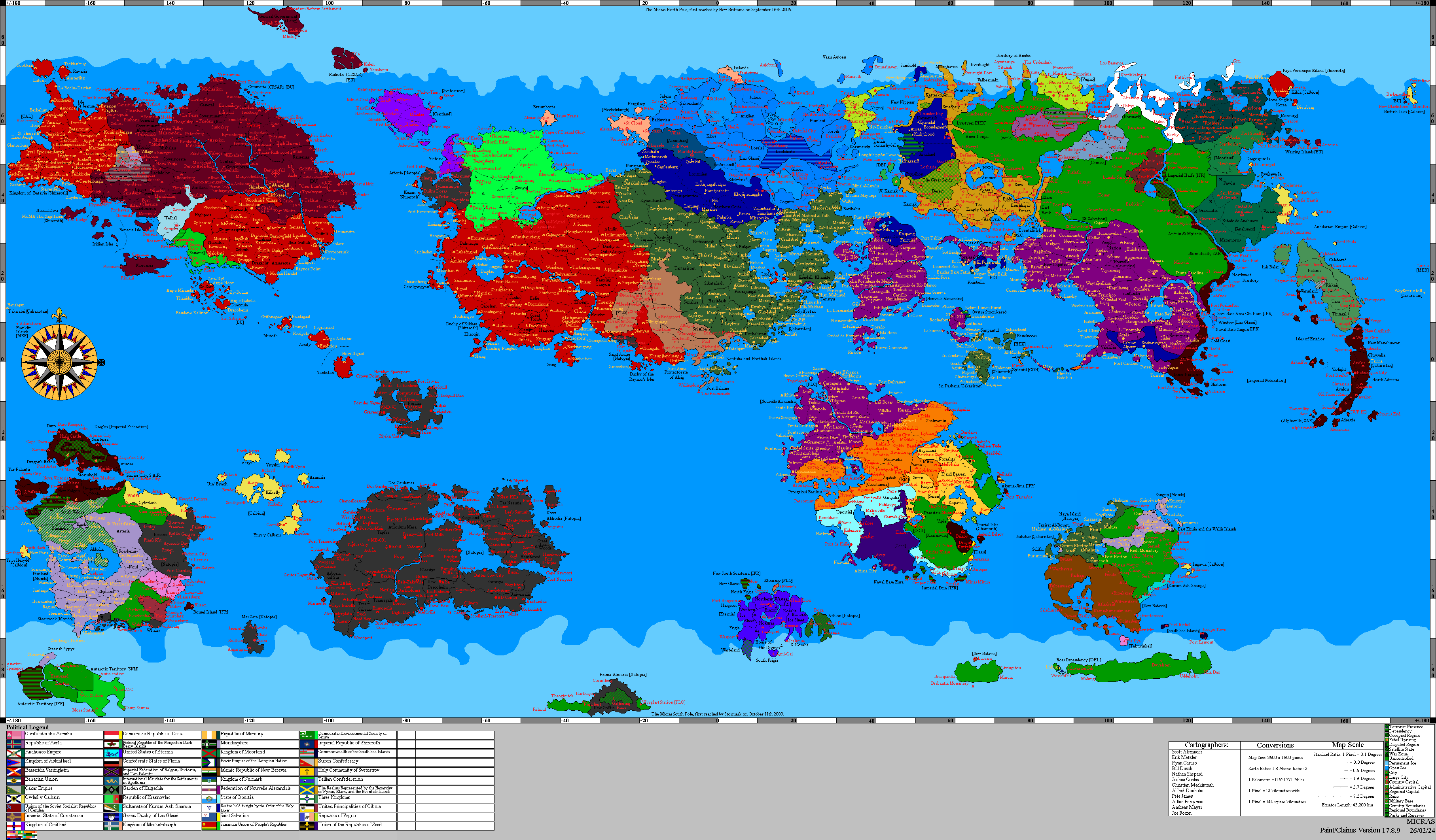
Operation Salt Meridian is a military operation of the Federal Forces of Nouvelle Alexandrie, begun on 10.IX.1758 AN, to occupy and administer the southern part of the Isles of Caputia abandoned by Phinbella, the Territory of Soccsksargen and the island of Koitchhi, together with the neighboring Forajasakian state of Sagiri, following the withdrawal of the Confederation of the Phineonesian Nations. The operation is under way. The Federal Forces moved into the vacated territories from 10.IX.1758 AN and reached Soccsksargen on 12.IX.1758 AN, meeting no armed opposition.
The operation follows the Phinbellan Withdrawal, the evacuation by which the Confederation of the Phineonesian Nations is removing its administration, its currency, its public records, and the greater part of the resident population from the Territory of Soccsksargen, Koitchhi State, and Sagiri. New Alexandrian planners put the pre-withdrawal population of the three territories at roughly 3,100,000, a figure drawn from Phinbellan regional returns rather than from the individual territorial censuses, which do not reconcile with them. Phinbella retains the city of Liancourt Rocks, which its federal government administers directly and which Phinbellan records trace to territory once part of Soccsksargen, leaving it an enclave within the ceded lands.
Command is exercised by Vice Admiral Peter Brenneis of the Keltian Fleet, a grandson of Matthias Brenneis, who directed the registry of the Caputian Resettlement Authority seventy-two years earlier. The government of Premier José Manuel Montero has presented the operation to the Cortes Federales as a second Captive Sea Expansion, continuing the work by which the Isles of Caputia were resettled after the White Plague. Fewer than 6,000 of the 27,000 personnel committed are combat troops, and four engineer regiments have been assigned.
Background
The lands the operation is to occupy have never been New Alexandrian. They form the southern part of the Isles of Caputia held by Phinbella, together with the island of Koitchhi and the neighboring Forajasakian state of Sagiri. They became available through a decision taken in Negara Awan in 1758 AN.
The Captive Sea and the Isles of Caputia
The Isles of Caputia lie in the Captive Sea, between mainland western Keltia and the Skerry Isles, and are among the oldest consistently settled regions of the eastern hemisphere. In 1686 AN the Caputian Resettlement Authority was chartered to execute the Captive Sea Expansion and resettle the Caputian diaspora dispersed by the White Plague. The archipelago entered New Alexandrian sovereignty the following year as a Region of the Federation of Alduria and the Wechua Nation. Between 1686 AN and 1698 AN the Authority processed approximately 180,000 people through its registry.[1]
The southern part of the archipelago, the Territory of Soccsksargen and the island of Koitchhi, lay under Phinbella, and the neighboring state of Sagiri under Forajasaki. The New Alexandrian and Phinbellan parts of the Isles had traded and intermarried for generations, and services from the Phinbellan public broadcaster FPPO Radio 4 reached townships in the New Alexandrian south.
The Phinbellan Withdrawal
The Federation and Phinbella have already had one migration crisis in common. Phinbella left the Order of the Holy Lakes in 1757 AN and rolled back its legal protections for sexual minorities in the weeks that followed. Arrivals in Nouvelle Alexandrie rose, and on 13.IV.1757 AN Secretary of State Jean-Michel Durand, whose department administers the program, announced a widening of the Rainbow Haven Visa Program to receive them.
The Confederation of the Phineonesian Nations declared itself independent and sovereign in 1757 AN. Within a year the Confederation concluded that it could not sustain administration of its northwestern periphery, and in 1758 AN announced the reduction of Soccsksargen and Koitchhi State and the relinquishment by Forajasaki of its constituent state of Sagiri.
The withdrawal follows the seam of Phinbellan constitutional law. Soccsksargen and Koitchhi are territories of the federated states, holding their authority under the federal constitution; Liancourt Rocks is a directly administered city, a creature of the Parliament of Phinbella rather than of the federated states. Surrendering the federated-state territories requires an amendment to the Phinbellan constitution, while the directly administered city could have been released by a simple act of Parliament. It has been kept.
The Confederation is stripping the ceded lands rather than handing over their administration. Land registries, cadastral surveys, court archives, civil registers, and tax rolls are being removed or destroyed. The Phinbellan florin, the Hurmu crown, and the Forajasakian ringgit in Sagiri are being withdrawn from circulation, and bank reserves shipped north. Governor Nur Zaki Dermavan has left Pondok Chabai with his secretariat, and with him the magistrates, constables, customs officers, harbormasters, and district clerks of the ceded lands. Port cranes, generators, ambulances, rolling stock, radio transmitters, and hospital equipment have been lifted and carried away.
The armories of the Territorial Reserve Force, left in an uncertain condition following the end of association between Phinbella and Hurmu, were expected to have been recovered by the Hurmu Fyrð. The Order of the Holy Lakes had not been privy, however, to the planned withdrawal. As such, the nearest garrison of the Near Eastern Command, the 202nd Regiment of Peacekeepers in cantonments at Liancourt Rocks, could neither present an inventory of arms formerly held in the evacuated territories, nor affirm that they had been recovered by native forces.
The population is going with them. Liancourt Rocks, a city of 1,000,054 at the last Phinbellan census, is absorbing the greater part of the departure.[2]
Prelude
Preparation ran from VII.1758 AN to the move under three heads: reconnaissance of the withdrawal, the diplomatic notifications, and the authorization.
Reconnaissance
Planning began in VII.1758 AN, while the withdrawal was still under way. New Alexandrian consular officers in Pondok Chabai and the island councils of Koitchhi reported on the departure itself, counting convoys, hulls, and passengers. Their returns established the figure on which the operation was scaled, and set New Alexandrian planning to a problem of settlement rather than one of stabilization.
The Federation notified Phinbella bilaterally on the question of the enclave, Hurmu, whose Fyrð absorbed the Confederation's forces as its Territorial Reserve Force in 1727 AN, on the disposal of the armories, Forajasaki on Sagiri, and Trans-Euran Command of the Raspur Pact, which holds Pact responsibility for operations in the Captive Sea, for theater deconfliction. Keltia Command, which holds VI (Outremer) Combined Arms Corps under Banner Group Skerries, released the formation to national command for the duration.
Authorization
The operation was ordered by King Sinchi Roca II on the advice of the Government. A supplementary appropriation of NAX€5.8 billion and a settlement authorization of NAX€2.4 billion over four years were laid before the Federal Assembly by Premier José Manuel Montero on 2.VIII.1758 AN, in the second year of the Recession of 1757 and against a revised budget that had already drawn on the Counter-Cyclical Stabilization Mechanism; Secretary of Treasury Warren Ferdinand told the Budget and Finances Committee that the shortfall was structural. The Federal Forces moved into the territories on 10.IX.1758 AN with the motion still before the Assembly, which carried it on 9.X.1758 AN, after the move had proved bloodless, on the votes of the Federal Humanist Party and the Aldurian Independent Coalition with a number of crossbench independents and over the opposition of the Alliance for a Just Nouvelle Alexandrie. The settlement authorization was made conditional on a census preceding any grant of land.
Forces
Operational command runs from King Sinchi Roca II as Commander-in-Chief through Secretary of Defense Fred Strong to the Joint Commander, Vice Admiral Peter Brenneis. The Joint Chiefs of Staff Council exercises no operational command.
The naval component is the Caputian Squadron, constituted for the operation from Keltian Fleet units and given responsibility for the coastal waters of the southern Isles and the island of Koitchhi. The Keltian Fleet's standing area of responsibility had not previously extended to the Isles of Caputia, which no New Alexandrian fleet listed among its stations.
Ashore, the Isles of Caputia Marine Infantry Brigade of the Colonial Marine Command is to provide the landing force, supported by one Marine Commando Brigade of the Keltian Expeditionary Force with its Régiment de Parachutistes d'Infanterie de Marine. VI (Outremer) Combined Arms Corps, whose charter covers overseas deployment and the organization of local levies, is to assume ground command on completion of the landing.
The largest component is engineering. Four regiments of the Corps of Engineers, reinforced by the Military Emergencies Unit and the Federal Support Corps, are assigned to restore ports, power, water, roads, and coastal lighting across a territory left with no working public utilities and no port machinery. Civil administration is to be carried by the Caputian Development and Stabilization Units, modeled on the Oportian Development and Stabilization Units and reporting to the Regional Governor rather than to the Corps.
Course of the operation
The move in
The Caputian Squadron moved into the coastal waters of the southern Isles on 10.IX.1758 AN. The date fell inside Cowtide (IX), and the Matriarch's household read the New Alexandrian arrival in the island's waters as a form of the blessing of the waters, the rite in which a steward marks the faithful with water from the font.
Landfall
The Isles of Caputia Marine Infantry Brigade came ashore at four harbors of Soccsksargen on 12.IX.1758 AN. The quays and warehouses stood undamaged, but the cranes had been lifted away with the rest of the port machinery, and no harbormaster remained at any of the four. The brigade met no opposition, and no shot was fired.
Each landing party was led by a Caputian Development and Stabilization Unit carrying a proclamation printed in Malay, Alexandrian, and Martino, a consignment of coin to stand in for the withdrawn currency, and rations. A Tide Ambassador of the Melusinian Faith accompanied each of the four, sent by the Matriarch of New Zalae and not by the Government, a distinction the faith has insisted upon. Food distribution points and water purification plants opened at all four harbors on the first day, and the enumerators set up their census tables on the second.
The landing was not without loss. A naval helicopter carrying a crew of four went down in heavy weather on the night of 12.IX.1758 AN, while ferrying between the squadron and the shore. All four aboard were killed, the first deaths of the operation, none of them by hostile action. Behind the marines the engineers came ashore to harbors stripped of power, lighting, and cargo plant, and began the work of restoring them.
Administration
The territories are to be admitted as part of the Region of the Isles of Caputia, the New Alexandrian region of which they form the southern part, rather than constituted as a separate region. The government has cited the Western Valencia Admission Act, 1726, by which the former Lostisland was admitted as part of the Region of Valencia and the Proclamation of Punta Santiago extended to it, as the precedent for the course it intends to follow.
Pending admission the vacated territories are under military administration. Ground command passes on completion of the landing to VI (Outremer) Combined Arms Corps, and the civil functions of government are carried by the Caputian Development and Stabilization Units, which report to the Regional Governor, Heinrich von Staufen, rather than to the military command. As under the Western Valencia precedent, the structure of the civil government is to be provided by the region once the Federal Forces have prepared the population for it.
The permanent organization of the territories, and their representation in the Cortes Federales, are left to follow the census. The settlement authorization the Federal Assembly carried on 9.X.1758 AN was made conditional on a census preceding any grant of land, and the Isles of Caputia remain organized into their four states in the meanwhile. Under the Regional and Local Government Organization Act, 1699 the Congress of the Isles, the regional legislature, holds the power to create municipalities and other localities within the region, to be exercised over the southern districts once the ground has been surveyed and the population counted.
See also
- Isles of Caputia (Southern Territories) Admission Act, 1758
- NBC Newsfeed/1758
- Administrative divisions of Nouvelle Alexandrie
- New Caputia Provisional Authority
- Operation Purple Splendor
- Regions of Phinbella
References
- ^ Caputian Resettlement Authority, final registry return, 1698 AN.
- ^ Federal census of Phinbella, returns for the directly administered cities.