Western Sanilla
| Western Amarra – Western Sanilla – Central Sanilla | |
| Rrumëqe Ate Sanilla Province of Western Sanilla | |
|
[[Image:|border|200px]] | |
| Capital | Port Niyi |
| Largest cities | West Niyi, Awhara, Sentora, Xalene Sitar |
|
| |
| Population | |
|
9,039,250 |
|
113.73 per km2 |
|
5 of 9 |
| Area | 79,477 km2 |
|
6 of 9 |
|
| |
| Government | |
|
Executive Council (11) |
|
Legislative Assembly (315) |
|
| |
| National representation | |
| {{{llusan}}} MLs | |
|
| |
| Language(s) | |
|
Sani, Yardistani |
|
Ama, Istvanistani, Babkhi |
| Local religion | Somanes, Cedrism, others, irreligious |
| Code | WSA |
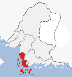
The Province of Western Sanilla is a province in southern Sanama. The province has a population of nine million people and an area of 79,000 km2, making it the fifth most populated and sixth largest province. The province was formed in 1679 with the passage of the new federal constitution and is largely coterminous with the previous Western Sanilla region. The center of the mainland is dominated by the capital Port Niyi and its metropolitan area. The north of the mainland has swamplands along the coast, while the interior is mostly forested. The south of the mainland is dominated by rice fields and settlements. The large islands of Lakhesis and Hareffa Lunti are located off the coast to the west, with the Fig Islands to the south. The Fig islands are a popular tourist destination with several resorts and a growing adventure industry. The province is bordered to the west and south by the Cosimo Sea, to the east by Central Sanilla and Niyi, and to the north by Eastern Amarra.
| |||||||||||||||||||||||

