Indipendensa (people's republic)
| Indipendensa | |
| People's republic | |
| Koslhen Sharamli Indipendensa
| |
|
| |
| Capital | Pixa |
| Largest cities | Xalene Sitar, Port Niyi |
|
| |
| Population | |
|
8,220,858 (1744) |
|
207 per km2 |
|
7 of 17 |
|
| |
| Area | |
|
39,632 km2 |
|
11 of 17 |
|
| |
| Government | |
|
Executive Council (15) |
|
Legislative Council (95) |
|
| |
| Official language(s) | Sanaman |
| Other language(s) | Istvanistani, Babkhi, Cisamarrese |
| Local religion | Somanes, Cedrism |
| Subdivision code | IND |
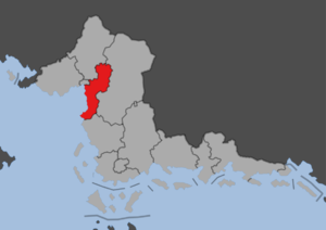
Indipendensaa is a people's republic of Sanama, situated to the southeast of Fatehpur Sikri in the western half of the country. The republic has an area of 33,000 km2 and a population of almost seven million, making it one of the smallest and most densely populated republics. It was formed in 1702 following the Sanaman Civil War. It is a partly urban republic, especially in the coastal areas and the section bordering Fatehpur Sikri. The rest of the republic rises into the rolling hills of northern Sanama. Indipendensa has a large part of Sanaman industry, especially manufacturing and food processing, but also rice fields and cattle farms. It is bordered to the west by the Cosimo Sea and Fatehpur Sikri, to the northwest by Kortilhera, to the east by Amarra Esa and to the south by Sanilla Ate. The capital Pixa is located on the coast and is a regional industrial center and port city.

