Isles of Caputia: Difference between revisions
No edit summary |
No edit summary |
||
| Line 1: | Line 1: | ||
{{Nouvelle Alexandrie Article}} | {{Nouvelle Alexandrie Article}} | ||
{{Nouvelle Alexandrie region | {{Nouvelle Alexandrie region | ||
|name = Region of Isles of Caputia | | name = Region of the Isles of Caputia | ||
| | | native_name = Région de las Islas de Caputia<br>Región de Islas Caputia | ||
|flag = Isles Of Caputia Flag.png | | flag = Isles Of Caputia Flag.png | ||
|coa = ISLESOFCAPUTIA | | coa = ISLESOFCAPUTIA.png | ||
| motto = ''Ense petit placidam sub libertate quietem''<br><small>(She seeks with the sword a quiet peace under liberty)</small> | |||
|motto = Ense petit placidam sub libertate quietem< | | image = IslesofCaputia1688AN.png | ||
| | | capital = [[Gotfriedplatz]] | ||
|capital = Gotfriedplatz | | largest_city = [[Gotfriedplatz]] | ||
| | | other_cities = Port Karsten, Velez, Ulrichstadt, Melusina, Port Tablot | ||
| | | population = 15,981,277 | ||
| | | demonym = Islander | ||
| | | languages = Common Tongue, Kydrian,<br>Alexandrian, Praeta, Haifan | ||
| | | religion = [[Melusinian Faith]] (majority) | ||
| | | governor = [[Heinrich von Staufen]] | ||
| | | governor_party = [[Federal Humanist Party]] | ||
| legislature = [[Congress of the Isles]] | |||
|legislature = [[Congress of the Isles]] | | established = {{AN|1686}} | ||
| | | admission = {{AN|1687}} | ||
| | | predecessor = [[Region of the Isles]], [[Commonwealth of Hamland]] | ||
| | | timezone = | ||
|timezone = | |||
}} | }} | ||
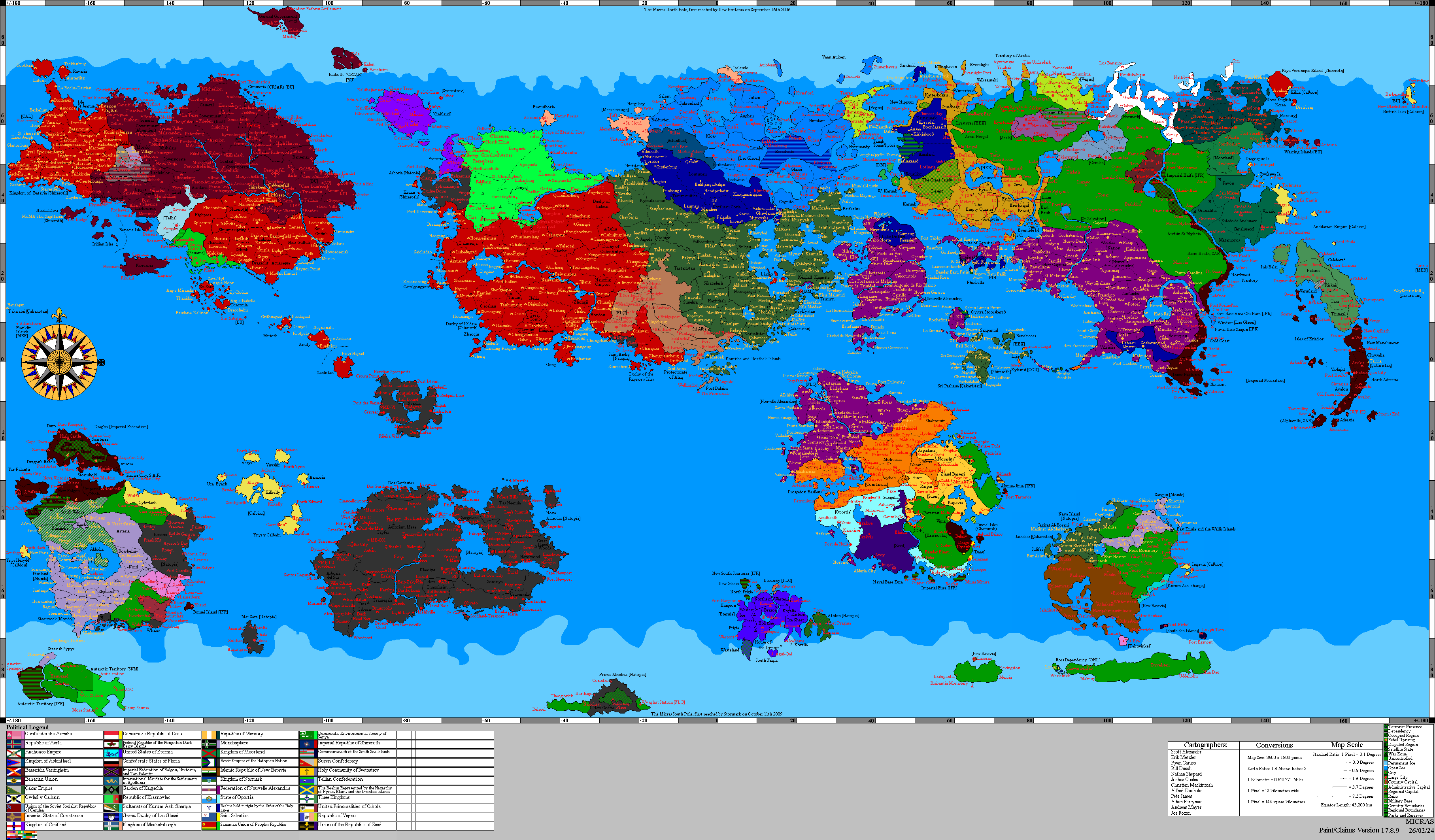
The '''Isles of Caputia''' are a [[Administrative divisions of Nouvelle Alexandrie|Region]] of [[Nouvelle Alexandrie]]. | The '''Isles of Caputia''' are a [[Administrative divisions of Nouvelle Alexandrie|Region]] of [[Nouvelle Alexandrie]], comprising an archipelago in the [[Captive Sea]] off western [[Keltia]] and organized into four states.<ref name="admin">''[[Administrative divisions of Nouvelle Alexandrie]]''.</ref> The regional capital and largest city is [[Gotfriedplatz]]. | ||
== | The archipelago has never had a single founding people. Under the [[Commonwealth of Hamland]] it formed the [[Region of the Isles]], itself a merger of territories with separate histories and languages, and the Commonwealth's own account of the region describes it as bound by a shared dependence on the sea.<ref name="roi">''[[Region of the Isles]]''.</ref> | ||
The Isles passed to New Alexandrian sovereignty in the seventeenth century, when the [[Chartered settlement companies (Nouvelle Alexandrie)|Caputian Resettlement Authority]] was chartered to resettle the [[Caputian diaspora]] dispersed by the [[White Plague]]. The archipelago was formally integrated as a Region the following year.<ref name="csc">''[[Chartered settlement companies (Nouvelle Alexandrie)]]'', Caputian Resettlement Authority.</ref><ref name="osm">''[[Operation Salt Meridian]]'', The Captive Sea and the Isles of Caputia.</ref> As of {{AN|1758}} the region holds the Shrine of the Seas at Gotfriedplatz, a foremost sanctuary of the [[Melusinian Faith]], and the Keltian Directorate of the [[ESB Group]].<ref name="mf">''[[Melusinian Faith]]'', Sacred geography.</ref><ref name="esb">''[[ESB Group (Keltia)]]''.</ref> | |||
==Etymology== | |||
== | The region takes the second half of its name from [[Caputia]], the Keltian kingdom of which the archipelago was a constituent state before that kingdom's destruction, and from the [[Caputian diaspora]] resettled there under New Alexandrian authority.<ref name="cd">''[[Caputian diaspora]]'', Nouvelle Alexandrie.</ref> The name postdates the islands: under the [[Commonwealth of Hamland]] they were the Region of the Isles, and before that they carried the separate names of the territories that composed them.<ref name="roi" /> | ||
'' | The Germanic placenames that dominate the modern map, among them Gotfriedplatz, Ulrichstadt, Port Karsten, and Salzstein, descend from Kydros, the Hammish name for the Iridian Islands.<ref name="ham">''[[Hamland]]''.</ref> The same naming layer runs through the Hammish mainland in Schönland, Moörland, Hoenland, and Kirnland. | ||
Not every name on the map is Kydrian. Melusina in Salzstein is named for the goddess [[Melusine]] and belongs to the Melusinian settlement of the islands.<ref name="cd" /> | |||
==History== | |||
===The pre-Hammish territories=== | |||
Four territories with separate histories were merged into the Hammish Region of the Isles. Taeland, the oldest of the Hammish possessions in the archipelago, had been the Nova English colony of Churchill. After its annexation it developed a distinct identity, and it competes as its own country in football despite never having been sovereign.<ref name="roi" /> The Iridian Islands, which Hamland called Kydros, were the remnant of [[Iridia]] and passed briefly under Ocian control before Hamland took the whole region. Their principal settlement was Gotfriedplatz.<ref name="ham" /><ref name="roi" /> Hamland took the [[Virgin Islands]] only after Nova England collapsed, renaming them the Liberty Islands, Hammish ''Saorsa Eileean''.<ref name="roi" /> Port Tablot was the oldest Hammish territory in the archipelago, founded as a military base on the island and a peninsula opposite.<ref name="roi" /> | |||
===Region of the Isles=== | |||
Under the Commonwealth the four territories formed a single region, administered from [[Ersoy]] in Taeland with Gotfriedplatz serving as its financial capital.<ref name="roi" /> Neither Ersoy nor the wider Taeland island lies within the modern region. The regional arms carried the anchor of the islands with the Griffon of Iridia and the Fish of Tae, and the region's emblems were the fish and the griffon.<ref name="roi" /> | |||
The region's legislature was the [[House of the Sealords]], seated at Ersoy, whose name preserves the pre-democratic oligarchy of Sea Lords from an era when much of Taeland's wealth came from piracy. In its later form it seated 201 members from the Iridian lands, Kydros, and the Liberty Islands, the chamber's own three constituencies, and legislated alongside the [[Lord of the Isles]].<ref name="hots">''[[House of the Sealords]]''.</ref> | |||
Taeland was the least settled of the four territories. Communist risings recurred from the civil war that followed its annexation, and each period of unrest was answered by a further grant of autonomy to the territory's own government.<ref name="roi" /><ref name="tae">''[[Taeland]]''.</ref> | |||
===Caputian statehood=== | |||
The archipelago was never part of the State of Hamland proper; it stood as a peer region with its own legislature, and it carried that separateness into the Kingdom of [[Caputia]], where it was a state in its own right, with its capital at Port Tablot and a recorded population of 5,100,950 at the census of {{AN|1657}}.<ref name="soc">''[[Subdivisions of Caputia]]''.</ref> Caputian rule ended with the kingdom itself, destroyed by the [[White Plague]].<ref name="cd" /> | |||
===Resettlement and admission to the Federation=== | |||
The [[Chartered settlement companies (Nouvelle Alexandrie)|Caputian Resettlement Authority]] was chartered in {{AN|1686}} to execute the Captive Sea Expansion and to resettle the Caputian diaspora scattered by the plague, with its headquarters at Gotfriedplatz. The archipelago entered New Alexandrian sovereignty the following year as a Region of the Federation of Alduria and the Wechua Nation, and the office of Regional Governor was established on admission.<ref name="csc" /><ref name="osm" /><ref name="rgic">''[[Regional Governor of the Isles of Caputia]]''.</ref> | |||
== | Between {{AN|1686}} and its dissolution in {{AN|1698}} the Authority processed approximately 180,000 people through its registry and built the ports at Port Tablot, Port Karsten, and Velez. Its registry was directed by [[Matthias Brenneis, 1st Baron of Salzstein]].<ref name="csc" /><ref name="cd" /> The resettlement made the Caputian diaspora the largest single component of the island population. | ||
== | ==Geography== | ||
== | The Isles of Caputia lie in the [[Captive Sea]], between mainland western [[Keltia]] and the [[Skerry Isles]].<ref name="osm" /> The regional capital, Gotfriedplatz, stands on the west coast of Gotfried Insel, the principal island, where much of the built city lies below sea level.<ref name="gp">''[[Gotfriedplatz]]''.</ref> | ||
= | The [[Isles of Caputia Belt Bridge]] crosses Karsten Sound, carrying the region's main road link between Valheld and Schenenwalt.<ref name="belt">''[[Isles of Caputia Belt Bridge]]''.</ref> | ||
==Administrative divisions== | |||
The Isles of Caputia are divided into four states, each subdivided into municipalities named for their seat, which is usually the largest urban center. Gotfriedplatz is further subdivided into Wards.<ref name="gp" /> | |||
{| class="wikitable" | {| class="wikitable" | ||
!Name of State | ! Name of State | ||
! Capital | |||
! Population | |||
!Capital | ! Other cities | ||
!Population | |||
!Other cities | |||
|- | |- | ||
|Gotfriedland and Karsten | | Gotfriedland and Karsten | ||
| | | [[Gotfriedplatz]] | ||
| 7,287,462 | |||
| Port Karsten | |||
|7,287,462 | |||
|Port Karsten | |||
|- | |- | ||
| Salzstein | | Salzstein | ||
| Velez | |||
|Velez | |||
| 5,129,990 | | 5,129,990 | ||
|Melusina | | Melusina | ||
|- | |- | ||
|Ulrichstadt | | Ulrichstadt | ||
| Ulrichstadt | |||
| 3,515,881 | |||
|Ulrichstadt | |||
|3,515,881 | |||
| | | | ||
|- | |- | ||
|Tablot Island | | Tablot Island | ||
| Port Tablot | |||
| 47,944 | |||
|Port Tablot | |||
|47,944 | |||
| | | | ||
|} | |} | ||
The modern states do not correspond to the territories the region was assembled from. Three of the four carry Kydrian names, and between them hold the region's principal Germanic cities; Salzstein, whose name alone has no Kydrian root, holds the Melusinian settlement of the islands. | |||
==Politics== | |||
The Isles of Caputia are governed as a Region of the Federation under the [[Regional and Local Government Organization Act, 1699]], with an elected Regional Governor and a unicameral [[Congress of the Isles]]. | |||
===Government officials=== | |||
The Regional Governor is elected at large by the voters of the region and serves a five-year term under the Regional and Local Government Organization Act, which repealed the [[Local Government Act, 1694]] and its six-year term.<ref name="lga">''[[Local Government Act, 1694]]''.</ref><ref name="rlgoa">''[[Regional and Local Government Organization Act, 1699]]''.</ref> The office was established on the region's admission to the Federation.<ref name="rgic" /> | |||
As of {{AN|1758}} the Regional Governor is [[Heinrich von Staufen]] of the [[Federal Humanist Party]], who won the [[New Alexandrian general election, 1749|1749 gubernatorial election]] with 72 percent of the vote.<ref name="rgic" /><ref name="hvs">''[[Heinrich von Staufen]]''.</ref> | |||
Among the region's earlier governors was [[Gerhardt Eugen Seydlitz]], who held the office from {{AN|1708}} to {{AN|1713}} and was created first [[Duke of Gotfriedplatz]] in {{AN|1718}}. Seydlitz had been Prime Minister of Caputia from {{AN|1665}} to {{AN|1668}} and Premier of Nouvelle Alexandrie from {{AN|1698}} to {{AN|1703}} before taking the governorship. He died on 13.XI.{{AN|1740}}.<ref name="ges">''[[Gerhardt Eugen Seydlitz]]''.</ref> | |||
===Governance=== | |||
The regional legislature is the [[Congress of the Isles]], a unicameral body whose members sit as Deputies.<ref name="hvs" /> Regional legislatures are elected at large and serve three-year terms, a rule first set by the Local Government Act and carried forward on its repeal.<ref name="lga" /><ref name="rlgoa" /> | |||
The Regional and Local Government Organization Act gives regional legislatures the power to charter Special City governments and to create municipalities, burghs, and other localities, provided that local boundaries are set in consultation with residents and approved by simple majority in plebiscite or referendum. The same Act grants the legislature power to review legislation adopted by its localities and to declare it invalid where it conflicts with law, and to dissolve localities it has created on the same referendum condition.<ref name="rlgoa" /> | |||
Below the regional level, the Local Government Act instituted Youth Assemblies and Civic Assemblies in every city, town, and burgh. These are deliberative bodies open to residents of at least six months' standing aged twenty-one or over, meeting monthly to discuss community and youth affairs, to adopt resolutions, and to receive petitions for redress of grievances.<ref name="lga" /> | |||
===Law=== | |||
A Regional Court was created for the region by Article III, Section 2 of the Local Government Act of {{AN|1694}}.<ref name="lga" /> | |||
==Economy== | ==Economy== | ||
The island economy rests on finance at Gotfriedplatz, on fishing throughout the archipelago, and on the shipping that the region's position in the Captive Sea has always carried. | |||
===Finance=== | |||
Gotfriedplatz has been the financial center of the archipelago since the Hammish period, when gold found in the Iridian islands underwrote the growth of a banking industry there.<ref name="roi" /> The city remains the region's commercial capital and is among the most populous in the Federation.<ref name="gp" /> | |||
The Keltian Directorate of the [[ESB Group]] is seated in the region, its continental headquarters having been redomiciled to the ESB residency at Seydlitz by a decision of the Board of Directors taken at Astérapolis on 14.IV.{{AN|1735}}.<ref name="esb" /> | |||
===Fishing=== | |||
Fishing remains a mainstay of the island economy. Gotfriedplatz began as a port and fishing community and its mussel production is known well beyond the region.<ref name="gp" /> | |||
===Transport=== | |||
The [[Isles of Caputia Belt Bridge]], officially the [[Elizabeth I]] Bridge, is the principal fixed link in the region. Two parallel bridges cross Karsten Sound over a total length of 12.7 kilometers, carrying road traffic and a regional data cable between Valheld in Gotfriedland and Schenenwalt in Karsten; a bascule span 515 meters long and 185 meters high gives 38 meters of clearance to shipping.<ref name="belt" /> | |||
The crossing was first proposed in a memorandum of {{AN|1710}} between the [[Congress of the Isles]] and Governor Seydlitz, but was not funded until {{AN|1729}}, under the National Infrastructure Plan of President [[Marissa Santini]]. Construction ran from III.{{AN|1730}} to VI.{{AN|1734}}, and the bridge opened to traffic on 1.VIII.{{AN|1734}} with King [[Sinchi Roca]] presiding. The Schenenwalt-Valheld and Prestkost-Dreigen ferries it replaced continue to operate at much reduced traffic, and an artificial reef was established at the bascule piers.<ref name="belt" /> | |||
The ports at Port Tablot, Port Karsten, and Velez were built by the Caputian Resettlement Authority during the resettlement.<ref name="csc" /> | |||
==Demographics== | |||
The region has no majority people, and its four states each carry a different share of the populations that settled the archipelago. | |||
===Ethnic groups=== | |||
The population is drawn from the Kydrians of the old Iridian islands, whose language and placenames dominate the map, and from the Hammish of Port Tablot, the most ethnically Hammish part of the region under the Commonwealth. The [[Caputian diaspora]] resettled from {{AN|1686}} is the largest single component of the modern population.<ref name="roi" /><ref name="cd" /> | |||
===Language=== | |||
Kydrian is the Germanic language of the islands and the source of the region's dominant toponymy. It is related to the other Germanic tongues of Micras but developed separately in the archipelago. | |||
The Common Tongue is used throughout the region for administration and commerce. Alexandrian, Praeta, and Haifan are also spoken, the last two chiefly in diaspora communities. | |||
===Major cities=== | |||
Gotfriedplatz is the regional capital and largest city.<ref name="gp" /> Port Karsten is the second city of the region and the seat of [[Port Karsten University]].<ref name="pku">''[[Port Karsten University]]''.</ref> Ulrichstadt, Velez, Melusina, and Port Tablot are the other principal settlements, together with Seydlitz, the seat of the [[ESB Group (Keltia)|Keltian Directorate]]. | |||
===Religion=== | |||
The [[Melusinian Faith]] is the principal religion of the Isles of Caputia, whose people are drawn largely from the [[Caputian diaspora]], and the region holds one of the faith's foremost shrines. At the regional capital of Gotfriedplatz stands the Shrine of the Seas, a major Melusinian sanctuary and a place of pilgrimage for the faithful of [[Nouvelle Alexandrie]] and beyond.<ref name="mf" /> The Melusinian character of the islands is marked in their settlement as well, among them the city of Melusina in Salzstein, named for the goddess.<ref name="cd" /> | |||
The faith venerated in the Isles descends, as across the wider Caputian diaspora, from the historical [[Church of Caputia]], and its adherents worship the goddess [[Melusine]], the Cow of the Sea, the sister and counterpart of [[Bous]] in the [[Bovinism|Bovic]] tradition. Its living institutions are led from the neighboring [[New Caputia|Region of New Caputia]], where the [[Matriarch of New Zalae]] resides at the city of [[St. Melusine]].<ref name="mf" /> | |||
=== | ===Education=== | ||
[[Port Karsten University]] was founded in {{AN|1698}} by the Department of Education, Sports, and Culture together with the [[Congress of the Isles]], and is the older of the region's two universities.<ref name="pku" /> The [[University of the Isles]] was established at Gotfriedplatz in {{AN|1733}}.<ref name="uoi">''[[University of the Isles]]''.</ref> | |||
==Culture== | ==Culture== | ||
Roasted bream, Islander gin, and the oak are traditional regional emblems inherited from the Commonwealth period.<ref name="roi" /> | |||
The region's motto, ''Ense petit placidam sub libertate quietem'', translates as "she seeks with the sword a quiet peace under liberty" and is retained from its Caputian statehood. | |||
Architecture in Gotfriedplatz derives from the Genevan style of [[Alduria]], a Caputian-era inheritance layered over the Kydrian character of the city's name.<ref name="gp" /> | |||
== | ==See also== | ||
* [[Caputian diaspora]] | |||
* [[Isles of Caputia Belt Bridge]] | |||
* [[New Caputia]] | |||
* [[Region of the Isles]] | |||
* [[Regional Governor of the Isles of Caputia]] | |||
== | ==References== | ||
{{reflist}} | |||
{{Template:CaputianTerritoryBar}} | {{Template:CaputianTerritoryBar}} | ||
| Line 172: | Line 197: | ||
{{Regions of Nouvelle Alexandrie}} | {{Regions of Nouvelle Alexandrie}} | ||
[[Category: | [[Category:Caputia]] | ||
[[Category:Regions of Nouvelle Alexandrie]] | [[Category:Regions of Nouvelle Alexandrie]] | ||
[[Category:Isles of Caputia]] | [[Category:Isles of Caputia]] | ||
Revision as of 21:42, 22 July 2026
| Region of the Isles of Caputia Région de las Islas de Caputia Región de Islas Caputia | |||
Region of  Nouvelle Alexandrie | |||
| |||
| Motto | Ense petit placidam sub libertate quietem (She seeks with the sword a quiet peace under liberty) | ||
|---|---|---|---|
 Location of Region of the Isles of Caputia | |||
| Geography | |||
| Status | Region | ||
| Capital | Gotfriedplatz | ||
| Largest city | Gotfriedplatz | ||
| Other cities | Port Karsten, Velez, Ulrichstadt, Melusina, Port Tablot | ||
| Demographics | |||
| Population | 15,981,277 | ||
| Demonym | Islander | ||
| Languages | Common Tongue, Kydrian, Alexandrian, Praeta, Haifan | ||
| Religion | Melusinian Faith (majority) | ||
| Government | |||
| Governor | Heinrich von Staufen | ||
| • Party | Federal Humanist Party | ||
| Legislature | Congress of the Isles | ||
| History & Other | |||
| Established | 1686 AN | ||
| Admitted to Federation | 1687 AN | ||
| Preceded by | Region of the Isles, Commonwealth of Hamland | ||
|
| |||


The Isles of Caputia are a Region of Nouvelle Alexandrie, comprising an archipelago in the Captive Sea off western Keltia and organized into four states.[1] The regional capital and largest city is Gotfriedplatz.
The archipelago has never had a single founding people. Under the Commonwealth of Hamland it formed the Region of the Isles, itself a merger of territories with separate histories and languages, and the Commonwealth's own account of the region describes it as bound by a shared dependence on the sea.[2]
The Isles passed to New Alexandrian sovereignty in the seventeenth century, when the Caputian Resettlement Authority was chartered to resettle the Caputian diaspora dispersed by the White Plague. The archipelago was formally integrated as a Region the following year.[3][4] As of 1758 AN the region holds the Shrine of the Seas at Gotfriedplatz, a foremost sanctuary of the Melusinian Faith, and the Keltian Directorate of the ESB Group.[5][6]
Etymology
The region takes the second half of its name from Caputia, the Keltian kingdom of which the archipelago was a constituent state before that kingdom's destruction, and from the Caputian diaspora resettled there under New Alexandrian authority.[7] The name postdates the islands: under the Commonwealth of Hamland they were the Region of the Isles, and before that they carried the separate names of the territories that composed them.[2]
The Germanic placenames that dominate the modern map, among them Gotfriedplatz, Ulrichstadt, Port Karsten, and Salzstein, descend from Kydros, the Hammish name for the Iridian Islands.[8] The same naming layer runs through the Hammish mainland in Schönland, Moörland, Hoenland, and Kirnland.
Not every name on the map is Kydrian. Melusina in Salzstein is named for the goddess Melusine and belongs to the Melusinian settlement of the islands.[7]
History
The pre-Hammish territories
Four territories with separate histories were merged into the Hammish Region of the Isles. Taeland, the oldest of the Hammish possessions in the archipelago, had been the Nova English colony of Churchill. After its annexation it developed a distinct identity, and it competes as its own country in football despite never having been sovereign.[2] The Iridian Islands, which Hamland called Kydros, were the remnant of Iridia and passed briefly under Ocian control before Hamland took the whole region. Their principal settlement was Gotfriedplatz.[8][2] Hamland took the Virgin Islands only after Nova England collapsed, renaming them the Liberty Islands, Hammish Saorsa Eileean.[2] Port Tablot was the oldest Hammish territory in the archipelago, founded as a military base on the island and a peninsula opposite.[2]
Region of the Isles
Under the Commonwealth the four territories formed a single region, administered from Ersoy in Taeland with Gotfriedplatz serving as its financial capital.[2] Neither Ersoy nor the wider Taeland island lies within the modern region. The regional arms carried the anchor of the islands with the Griffon of Iridia and the Fish of Tae, and the region's emblems were the fish and the griffon.[2]
The region's legislature was the House of the Sealords, seated at Ersoy, whose name preserves the pre-democratic oligarchy of Sea Lords from an era when much of Taeland's wealth came from piracy. In its later form it seated 201 members from the Iridian lands, Kydros, and the Liberty Islands, the chamber's own three constituencies, and legislated alongside the Lord of the Isles.[9]
Taeland was the least settled of the four territories. Communist risings recurred from the civil war that followed its annexation, and each period of unrest was answered by a further grant of autonomy to the territory's own government.[2][10]
Caputian statehood
The archipelago was never part of the State of Hamland proper; it stood as a peer region with its own legislature, and it carried that separateness into the Kingdom of Caputia, where it was a state in its own right, with its capital at Port Tablot and a recorded population of 5,100,950 at the census of 1657 AN.[11] Caputian rule ended with the kingdom itself, destroyed by the White Plague.[7]
Resettlement and admission to the Federation
The Caputian Resettlement Authority was chartered in 1686 AN to execute the Captive Sea Expansion and to resettle the Caputian diaspora scattered by the plague, with its headquarters at Gotfriedplatz. The archipelago entered New Alexandrian sovereignty the following year as a Region of the Federation of Alduria and the Wechua Nation, and the office of Regional Governor was established on admission.[3][4][12]
Between 1686 AN and its dissolution in 1698 AN the Authority processed approximately 180,000 people through its registry and built the ports at Port Tablot, Port Karsten, and Velez. Its registry was directed by Matthias Brenneis, 1st Baron of Salzstein.[3][7] The resettlement made the Caputian diaspora the largest single component of the island population.
Geography
The Isles of Caputia lie in the Captive Sea, between mainland western Keltia and the Skerry Isles.[4] The regional capital, Gotfriedplatz, stands on the west coast of Gotfried Insel, the principal island, where much of the built city lies below sea level.[13]
The Isles of Caputia Belt Bridge crosses Karsten Sound, carrying the region's main road link between Valheld and Schenenwalt.[14]
Administrative divisions
The Isles of Caputia are divided into four states, each subdivided into municipalities named for their seat, which is usually the largest urban center. Gotfriedplatz is further subdivided into Wards.[13]
| Name of State | Capital | Population | Other cities |
|---|---|---|---|
| Gotfriedland and Karsten | Gotfriedplatz | 7,287,462 | Port Karsten |
| Salzstein | Velez | 5,129,990 | Melusina |
| Ulrichstadt | Ulrichstadt | 3,515,881 | |
| Tablot Island | Port Tablot | 47,944 |
The modern states do not correspond to the territories the region was assembled from. Three of the four carry Kydrian names, and between them hold the region's principal Germanic cities; Salzstein, whose name alone has no Kydrian root, holds the Melusinian settlement of the islands.
Politics
The Isles of Caputia are governed as a Region of the Federation under the Regional and Local Government Organization Act, 1699, with an elected Regional Governor and a unicameral Congress of the Isles.
Government officials
The Regional Governor is elected at large by the voters of the region and serves a five-year term under the Regional and Local Government Organization Act, which repealed the Local Government Act, 1694 and its six-year term.[15][16] The office was established on the region's admission to the Federation.[12]
As of 1758 AN the Regional Governor is Heinrich von Staufen of the Federal Humanist Party, who won the 1749 gubernatorial election with 72 percent of the vote.[12][17]
Among the region's earlier governors was Gerhardt Eugen Seydlitz, who held the office from 1708 AN to 1713 AN and was created first Duke of Gotfriedplatz in 1718 AN. Seydlitz had been Prime Minister of Caputia from 1665 AN to 1668 AN and Premier of Nouvelle Alexandrie from 1698 AN to 1703 AN before taking the governorship. He died on 13.XI.1740 AN.[18]
Governance
The regional legislature is the Congress of the Isles, a unicameral body whose members sit as Deputies.[17] Regional legislatures are elected at large and serve three-year terms, a rule first set by the Local Government Act and carried forward on its repeal.[15][16]
The Regional and Local Government Organization Act gives regional legislatures the power to charter Special City governments and to create municipalities, burghs, and other localities, provided that local boundaries are set in consultation with residents and approved by simple majority in plebiscite or referendum. The same Act grants the legislature power to review legislation adopted by its localities and to declare it invalid where it conflicts with law, and to dissolve localities it has created on the same referendum condition.[16]
Below the regional level, the Local Government Act instituted Youth Assemblies and Civic Assemblies in every city, town, and burgh. These are deliberative bodies open to residents of at least six months' standing aged twenty-one or over, meeting monthly to discuss community and youth affairs, to adopt resolutions, and to receive petitions for redress of grievances.[15]
Law
A Regional Court was created for the region by Article III, Section 2 of the Local Government Act of 1694 AN.[15]
Economy
The island economy rests on finance at Gotfriedplatz, on fishing throughout the archipelago, and on the shipping that the region's position in the Captive Sea has always carried.
Finance
Gotfriedplatz has been the financial center of the archipelago since the Hammish period, when gold found in the Iridian islands underwrote the growth of a banking industry there.[2] The city remains the region's commercial capital and is among the most populous in the Federation.[13]
The Keltian Directorate of the ESB Group is seated in the region, its continental headquarters having been redomiciled to the ESB residency at Seydlitz by a decision of the Board of Directors taken at Astérapolis on 14.IV.1735 AN.[6]
Fishing
Fishing remains a mainstay of the island economy. Gotfriedplatz began as a port and fishing community and its mussel production is known well beyond the region.[13]
Transport
The Isles of Caputia Belt Bridge, officially the Elizabeth I Bridge, is the principal fixed link in the region. Two parallel bridges cross Karsten Sound over a total length of 12.7 kilometers, carrying road traffic and a regional data cable between Valheld in Gotfriedland and Schenenwalt in Karsten; a bascule span 515 meters long and 185 meters high gives 38 meters of clearance to shipping.[14]
The crossing was first proposed in a memorandum of 1710 AN between the Congress of the Isles and Governor Seydlitz, but was not funded until 1729 AN, under the National Infrastructure Plan of President Marissa Santini. Construction ran from III.1730 AN to VI.1734 AN, and the bridge opened to traffic on 1.VIII.1734 AN with King Sinchi Roca presiding. The Schenenwalt-Valheld and Prestkost-Dreigen ferries it replaced continue to operate at much reduced traffic, and an artificial reef was established at the bascule piers.[14]
The ports at Port Tablot, Port Karsten, and Velez were built by the Caputian Resettlement Authority during the resettlement.[3]
Demographics
The region has no majority people, and its four states each carry a different share of the populations that settled the archipelago.
Ethnic groups
The population is drawn from the Kydrians of the old Iridian islands, whose language and placenames dominate the map, and from the Hammish of Port Tablot, the most ethnically Hammish part of the region under the Commonwealth. The Caputian diaspora resettled from 1686 AN is the largest single component of the modern population.[2][7]
Language
Kydrian is the Germanic language of the islands and the source of the region's dominant toponymy. It is related to the other Germanic tongues of Micras but developed separately in the archipelago.
The Common Tongue is used throughout the region for administration and commerce. Alexandrian, Praeta, and Haifan are also spoken, the last two chiefly in diaspora communities.
Major cities
Gotfriedplatz is the regional capital and largest city.[13] Port Karsten is the second city of the region and the seat of Port Karsten University.[19] Ulrichstadt, Velez, Melusina, and Port Tablot are the other principal settlements, together with Seydlitz, the seat of the Keltian Directorate.
Religion
The Melusinian Faith is the principal religion of the Isles of Caputia, whose people are drawn largely from the Caputian diaspora, and the region holds one of the faith's foremost shrines. At the regional capital of Gotfriedplatz stands the Shrine of the Seas, a major Melusinian sanctuary and a place of pilgrimage for the faithful of Nouvelle Alexandrie and beyond.[5] The Melusinian character of the islands is marked in their settlement as well, among them the city of Melusina in Salzstein, named for the goddess.[7]
The faith venerated in the Isles descends, as across the wider Caputian diaspora, from the historical Church of Caputia, and its adherents worship the goddess Melusine, the Cow of the Sea, the sister and counterpart of Bous in the Bovic tradition. Its living institutions are led from the neighboring Region of New Caputia, where the Matriarch of New Zalae resides at the city of St. Melusine.[5]
Education
Port Karsten University was founded in 1698 AN by the Department of Education, Sports, and Culture together with the Congress of the Isles, and is the older of the region's two universities.[19] The University of the Isles was established at Gotfriedplatz in 1733 AN.[20]
Culture
Roasted bream, Islander gin, and the oak are traditional regional emblems inherited from the Commonwealth period.[2]
The region's motto, Ense petit placidam sub libertate quietem, translates as "she seeks with the sword a quiet peace under liberty" and is retained from its Caputian statehood.
Architecture in Gotfriedplatz derives from the Genevan style of Alduria, a Caputian-era inheritance layered over the Kydrian character of the city's name.[13]
See also
- Caputian diaspora
- Isles of Caputia Belt Bridge
- New Caputia
- Region of the Isles
- Regional Governor of the Isles of Caputia
References
- ^ Administrative divisions of Nouvelle Alexandrie.
- ^ a b c d e f g h i j k l Region of the Isles.
- ^ a b c d Chartered settlement companies (Nouvelle Alexandrie), Caputian Resettlement Authority.
- ^ a b c Operation Salt Meridian, The Captive Sea and the Isles of Caputia.
- ^ a b c Melusinian Faith, Sacred geography.
- ^ a b ESB Group (Keltia).
- ^ a b c d e f Caputian diaspora, Nouvelle Alexandrie.
- ^ a b Hamland.
- ^ House of the Sealords.
- ^ Taeland.
- ^ Subdivisions of Caputia.
- ^ a b c Regional Governor of the Isles of Caputia.
- ^ a b c d e f Gotfriedplatz.
- ^ a b c Isles of Caputia Belt Bridge.
- ^ a b c d Local Government Act, 1694.
- ^ a b c Regional and Local Government Organization Act, 1699.
- ^ a b Heinrich von Staufen.
- ^ Gerhardt Eugen Seydlitz.
- ^ a b Port Karsten University.
- ^ University of the Isles.
| Political divisions of Caputia | 
| ||||||
|---|---|---|---|---|---|---|---|
| |||||||
| |||||||||||