Transport in Anglien

|
This article or section is a work in progress. The information below may be incomplete, outdated, or subject to change. |
| Vervoer in Anglien | |
| Country | Free Duchy of Anglien |
|---|---|
| Administrator | Ministry of Territorial Affairs |
| Drives on | right |
| Rail | |
| Operator | Anglien Spoorwegen |
| Length | ~685 km operational (of ~770 km pre-war) |
| Track gauge | 1,435 mm |
| Lines | 5 numbered; 3 operational (Hovedlijn 1, Hovedlijn 2, Kustlijn) |
| Road | |
| Authority | Atalwegen-Bestuur fonn Anglien |
| Primary highways | 4 numbered routes (A1–A4); ~720 km |
| Total network | ~5,000 km (paved and unpaved) |
| Vehicles registered | ~92,000 (1757 AN) |
| Aviation | |
| Authority | Burgerluchtvaart-Bestuur fonn Anglien |
| Airports | 1 international; 2 regional; 2 smaller |
| National flag carrier | none |
| Maritime | |
| Service | Anglian Maritime Service |
| Principal port | Port of Johannsessbuurg |
| Cargo throughput | ~2.1 million tonnes/year |
| Data as of late 1757 AN unless noted. | |
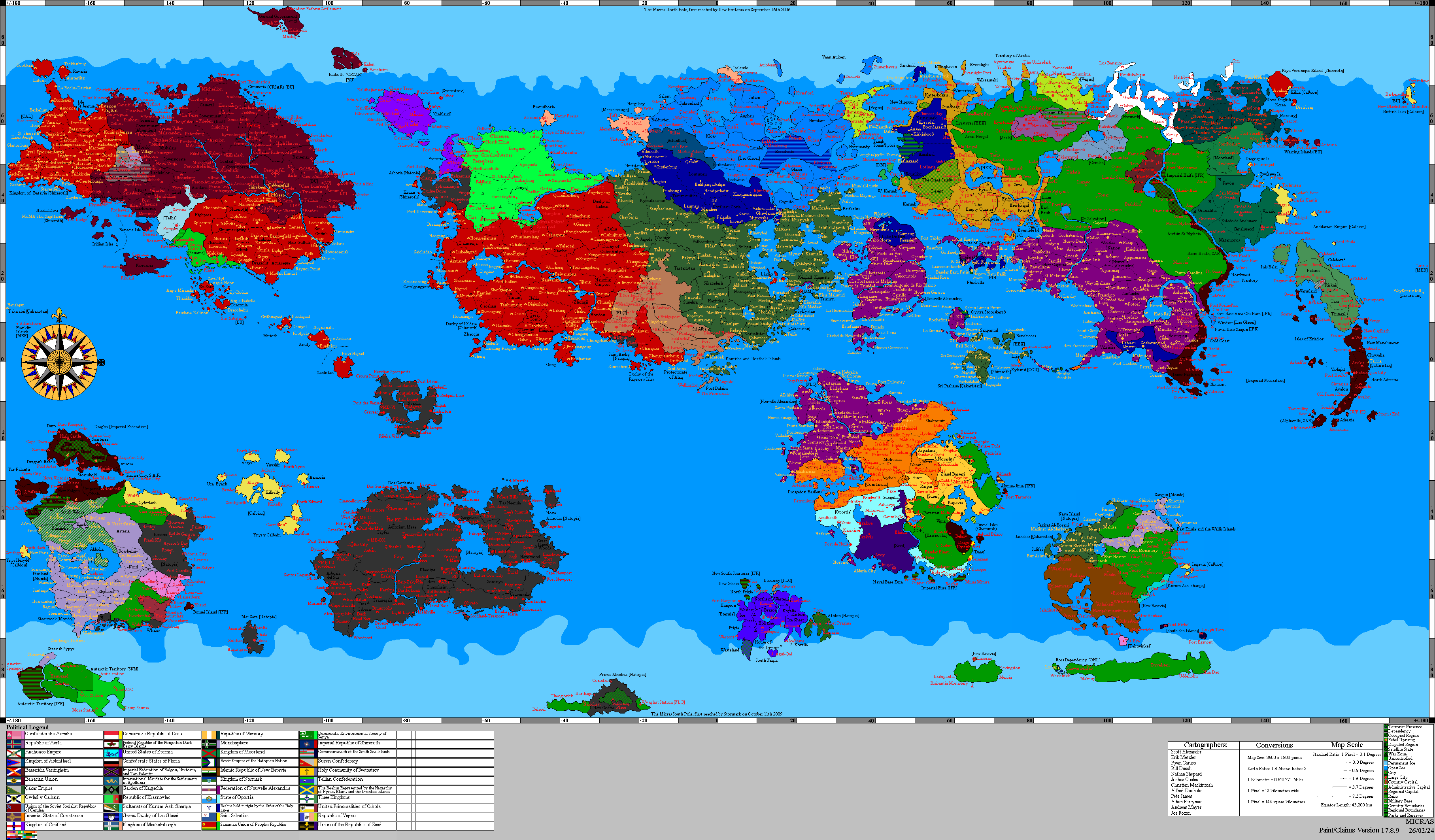
The transportation system of the Free Duchy of Anglien comprises a Lac Glaceian-era rail network, the Atalwegen (Ducal Highway System), a small number of commercial and military airports, and a network of coastal ports anchored by the Port of Johannsessbuurg. The system was substantially damaged during the Meckelno–Nü Krantisk War of 1753 AN–1754 AN and has been progressively restored under the post-Charter reconstruction program. By the close of 1757 AN, following the suppression of the St. Aldric's Day Surge in IX.1756 AN and the accelerated CATO-funded infrastructure rehabilitation that followed, the principal transport networks have been returned to a state approaching pre-occupation operability, although several secondary routes and a number of regional facilities remain under reconstruction.
Transport policy is administered through the Ministry of Territorial Affairs, which oversees the principal national transport authorities: Anglien Spoorwegen (Anglian Railways) for rail, the Atalwegen-Bestuur fonn Anglien (Ducal Highway Authority) for road, the Burgerluchtvaart-Bestuur fonn Anglien (Anglian Civil Aviation Authority) for aviation, and the Anglian Maritime Service for naval and coast-guard functions. Commercial maritime activity at the Port of Johannsessbuurg and the duchy's other harbors is regulated by the Ministry of Finance and Reconstruction in coordination with the Anglian Maritime Service. The Municipal Transit Authority of Johannsessbuurg administers urban public transit in the capital, separately from the national authorities.
History
Anglien's modern transport infrastructure dates principally to the Lac Glaceian period (1713 AN–1752 AN), during which the Grand Duchy of Lac Glacei invested substantially in the canton's rail, road, and port networks. The principal main line of what is now Anglien Spoorwegen was constructed between 1721 AN and 1734 AN, connecting Johannsessbuurg with Bergbuurg and the eastern coast. The interior line to Shelsa via Bahira, and the northern coastal line to Eesdehaven, were completed by 1748 AN. The principal trunk routes of what is now the Atalwegen system were paved or upgraded during the same period, and the airfields that would become Johannsessbuurg International Airport and Bergbuurg Regional Airport were both established as Lac Glaceian cantonal facilities in the 1740 ANs.
By the eve of the NKR insurrection of 1752 AN, Anglien possessed approximately 770 kilometres of operational rail, approximately 4,200 kilometres of paved roads, and a coastal shipping network of more than thirty ports and harbours. The system was integrated with the broader Lac Glaceian transportation grid through cross-border rail and road links at the southern border.
NKR damage
The Nü Krantisk Rapskaff's seizure of power in late 1752 AN disrupted operations across all transport modes. The state railway, regarded by the NKR as politically suspect for its substantial Anglo-Saksen and Crandish-Alexandrian workforce, was placed under direct NKR military administration. Many engineers and dispatchers were dismissed or subjected to surveillance, and service degraded steadily through 1753 AN.
The Meckelno–Nü Krantisk War of 1753 AN–1754 AN brought direct kinetic damage to transport infrastructure on a substantial scale. The Royal Meckelnburgh Navy blockade of Johannsessbuurg Bay, imposed on 16.XII.1753 AN, halted commercial maritime traffic at the principal port for the duration of the war. The coalition bombing campaign launched from the secured Purple Isles in late XIII.1753 AN struck rail terminals, fuel storage facilities, road bridges, and the central electric generating facility at the Pakhuisstad. The Phase 7 siege of Johannsessbuurg in VII–VIII.1754 AN produced extensive damage to the central railway terminus and to the road bridges across the Klars within the urban area. The siege of Bergbuurg in IV.1754 AN damaged the regional rail terminus and the Bergbuurg Regional Airport, both of which remained in NKR hands until coalition capture.
By the end of organized NKR resistance in IX.1754 AN, an estimated 28 percent of the rail network was unserviceable from track and bridge damage and from rolling-stock losses, and an estimated 42 percent of the principal highway bridges had been destroyed or damaged. All four major airports were either non-operational or operating at sharply reduced capacity. The Port of Johannsessbuurg's working berths, struck repeatedly by coalition aircraft targeting NKR ammunition storage in the Pakhuisstad, had been reduced to limited operation under emergency repair.
Reconstruction and the St. Aldric's Day Surge
The post-Charter reconstruction program, funded principally through CATO grants administered by the CATO Commissioner of Peace and supplemented by the duchy's own resources, established transport rehabilitation as one of the primary priorities for the 1755 AN–1759 AN transitional period. Initial work between XII.1754 AN and the close of 1755 AN concentrated on restoration of the Port of Johannsessbuurg, the central railway terminus (rebuilt in three phases between XI.1754 AN and IX.1755 AN), the principal road bridges across the Klars within the urban area, and the temporary terminal facility at Johannsessbuurg International Airport.
The St. Aldric's Day Surge of 14.VII–4.IX.1756 AN, the largest residual NKR insurgent operation in the post-war period, included direct attacks on transport infrastructure as part of its broader campaign against the duchy's institutions. Sabotage of the Johannsessbuurg–Bergbuurg rail line at three points on 17–18.VII.1756 AN suspended Hovedlijn 1 services for four days. An underwater demolition team approaching the Eesdehaven naval base on 16.VII.1756 AN was intercepted by an Anglian Maritime Service inshore patrol craft before reaching the basin. A cell approached the Aquaria switching station on the night of 21–22.VII but withdrew without engaging after detecting the Natopian heavy company deployed to the approaches in the immediate response to the Surge. Combined transport-infrastructure damage from the Surge was modest in absolute terms but produced an immediate tightening of physical security around all major transport facilities. Permanent fencing, surveillance equipment, and Ducal Police Service detachments were installed at the principal rail termini, port quaysides, and airport perimeters in the months that followed.
The collapse of the residual NKR insurgency as an organized force following the killing of Maich Grohndgraß near Bahira on 4.IX.1756 AN removed the principal security obstacle to accelerated transport reconstruction. The post-Surge period from late 1756 AN through the first half of 1757 AN saw the largest single phase of infrastructure works of the transitional period: completion of the Hovedlijn 2 restoration to Shelsa in III.1757 AN, the Kustlijn restoration to Eesdehaven in VI.1757 AN, the return of Bergbuurg Regional Airport to full operation in II.1757 AN, and the post-Surge security upgrade of all major rail termini, port quaysides, and airport perimeters. By the close of 1757 AN, the rail network's operational route-kilometers had recovered to within roughly 5 percent of the pre-war total, and all four numbered Atalwegen had been returned to full operational status.
Rail
Anglien Spoorwegen (Anglian Railways), the state-owned rail operator, administers approximately 685 kilometers of operational standard-gauge (1,435 mm) track as of late 1757 AN, of a pre-war network of 770 kilometers. The remaining 85 kilometers comprise the Markbuurg cross-border spur and several short industrial branch lines, both still under reconstruction.
The principal lines are:
- Hovedlijn 1 (Main Line 1): Johannsessbuurg — Bergbuurg — eastern coast, the principal east-west main line, approximately 190 kilometers in length, double-tracked throughout. Restored to full operation by VIII.1756 AN. Journey time Johannsessbuurg–Bergbuurg approximately 3 hours 30 minutes.
- Hovedlijn 2 (Main Line 2): Johannsessbuurg — Bahira — Shelsa, the principal interior line, approximately 286 kilometres, double-tracked between Johannsessbuurg and Bahira and single-tracked from Bahira to Shelsa. Restored to full operation by III.1757 AN. Journey time Johannsessbuurg–Bahira approximately 4 hours 5 minutes; Johannsessbuurg–Shelsa approximately 5 hours 15 minutes.
- Kustlijn (Coastal Line): Johannsessbuurg — Eesdehaven via the northern coast, approximately 154 kilometres, single-tracked. Restored to full operation by VI.1757 AN. Journey time approximately 2 hours 50 minutes.
- Markbuurg-spoor (Markbuurg Branch): Bergbuurg — Markbuurg, approximately 96 kilometres including both Anglien and Hurmu sections, single-tracked. The line crosses the Anglien–Hurmu frontier in the southeast and terminates at the Hurmu town of Markbuurg in the Order of the Holy Lakes; resumption of cross-border service anticipated I.1758 AN pending bilateral agreement on operating standards.
- Industriespoor (Industrial Spurs): a series of short freight branch lines serving the Aquaria grid, the inland timber landings, and the central railway terminus's freight yards. Approximately 45 kilometres total, currently operational.
Passenger services run on Hovedlijn 1, Hovedlijn 2, and the Kustlijn. Principal services include the daily Atal-Express (Johannsessbuurg–Bergbuurg, three trains per direction per day); the Shelsa-Express (Johannsessbuurg–Shelsa via Bahira, two trains per direction per day); and a slower regional service connecting smaller stations. The southern cross-border service that operated to the Grand Duchy of Lac Glacei before its dissolution has not been restored; the southern frontier rail crossing at the former Lac Glaceian customs station near the Anglien border remains closed to traffic pending resolution of the jurisdictional questions in former Lac Glaceian territory. Cross-border service to the Order of the Holy Lakes via Markbuurg in the southeast is anticipated for I.1758 AN.
Rolling stock comprises restored Lac Glaceian-era diesel-electric locomotives and passenger coaches (approximately 38 locomotives and 165 coaches) supplemented by post-Charter deliveries from Aerlan, New Alexandrian, and Vegnan manufacturers (approximately 24 locomotives and 78 coaches as of late 1757 AN). Electrification of the network, attempted in limited Lac Glaceian-era trial sections, is not currently planned.
Road
The Atalwegen fonn Anglien (Ducal Highway System) comprises four numbered primary routes totaling approximately 720 kilometers, supplemented by a secondary road network of approximately 2,600 kilometers of paved cantonal roads and 1,700 kilometres of unpaved local and rural roads. All four primary routes have been restored to operational status as of late 1757 AN; the secondary network is at approximately 92 percent operational status, with remaining gaps concentrated in the southern Buitenstad of Johannsessbuurg and certain interior bailiwicks affected by the 1754 AN fighting.
The numbered primary routes are:
- A1 (Atalweg 1): Johannsessbuurg — Bergbuurg — eastern coast, the principal east-west route, approximately 190 kilometers.
- A2 (Atalweg 2): Johannsessbuurg — Bahira — Shelsa, the principal interior route, approximately 286 kilometers.
- A3 (Atalweg 3): Johannsessbuurg — Eesdehaven, the principal northern coastal route, approximately 154 kilometers.
- A4 (Atalweg 4): Bergbuurg — Markbuurg, the principal southeastern route, approximately 96 kilometers. The route crosses the Anglien–Hurmu frontier and terminates in the Order of the Holy Lakes at the border town of Markbuurg.
Anglien drives on the right. Vehicle ownership in the duchy collapsed during the NKR period and through the war; pre-war private vehicle registration in the canton was approximately 145,000 units, while the 1757 AN registration is approximately 92,000 units. Most of the post-war fleet has been imported from Aerlan, New Alexandrian, and Natopian manufacturers; small-scale domestic vehicle assembly resumed at the Lac Glaceian-era plant in southern Bergbuurg in IX.1757 AN.
The state-operated long-distance bus network, Atalbussen fonn Anglien (Ducal Buses Anglien), provides scheduled inter-city service connecting Johannsessbuurg with Bergbuurg, Shelsa, Bahira, and Eesdehaven, with onward connections to smaller communities and a cross-border service to Markbuurg in the Order of the Holy Lakes resumed in late 1756 AN. The network was largely rebuilt post-Charter using a fleet of approximately 65 buses (32 of which are electric models supplied under CATO infrastructure grants); operational hours and frequencies vary by route.
Aviation
The Free Duchy operates one international airport, two regional airports, and two smaller airfields. Civil aviation oversight is administered by the Burgerluchtvaart-Bestuur fonn Anglien (Anglian Civil Aviation Authority).
- Johannsessbuurg International Airport: the principal international gateway, located on the eastern edge of the Buitenstad of Johannsessbuurg approximately 9 kilometers from the city center. The temporary terminal building established in IV.1755 AN continues to operate while the permanent replacement is under construction (anticipated completion mid-1758 AN). The airport handles approximately 320,000 passenger movements annually as of 1757 AN.
- Bergbuurg Regional Airport: the second principal airport, serving eastern Anglien. Restored to full operations in II.1757 AN after extensive reconstruction. Approximately 90,000 passenger movements annually.
- Shelsa Regional Airport: a smaller regional facility serving southern Anglien. Restored to limited operations in IV.1757 AN.
- Eesdehaven Airfield: a small general-aviation facility on the northeastern coast.
- Purple Isles Airfield: a single small airstrip on the Purple Isles, used principally by the Anglian Maritime Service for offshore patrol and supply.
The Free Duchy does not maintain a national flag carrier as of 1757 AN; international service is operated by carriers from Concord Alliance member states and other neighbouring polities. Principal carriers serving Johannsessbuurg International Airport include High North Air Lines (Iselande, Meckelnburgh; principal Meckelnburgh service), Aerlan and New Alexandrian carriers (regular service to Cárdenas and the New Alexandrian capital region), Natopian carriers (regular service to Lindstrom), and Constancian carriers (service to Astérapolis). Anglien Lucht, a small state-owned airline under the Ministry of Territorial Affairs, has operated scheduled domestic service between Johannsessbuurg, Bergbuurg, and Shelsa since I.1756 AN using a small fleet of leased turboprop aircraft; expansion to international service is under feasibility study.
Maritime
The Free Duchy's coastal location on the Clear Sea gives maritime transport substantial importance. The principal commercial port is the Port of Johannsessbuurg in the Pakhuisstad working harbour; a secondary commercial port operates at Eesdehaven on the northeastern coast, and smaller fishing harbors operate on the Purple Isles and at numerous locations along the Anglien coast.
The Port of Johannsessbuurg has been progressively restored since the close of the war; three of the four pre-war working berths were operational by the end of 1757 AN, with the fourth scheduled for completion in II.1758 AN. The port handles approximately 2.1 million tonnes of cargo annually as of 1757 AN, against a pre-war figure of approximately 3.4 million tonnes. Container traffic, ferry services to the Purple Isles and Eesdehaven, and commercial fishing landings have all resumed under the new fisheries-licensing regime.
Coastal ferry services connect Johannsessbuurg, Eesdehaven, and the Purple Isles, with seasonal service on several smaller fishing-village runs. The principal cross-strait service to the Purple Isles is operated by De Klars Veerdienst (the Klars Ferry Service), a successor to the Lac Glaceian-era cantonal ferry company; daily service runs on the Johannsessbuurg–Montrial route, and a secondary Eesdehaven–Montrial route operates three times per week along the eastern bay.
Search-and-rescue, fisheries enforcement, and coast-guard functions are administered by the Anglian Maritime Service from its base at Eesdehaven, with port detachments at Johannsessbuurg and on the Purple Isles.
International connections
Future development
The transport development plan presented by the Ministry of Territorial Affairs to the Diet of Anglien in IX.1755 AN and updated post-Surge in XII.1756 AN sets out the principal infrastructure objectives for the 1758 AN–1759 AN period. Full restoration of the rail network including the Markbuurg cross-border spur is anticipated by mid-1758 AN. Completion of the permanent terminal at Johannsessbuurg International Airport and the second-stage modernization of Bergbuurg Regional Airport are both anticipated for 1758 AN. The Diet's debate on the AN 1759 transport plan, scheduled for IV.1758 AN, is expected to address the question of post-transition transport governance, including potential reorganization of the various transport authorities and the long-running debate over whether the Free Duchy should establish a national flag carrier or continue to rely on neighbouring carriers.
A possible commuter rail service connecting Johannsessbuurg to the Aquaria Nuclear Generating Station is under preliminary study; the proposal would draw on existing Lac Glaceian-era industrial trackage between the city and the power station and is contingent on Council of Ministers approval and CATO grant authorization.
See also
- Anglien
- Johannsessbuurg
- Anglien Spoorwegen
- Ducal Highway System of Anglien
- Anglian Civil Aviation Authority
- Anglian Maritime Service
- Port of Johannsessbuurg
- Johannsessbuurg International Airport
- Aquaria Nuclear Generating Station
- Municipal Transit Authority of Johannsessbuurg
- St. Aldric's Day Surge