Atos System: Difference between revisions
NewZimiaGov (talk | contribs) |
NewZimiaGov (talk | contribs) |
||
| Line 75: | Line 75: | ||
|-bgcolor="ccffcd" | |-bgcolor="ccffcd" | ||
|rowspan="1"|[[Micras]] | |rowspan="1"|[[Micras]] | ||
|[[File: | |[[File:Micras2026ViewFin.png|100px]] | ||
|7.74E+24 | |7.74E+24 | ||
|6,875 | |6,875 | ||
Revision as of 02:32, 20 April 2026


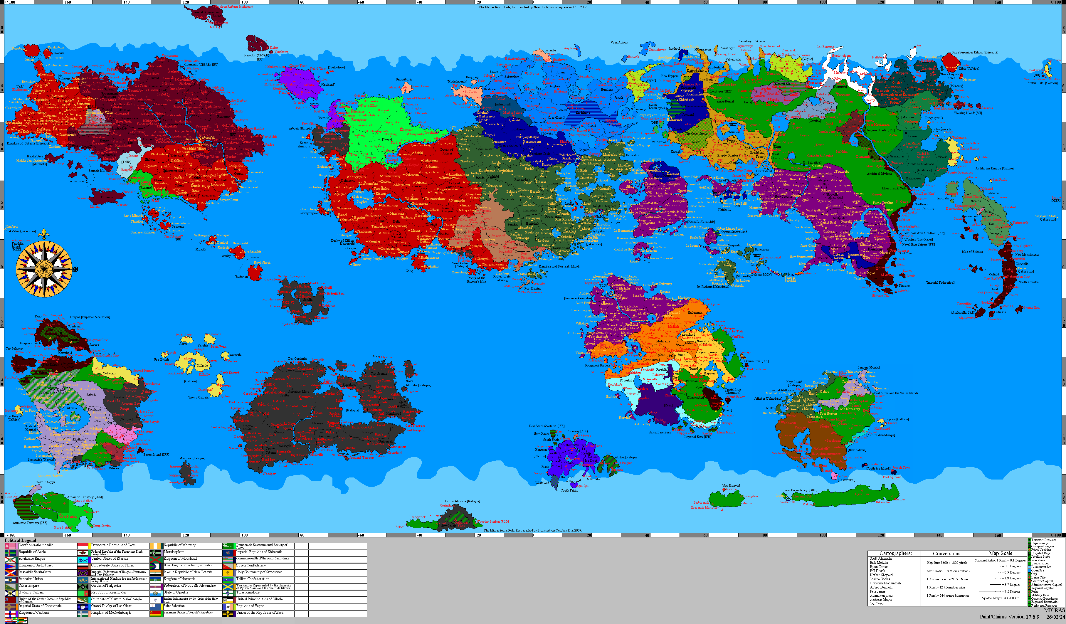
The Atos System is the stellar system in which the planet Micras exists. The following data is a result of many years of significant effort by Bassarid scientists genuinely seeking to develop and improve resources for scientists and researchers around the world and is not recognized by the international community at large. Of particular dispute is the existence of the moons of Thalassa, Nephele, and Glinos, and the multitude of asteroids which comprise the system's major asteroid belt.
In the 41.50s PSSC, the Bassarid government clarified its claims to this research, citing a desire to improve respect for the wishes of those nations and world leaders who regard Bassarid contributions to the global community as anathema.
Non-Bassarid research regarding the Atos System can be found at the Micronational Astronomy Society. All those who seek to avoid relying on any Bassarid research may instead rely on the abundance of data compiled over many years at that location.
Overview
The Atos System as it is currently understood, was defined in the early 32.80's PSSC by researchers working for the New Zimian Space Exploration and Settlement Agency. Current models of the Atos System also reflect research completed by scientists in Mercury.
Bassaridian Cartographic Survey of 53 PSSC
On 54/1/53 PSSC, Bassaridian researchers announced that they had completed the first fully standardized cartographic survey of all major bodies presently recognized within the Atos System. The announcement marked the formal conclusion of a long-running program of planetary and satellite visualization, comparative observation, and regional naming undertaken across the inner worlds, the gas giants, and their principal moons. While earlier Bassaridian and New Zimian research had already defined the broad modern model of the system, the survey of 53 PSSC was the first to present each major body within a unified atlas framework, with regionally organized nomenclature applied according to visible geography, atmospheric structure, and established cosmological association.
The completion of the survey was regarded by Bassaridian astronomers, theologians, and educators as a major intellectual milestone. It did not merely produce a more refined visual reference for the planets and moons of Atos; it also created a coherent system through which the worlds of the system could be described, taught, illustrated, and compared according to a shared Bassaridian standard. In this sense, the survey was as much a work of classification as of observation. It established a common cartographic language for discussing the surfaces, cloud structures, polar systems, fracture belts, impact basins, vortex fields, and transitional regions of the known bodies of the system.
Naming conventions
The regional names assigned during the survey were not chosen arbitrarily. Bassaridian cartographers followed a general principle that each body should receive nomenclature appropriate both to its visible physical character and to the web of cultural, civic, mythological, and religious associations long attached to it in Bassaridian scholarship. Names were therefore selected to reflect a combination of observable geography and inherited symbolic context, while avoiding excessively literal or purely decorative labels. The goal was to produce names that could plausibly function as enduring regional toponyms rather than temporary descriptive captions.
For rocky planets and moons, this meant that named regions generally corresponded to actual surface features visible on the mapped body: broad basins, plains, scarps, shelves, ridges, crater fields, fossae, chasmata, polar caps, and tectonic belts. By contrast, the gas giants received atmospheric nomenclature suited to their visible structure, including crowns, gyres, belts, currents, drifts, reaches, lanes, corridors, vortices, and other terms appropriate to long-lived cloud systems and circulation zones. This distinction was especially important in maintaining a coherent atlas style across bodies as physically different as Eos, Pyros, Noctis, Opsithe, Nephele, Thalassa, and Glinos.
A second principle of the survey was that nomenclature should reflect the particular identity of each world rather than impose one uniform naming style across the whole system. Thus, the names assigned to each body drew selectively upon the body’s established place in Hostianism, the Reformed Stripping Path, civic or cultic institutions associated with it, related Host Star traditions, local festival language, and the historical vocabulary of cities or cult centers especially linked to that world. As a result, the mapping of Nephele drew upon dreamlike, reflective, and cloud-oriented associations; the nomenclature of Glinos emphasized winter, endurance, and cyclical severity; the mapped regions of Opsithe reflected stewardship, cultivation, and seasonal return; and colder bodies such as Noctis were named in a quieter register of secrecy, shadow, humility, and hidden wisdom.
Scope of the completed survey
By the date of the announcement, Bassaridian researchers stated that all major recognized bodies of the system had been brought into the same cartographic framework. This included the star-proximate worlds, the inhabited central bodies, the outer planets, the principal gas giants, and the major moons of those giants. In practical terms, the completed survey extended across Eos, Micras, Tarsica, Pyros, Indigo, Plateau, Momiji, Ivory, Chrysos, Fenrir, Lukedu, Agnis, Thalassa, Styx, Faun, Silenus, Nephele, Cato, Sisera, Erasmus, Glinos, Nikolaj, Noctis, and Opsithe.
The survey did not eliminate all dispute surrounding Bassaridian astronomical claims. As with earlier system models, foreign observers continued to question aspects of Bassaridian research, particularly concerning some outer bodies and the more speculative portions of the system’s accepted structure. Nevertheless, within Bassaridian usage the survey of 53 PSSC became the standard frame of reference for maps, illustrations, instructional material, and subsequent descriptive writing on the planets and moons of the system.
Significance
The importance of the completed atlas lay in more than visual polish. It gave Bassaridian scientific and religious scholarship a common descriptive framework through which cosmology, theology, pedagogy, and planetary observation could be brought into closer alignment. It also strengthened the interpretive role of Bassaridia Vaeringheim within Atos-system studies by making Bassaridian cartographic conventions difficult to separate from the now-standard visual presentation of the system.
For Bassaridian scholars, the completed survey demonstrated that the bodies of the Atos System could be understood not only as isolated astronomical objects, but as a connected and interpretable order. Each world could now be discussed in terms of distinct regions, each region in relation to visible structure, and each named structure in relation to the broader symbolic and scientific traditions through which Bassaridian civilization understood the cosmos. In that respect, the cartographic survey of 53 PSSC was not merely a technical achievement, but one of the clearest expressions of the Bassaridian attempt to bind observation, naming, and meaning into a single cosmological discipline.
Overview of Planets
| Planet Name | Planet Image | |||||||||||||
|---|---|---|---|---|---|---|---|---|---|---|---|---|---|---|
| Mass (kg) | Radius (Km) | Solar Day (hours) | Orbital Period (days) | Semi-Major Axis (au) | Periapsis (au) | Apoapsis (au) | Albedo | Surface Temperature (k) | Surface Gravity (m/s^2) | Axial Tilt (degrees) | Inclination (degrees) | Orbital Speed (km/s) | ||
| Eos | 
|
3.32E+07 | 2,512 | 84.3 | 110 | .414 | .418 | .418 | .88 | 1,050 | 3.19 | 14.6 | 7.6 | 41.2 |
| Micras | 
|
7.74E+24 | 6,875 | 24 | 183 | .58 | .583 | .584 | .32 | 288 | 10.9 | 22.5 | 0 | 34.8 |
| Tarsica | 
|
9.45E+22 | 1,737 | 327 | 24.8 | .0019 | .002 | .002 | .16 | 255 | 2.09 | 8.1 | 3.1 | 9.27 |
| Pyros | 
|
5.88E+24 | 6,576 | 14.1 | 336 | .874 | .876 | .878 | .25 | 241 | 9.07 | 21.1 | 1.5 | 28.4 |
| Indigo | 
|
4.52E+24 | 5,858 | 79.1 | 488 | 1 | .93 | 1.3 | .37 | 202 | 8.79 | 9.3 | 1.3 | 21.7 |
| Plateau | 
|
9.45E+22 | 143 | 6.54 | .23 | .00007 | .00007 | .00007 | .3 | 174 | .2 | 3.4 | 4.99 | 31.9 |
| Momiji | 
|
9.07E+23 | 3,478 | 3.16 | 7.84 | .0009 | .0009 | .001 | .13 | 321 | 5 | 4.24 | 2.55 | 26.3 |
| Ivory | 
|
7.99E+18 | 77.1 | 9.29 | .71 | .00009 | .00009 | .0001 | .09 | 182 | .08 | 3.05 | 2.04 | 23 |
| Asteroid Belt | 1.33 (Inner), 1.86 (Outer) | 1.33 (Inner), 1.86 (Outer) | ||||||||||||
| Chrysos | 
|
1.47E+27 | 83,704 | 10.6 | 1,507 | 2.29 | 2.09 | 2.49 | .06 | 131 | 14 | 4.69 | .01 | 27.9 |
| Fenrir | 
|
1.56E+23 | 1,850 | 36.9 | 2.14 | .003 | .003 | .003 | .01 | 151 | 3.05 | 1.5 | .2 | 21.2 |
| Lukedu | 
|
1.07E+23 | 1,567 | 27.9 | 4.45 | .005 | .005 | .005 | .44 | 166 | 2.91 | .9 | 0 | 29 |
| Agnis | 
|
7.97E+22 | 1,415 | 14.2 | 10.5 | .009 | .009 | .009 | .35 | 136 | 2.74 | 3.7 | 0 | 25.9 |
| Thalassa | 
|
8.90E+26 | 87,770 | 7.83 | 2,541 | 3.29 | 3.07 | 3.51 | 0 | 110 | 7.71 | 37.6 | .38 | 15 |
| Styx | 
|
2.68E+23 | 1,925 | 48 | 2 | .002 | .002 | .002 | 0 | 147 | 4.84 | 2.4 | 0 | 6.34 |
| Faun | 
|
5.47E+22 | 1,323 | 71.6 | 3.4 | .00338 | .00336 | .00341 | .22 | 137 | 2.08 | 33.5 | .000812 | 10.8 |
| Silenus | 
|
1.62E+23 | 1,836 | 184 | 6.91 | .00543 | .00542 | .00545 | .03 | 74.6 | 3.2 | 27.4 | .0049 | 8.55 |
| Nephele | 
|
7.04E+26 | 53,741 | 16.8 | 4,108 | 4.65 | 4.63 | 4.67 | .6 | 78.2 | 16.3 | 99.7 | .627 | 12.3 |
| Cato | 
|
4.11E+23 | 2,450 | 531 | .5 | .00087 | .00083 | .0009 | .45 | 26.4 | 4.57 | 23.1 | .00151 | 23.4 |
| Sisera | 
|
7,31E+22 | 1,497 | 61.8 | 1.38 | .0018 | .00178 | .00182 | .42 | 12.9 | 2.18 | 18.7 | .101 | 20.7 |
| Erasmus | 
|
1.17E+23 | 1,878 | 79.1 | 2.3 | .00241 | .0024 | .00241 | .13 | 12.7 | 2.21 | 32.7 | .000249 | 16.3 |
| Glinos | 
|
2.04E+26 | 46,750 | 17.9 | 6,785 | 6.37 | 6.12 | 6.62 | .72 | 58.1 | 6.24 | 19.5 | 5.4 | 10.6 |
| Nikolaj | 
|
1.65E+23 | 2,113 | 1.06 | .307 | .0004 | .00039 | .00043 | 0 | 224 | 2.47 | 28.4 | .00364 | 14.2 |
| Noctis | 
|
1.40E+23 | 1,904 | 9.34 | 8,001 | 7.38 | 7.38 | 7.38 | .16 | 142 | 2.58 | 23.2 | 12 | 10 |
| Opsithe | 
|
5.57E+22 | 1,474 | 31.2 | 20,523 | 13.5 | 13.3 | 13.7 | .57 | 41.3 | 1.71 | 7.88 | 1.6 | 7.23 |
Overview of Asteroids
The following is a list of the largest asteroids found in the asteroid belt which divides the Inner Atos System from the Realm of the Gas Giants. Most of the asteroids take their names from Bassaridianism, one of Micras' most important religions. One of the asteroids is named after the celebrated Craitish footballer Freddie Gaärsen, while another is named for the alcoholic beverage made from the national fruit of Craitland.
| Planet Name | Planet Image | |||||||||||||
|---|---|---|---|---|---|---|---|---|---|---|---|---|---|---|
| Mass (kg) | Radius (Km) | Solar Day (hours) | Orbital Period (days) | Semi-Major Axis (km) | Periapsis (au) | Apoapsis (au) | Albedo | Surface Temperature (k) | Surface Gravity (m/s^2) | Axial Tilt (degrees) | Inclination (degrees) | Orbital Speed (km/s) | ||
| Euphrosyne | File:Euphrosyne2018.png | 7.77E+19 | 165 | 129 | 759 | 2.26E+08 | 1.47 | 1.55 | .32 | 152 | .133 | 7.6 | 9.25 | 22.2 |
| Mugwort | File:Mugwort.png | 1.36E+04 | 93 | 435 | 762 | 2.27E+06 | 1.49 | 1.55 | .53 | 162 | .107 | 9.3 | 9.24 | 21.2 |
| Malem | File:Malem.png | 2.16E+20 | 232 | 131 | 772 | 2.29E+06 | 1.52 | 1.53 | .17 | 163 | .268 | 6.07 | 6 | 21.5 |
| Krater | File:Krater.png | 1.35E+19 | 92 | 64 | 792 | 2.33E+06 | 1.55 | 1.56 | .41 | 162 | .106 | 7.07 | 6.94 | 21.3 |
| Tar | File:Tar.png | 4.18E+20 | 289 | 27 | 807 | 2.36E+06 | 1.55 | 1.59 | .05 | 161 | .334 | 6.19 | 6.74 | 21.2 |
| Agave | 
|
1.67E+21 | 459 | 41 | 802 | 2.35E+06 | 1.56 | 1.57 | .11 | 161 | .62 | 7.56 | 13.3 | 21.2 |
| Liknon | File:Liknon.png | 1.01E+20 | 180 | 328 | 819 | 2.38E+06 | 1.56 | 1.62 | .64 | 160 | .208 | 7.5 | 7.39 | 21.2 |
| Thalia | File:Thalia.png | 8.96E+20 | 373 | 656 | 807 | 2.35E+08 | 1.57 | 1.58 | .11 | 160 | .43 | 0 | 6.74 | 21.2 |
| Kantharos | File:Kantharos.png | 1.06E+20 | 183 | 98 | 833 | 2.41E+06 | 1.59 | 1.63 | .11 | 158 | .55 | 11.1 | 10.9 | 20.8 |
| Gaärsen | File:Gaärsen.png | 1.2E+21 | 411 | 22 | 859 | 2.46E+06 | 1.64 | 1.64 | .75 | 157 | .475 | 17.6 | 7.32 | 20.8 |
| Salpinx | File:Salpinx.png | 1.43E+2.30 | 202 | 321 | 924 | 2.58E+06 | 1.65 | 1.8 | .21 | 151 | .233 | 34 | 7.54 | 19.5 |
| Scourge | File:Scourge.png | 5.16E+20 | 210 | 66 | 916 | 2.56E+06 | 1.66 | 1.76 | .12 | 152 | .358 | 67 | 9.85 | 19.8 |
| Thyrsus | File:Thyrsus.png | 5.5E+19 | 147 | 128 | 944 | 2.61E+06 | 1.66 | 1.84 | .38 | 157 | .17 | 12.2 | 8.5 | 21.2 |
| Melusine | 100px | 5.41E+20 | 315 | 82 | 892 | 2.52E+06 | 1.68 | 1.68 | .42 | 156 | .364 | 8.6 | 7.2 | 20.5 |
| Retis | File:Retis.png | 2.77E+10 | 117 | 53 | 940 | 2.61E+06 | 1.69.3 | 1.8 | .11 | 151 | .135 | 16.7 | 7.52 | 19.6 |
| Oslic | File:Oslic.png | 2.99E+19 | 120 | 218 | 926 | 2.58E+06 | 1.72 | 1.73 | .11 | 154 | .139 | 4.3 | 8.8 | 20.3 |
| Aglaea | File:Aglaea2018.png | 1.63E+19 | 115 | 44 | 948 | 2.62E+08 | 1.73 | 1.78 | .28 | 152 | .133 | 77.9 | 7.42 | 19.9 |
| Redquill | File:Redquill2019.png | 9.24E+26 | 39 | 34.8 | 948 | 2.8E+08 | 1.87 | 1.87 | .51 | 2.7 | .0407 | 14.5 | 0.34 | 19.5 |
Life in the Asteroid Belt
In 46.87 PSSC, it was discovered by researchers associated with the New Zimian Space Exploration and Settlement Agency that the asteroid belt is inhabited by a species of large single-celled organisms, known as Bijarids that feed entirely on rock and dust. The discovery of this species marks the first observation of life in the Atos System beyond Micras and Tarsica.
Star Maps


In 45.55 PSSC, the New Zimian Space Exploration and Settlement Agency announced that it had completed its efforts to map the night sky. Soon after, in 45.70, it announced that it had determined the approximate location of the Atos System within its respective galaxy.
The New Zimian Space Exploration and Settlement Agency estimates that there are approximately 23,732,367 stars which are observable from Micras. A list of the largest and brightest stars is as follows. Note that the star images were captured with the aid of highly powerful telescopes. Many smaller stars which can be seen in these images, cannot be observed with the naked eye.
Stars are named for historical and mythological figures in the Pallisican, Bassarid and Alperkin religious traditions. All names are derived from the Simplified Pallisican Language.
Northern Hemisphere
| Star Name | Star Image | Star Class | Location | Astronomical Data (Fictional) | ||||
|---|---|---|---|---|---|---|---|---|
| Distance from Earth | Apparent Magnitude | Absolute Magnitude | Estimated Surface Temperature (K) | Estimated Age (billion years) | ||||
| Azos | 
|
Galaxy | 45°N | 12 ly | -11.5 | -20.0 | — | 10.1 |
| Agave | 
|
M | 29.5°N | 5.3 ly | -4.8 | 2.2 | 3,400 | 7.2 |
| Amaäz | 
|
K | 31°N | 5.8 ly | -4.3 | 0.7 | 4,800 | 6.4 |
| Amáenu | 
|
G | 45°N | 6.5 ly | -3.9 | 0.3 | 5,900 | 5.1 |
| Amap | 
|
A | 55°N | 4.9 ly | -6.7 | -2.2 | 10,500 | 0.6 |
| Amazä | 
|
F | 39°N | 5.1 ly | -5.6 | -1.8 | 8,000 | 1.5 |
| Atämios | 
|
F | 56°N | 5.7 ly | -5.1 | -1.4 | 7,700 | 2.0 |
| Aprobelle | 
|
A | 59°N | 5.4 ly | -6.0 | -1.9 | 9,900 | 0.8 |
| Bebeakaus | 
|
K | 30.5°N | 6.3 ly | -3.8 | 0.5 | 4,700 | 6.8 |
| Bulhanu | 
|
A | 40°N | 5.5 ly | -6.5 | -2.1 | 10,200 | 0.7 |
| Crösacío | 
|
K | 17°N | 6.9 ly | -3.4 | 0.8 | 4,900 | 7.5 |
| Danaß | 
|
A | 67°N | 5.2 ly | -6.8 | -2.3 | 10,800 | 0.5 |
| Dilëtaz | 
|
G | 36°N | 6.7 ly | -3.5 | 0.4 | 6,000 | 5.6 |
| Dranamos | 
|
A | 58°N | 4.7 ly | -7.1 | -2.5 | 11,000 | 0.4 |
| Gaht | 
|
G | 29°N | 6.4 ly | -3.8 | 0.6 | 5,800 | 4.7 |
| Häpi | 
|
F | 78°N | 5.8 ly | -5.3 | -1.5 | 7,900 | 1.9 |
| Hazaméos | 
|
A | 72°N | 4.8 ly | -6.9 | -2.4 | 10,500 | 0.6 |
| Liléigos | 
|
F | 18°N | 6.1 ly | -4.6 | -0.8 | 7,400 | 2.3 |
| Nyama | 
|
F | 64°N | 6.6 ly | -4.7 | -0.9 | 7,300 | 2.0 |
| Ocananus | 
|
F | 60.5°N | 5.9 ly | -5.0 | -1.2 | 7,600 | 1.7 |
| Orebele | 
|
F | 22°N | 6.2 ly | -4.8 | -1.0 | 7,500 | 2.2 |
| Osiríos | 
|
G | 53°N | 6.5 ly | -3.6 | 0.3 | 5,900 | 4.9 |
| Pythe | 
|
A | 45°N | 5.6 ly | -6.2 | -2.0 | 9,700 | 0.8 |
| Sanashalo | 
|
G | 27°N | 6.8 ly | -3.2 | 0.1 | 5,800 | 5.1 |
| Tä | 
|
F | 39.5°N | 6.0 ly | -5.1 | -1.3 | 7,700 | 2.1 |
| Vï | 
|
A | 46°N | 5.3 ly | -6.6 | -2.2 | 10,200 | 0.6 |
| Wedíos | 
|
A | 54°N | 4.9 ly | -7.0 | -2.5 | 11,100 | 0.4 |
Southern Hemisphere
| Star Name | Star Image | Star Class | Location | Astronomical Data (Fictional) | ||||
|---|---|---|---|---|---|---|---|---|
| Distance from Earth | Apparent Magnitude | Absolute Magnitude | Estimated Surface Temperature (K) | Estimated Age (billion years) | ||||
| Akäz | 
|
A | 41.5°S | 5.2 ly | -6.3 | -1.8 | 9,800 | 0.7 |
| Amaos | 
|
A | 72°S | 6.3 ly | -5.8 | -1.3 | 9,500 | 0.5 |
| Amacéu |
|
A | 81°S | 7.1 ly | -4.9 | -1.0 | 9,200 | 0.6 |
| Aña | 
|
K | 37°S | 8.9 ly | -3.8 | 0.2 | 5,000 | 5.4 |
| Anäth | 
|
F | 82°S | 6.7 ly | -5.0 | -0.6 | 7,800 | 2.1 |
| Ashenos | 
|
F | 46°S | 7.5 ly | -4.3 | 0.1 | 7,100 | 2.2 |
| Bacíoéo | 
|
A | 52.5°S | 5.9 ly | -6.0 | -1.7 | 10,200 | 0.6 |
| Däle | 
|
A | 53°S | 6.4 ly | -5.5 | -1.5 | 9,900 | 0.7 |
| Griléiv | 
|
A | 64°S | 6.8 ly | -5.7 | -1.2 | 9,700 | 0.8 |
| Io | 
|
G | 38°S | 8.5 ly | -3.6 | 0.3 | 6,000 | 4.6 |
| Juno | 
|
A | 52.5°S | 7.2 ly | -5.2 | -0.9 | 9,400 | 0.6 |
| Jupbella | 
|
F | 69°S | 7.9 ly | -4.4 | 0.0 | 7,500 | 2.0 |
| Nilu | 
|
G | 46°S | 8.2 ly | -3.9 | 0.2 | 5,900 | 5.2 |
| Pänatus | 
|
A | 49°S | 5.5 ly | -6.1 | -1.9 | 10,300 | 0.5 |
| Pazdu | 
|
A | 29°S | 6.1 ly | -5.9 | -1.6 | 9,800 | 0.7 |
| Puzo | 
|
K | 38°S | 9.3 ly | -3.2 | 0.5 | 4,800 | 7.1 |
| Riro | 
|
A | 25°S | 6.6 ly | -5.4 | -1.1 | 9,100 | 0.9 |
| Räme | 
|
F | 55°S | 7.7 ly | -4.2 | -0.1 | 7,300 | 2.3 |
| Séun | 
|
F | 63°S | 7.3 ly | -4.8 | -0.5 | 7,600 | 1.8 |
| Shep | 
|
A | 39.5°S | 6.9 ly | -5.3 | -1.2 | 9,600 | 0.8 |
| Sofia | 
|
A | 49°S | 6.2 ly | -5.8 | -1.4 | 9,700 | 0.7 |
| Thebéos | 
|
G | 33°S | 8.7 ly | -3.7 | 0.4 | 5,800 | 5.7 |
| Venus | 
|
F | 39°S | 7.0 ly | -4.9 | -0.6 | 7,400 | 2.0 |
| Upa | 
|
F | 83°S | 6.8 ly | -5.1 | -0.8 | 7,800 | 1.7 |