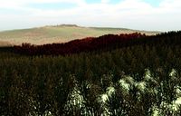
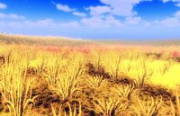
Eastern Eura Trade Association
Established in 31.06 PSSC following the approval of a treaty between Passio-Corum and pirate leaders in Eura, the Eastern Eura Trade Association is among the most important regions which constitute the Greater Pallisican Trade Association insofar as it represents the bridge between the nation's holdings in Corum and Keltia. All commerce traveling between the two continents passes through the trade routes of the Eastern Eura Trade Association.
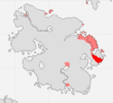
Réi
| Rey Hed Port ile Kói (The Port is King) | |||
| |||
| |||
| Capital | Réi | ||
| Major cities | Réi | ||
| Demonym | Delreyani | ||
| - Adjective | Delreyani | ||
| Area | 230,544 km² | ||
| - Ranked | |||
| Population | 562,096 (37.20 PSSC) | ||
| - Ranked | |||
| Density | 2.43/km² | ||
| Abbreviation | RY | ||
History
The informal capital of the Eastern Eura Trade Association, the city of Rey - formerly known as Alcazar Haketia - was established by the Republic of Ashkenatza in the year 20.62 PSSC, and was later resettled and and re-named by the Kingdom of Babkha in 23.19. Today the city represents the gateway to Eura for visitors traveling from Corum and the regions of the Austral Strait. With that said, the city holds a special place in the hearts and minds of most Pallisicans, especially given its role in the whirlwind romance which existed between Queen Esper I and the King of Rey.
Geography
Climate and Topography
| Climate V|Topography > | |||||
|---|---|---|---|---|---|
| Sea Level | Coastal Plains | High Plains | Highlands | Mountains | |
| Cwa | X | ||||
| Cwc | X | X | |||
| Cfa | X | X | |||
| Dsd | X | ||||
| Dwa | X | X |
Demographics
Region Statistics
Note: Réi is represented on the Port of Vines by the Regional Investor of the Eastern Eura Trade Association.
| Year | Population | Growth (Growth %) | Food Imports (/Person) | Fuel Imports (/Person) | Other Imports (/Person) | Immigration Modifier (%) | Seats in Regional Government | Seats in Houses of Corum
|
|---|---|---|---|---|---|---|---|---|
| 39.80 PSSC | 565,648 | -944 (-.17%) | 233,818 (.41) | 601,552 (1.06) | 653,177 (1.15) | N/A | N/A | N/A |
| 39.60 PSSC | 566,593 | 6,396 (1.13%) | 229,168 (.4) | 573,361 (1.01) | 728,802 (1.01) | N/A | N/A | N/A |
| 39.40 PSSC | 560,197 | -1,520 (-.27%) | 243,094 (.43) | 545,550 (.97) | 725,291 (1.29) | N/A | N/A | N/A |
| 39.20 PSSC | 561,718 | -935 (-.17%) | 276,593 (.49) | 664,344 (1.18) | 711,176 (1.26) | N/A | N/A | N/A |
| 39.00 PSSC | 562,654 | -4,821 (-.86%) | 212,961 (.37) | 752,888 (1.33) | 641,733 (1.14) | N/A | N/A | N/A |
| 38.80 PSSC | 567,476 | 1,119 (.2%) | 199,171 (.35) | 745,735 (1.31) | 510,161 (.89) | N/A | N/A | N/A |
| 38.60 PSSC | 566,357 | 2,787 (.49%) | 162,385 (.286) | 689,576 (1.21) | 303,869 (.53) | N/A | N/A | N/A |
| 38.40 PSSC | 563,570 | -3,688 (-.65%) | 161,787 (.287) | 671,710 (1.191) | 293,643 (.521) | N/A | N/A | N/A |
| 38.20 PSSC | 567,259 | 320 (.06%) | 186,270 (.328) | 792,624 (1.39) | 340,312 (.59) | N/A | N/A | N/A |
| 38.00 PSSC | 566,939 | -497 (-.09%) | 163,122 (.287) | 630,292 (.1.11) | 296,853 (.52) | N/A | N/A | N/A |
| 37.80 PSSC | 567,437 | -2,412 (-.43%) | 92,254 (.162) | 559,551 (.98) | 248,888 (.43) | N/A | N/A | N/A |
| 37.60 PSSC | 569,850 | -2,796 (-.49%) | 85,241 (.149) | 524,527 (.92) | 266,923 (.468) | N/A | N/A | N/A |
| 37.40 PSSC | 572,647 | 10,551 (1.84%) | 77,057 (.13) | 504,885 (.88) | 190,876 (.33) | N/A | N/A | N/A |
| 37.20 PSSC | 562,096 | N/A (N/A%) | 70,931 (.12) | 472,887 (.84) | 215,109 (.38) | N/A | N/A | N/A |
Transportation
The most common mode of transportation in Réi is rail. Railways in the region are maintained by the Trans-Eurani Railway Corporation.
The city of Réi is home to an Imperial Bassarid Orbital Transit Depot, which connects the city to the orbital trade routes which extend between Corum, Eura, and Keltia.
Military Installations
Réi is home to Fort Rey. The second largest of the Haifo-Pallisican military installations in Eastern Eura, Fort Rey plays a central role in the operations of the Railway Archer Regiments in Eura.
Protected Areas
| |||||||||||
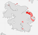
Zinjibä
| Zinjibar Lajíos del hed Northazn Vï (Lands of the Northern Vine) | |||
| |||
| |||
| Capital | Zinjibä | ||
| Major cities | Zinjibä | ||
| Demonym | Zinjibari | ||
| - Adjective | Zinjibari | ||
| Area | 221,472 km² | ||
| - Ranked | |||
| Population | 936,828 (37.20 PSSC) | ||
| - Ranked | |||
| Density | 4.23/km² | ||
| Abbreviation | ZN | ||
History
Located on the northern edge of Eura's prime wine country, the city of Zinjibar is among the oldest continuously inhabited cities in Eastern Eura. Established by the Kingdom of Babkha in 16.98 PSSC, the city today serves as a particular stronghold for Pallisican interests in the Eurani continent. To that extent, Zinjibar is home to the Eurani headquarters of the New Zimian War League, as well as that of the Greater Eurani Trade Association, which represents the Eurani continent on the Port of Storms.
Geography
Climate and Topography
| Climate V|Topography > | |||||
|---|---|---|---|---|---|
| Sea Level | Coastal Plains | High Plains | Highlands | Mountains | |
| Csa | X | X | |||
| Csb | X | X | X | ||
| Cwb | X | X |
Demographics
Region Statistics
Note: Zinjibä is represented on the Port of Vines by the Regional Investor of the Eastern Eura Trade Association.
| Year | Population | Growth (Growth %) | Food Imports (/Person) | Fuel Imports (/Person) | Other Imports (/Person) | Immigration Modifier (%) | Seats in Regional Government | Seats in Houses of Corum
|
|---|---|---|---|---|---|---|---|---|
| 39.80 PSSC | 942,747 | -1,573 (-.17%) | 389,697 (.41) | 1,002,586 (1.06) | 1,088,629 (1.15) | N/A | N/A | N/A |
| 39.60 PSSC | 944,321 | 10,659 (1.13%) | 381,947 (.4) | 955,602 (1.01) | 1,214,671 (1.28) | N/A | N/A | N/A |
| 39.40 PSSC | 933,662 | -2,534 (-.27%) | 405,157 (.43) | 909,434 (.97) | 1,208,819 (1.29) | N/A | N/A | N/A |
| 39.20 PSSC | 936,197 | -1,559 (-.17%) | 460,988 (.49) | 1,107,340 (1.18) | 1,185,293 (1.26) | N/A | N/A | N/A |
| 39.00 PSSC | 937,757 | -8,036 (-.86%) | 354,936 (.37) | 1,254,814 (1.33) | 1,069,555 (1.14) | N/A | N/A | N/A |
| 38.80 PSSC | 945,794 | 1,865 (.2%) | 331,953 (.35) | 1,242,892 (1.31) | 850,269 (.89) | N/A | N/A | N/A |
| 38.60 PSSC | 943,929 | 4,646 (.49%) | 270,643 (.286) | 1,149,293 (1.21) | 5096,449 (.53) | N/A | N/A | N/A |
| 38.40 PSSC | 939,283 | -6,147 (-.65%) | 269,645 (.287) | 1,119,516 (1.191) | 489,405 (.521) | N/A | N/A | N/A |
| 38.20 PSSC | 945,431 | 532 (.06%) | 310,451 (.32) | 1,321,040 (1.39) | 567,187 (.59) | N/A | N/A | N/A |
| 38.00 PSSC | 944,899 | -850 (-.09%) | 271,870 (.287) | 1,050,487 (1.11) | 494,756 (.52) | N/A | N/A | N/A |
| 37.80 PSSC | 945,729 | -4,020 (-.43%) | 153,757 (.16) | 932,586 (.98) | 414,814 (.43) | N/A | N/A | N/A |
| 37.60 PSSC | 949,750 | -4,660 (-.49%) | 142,069 (.149) | 874,212 (.92) | 444,871 (.468) | N/A | N/A | N/A |
| 37.40 PSSC | 954,411 | 17,583 (1.84%) | 128,429 (.13) | 841,475 (.88) | 281,127 (.33) | N/A | N/A | N/A |
| 37.20 PSSC | 936,828 | N/A (N/A%) | 118,219 (.12) | 788,146 (.84) | 358,515 (.38) | N/A | N/A | N/A |
Transportation
The most common mode of transportation in Zinjibä is rail. Railways in the region are maintained by the Trans-Eurani Railway Corporation.
Military Installations
While there are no major military installations in Zinjibä, the region is defended by the New Zimian War League, as well as by local authorities.
Protected Areas
| |||||||||||
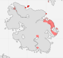
Bajiä-e Ebrahíama
| Bandar-e Ebrahim Hed Cazäma Azdéickos Suéileza (The Salt Sticks Sweetly) | |||
| |||
| |||
| Capital | Bajiä-e Ebrahíama | ||
| Major cities | Bajiä-e Ebrahíama, Truva, Qóamävra, Corasunt, Vandía-Levi | ||
| Demonym | Ebrahíama | ||
| - Adjective | Ebrahíama | ||
| Area | 86,400 km² | ||
| - Ranked | |||
| Population | 1,124,193 (37.20 PSSC) | ||
| - Ranked | |||
| Density | 13.01/km² | ||
| Abbreviation | BE | ||
History
Located at the tip of northeastern Eura, in the furthest windswept eastern reaches of the region of Shahzamin, Bandar-e Ebrahim is an ancient and storied city which today defines the portal between the Storish Orange Sea and the vast Pallisican-controlled Sea of Storms. Given its highly strategic location in the Micrasian east, Bandar-e Ebrahim - known from 16.82 PSSC until 23.19 as Bandar i-Aurang - is in modern times the last major port of Eura's Pallisican privateers, whose numbers have been on the decline since the establishment of the Eastern Eura Trade Association in 31.06 PSSC.
Geography
Climate and Topography
| Climate V|Topography > | |||||
|---|---|---|---|---|---|
| Sea Level | Coastal Plains | High Plains | Highlands | Mountains | |
| Af | X | ||||
| Am | X | X | |||
| BWh | X | ||||
| BSh | X | ||||
| BSk | X | X | |||
| Csa | X | X | |||
| Csb | X |
Demographics
Region Statistics
Note: Bajiä-e Ebrahíama is represented on the Port of Vines by the Regional Investor of the Eastern Eura Trade Association.
| Year | Population | Growth (Growth %) | Food Imports (/Person) | Fuel Imports (/Person) | Other Imports (/Person) | Immigration Modifier (%) | Seats in Regional Government | Seats in Houses of Corum
|
|---|---|---|---|---|---|---|---|---|
| 39.80 PSSC | 1,131,297 | -1,888 (-.17%) | 467,637 (.41) | 1,203,104 (1.06) | 1,306,355 (1.15) | N/A | N/A | N/A |
| 39.60 PSSC | 1,133,186 | 12,791 (1.13%) | 458,336 (.4) | 1,146,723 (1.01) | 1,457,605 (1.28) | N/A | N/A | N/A |
| 39.40 PSSC | 1,120,395 | -3,041 (-.27%) | 486,189 (.43) | 1,091,321 (.97) | 1,450,583 (1.29) | N/A | N/A | N/A |
| 39.20 PSSC | 1,123,437 | -870 (-.17%) | 553,186 (.49) | 1,328,686 (1.18) | 1,328,688 (1.26) | N/A | N/A | N/A |
| 39.00 PSSC | 1,124,308 | -9,644 (-.86%) | 425,923 (.37) | 1,505,777 (1.33) | 1,283,467 (1.14) | N/A | N/A | N/A |
| 38.80 PSSC | 1,134,953 | 2,238 (.2%) | 398,343 (.35) | 1,491,471 (1.31) | 1,010,323 (.89) | N/A | N/A | N/A |
| 38.60 PSSC | 1,132,715 | 5,575 (.49%) | 324,771 (.286) | 1,379,152 (1.21) | 607,739 (.53) | N/A | N/A | N/A |
| 38.40 PSSC | 1,127,140 | -7,377 (-.65%) | 323,574 (.287) | 1,343,420 (1.191) | 587,287 (.521) | N/A | N/A | N/A |
| 38.20 PSSC | 1,134,518 | 639 (.06%) | 372,541 (.32) | 1,585,248 (1.39) | 680,624 (.59) | N/A | N/A | N/A |
| 38.00 PSSC | 1,133,879 | -995 (-.09%) | 326,244 (.287) | 1,260,584 (1.11) | 593,707 (.52) | N/A | N/A | N/A |
| 37.80 PSSC | 1,134,875 | -4,828 (-.43%) | 184,509 (.162) | 1,119,103 (.986) | 497,777 (.438) | N/A | N/A | N/A |
| 37.60 PSSC | 1,139,700 | -5,593 (-.49%) | 170,483 (.149) | 1,049,055 (.92) | 533,846 (.468) | N/A | N/A | N/A |
| 37.40 PSSC | 1,145,294 | 21,101 (1.84%) | 154,115 (.13) | 1,009,770 (.88) | 381,753 (.33) | N/A | N/A | N/A |
| 37.20 PSSC | 1,124,193 | N/A (N/A%) | 141,862 (.12) | 945,775 (.84) | 430,219 (.38) | N/A | N/A | N/A |
Transportation
The primary mode of transportation in Bajiä-e Ebrahíama is sail. Ferries are very common in the region; travelers may venture across the entirety of northern Corum at ease on board any number of private ferries which operate out of the region's capital city, and which offer 24 hour passage between Bajiä-e Ebrahíama and the Stars Archipelago. With this said, rail is another common mode of transportation in the region. Railways are maintained by the Trans-Eurani Railway Corporation.
The city of Corasunt is home to an Imperial Bassarid Orbital Transit Depot, which connects the city to the orbital trade routes which extend between Corum, Eura, and Keltia.
Military Installations
The primary military installation in the region of greater Bajiä-e Ebrahíama is Fort Truva.
Protected Areas
| |||||||||||
Vëlacío
| Vëlacío TBA | |||
| |||
| |||
| Capital | Vëlacío | ||
| Major cities | Vëlacío | ||
| Demonym | Vayelon | ||
| - Adjective | Vayelon | ||
| Area | 37,296 km² | ||
| - Ranked | |||
| Population | 93,682 (37.20 PSSC) | ||
| - Ranked | |||
| Density | 2.51/km² | ||
| Abbreviation | VE | ||
History
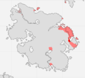
Perhaps the oldest settlement in Eastern Eura, the city of Vëlacío has long been supported by a rich and vibrant dye industry, which continues today to prosper across the region's hilly, sub-tropical climate. Despite its relatively small population in contrast to Eastern Eura's other Bassarid territories, Vayelon is regarded as playing a particularly central role in the overall well-being of the Trade Association as a whole.
Geography
Climate and Topography
| Climate V|Topography > | |||||
|---|---|---|---|---|---|
| Sea Level | Coastal Plains | High Plains | Highlands | Mountains | |
| Cfa | X | X | |||
| Cwb | X | X |
Demographics
Region Statistics
Note: Vëlacío is represented on the Port of Vines by the Regional Investor of the Eastern Eura Trade Association.
| Year | Population | Growth (Growth %) | Food Imports (/Person) | Fuel Imports (/Person) | Other Imports (/Person) | Immigration Modifier (%) | Seats in Regional Government | Seats in Houses of Corum
|
|---|---|---|---|---|---|---|---|---|
| 39.80 PSSC | 94,274 | -157 (-.17%) | 38,969 (.41) | 100,258 (1.06) | 108,862 (1.15) | N/A | N/A | N/A |
| 39.60 PSSC | 94,432 | 1,066 (1.13%) | 38,194 (.4) | 95,560 (1.01) | 121,467 (1.28) | N/A | N/A | N/A |
| 39.40 PSSC | 93,366 | -252 (-.27%) | 40,515 (.43) | 90,943 (.97) | 120,881 (1.29) | N/A | N/A | N/A |
| 39.20 PSSC | 93,619 | -155 (-.17%) | 46,098 (.49) | 110,724 (1.18) | 118,529 (1.26) | N/A | N/A | N/A |
| 39.00 PSSC | 93,775 | -803 (-.86%) | 35,943 (.37) | 125,481 (1.33) | 106,955 (1.14) | N/A | N/A | N/A |
| 38.80 PSSC | 94,579 | 187 (.2%) | 33,195 (.35) | 124,289 (1.31) | 85,026 (.89) | N/A | N/A | N/A |
| 38.60 PSSC | 94,392 | 464 (.49%) | 27,064 (.286) | 114,929 (1.21) | 50,644 (.53) | N/A | N/A | N/A |
| 38.40 PSSC | 93,928 | -614 (-.65%) | 26,964 (.287) | 111,951 (1.191) | 48,940 (.521) | N/A | N/A | N/A |
| 38.20 PSSC | 94,543 | 54 (.06%) | 31,045 (.32) | 132,104 (1.39) | 56,718 (.59) | N/A | N/A | N/A |
| 38.00 PSSC | 94,489 | -82 (-.09%) | 27,187 (.287) | 105,048 (1.11) | 49,475 (.52) | N/A | N/A | N/A |
| 37.80 PSSC | 94,572 | -402 (-.43%) | 15,375 (.162) | 93,258 (.986) | 41,481 (.438) | N/A | N/A | N/A |
| 37.60 PSSC | 94,975 | -465 (-.49%) | 14,206 (.149) | 87,421 (.92) | 44,487 (.468) | N/A | N/A | N/A |
| 37.40 PSSC | 95,441 | 1,759 (1.84%) | 12,842 (.13) | 84,147 (.88) | 31,812 (.33) | N/A | N/A | N/A |
| 37.20 PSSC | 93,682 | N/A (N/A%) | 11,821 (.12) | 78,814 (.84) | 35,851 (.38) | N/A | N/A | N/A |
Transportation
The primary mode of transportation in Vëlacío is rail. Railways in the region are maintained by the Trans-Eurani Railway Corporation.
Military Installations
While there are no major military installations located in Vëlacío, the region is defended by the New Zimian War League, as well as by local authorities.
Protected Areas
| |||||||||||
Shahpéo
| Shahpéo TBA | |||
| |||
| |||
| Capital | Shahpéo | ||
| Major cities | Shahpéo, Bajiä-e Tude, Neza-deh, Béihagh | ||
| Demonym | Shahpuri | ||
| - Adjective | Shahpuri | ||
| Area | 406,944 km² | ||
| - Ranked | |||
| Population | 749,462 (37.20 PSSC) | ||
| - Ranked | |||
| Density | 1.84/km² | ||
| Abbreviation | SH | ||
History
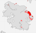
By far the largest of the constituent member-states of the Eastern Eura Trade Association, Shahpéo is a vast sub-tropical region which despite the presence of several key cities, remains largely un-urbanized and lacking in any major industry or trade with outside investors. Despite initiatives aimed at bolstering trade in the region, most of the region's rural inhabitants remain steadfastly committed to their local, pastoralist traditions.
Geography
Climate and Topography
| Climate V|Topography > | |||||
|---|---|---|---|---|---|
| Sea Level | Coastal Plains | High Plains | Highlands | Mountains | |
| BWk | X | X | |||
| BSh | X | X | |||
| Csa | X | X | |||
| Csb | X | X | |||
| Cwb | X | X |
Demographics
Region Statistics
Note: Shahpéo is represented on the Port of Vines by the Regional Investor of the Eastern Eura Trade Association.
| Year | Population | Growth (Growth %) | Food Imports (/Person) | Fuel Imports (/Person) | Other Imports (/Person) | Immigration Modifier (%) | Seats in Regional Government | Seats in Houses of Corum
|
|---|---|---|---|---|---|---|---|---|
| 39.80 PSSC | 754,198 | -1,258 (-.17%) | 311,758 (.41) | 802,069 (1.06) | 870,903 (1.15) | N/A | N/A | N/A |
| 39.60 PSSC | 755,457 | 8,527 (1.13%) | 305,557 (.4) | 764,482 (1.01) | 764,482 (1.28) | N/A | N/A | N/A |
| 39.40 PSSC | 746,930 | -2,027 (-.27%) | 324,126 (.43) | 727,547 (.97) | 967,055 (1.29) | N/A | N/A | N/A |
| 39.20 PSSC | 748,958 | -1,246 (-.17%) | 368,791 (.49) | 885,792 (1.18) | 948,234 (1.26) | N/A | N/A | N/A |
| 39.00 PSSC | 750,205 | -6,429 (-.86%) | 283,949 (.37) | 1,003,851 (1.33) | 855,644 (1.14) | N/A | N/A | N/A |
| 38.80 PSSC | 756,635 | 1,492 (.2%) | 265,562 (.35) | 994,314 (1.31) | 680,215 (.89) | N/A | N/A | N/A |
| 38.60 PSSC | 755,143 | 3,716 (.49%) | 216,514 (.286) | 919,434 (1.21) | 405,159 (.53) | N/A | N/A | N/A |
| 38.40 PSSC | 751,427 | -4,917 (-.65%) | 215,716 (.287) | 895,613 (1.191) | 391,524 (.521) | N/A | N/A | N/A |
| 38.20 PSSC | 756,345 | 426 (.06%) | 248,360 (.32) | 1,056,832 (1.39) | 45,749 (.59) | N/A | N/A | N/A |
| 38.00 PSSC | 755,919 | -663 (-.09%) | 217,496 (.287) | 840,389 (1.11) | 395,805 (.52) | N/A | N/A | N/A |
| 37.80 PSSC | 756,583 | -3,216 (-.43%) | 123,006 (.162) | 746,068 (.986) | 331,851 (.438) | N/A | N/A | N/A |
| 37.60 PSSC | 759,800 | -3,728 (-.49%) | 113,655 (.149) | 699,370 (.92) | 355,897 (.468) | N/A | N/A | N/A |
| 37.40 PSSC | 763,529 | 14,067 (1.84%) | 102,743 (.13) | 673,180 (.88) | 254,502 (.33) | N/A | N/A | N/A |
| 37.20 PSSC | 749,462 | N/A (N/A%) | 94,575 (.12) | 630,516 (.84) | 286,612 (.38) | N/A | N/A | N/A |
Transportation
The primary mode of transportation in Shahpéo is rail. Railways in the region are maintained by the Trans-Eurani Railway Corporation. Sail is also common in the region, as is travel along the roadway network which connects major coastal settlements.
Military Installations
While there are no major military installations located in Shahpéo, the region is defended by the New Zimian War League, as well as by local authorities.
Protected Areas
| |||||||||||
Norasht
| Norasht TBA | |||
| |||
| |||
| Capital | Norasht | ||
| Major cities | Norasht | ||
| Demonym | TBA | ||
| - Adjective | TBA | ||
| Area | 76,032 km² | ||
| - Ranked | |||
| Population | 281,048 (37.20 PSSC) | ||
| - Ranked | |||
| Density | 3.69/km² | ||
| Abbreviation | NS | ||
History
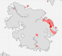
Formally recognized in 37.20 PSSC - along with Vëlacío and Shahpéo - as a semi-independent constituent member of the Eastern Eura Trade Association, Norasht is the military capital of the Haifo-Pallisican Imperial Trade Union in Eura. The New Zimian War League maintains a considerable presence in this region, which is perceived as being the gateway to the wild and volatile Eurani heartland.
Geography
Climate and Topography
| Climate V|Topography > | |||||
|---|---|---|---|---|---|
| Sea Level | Coastal Plains | High Plains | Highlands | Mountains | |
| Csb | X | ||||
| Cwb | X | X |
Demographics
Region Statistics
Note: Norasht is represented on the Port of Vines by the Regional Investor of the Eastern Eura Trade Association.
| Year | Population | Growth (Growth %) | Food Imports (/Person) | Fuel Imports (/Person) | Other Imports (/Person) | Immigration Modifier (%) | Seats in Regional Government | Seats in Houses of Corum
|
|---|---|---|---|---|---|---|---|---|
| 39.60 PSSC | 283,296 | 3,198 (1.13%) | 114,584 (.4) | 286,680 (1.01) | 364,401 (1.28) | N/A | N/A | N/A |
| 39.40 PSSC | 280,098 | -760 (-.27%) | 121,547 (.43) | 272,830 (.97) | 362,645 (1.29) | N/A | N/A | N/A |
| 39.20 PSSC | 280,859 | -467 (-.17%) | 138,296 (.49) | 332,172 (1.18) | 355,588 (1.26) | N/A | N/A | N/A |
| 39.00 PSSC | 281,327 | -2,410 (-.86%) | 106,480 (.37) | 376,444 (1.33) | 320,866 (1.14) | N/A | N/A | N/A |
| 38.80 PSSC | 283,738 | 560 (.2%) | 99,585 (.35) | 372,867 (1.31) | 255,080 (.89) | N/A | N/A | N/A |
| 38.60 PSSC | 283,178 | 1,393 (.49%) | 81,192 (.286) | 344,788 (1.21) | 151,934 (.53) | N/A | N/A | N/A |
| 38.40 PSSC | 281,785 | -1,843 (-.65%) | 80,893 (.287) | 335,855 (1.191) | 146,821 (.521) | N/A | N/A | N/A |
| 38.20 PSSC | 283,629 | 160 (.05%) | 93,135 (.32) | 396,312 (1.39) | 170,156 (.59) | N/A | N/A | N/A |
| 38.00 PSSC | 283,469 | -248 (-.09%) | 81,561 (.287) | 315,146 (1.11) | 148,426 (.52) | N/A | N/A | N/A |
| 37.80 PSSC | 283,718 | -1,206 (-.43%) | 46,127 (.162) | 279,775 (.986) | 124,444 (.438) | N/A | N/A | N/A |
| 37.60 PSSC | 284,925 | -1,397 (-.49%) | 42,620 (.149) | 262,263 (.92) | 133,461 (.468) | N/A | N/A | N/A |
| 37.40 PSSC | 286,323 | 5,275 (1.84%) | 38,528 (.13) | 252,448 (.88) | 95,348 (.33) | N/A | N/A | N/A |
| 37.20 PSSC | 281,048 | N/A (N/A%) | 35,465 (.12) | 236,443 (.84) | 107,554 (.38) | N/A | N/A | N/A |
Transportation
The most common mode of transportation in Norasht is rail. Railways in the region are maintained by the Trans-Eurani Railway Corporation.
Military Installations
Norasht is home to Fort Norasht. The largest of the Haifo-Pallisican military installations in Eastern Eura, Fort Norasht plays a central role in the operations of the Railway Archer Regiments in Eura.
Protected Areas
| |||||||||||
