Bassaridian Normark
| Bassaridian Normark | |
|---|---|

| |
| -. | |
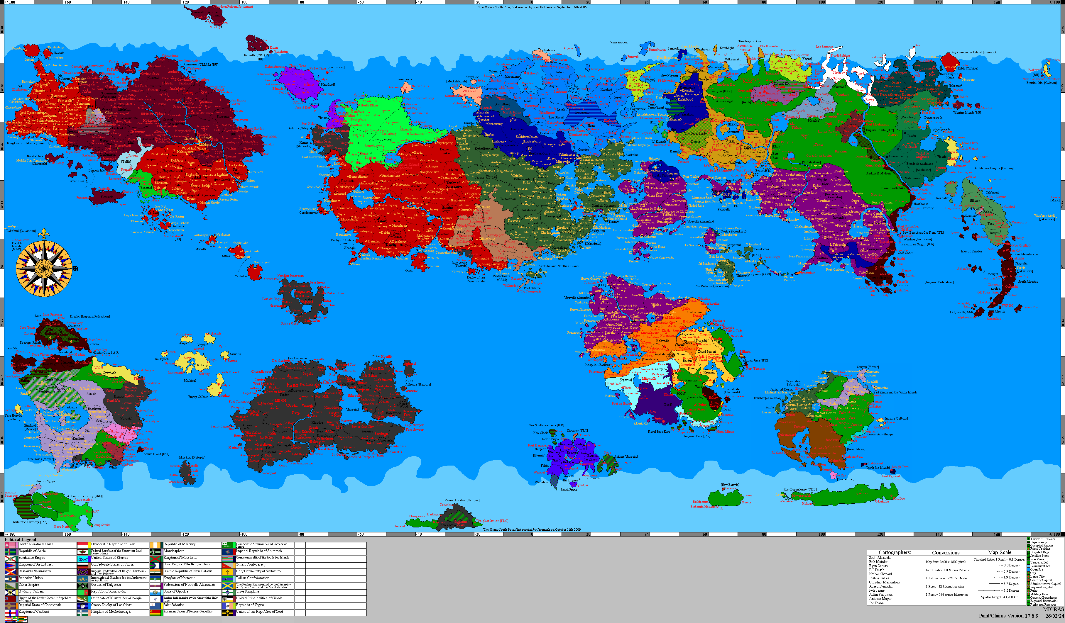
| Location | Far-northern Keltia, bordered by New South Jangsong to the south, the Eastern Caledonian Highlands to the west, the Normark–Lindley Passage to the east, and the northern mouth of the Northern Strait of Haifa to the southeast within northern Bassaridia Vaeringheim |
| Climate | Subarctic and subpolar oceanic maritime climate; long cold winters, short cool summers, frequent coastal storms, storm surges, blizzards, icing, sea spray, heavy snowfall, avalanche risks on Aderstein, and weather-dependent transport closures along exposed sea, rail, and village routes |
| Character | Far-northern maritime frontier dominated by storm-harbors, winter routing, fortified quay districts, cold-sea extraction, reindeer pastoralism, remote rural villages, military rail yards, preserved export chains, and strict harbor discipline |
| Major settlements | Ardclach; Riddersborg; Peripheral Normarkian Villages |
| Noted features | Southern coast of Aderstein; remote Peripheral Normarkian Villages; rocky coastal forests; mountainous island interior; sheltered fishing coves; reindeer ranges; fortified quay districts; cold-storage depots; storm-harbors; village route houses; military rail yards; preserved-goods warehouses; Trans-Keltian Express infrastructure; western approaches to the Normark–Lindley Passage; northern approaches to the Northern Strait of Haifa |
| Cultural associations | Normarkian maritime tradition; Reinish reindeer herding; rural traditional Stripping Path practice; post-annexation Reformed Stripping Path administration; village storm-lamp customs; route-house hospitality; winter storage rites; cold-sea survival culture; martial memory of the Lower Jangsong Campaign |
| Noted presences | Lindley Whaling Company; Knights Castle Reindeer Herders; King's Home Fur Trappers' Cooperative; Bassaridian War League patrols; Port inspectors; Temple Bank auditors; Lothayan Skybridge Airways; reindeer herders; village elders; storm-route guides; coastal watchkeepers; whalers; trappers; rail inspectors |
| Access | Storm-harbors, guarded rail corridors, seasonal sea lanes, aerial ferry links, military inspection points, cold-storage depots, supervised Port-cleared cargo routes, village route houses, and weather-dependent convoy windows generally maintained; exposed coastal routes, avalanche-prone interiors, remote village paths, off-road reindeer ranges, storm-closed harbors, and highland approaches subject to weather closure, War League restriction, Port inspection, or local village custom |
Bassaridian Normark is a far-northern maritime and subarctic region of Bassaridia Vaeringheim, encompassing Ardclach, Riddersborg, Aderstein, and the remote rural settlements collectively known as the Peripheral Normarkian Villages. It occupies the northern frontier of Bassaridian power in Keltia, where the storm-coast of Aderstein, the military rail corridors of Riddersborg, the western approaches to the Normark–Lindley Passage, and the northern mouth of the Northern Strait of Haifa converge.
The region is bordered by New South Jangsong to the south, the Eastern Caledonian Highlands to the west, the Normark–Lindley Passage to the east, and the northern mouth of the Northern Strait of Haifa to the southeast. This position gives Bassaridian Normark a strategic importance greater than its population or agricultural output would otherwise suggest. It is simultaneously an island-facing maritime region, a rail-security zone, a cold-weather pastoral district, a storm-harbor economy, and a northern passage frontier.
In Bassaridian geographic writing, the region is generally described as the nation’s far-northern maritime belt. Unlike the warmer lake-basin regions of Bassaridia Vaeringheim, where canal markets, shrine roads, riverine agriculture, and dense settlement define local life, Bassaridian Normark is organized around exposure. Its harbors, rail yards, warehouses, fisheries, aerial ferry towers, reindeer stations, village route houses, and military depots are designed to operate through cold spray, snow, icing, long winter darkness, and periodic closures of sea, rail, and interior routes.
Bassaridian Normark is also a region of layered inheritance. Older Normarkian maritime customs remain visible in its harbor districts, seafarer houses, storm shrines, village warning systems, and memorial sites. Reinish herding traditions persist in the reindeer ranges around Riddersborg and across Aderstein’s rural interior. The older Stripping Path survives most visibly in the Peripheral Normarkian Villages, where household shrines, reindeer-blessing posts, storm lamps, and smokehouse altars remain part of seasonal life. Since annexation, these practices have been increasingly integrated into the institutions of Bassaridia Vaeringheim, especially the Reformed Stripping Path, the Temple Bank of the Reformed Stripping Path, the General Port of Lake Morovia, and the Bassaridian War League.
The modern political geography of Bassaridian Normark was shaped by the Lower Jangsong Campaign, through which Bassaridia Vaeringheim secured Ardclach, Riddersborg, Aderstein, and the surrounding transport corridors. The resulting territory became a northern lock of the Bassaridian system: a region where seaborne access, railborne access, military authority, rural endurance, cold-weather production, and Port-ledger integration are coordinated through a single frontier administration.
The deeper historical importance of Bassaridian Normark, however, predates the Lower Jangsong Campaign. The region’s northern coasts, passage routes, and approaches to the Gulf of Jangsong were shaped by the earlier Strait of Haifa Campaign, the central northern-Keltian campaign of the War of the Harpy. During that conflict, the Gulf of Jangsong, Normarkian waters, and the northern approaches to the Strait of Haifa became contested spaces between Natopian, Bassarid, Haifan, and Pallisican-aligned forces. The campaign helped entrench the strategic logic that later made Bassaridian Normark so valuable: control of the far north depended not only on cities, but on passages, harbors, rail routes, fortified coastal settlements, insurgent networks, and religious-commercial institutions capable of surviving a prolonged maritime struggle.
Regional divisions
Bassaridian Normark is commonly described in terms of functional belts rather than a single uniform landscape. These divisions reflect climate, settlement, transport, exposure, economic use, and military importance. They are not strict administrative boundaries, but they are stable enough in local usage that Port officials, War League officers, reindeer herders, pilots, dockworkers, village elders, and route guides often refer to them as named zones.
The Aderstein Island Belt is centered on Ardclach, the territorial capital, and includes the many remote rural settlements scattered across Aderstein that are collectively known as the Peripheral Normarkian Villages. This belt includes the southern coast of Aderstein, rocky coastal forests, exposed inlets, sheltered fishing coves, upland hamlets, reindeer stations, snow-covered ridges, avalanche channels, storm-warning points, and a mountainous island interior. Its settlements are shaped by subarctic weather, maritime isolation, and the difficulty of maintaining contact during winter storms.
The Riddersborg Rail-Coast Belt is centered on Riddersborg, the region’s principal economic, military, and rail hub. Located on the far northern coast of Keltia, near the northern mouth of the Northern Strait of Haifa, Riddersborg links maritime traffic to the Trans-Keltian Express. This belt includes fortified rail yards, military depots, quay districts, ferry terminals, university precincts, customs offices, and the principal overland route by which Bassaridian Normark connects to eastern and central Keltia.
The Southern Jangsong Borderlands form the transition between Bassaridian Normark and New South Jangsong. This belt is politically important because it links the far-northern maritime region to the Jangsong territories consolidated during and after the Lower Jangsong Campaign. It is characterized by guarded transport corridors, post-campaign administrative lines, rail approaches, and military-supervised movement between the northern storm-coast and the Bassaridian-controlled Jangsong interior.
The Western Highland Approach lies along the border with the Eastern Caledonian Highlands. This belt is more rugged and landward than the coastal districts. It is defined by upland routes, sparse settlement, difficult weather, rail-security concerns, and the long strategic shadow of the Trans-Keltian Express. Whereas the eastern edge of Bassaridian Normark faces the sea, the western edge faces the highland interior of eastern Caledonia.
The Reindeer and Fur Interior consists of plains, boreal forests, uplands, and cold-weather grazing districts surrounding the major settlements and many of the Peripheral Normarkian Villages. This zone supports reindeer herding, winter hunting, trapping, hide preparation, smoked meat production, sinew cordage, tallow soap, antler blanks, and other durable goods suited to long-distance movement through Port markets. It is closely associated with Reinish pastoral communities and with firms such as Knights Castle Reindeer Herders.
The Storm-Harbor and Preservation Belt includes smaller harbors, cold-storage yards, sealing stations, whale-processing sites, ice-proof warehouses, smokehouses, village storehouses, and preserved-goods depots that connect Ardclach, Riddersborg, and the Peripheral Normarkian Villages to the wider Bassaridian economy. Its defining feature is not high-frequency shipping, but the ability to hold goods safely until the next reliable transport window. Salted meat, rendered oil, cured hides, sealed crates, frozen cargo, smoked fish, preserved berries, wool, and winter survival supplies are characteristic products of this belt.
The Military-Rail Security Corridor consists of rail yards, checkpoints, storage depots, signal stations, security compounds, and War League-controlled approaches tied to the Trans-Keltian Express. This corridor emerged as a formal zone of concern following the surrender of Riddersborg and the permanent transfer of rail authority to the Bassaridian War League. It remains one of the most closely supervised parts of Bassaridian Normark.
The Normark–Lindley Maritime Approach refers to the eastern waters and storm-coast approaches associated with the Normark–Lindley Passage. This zone gives Bassaridian Normark its wider oceanic significance. Even though the region is harsh and frequently storm-disrupted, the ice-free character of the Passage allows maritime activity to continue through much of the year, provided that vessels are properly equipped for poor visibility, icing, heavy swell, and sudden weather escalation.
The Northern Strait Mouth forms the southeastern interface between Bassaridian Normark and the Northern Strait of Haifa. This zone is strategically important because it links the cold storm-coast economy of the far north to the wider strait system of Bassaridia Vaeringheim. It is therefore treated as both a maritime boundary and a gateway into the commercial, military, and religious networks of the Bassaridian core.
Geography and weather
Bassaridian Normark occupies the far-northern maritime edge of Bassaridia Vaeringheim, where cold seas, subpolar weather, exposed coasts, boreal forests, island mountains, and strategic transport routes meet. The region is bordered by New South Jangsong to the south, the Eastern Caledonian Highlands to the west, the Normark–Lindley Passage to the east, and the northern mouth of the Northern Strait of Haifa to the southeast.
The climate is generally subarctic to subpolar oceanic. Long cold winters, short cool summers, frequent coastal storms, blizzards, sea spray, icing, and heavy snowfall shape settlement and travel. On Aderstein, avalanche risk and mountainous interior terrain further restrict movement. Around Riddersborg, storm surge, rail exposure, and coastal flooding are more significant concerns. In both cases, weather is not treated as background. It is a governing fact that determines when cargo moves, when animals can be driven, when villages can be reached, when ships can depart, and when military patrols can safely operate.
Ardclach is situated on the southern coast of Aderstein, an arctic island known for rocky coastal forests and a mountainous interior. The city functions as the island-facing capital and maritime administrative center of Bassaridian Normark. Its harbor, ship repair yards, cold-storage facilities, and specialized manufacturing districts developed in response to the island’s exposed conditions. Buildings are typically insulated, harbor works are reinforced against spray and ice, and roads are laid out with attention to snow clearance, wind exposure, avalanche risk, and safe movement between the coast, the interior, and the Peripheral Normarkian Villages.
Riddersborg occupies the far northern coast of Keltia, northwest of the northern mouth of the Northern Strait of Haifa. Its geography is defined by the convergence of port facilities, rail yards, military depots, and the Trans-Keltian Express. The city’s weather is generally cold, wet, and storm-prone, with blizzards, surge events, and occasional flooding. Because Riddersborg combines maritime and rail functions, interruptions to one transport system often increase pressure on the other. A storm that closes the sea may push urgent cargo toward the railway; a rail disruption may force goods into storage at the harbor; and severe weather may require both systems to enter emergency discipline.
The Peripheral Normarkian Villages are scattered across Aderstein, especially in sheltered coves, forest margins, upland routes, reindeer grazing districts, and small valleys leading inland from the coast. Some villages face the sea and serve fishing, sealing, or storm-warning functions. Others are more landward, supporting reindeer herding, trapping, timber, shrine maintenance, or route-keeping. Their small size and isolation make them vulnerable during winter closures, but also make them essential to local survival, since they maintain the trails, shelters, signals, and storehouses that allow movement between Ardclach and the island interior.
Travel conditions vary sharply across short distances. A quay may remain operational while the road above it is buried. A coastal cove may be sheltered while a nearby headland is impassable. A rail line may be technically open but under military priority. A village path may remain visible while becoming unsafe because of snow, wind, predator movement, or avalanche risk. For this reason, movement in Bassaridian Normark depends heavily on local knowledge, route reports, weather signs, and the authority of pilots, guides, inspectors, and village elders.
Autumn is often treated as the principal preparation season. Vessels are repaired, warehouses are sealed, winter fuel is stored, meat is smoked, hides are cured, storm lamps are checked, herd markers are inspected, and village route houses are stocked. Winter is a season of endurance and controlled movement. Spring brings thaw, unstable ground, meltwater, and repair work. Summer offers the most reliable movement window, though fog, rain, and sudden storms remain common.
Boundary regions

To the south, Bassaridian Normark is bordered by New South Jangsong, whose harbors, fortified settlements, and post-campaign transport corridors connect the region to the wider Jangsong theater. This southern boundary is politically important because it links the far-northern maritime belt to the territory secured during the Lower Jangsong Campaign, creating a continuous Bassaridian zone of control across the northern approaches of Keltia.
To the west, the region is bordered by the Eastern Caledonian Highlands, a rugged upland frontier that separates Bassaridian Normark from the broader Caledonian interior. This western boundary is defined less by dense settlement than by difficult terrain, military watch routes, rail approaches, and the long strategic shadow of the Trans-Keltian Express. It forms the landward counterpart to the maritime exposure of the eastern coast.
To the east, Bassaridian Normark opens onto the Normark–Lindley Passage, the year-round ice-free maritime route linking the World Ocean to Normark. This eastern boundary gives the region its broader oceanic significance and explains why its harbors, cold-storage depots, whaling stations, naval patrols, rural coastal watch posts, and Port inspection systems carry importance beyond local trade.
To the southeast lies the northern mouth of the Northern Strait of Haifa, where Bassaridian Normark connects to the wider strait system of Bassaridia Vaeringheim. This southeastern boundary is one of the region’s most important strategic interfaces, linking the storm-coast economy of the far north to the commercial, military, and religious networks of the Bassaridian core.
To the north and northeast, the region is shaped by the open maritime approaches surrounding Aderstein and the cold northern seas beyond the main settlement belt. These waters reinforce the region’s identity as a storm-coast frontier, where harbor discipline, convoy timing, route knowledge, village warning systems, and winterized storage are essential to both survival and commerce.
To the north, Bassaridian Normark faces the icy expanses of the Micrasian north pole and the wider polar world associated with Leng. This northern frontier is marked in regional imagination by glacial fields, black stone ridges, ancient mineral zones, and the Obsidian Spires of the Iron Cult of Leng, which are regarded in some traditions as among the earliest known life-forms on Micras. Economically, the arctic north is linked to Bassaridian Normark through oil and iron extraction, especially through the Federation of North Brabipant and Thesean Iron Exports.
Normark–Lindley Passage
The Normark–Lindley Passage is central to the geography, economy, and strategic value of Bassaridian Normark. Also known as the North-East Passage, Normark Strait, Normark Straits, and the Normark Passage, it is a year-round ice-free maritime passage from the World Ocean to Normark. This makes it one of the defining northern sea corridors associated with the region.
Although the Passage is ice-free, it is not easy. Weather remains severe, and maritime activity is subject to storms, poor visibility, sea spray, sudden squalls, icing, high swell, and navigational hazards. The distinction is therefore not that the route is safe, but that it remains possible. In Bassaridian terms, the Passage represents navigable hardship: a route that can be used in all seasons only by those with the ships, discipline, harbors, storage systems, village warning networks, and security arrangements needed to endure it.
For Bassaridia Vaeringheim, the Passage gives Bassaridian Normark a maritime value distinct from its land-based production. Control over its western approaches provides a northern counterpart to Bassaridian control over the Trans-Keltian Express. Together, the Passage and the railway allow the state to monitor two major forms of movement across the far north: seaborne access to Normark and railborne access between eastern and central Keltia.
The Passage is especially important to Riddersborg, whose status as a rail and port city depends on its ability to connect sea routes with the Trans-Keltian Express. Goods arriving through the northern sea lanes may be transferred inland by rail, while goods produced or consolidated in the interior can be moved outward through storm-harbors and cold-storage facilities. This gives Riddersborg logistical importance comparable to far larger cities elsewhere in Bassaridia Vaeringheim.
For Ardclach, the Passage reinforces the city’s maritime orientation. Located on the southern coast of Aderstein, Ardclach functions as a winterized harbor settlement shaped by fishing, vessel repair, cold-sea extraction, coastal manufacturing, and island transport. Its position near the broader passage system allows it to serve as a staging point for weather-dependent maritime activity, especially during periods when direct access to smaller harbors and the Peripheral Normarkian Villages becomes hazardous.
The Passage has also influenced the cultural identity of Bassaridian Normark. Local seafarers, reindeer herders, fur trappers, dockworkers, rail inspectors, pilots, village elders, and military households all understand the region as a place defined by movement through difficult conditions. Storms, cold, fog, and darkness are not treated as interruptions to ordinary life, but as permanent facts around which society is organized.
The Passage also carries the memory of the Strait of Haifa Campaign, during which the northern sea lanes, the Gulf of Jangsong, and the wider Normarkian approaches became part of the contested maritime geography of the War of the Harpy. In later Bassaridian interpretation, the campaign revealed the importance of holding not only the southern strait cities, but also the far-northern exits, passage routes, and storm-coast harbors through which military pressure, religious influence, smuggling, convoy movement, and political authority could be projected. For this reason, Bassaridian Normark is often understood as a continuation of older northern-stratagems first tested during the War of the Harpy and later consolidated under Bassaridia Vaeringheim.
Northern polar frontier
To the north, Bassaridian Normark faces the icy expanses of the Micrasian north pole, a remote polar world of glacial fields, frozen seas, black stone ridges, and ancient mineral frontiers. This northern horizon is not simply an empty wasteland beyond the settled coast. In Bassaridian geographic writing, it is treated as a deep frontier whose dangers, resources, and mythic associations shape the economy and identity of the far north.
The most important symbolic landscape beyond Bassaridian Normark’s northern approaches is western Leng, where the frozen wastes are dotted with the strange Obsidian Spires associated with the Iron Cult of Leng. These large conical formations of sentient obsidian are believed by some traditions to represent one of the earliest known life-forms on Micras, predating the arrival of humans by vast spans of time. Their presence gives the northern polar frontier a significance beyond ordinary geography. To Bassaridian observers, the spires represent both a reminder of Micrasian antiquity and a warning that the far north contains forms of life, memory, and intelligence older than the political orders that now claim its coasts.
This polar orientation gives Bassaridian Normark a mythic and economic connection to the wider arctic world. The same cold routes that lead toward the Normark–Lindley Passage and the storm coasts of the Gulf of Jangsong also point toward the oil fields, iron mines, and ritual-industrial communities of the far north. As a result, Bassaridian Normark is not merely a coastal and rail region. It is also the southern administrative and commercial face of a much harsher polar hinterland.
The arctic north plays a direct role in the economy of Bassaridian Normark through the Federation of North Brabipant and Thesean Iron Exports. The Federation of North Brabipant represents a network of oil drilling communities in the arctic north of Aderstein, organized around twelve distinct sovereign arctic operations. Its activities link Bassaridian Normark to polar oil and gas extraction, expanding the region’s role beyond whaling, reindeer herding, fur trapping, and rail-port logistics. Thesean Iron Exports, by contrast, connects the region to the iron-working traditions of Leng. It extracts and exports arctic iron ore smelted according to ritualized procedures associated with the Iron Cult of Leng, providing high-grade arctic iron for tools, equipment, infrastructure, and ceremonial works.
Together, these institutions give Bassaridian Normark a polar-industrial dimension. Oil from North Brabipant supports fuel security, winter transport, heating, machinery, and emergency reserves across the region, while Thesean iron contributes to the material foundation of tools, rail components, harbor works, military equipment, ritual objects, and cold-weather infrastructure. These industries also reinforce the spiritual character of the northern economy: extraction is not treated merely as a technical process, but as an activity carried out under the shadow of ancient polar life, ritual smelting traditions, and the dangerous memory of Leng.
The polar frontier also affects regional culture. In the Peripheral Normarkian Villages, stories of the far north often blend practical warnings about ice, fuel, and dangerous routes with older accounts of black spires, strange lights, polar silence, and the deep mines of Leng. For dockworkers in Ardclach and rail inspectors in Riddersborg, the north is a source of oil, iron, and strategic cargo. For priests and village elders, it is a region of ancient beings, old rites, and powerful materials that must be handled with discipline. For the Bassaridian War League, it is a resource frontier whose security affects the entire northern system of Bassaridia Vaeringheim.
Waters, coasts, and the shaping of habitats

Water is the primary force shaping Bassaridian Normark. Unlike the marshy freshwater and brackish systems of the Morovian basin, the waters of Normark are maritime, cold, exposed, and often violent. Tides, sea spray, storm surge, ice, and fog define the coastal belt. Harbors are therefore built less as open civic promenades and more as defensive instruments: breakwaters, wind walls, reinforced quays, storm gates, mooring towers, rope sheds, winch houses, customs barracks, and cold-storage facilities form the ordinary architecture of the coast.
The southern coast of Aderstein is especially shaped by the meeting of mountains and sea. Short streams descend from the island’s interior, carrying snowmelt and sediment into rocky coves. Forests cling to slopes where wind exposure permits growth, while steeper areas give way to stone, snowfields, avalanche channels, and exposed ridgelines. In winter, the distinction between land route and weather route becomes especially important, as some paths remain physically present but practically unusable.
Many of the Peripheral Normarkian Villages are located along these marginal spaces, where a cove, valley mouth, forest edge, or reindeer track makes permanent settlement barely possible. Their placement reflects generations of local judgment. Villages are rarely positioned for ease alone; they are positioned where boats can be pulled above storm surge, where animals can be sheltered, where snowmelt can be reached, where smoke can be seen from nearby watch points, or where travelers can survive a closure between Ardclach and the interior.
Around Riddersborg, the coast is more urbanized and infrastructural. Rail yards and quay districts press close to one another, producing a city where shoreline and inland corridor cannot be separated. The waterfront is a commercial, military, and symbolic space: a place of loading, repair, inspection, memory, and control. Since the Lower Jangsong Campaign, this waterfront has been understood not only as a port, but as a conquered and rebuilt strategic interface.
The southeastern edge of the region, where the northern mouth of the Northern Strait of Haifa meets the storm-coast system, functions as a maritime hinge. Southbound traffic enters the more densely connected Bassaridian strait network, while northbound traffic moves into the colder and more exposed passage environment. This makes the southeastern boundary both a physical transition and an administrative checkpoint.
Cold waters shape the region’s economy by supporting whale, seal, sea lion, fish, and other marine products. These resources are not simply harvested and consumed locally. They are processed into durable commodities: meat, oil, bone, fur, rendered fat, and other goods capable of surviving delay. The cold sea therefore feeds a preservation economy, while the cold shore provides the infrastructure required to store and regulate it.
The deeper waters associated with the Gulf of Jangsong and the eastern reaches of the Normark–Lindley Passage are also associated with the Gadial Thallas (Teuthikraken glacialis), an immense deep-sea cephalopod estimated at 18–24 m in length and 14,000–18,000 kg in mass. Although rarely seen in full, the creature is regarded by coastal inhabitants with awe and fear. It is believed to breach during sudden shifts in temperature or salinity, and its presence in local tradition is tied to the rhythms of the frozen sea. Ecologically, the Gadial Thallas functions as a deep-water predator and scavenger, disrupting large fish schools and consuming icebound carcasses that might otherwise stagnate in remote polar basins.
Boreal forests, tundra, and cold-ground systems
The landward ecology of Bassaridian Normark is defined by boreal forests, cold plains, tundra margins, mountain slopes, storm-harbors, and pastoral ranges. Unlike the wetter interior woodland of the Gloom Forest of Perpetual Autumn, Bassaridian Normark’s forests are more open, wind-shaped, and seasonal. Trees must endure short growing seasons, freezing winds, poor soils, and heavy snow. Conifers, mosses, lichens, dwarf shrubs, hardy grasses, and cold-adapted undergrowth form the dominant vegetation patterns outside the urban and harbor districts.
The forested areas surrounding Riddersborg are especially important to the region’s pastoral economy. Reindeer ranges, winter trails, trapping lines, and smokehouse settlements depend upon a landscape where grazing, shelter, and movement remain possible under difficult conditions. These forests are not dense in the same way as the Gloom Forest. They are more open, with long sightlines in some districts and sudden pockets of shelter in others.
On Aderstein, the rocky coastal forests transition quickly into mountain terrain. Settlement is therefore concentrated where the coast permits harbor construction or where valleys allow passage inland. The island interior remains a place of avalanche risk, mineral extraction, timber use, hunting, and local tradition rather than broad agricultural expansion. The Peripheral Normarkian Villages are the main human expression of this interior and coastal fringe, maintaining small clearings, timber paths, winter barns, smokehouses, and shrine shelters in places where large urban settlement would be impossible.
Along the western border with the Eastern Caledonian Highlands, the terrain becomes more rugged and landward. The highland boundary shapes overland movement and reinforces the importance of known routes. Military patrols, herders, and rail inspectors treat this border as a difficult approach rather than an open frontier.
The rugged highlands and snowy passes adjoining Bassaridian Normark are also associated with the Aetherium Rex (Theropteryx aetherii), a massive avian-descended predator of the Bassaridian highlands. Reaching roughly 3.5 m in height and 600 kg in mass, the Aetherium Rex occupies high-altitude valleys, cavern systems, and cold mountain slopes, where it hunts large herbivores such as Antler Rams and Haifan Wooly Pouch Rabbits. By regulating herbivore populations, it prevents overgrazing of fragile alpine flora, while its use of cave systems for nesting helps redistribute guano-based nutrients into underground ecosystems. Among Alperkin groups, the creature is respected for its raw strength, and its feathers are sometimes associated with sacred medicines.
The cold-ground systems of Bassaridian Normark also shape built culture. Foundations must account for frost, roads for snow clearance, barns for long indoor feeding cycles, and warehouses for the possibility that shipment may be delayed for days or weeks. Even sacred architecture reflects these conditions: shrines are commonly compact, reinforced, sheltered, and positioned along routes rather than in exposed open plazas.
Ecology
The ecology of Bassaridian Normark is shaped by the overlap of cold maritime waters, boreal forest, tundra margin, mountain slope, storm-harbor, pastoral range, remote village settlement, and military transport corridor. Unlike the lake marshes of the Morovian basin or the sacred autumnal woodland of the Gloom Forest of Perpetual Autumn, Bassaridian Normark is defined by exposure, seasonal scarcity, predation, and the need to conserve energy.
The dominant ecological pattern is compression around usable corridors. Animals, people, cargo, and weather-safe routes all concentrate in the same viable passages: valleys, leeward slopes, sheltered coves, rail lines, reindeer tracks, forest edges, village trails, cliff shelves, rookery approaches, and harbor approaches. This creates intense ecological and administrative importance around routes that might appear minor on a map. A sheltered inlet, reliable winter crossing, cliff rookery, or forested grazing belt may be as valuable as a much larger open area that cannot be used safely.
Marine ecology forms the most commercially visible layer of the region. Whale, seal, sea lion, fish, and cold-water species sustain local food systems and export industries. These animals also support secondary economies in oil rendering, bone work, fur preparation, equipment maintenance, and ritual provisioning. The Lindley Whaling Company is the most prominent corporate expression of this marine economy.
The deepest and most feared layer of this marine ecology is represented by the Gadial Thallas (Teuthikraken glacialis), an immense cephalopod associated with the frigid waters of the Gulf of Jangsong. As both predator and scavenger, it disrupts large fish schools and consumes icebound carcasses, helping prevent ecological stagnation in remote polar basins. In coastal folklore, it is described as an ancient watcher of the frozen sea, rarely seen in full but recognized by a rust-hued mantle and serpentine limbs during rare surface breaches.
The coastal and upland predator niche is dominated in part by El's Crook (Uncinavis boreomoroviana), a massive, heavily feathered northern predator reaching roughly 3.7 m in height and 210 kg in mass. Found along the far northern Normark–Lindley Passage, exposed island rookeries, high arctic cliff shelves, and storm coasts approaching the Gulf of Jangsong, El's Crook regulates populations of large seabirds, juvenile ungulates, carrion-feeders, and shoreline scavengers. By stripping carcasses rapidly and scattering smaller predators, it transfers nutrients between cliff rookeries, tundra, and storm-lashed beaches.
El's Crook also occupies an important place in northern folklore. Its long, brutal beak and hooked upper edge give the animal its name, while its charcoal, frost-white, and iron-grey plumage makes it appear almost architectural when seen through sea-fog. In the northern straits, sightings are closely associated with the Crookening, the strange fogs of the Gulf of Jangsong that make distant forms appear bent or askew. Sailors and pilgrims claim that, when fog thickens before or after the northern lights, the silhouette of an El's Crook may first appear as a crooked tower or broken mast before resolving into a living predator. For this reason, many treat sightings as omens of distortion, misjudgment, wreckage, or sudden death.
The landward ecology is centered on reindeer, fur-bearing animals, boreal predators, scavengers, cold-adapted birds, and large highland carnivores. Reindeer herding shapes grazing patterns and supports the movement culture of Reinish communities. Fur trapping reflects both subsistence and export traditions, especially where arctic fox, marten, hare, wolf, and other cold-weather animals appear in commercial supply chains.
The Aetherium Rex (Theropteryx aetherii) occupies the highland predator niche in rugged Bassaridian highlands and high-altitude valleys. Although avian in ancestry, it is an imposing terrestrial predator, reaching roughly 3.5 m in height and 600 kg in mass. Its thunderous calls echo through snowy passes, and it is known to emerge from deep cavern systems to pursue large herbivores across icy slopes. By hunting Antler Rams, Haifan Wooly Pouch Rabbits, and similar animals, it prevents overgrazing of alpine vegetation, while its nesting habits enrich cave systems through guano deposition.
The Northern Horned Polar Bear (Ursus rhinocornis borealis) is one of the rarest and most formidable predators associated with the arctic ice fields and glacial valleys around Aderstein. Reaching roughly 4.2 m in height and 1,600 kg in mass, it is distinguished by the singular spiraled horn rising from its snout. Although primarily a hunter of seals and fish, it is capable of shattering thick ice and defending territory with extraordinary force. Its white fur provides camouflage against tundra and snow, while its endurance allows it to roam great distances in search of food. In Arctic folklore, it is revered as an omen of transformation, believed to signal shifts in the balance of nature and the turning of great cycles.
The Peripheral Normarkian Villages play an important ecological role because they maintain the inherited knowledge needed to use these landscapes without exhausting them. Village households track snow conditions, herd movement, storm exposure, trapping cycles, berry grounds, timber limits, predator routes, cliff nesting seasons, and coastal danger signs. Their customs often function as local conservation systems, especially where formal administration cannot reach every cove, valley, rookery, or winter trail.
Human activity is part of the ecology. Reindeer herders, whalers, fishers, trappers, shipwrights, priests, War League patrols, village guides, and Port inspectors all shape how the region is used. Because survival depends on timing and restraint, local custom often functions as conservation. Closed seasons, storm taboos, sacred route observances, rookery restrictions, predator warnings, and restrictions on unsafe ground help prevent both environmental damage and loss of life.
Animals and trophic structure
The trophic structure of Bassaridian Normark is divided between marine, coastal, terrestrial, and highland food webs, with human harvesters occupying an unusually visible position in each. The marine system begins with cold-water plankton, fish, kelp forests, shellfish, and nutrient circulation produced by storm mixing. These sustain fish, seals, sea lions, whales, seabirds, large cephalopods, and larger predators. The commercial capture of marine mammals by the Lindley Whaling Company represents the most organized human intervention in this system.
Whales and other large marine animals function as both ecological actors and economic foundations. Their movement helps redistribute nutrients, while their capture supports meat, oil, bone, and related industries. Seal and sea lion products occupy a similar position, linking the shore economy to the wider Port system. Because these goods can be preserved, rendered, stored, and shipped during safe windows, they are especially suited to Normark’s weather-constrained economy.
The Gadial Thallas represents the deep-water apex layer of the region’s marine food web. By preying on fish schools and scavenging large carcasses in the frigid waters of the Gulf of Jangsong, it helps prevent the buildup of dead biomass in remote polar waters. Its rare surface breaches are treated by coastal communities as ecological events and spiritual warnings, especially when they occur during sudden shifts in temperature, salinity, or storm pressure.
Along the coast, cliff shelves, rookeries, and storm-lashed beaches are shaped by large seabirds, scavengers, juvenile ungulates, and predators such as El's Crook. El's Crook occupies a dominant coastal and upland role, stripping carcasses, scattering smaller predators, and regulating cliff and shoreline animal populations. Because it moves between rookeries, tundra, and beaches, it helps transfer nutrients across otherwise separate ecological zones.
The terrestrial system is centered on reindeer, fur-bearing animals, forest birds, scavengers, wolves, bears, and smaller cold-adapted species. Reindeer browse lichens, mosses, hardy grasses, and low shrubs, converting thin northern vegetation into meat, hide, bone, antler, sinew, and transport capacity. Knights Castle Reindeer Herders represents this system in the General Port of Lake Morovia economy, but the cultural foundation of the industry lies in Reinish pastoral practice, much of which remains visible in the Peripheral Normarkian Villages.
The highland predator system is represented by the Aetherium Rex, whose hunting of large herbivores helps protect fragile alpine vegetation from overgrazing. Its use of caves for nesting also links surface food webs to subterranean nutrient systems, making it both a predator and a carrier of nutrients into otherwise isolated underground environments.
Fur-bearing animals occupy a mid-tier economic and ecological role. Foxes, martens, hares, wolves, and other animals provide pelts, but they also participate in seed dispersal, carrion cycling, predator-prey regulation, and winter food webs. Trapping is therefore both an economic activity and an ecological relationship, governed by seasonal knowledge and inherited route discipline.
Apex predators, including the Northern Horned Polar Bear, Aetherium Rex, El's Crook, and other large northern carnivores, regulate herbivore, scavenger, and shoreline populations while influencing human movement. Their presence can close trails, redirect herds, interrupt coastal travel, or force escorted movement. In local culture, predator sightings are often interpreted as warnings of weather change, spiritual imbalance, route danger, or approaching transformation.
Scavengers and decomposers are especially important because cold slows decay. Carrion birds, insects, fungi, small predators, El's Crook, and the Gadial Thallas all help return nutrients to soils, beaches, cliff colonies, and cold seas that are otherwise limited by short growing seasons and slow breakdown of organic matter. Around harbors, smokehouses, and village storehouses, strict waste control is necessary to prevent scavenger congregation, disease, and predator attraction.
Settlement edges, passage, and access management
Settlement in Bassaridian Normark is organized around the edge between usable and dangerous space. Cities, villages, depots, and camps are placed where shelter, transport, and resource access overlap. The result is a regional settlement pattern built around harbors, rail yards, ferry towers, reindeer routes, protected coves, village storehouses, and cold-storage nodes.
Ardclach functions as the island capital and maritime administrative center. Its position on the southern coast of Aderstein gives it access to coastal trade, marine extraction, island forests, and mountain resources. The city’s infrastructure reflects its exposed environment: heavy roofs, sheltered lanes, reinforced harbor walls, repair yards, and compact winterized neighborhoods are characteristic features.
Riddersborg functions as the principal rail-port city. Its importance comes from the convergence of harbor activity, military occupation, university life, customs administration, and the Trans-Keltian Express. The city’s built environment is therefore both civic and strategic. Rail yards, depots, barracks, quay districts, warehouses, inspection points, and government offices operate in close proximity.
The Peripheral Normarkian Villages are the many remote rural settlements scattered across Aderstein, especially in sheltered coves, forest margins, upland routes, reindeer grazing districts, and small valleys leading inland from the coast. These villages are generally smaller and more seasonal in their economic rhythm than Ardclach or Riddersborg. Some serve reindeer herding ranges, others support fishing, trapping, timber, route maintenance, storm-warning stations, small shrine houses, or local storehouses. Many maintain strong customs related to winter storage, mutual aid, weather warnings, route hospitality, and the obligation to shelter travelers caught between safe roads, harbors, or ferry points.
Because of their isolation, the Peripheral Normarkian Villages are often the first to experience the hardships of closure and the first to detect local danger. A damaged trail, failed smokehouse, missing herd marker, unusual predator movement, cliff-nesting disturbance, sudden fog formation, or change in wind direction may be reported through village networks before it reaches Ardclach. For this reason, Bassaridian administrators treat the villages not merely as rural settlements, but as practical instruments of survival and early warning across Aderstein.
Access management is a central feature of regional governance. Travel may be restricted because of storms, sea closure, rail security, avalanche danger, animal movement, military operations, predator sightings, or Port inspection requirements. In winter, permission to move is often less important than capacity to move safely. A route may be legal but functionally closed; a harbor may be open but unsafe for smaller vessels; a rail line may be clear but under military priority; a village road may remain visible while being impassable.
Guides, inspectors, pilots, route wardens, and village elders therefore hold significant practical authority. Their judgments determine when goods move, when herds shift, when ships depart, when villages remain isolated, when emergency stores are opened, and when predator warnings are issued. In Bassaridian Normark, local knowledge is infrastructure.
Storm-coast governance and regional identity
Governance in Bassaridian Normark reflects the territory’s annexed status, severe climate, strategic geography, rural isolation, and commercial importance. Authority is shared among civil administrators, the Bassaridian War League, the General Port of Lake Morovia, the Temple Bank of the Reformed Stripping Path, local city governments, village authorities, and surviving Normarkian civic institutions.
The Regional Investor of Bassaridian Normark integrates the territory into the national stipend and voucher system. Through this mechanism, citizens in Riddersborg, Ardclach, and the Peripheral Normarkian Villages participate in the same ritual-economic order that governs the Morovian core. At the same time, the region’s commodities, weather risks, rural settlement patterns, and transport cycles distinguish it from more temperate investor regions.
The General Port of Lake Morovia is responsible for incorporating Normarkian goods into the broader Bassaridian market. Its inspectors monitor whale products, seal products, reindeer goods, hides, furs, preserved meats, timber, mineral cargo, rail-linked freight, aerial ferry services, and village-produced goods routed through Ardclach. Because storms interrupt movement, Port oversight emphasizes documentation, storage condition, custody chains, and release timing.
The Bassaridian War League maintains a major role because the territory was born from military conquest. Railheads, port districts, signal stations, and former resistance corridors remain high-sensitivity zones. War League authority is especially visible around Riddersborg, where the surrender terms of the Lower Jangsong Campaign transferred the Trans-Keltian Express to Bassaridian control. On Aderstein, military authority is less dense but still visible through coastal watch points, emergency movement orders, aerial ferry protection, and route-security coordination with the Peripheral Normarkian Villages.
The Temple Bank of the Reformed Stripping Path regulates the ritual and financial dimensions of commerce. In Bassaridian Normark, this work often concerns oath-ledger verification, fair distribution during closures, proper handling of animal products, and the reconciliation of older Normarkian and Reinish practices with post-annexation Bassaridian religious administration. In the Peripheral Normarkian Villages, Temple Bank oversight often works through local shrine custodians rather than large urban institutions.
Regional identity is shaped by these overlapping authorities. Normarkians often describe themselves through endurance, weather knowledge, memory, and practical discipline. Bassaridian state writing tends to describe the region as the northern lock of the Bassaridian system: a place where sea routes, rail routes, winter depots, village warning networks, military authority, and Port ledgers converge.
Regional politics
The politics of Bassaridian Normark are shaped by the region's position as the far-northern frontier of Bassaridia Vaeringheim, centered on the cold-water cities of Riddersborg and Ardclach, and supported by the scattered Peripheral Normarkian Villages across Aderstein and the adjoining northern approaches. Unlike the older Morovian heartland around Lake Morovia or the more densely integrated cities of New South Jangsong, Bassaridian Normark entered the national system as a far-northern territory whose political life is dominated by ferry control, harbor clearance, winter logistics, cold-sea trade, Normarkian civic memory, rural contraband suppression, and the security of routes linking the Normark–Lindley Passage, the Northern Strait of Haifa, and the wider Trans-Morovian Express network. Under the Bassaridian Constitution of 50.43 PSSC, the region participates in national politics through elected representatives to the Council of Representatives, while its local institutions remain influenced by the corporatist and spiritual structure of the Senate of Elders, the authority of the Council of Kings, the military responsibilities of the Bassaridian War League, and the commercial oversight of the General Port of Lake Morovia.
Electoral politics in Bassaridian Normark are marked above all by the recurring strength of the Free Investors & Merchants League and the Councilist Unity Front. This reflects the region's dual dependence on commercial autonomy and constitutional protection. Free Investors support is associated with ferry contracts, harbor services, winter provisioning, timber and cold-sea goods, private warehouses, ship repair, and Regional Investor development, while Councilist support reflects confidence in the post-50.43 PSSC constitutional order and the ability of the Council of Kings to preserve security and market access in a distant northern territory. The recurring presence of the Civic Reform Covenant further reflects concern for lawful administration, predictable municipal procedure, transparent clearance rules, and trust-building between Bassaridian officials and older Normarkian civic institutions.
In Riddersborg, electoral politics are shaped by the city's status as the principal urban center of Bassaridian Normark and the northern terminus of the Trans-Morovian Express. The recurring success of the Free Investors & Merchants League, Councilist Unity Front, and Civic Reform Covenant reflects a city whose public life is closely tied to trade, inspection, ferry scheduling, frontier law, and the controlled integration of Normarkian institutions into the Bassaridian state. Free Investors support reflects the importance of merchants, ferry operators, warehouse owners, cold-sea suppliers, and transport brokers; Councilist support reflects the city's dependence on national coordination and War League protection; and Civic Reform support reflects concern for municipal accountability, fair inspection procedure, and the orderly incorporation of local elites into Bassaridian constitutional government.
In Ardclach, politics are shaped by ferry-service dependence, harbor security, older Normarkian leadership networks, and the city's role as a sensitive maritime gateway between Bassaridian Normark and the northern strait corridor. The recurring success of the Free Investors & Merchants League and Councilist Unity Front, alongside representation by the Morovian Social Cooperative and later the Civic Reform Covenant, reflects the city's mixed political character. Free Investors support reflects Ardclach's reliance on private maritime enterprise, ferry commerce, port-service contracts, and cross-strait exchange; Councilist support reflects confidence in national security and constitutional order; Morovian Social Cooperative support reflects concern for dock workers, ferry crews, poorer harbor households, and communities affected by post-campaign instability; and Civic Reform support reflects the need for lawful administration after periods of mistrust, assassination, contraband movement, and emergency deployment.
The Peripheral Normarkian Villages are politically important even when they do not function as a single ordinary city constituency in the same way as Riddersborg or Ardclach. These settlements represent the rural and maritime hinterland of Bassaridian Normark: fishing villages, fjord hamlets, seasonal depots, timber settlements, watch posts, and isolated communities whose daily concerns are shaped by weather, distance, ferry access, winter storage, and relations with both local Normarkian authorities and Bassaridian security institutions. Their interests are commonly mediated through the Regional Investor of Bassaridian Normark, nearby municipal legislatures, War League patrol structures, ferry-service administration, and Port-linked inspection systems. In political terms, the villages tend to amplify the same issues visible in Riddersborg and Ardclach: lawful trade, winter provisioning, anti-smuggling enforcement, protection from rebel networks, and the preservation of local custom within the wider Bassaridian constitutional order.
Municipal politics in Bassaridian Normark also operate through the constitutional structure of local bicameral government. The lower houses of municipal legislatures represent local residents through elected members, while the upper houses include military leaders, business leaders connected to the General Port of Lake Morovia, and representatives of major Reformed Stripping Path cults active in or near each city. In practice, this means that political decisions in Bassaridian Normark are rarely determined by party competition alone. Questions of ferry access, harbor inspection, winter-road opening, contraband suppression, rural policing, cold-storage allocation, ship repair, dock labor, village provisioning, shrine licensing, and Port-sealed storage are shaped by negotiations among elected municipal officials, Bassaridian Normark Division officers, Temple Bank auditors, Port inspectors, ferry masters, warehouse owners, rural elders, harbor pilots, Baratar commanders, and local Normarkian civic authorities.
As a result, Bassaridian Normark is best understood as a commercially oriented but security-sensitive frontier region. Across its principal cities, the repeated strength of the Free Investors & Merchants League demonstrates the importance of trade, ferry enterprise, private investment, and Port-linked development, while the recurring presence of the Councilist Unity Front indicates continued support for the post-50.43 PSSC constitutional settlement. The success of the Civic Reform Covenant and, in some cases, the Morovian Social Cooperative reflects the region's continuing need for lawful administration, public trust, worker protection, and social repair in a territory where Bassaridian sovereignty, Normarkian local identity, northern maritime commerce, and frontier security remain closely intertwined.
Economy, staging, and Port integration

The economy of Bassaridian Normark is a winter economy. It is not defined by constant movement, but by controlled movement. Production depends on the ability to preserve goods, store them safely, and release them during suitable weather, security, and market conditions.
The General Port of Lake Morovia recognizes the region through the Regional Investor of Bassaridian Normark, whose principal population and economic centers include Riddersborg, Ardclach, and the Peripheral Normarkian Villages. Riddersborg functions as the largest investor center, Ardclach serves as the capital and island-facing maritime hub, and the Peripheral Normarkian Villages form the rural support network that makes Aderstein governable.
The most distinctive agricultural and animal-production enterprise in the region is Knights Castle Reindeer Herders, a union of ranchers who raise herds of reindeer in the plains and forests surrounding Riddersborg and across rural Normarkian grazing districts. Its products include reindeer meat, leather, bone products, antler blanks, sinew, hide, and other cold-weather materials. The company also represents the financial interests of nomadic Reinish people, whose pastoral traditions form one of the region’s most important cultural-economic foundations.
The most distinctive marine enterprise is the Lindley Whaling Company, based in Ardclach. It oversees the majority of whaling operations in the waters surrounding Aderstein and exports whale, seal, and sea lion products through the Port system. Its goods include whale meat, whale oil, whale bone, seal meat, seal oil, seal fur, sea lion meat, and sea lion oil. These products are particularly suited to the regional economy because they can be stored, rendered, cured, and transported during limited movement windows.
The northern polar economy adds another layer to Bassaridian Normark’s regional importance. The Federation of North Brabipant, an association of oil drilling communities in the arctic north of Aderstein, represents twelve distinct sovereign arctic operations and connects the region to oil and gas extraction across the polar frontier. Thesean Iron Exports links Bassaridian Normark to the ritual-industrial traditions of the Iron Cult of Leng, extracting and exporting arctic iron ore smelted according to Thesean and Lengian procedures. Through these industries, Bassaridian Normark supplies and routes fuel, iron, tools, equipment, infrastructure materials, and ceremonial metalwork, expanding its economy beyond storm-harbor logistics, reindeer herding, whaling, and preserved village goods.
The Peripheral Normarkian Villages contribute to the region’s economy through small-scale but essential production. Their households supply smoked fish, dried meat, cured hides, reindeer products, timber, wool, pelts, whale and seal byproducts, preserved berries, medicinal herbs, and route services. Although individually small, these settlements form the rural support network that keeps Aderstein inhabited and supplied. They maintain trails, watch coastal weather, support herding movements, provide emergency shelter, and feed goods into Ardclach’s warehouses before those goods are inspected and routed through the General Port.
Fur trapping links Bassaridian Normark to the wider northern trade network. King's Home Fur Trappers' Cooperative, while associated with northern pelt supply beyond the immediate urban core, is frequently connected to Normarkian routing through military and ritual cargo flows. Arctic fox, marten, hare, wolf, and other high-grade pelts form part of the cold-weather commodity system that moves through Bassaridian markets.
The services economy is equally important. Lothayan Skybridge Airways operates passenger and cargo lines that overlay the Trans-Morovian and Trans-Keltian corridors, including the Riddersborg–Ardclach–Redcliff Citadel Normark Passenger Aerial Ferry. In a region where weather may close roads or seas, aerial ferry services are treated as strategic infrastructure rather than luxury transport. For the Peripheral Normarkian Villages, aerial ferry access may determine whether medicine, emergency personnel, mail, ritual auditors, or critical supplies can reach isolated communities during closure periods.
Riddersborg’s economy is further strengthened by the Trans-Keltian Express, its port facilities, vessel repair services, shipping logistics, university activity, and administrative services. The University of Riddersborg contributes to the region’s service and research economy, while rail integration connects the city to markets in Mercury, Moorland, and other parts of Keltia.
Ardclach’s economy is more strongly tied to maritime trade, cold-climate manufacturing, timber harvesting, mineral extraction, ship repair, marine mammal products, island resource extraction, and the collection of village-produced goods from across Aderstein. Its older trade links were redirected following annexation, bringing local industries into alignment with the General Port.
The region’s borders reinforce this economic role. To the south, New South Jangsong provides a post-campaign territorial link into Bassaridian-controlled Jangsong. To the west, the Eastern Caledonian Highlands provide rugged overland approaches and rail-linked strategic depth. To the east, the Normark–Lindley Passage offers oceanic access. To the southeast, the northern mouth of the Northern Strait of Haifa connects the storm-coast economy to the broader Bassaridian strait network.
Strait of Haifa Campaign legacy
The Strait of Haifa Campaign forms one of the deeper historical layers beneath the later creation of Bassaridian Normark. Although the modern territory was formally established only after the Lower Jangsong Campaign, the earlier campaign had already demonstrated the military and political importance of the northern strait approaches, the Gulf of Jangsong, the Normark–Lindley Passage, and the wider Normarkian maritime frontier.
During the War of the Harpy, the Strait of Haifa Campaign drew the Gulf of Jangsong and the northern Keltian coast into a complex conflict involving Natopian, Bassarid, Haifan, Pallisican, and local irregular forces. The campaign was not only a conventional contest between fleets and fortifications. It also involved insurgent movements, pirate networks, religious expansion, market institutions, and competing claims over the political future of Normarkian and Haifan spaces. This made the campaign especially important in later Bassaridian memory, because it showed that control over the far north required command of both visible infrastructure and less formal systems of influence.
The rise of the Hatch Ministry, the spread of Bassarid religious institutions, and the establishment of Bassarid-backed structures in New Normark all contributed to the long-term political atmosphere from which Bassaridian Normark eventually emerged. In this sense, the Strait of Haifa Campaign did not directly create the modern region, but it helped create the conditions under which Bassaridian claims to northern Keltia could later be framed as historically continuous, strategically necessary, and religiously meaningful.
The campaign also left a lasting mark on the region’s maritime culture. Storm-harbors, coastal watch points, convoy discipline, route secrecy, and suspicion of foreign naval presence all became part of the inherited security culture of the northern coast. In the Peripheral Normarkian Villages, older stories of the campaign survive less as formal military history than as warnings about strangers in fog, false lights offshore, sudden blockades, disappearing vessels, and the dangers of trusting a calm sea during a political crisis.
For the modern Bassaridian War League, the Strait of Haifa Campaign is remembered as a precursor to later northern operations. It revealed the importance of maintaining pressure across multiple forms of movement: sea lanes, rail routes, island villages, harbor depots, fortified cities, and religious-commercial networks. The later annexation of Ardclach, Riddersborg, Aderstein, and the Peripheral Normarkian Villages during the Lower Jangsong Campaign therefore represented not only a new conquest, but the fulfillment of a much older strategic lesson first demonstrated during the War of the Harpy.
This strategic interpretation is rooted partly in the memory of the Strait of Haifa Campaign. During the War of the Harpy, the northern strait approaches and the Gulf of Jangsong became a contested theater in which conventional military force, privateering, insurgency, religious expansion, and market logistics all overlapped. Bassaridian doctrine later treated this conflict as evidence that the far north could not be controlled by naval patrols alone. It required a layered system of harbors, rail access, village intelligence, religious administration, Port oversight, and military readiness.
Lower Jangsong Campaign and annexation
The modern political status of Bassaridian Normark was established during the Lower Jangsong Campaign, when Bassaridian forces moved to secure Western Jangsong, Ardclach, Riddersborg, Aderstein, and the surrounding transport corridors. The campaign transformed the region from a contested Normarkian and Jangsong frontier into a formal Bassaridian territory.
Ardclach surrendered after a short but decisive period of naval and aerial bombardment. The city’s vulnerability was shaped by the earlier abandonment of a major Nordhær base following the East Keltian Collapse, which had left local defenses weakened. After surrender, Ardclach was annexed by Bassaridia Vaeringheim and designated as the capital of the newly formed territory of Bassaridian Normark.
The many remote settlements later grouped under the name Peripheral Normarkian Villages were incorporated through the same annexation framework that brought Ardclach and Aderstein under Bassaridian administration. In practice, the incorporation of these villages required more than formal surrender. Bassaridian authorities had to secure local routes, recognize village storehouses, account for reindeer movements, identify shrine custodians, register rural households, and establish reliable links between village networks and the new territorial capital at Ardclach.
Riddersborg resisted much longer. Its location along the Trans-Keltian Express, its history of conflict, and its role as a major port and rail city made it the decisive objective of the campaign. Bassaridian forces secured approach routes, encircled the city, established naval and aerial superiority, and conducted a brutal multi-day siege. By 13/1/51 PSSC, organized resistance had collapsed and the city was under Bassaridian control.
On 15/1/51 PSSC, the government of Riddersborg formally surrendered. The annexation of the city was finalized under terms identical to those accepted by Ardclach, and the Trans-Keltian Express was permanently ceded to the Bassaridian War League. Officials who refused to recognize annexation were arrested and transported to Vaeringheim to await trial, while the remaining provisional leadership cooperated with the transition to Bassaridian administration.
The fall of Riddersborg marked the final step in the complete military conquest of Western Jangsong. With Ardclach already secured, Riddersborg became the principal stronghold of the newly formed territory. Its trade networks, formerly aligned with Normarkian and Raspur-affiliated interests, were redirected toward the General Port of Lake Morovia, and former trade facilities were placed under the authority of the Merchant General.
The campaign remains central to the region’s identity. In Ardclach, it is remembered as the moment when a vulnerable but historic maritime city was drawn into Bassaridian rule. In Riddersborg, it is remembered as a siege, an occupation, and the end of political defiance. In the Peripheral Normarkian Villages, the campaign is remembered more indirectly through the arrival of new inspectors, new route rules, new religious auditors, and the incorporation of older local customs into Bassaridian administrative life. In Bassaridian national history, it is treated as the operation that secured the northern rail gate and created the far-northern maritime belt.
Military and strategic importance

Bassaridian Normark is one of the most strategically important extended territories of Bassaridia Vaeringheim. Its value rests on the convergence of the Normark–Lindley Passage, the northern mouth of the Northern Strait of Haifa, the Trans-Keltian Express, the southern connection to New South Jangsong, the western landward boundary with the Eastern Caledonian Highlands, and the island settlement network of Aderstein.
Control of the Normark–Lindley Passage gives Bassaridian authorities a role in supervising oceanic access to Normark. Control of Riddersborg and the railway gives them the ability to regulate movement between eastern and central Keltia. Control of Ardclach and Aderstein provides an island-facing administrative and maritime platform. Control of the Peripheral Normarkian Villages gives Bassaridian authorities practical reach across the rural island interior, including storm-warning routes, emergency shelters, herding districts, small harbors, and inland paths. Control of the southern boundary with New South Jangsong links Bassaridian Normark to the post-campaign Jangsong settlement system. Control of the western approaches near the Eastern Caledonian Highlands gives the region a landward security function that complements its maritime role.
Taken together, these systems make Bassaridian Normark a northern lock: a territorial mechanism through which sea routes, rail routes, winter depots, village networks, military authority, and Port-ledger control are coordinated.
The Bassaridian War League maintains a visible presence in the region because of its annexation history and transport significance. Riddersborg’s rail yards, waterfront districts, and former siege zones are especially sensitive. Security measures include patrols, checkpoint inspections, rail registry oversight, harbor controls, and emergency weather-response operations.
The region is also important for cold-weather readiness. Whale oil, seal oil, hides, fur, reindeer products, preserved meats, timber, mineral cargo, winter gear, village stores, and survival supplies all contribute to Bassaridia Vaeringheim’s ability to operate in harsh northern conditions. This gives the Normarkian economy a military value beyond ordinary trade.
The arctic north also strengthens the region’s strategic value. Oil extracted through the Federation of North Brabipant supports heating, transport, machinery, emergency reserves, and military readiness in a region where winter failure can quickly become a security crisis. Iron exported through Thesean Iron Exports provides material for tools, rail infrastructure, harbor works, ceremonial objects, and military equipment. Because this iron is associated with the ritual smelting traditions of the Iron Cult of Leng, it also carries religious and symbolic weight within Bassaridian political culture. Control over Bassaridian Normark therefore helps secure not only sea lanes and rail corridors, but also access to the polar resource systems that support northern sovereignty.
The Normark–Lindley Passage adds a maritime dimension to this security role. The Passage allows year-round navigation, but only under difficult conditions. Bassaridian patrols, Port inspectors, customs officials, and military planners therefore treat the waterway as both an opportunity and a risk. Unauthorized cargo, former insurgent movements, smuggling, foreign military observation, and weather emergencies all fall within the region’s security logic.
The northern mouth of the Northern Strait of Haifa adds a second maritime function. It links Bassaridian Normark to the broader strait system and ensures that the territory cannot be understood only as a remote northern coast. It is also a gateway into the Bassaridian core.
In Bassaridian doctrine, the region’s purpose is not merely to defend a frontier, but to make the frontier economically useful. A harbor that cannot load safely, a rail line that cannot be inspected, a herd that cannot reach winter range, a village that cannot report weather danger, or a warehouse that cannot preserve cargo represents both an economic loss and a strategic weakness.
Cultural ecology and conservation traditions
The cultural ecology of Bassaridian Normark is based on restraint, endurance, and route knowledge. Harsh weather, short growing seasons, slow ecological recovery, and transport risk all encourage conservative land use. Local customs often protect the same places that practical safety rules protect: avalanche slopes, storm beaches, ice margins, predator territories, sacred routes, village storehouses, and winter grazing areas.
Reinish reindeer herding traditions are central to the landward cultural ecology of the region. Herd movement depends on inherited knowledge of forest shelter, lichen grounds, snow conditions, and safe crossings. Because overuse of grazing areas can threaten both animals and households, herding customs emphasize rotation, timing, and respect for winter range. These traditions remain especially visible in the Peripheral Normarkian Villages, where herding families maintain seasonal movement patterns and route obligations across Aderstein.
Normarkian maritime traditions perform a similar role along the coast. Fishing, sealing, whaling, and cargo movement are governed by weather signs, sea-state judgment, vessel readiness, and community memory. Older storm taboos, while sometimes described as superstition by outside observers, often encode practical knowledge about dangerous winds, fog banks, ice patterns, predator movement, and seasonal animal behavior.
The region’s relationship with large predators forms part of this cultural ecology. Sightings of El's Crook, the Northern Horned Polar Bear, or the Aetherium Rex are rarely treated as ordinary animal encounters. They are interpreted as signs of ecological pressure, route danger, spiritual imbalance, or approaching seasonal change. In the villages, such sightings may close trails, delay herding movement, alter fishing plans, or trigger ritual observance. Even stories of the Gadial Thallas breaching in the Gulf of Jangsong are treated as more than sea tales; they serve as warnings about currents, water temperature, salinity shifts, and the hazards of assuming the northern sea is ever fully knowable.
The Reformed Stripping Path has gradually absorbed these traditions into its own ritual geography. Temple auditors and local shrine custodians do not usually erase older practices; instead, they reinterpret endurance, storm discipline, animal use, predator warnings, and preserved-goods preparation as expressions of divine order within a northern landscape. This has allowed rural traditional Stripping Path practice to survive in altered form while remaining legible to Bassaridian religious administration.
Conservation in Bassaridian Normark is therefore not framed only as protection from human use. It is framed as correct use. Animals may be harvested, but waste is condemned. Routes may be opened, but not during dangerous conditions. Forests may be cut, but shelter belts and winter paths are preserved. Rookeries may be approached, but not during sensitive seasons. Marine products may be exported, but only when Port documentation, weather discipline, and ritual handling are satisfied. Village custom reinforces this system by treating safe route maintenance, emergency stores, seasonal restraint, and respect for dangerous animals as obligations owed to the living and the dead.
Ritual practice and northern observance
Ritual practice in Bassaridian Normark differs from the more public, colorful, and urban religious life of the Morovian core. The region’s observances are often quieter, colder, and more practical. They take place in harbor shelters, smokehouses, ferry towers, rail chapels, storm shrines, reindeer camps, village shrine houses, memorial plazas, and fortified civic halls.
In Riddersborg, ritual life reflects the city’s layered history. Traditional Stripping Path practice, especially among rural Normarkians and Reinish communities, remains an important inheritance. After annexation, this older practice was brought into contact with the Reformed Stripping Path, creating a local religious culture marked by remembrance, discipline, and uneasy reconciliation.
In Ardclach, rituals are shaped by maritime endurance, island memory, and the legacy of previous wars. The Sorgstóll monument, honoring those lost in the Ardclach Orbital Strike, represents the city’s strong culture of remembrance. Seasonal rites often emphasize survival through darkness, the protection of harbor workers, the safe return of vessels, and the preservation of households through winter.
In the Peripheral Normarkian Villages, ritual life is more rural and household-centered. Small shrine houses, storm lamps, carved route markers, reindeer-blessing posts, smokehouse altars, and memorial stones are common features of village religious practice. These communities often preserve older Normarkian and Reinish customs more visibly than the larger cities, though most have been gradually incorporated into the ritual administration of the Reformed Stripping Path and the Temple Bank of the Reformed Stripping Path.
Across the wider region, winter observances commonly involve the blessing of stored food, the inspection of herd markers, the lighting of storm lamps, the sealing of warehouses, the honoring of those lost at sea, and the ceremonial opening or closing of routes. These rituals are practical as well as devotional. A blessing over a storehouse may accompany an actual inventory. A prayer for safe passage may accompany a War League inspection. A reindeer rite may also confirm ownership, range access, and winter herd condition.
Predator-related observances are common in the rural interior and exposed coastal districts. An El's Crook sighting near a cliff route may lead to the temporary closing of a path or the lighting of warning lamps. Tracks attributed to a Northern Horned Polar Bear may prompt offerings at a route marker before hunters or herders continue. Echoing calls associated with the Aetherium Rex in highland passes are sometimes treated as warnings to avoid certain slopes or caves. Reports of the Gadial Thallas offshore may be followed by prayers for sailors, postponed departures, or the ritual inspection of nets, hulls, and storehouses.
The Temple Bank plays an important role in regulating the ritual economy of the region. Its auditors oversee the proper handling of offerings, voucher disbursements, ceremonial cargo, and the financial obligations of religious institutions. Because the Normarkian economy depends on animal products, preserved goods, and transport timing, Temple Bank oversight often concerns whether economic activity has been conducted in a ritually acceptable and socially stabilizing manner.
Regional identity
Bassaridian Normark is commonly described as one of the least Morovian and yet most strategically Bassaridian of the nation’s regions. It does not resemble the canal markets of Vaeringheim, the sacred forest roads of Erythros, the swamp settlements of Odiferia, or the Mediterranean agricultural belts of Haifan Bassaridia. Its identity is colder, harder, more defensive, more rural in its island interior, and more strongly tied to transport discipline.
To local inhabitants, the region is home because it is survivable through knowledge. A person belongs to Bassaridian Normark not simply by birth, but by knowing when to travel, how to read snow, where to shelter, when to trust the harbor horn, how to prepare meat, how to calm a herd, how to secure cargo, how to keep a storm lamp lit, and when to stay still.
The Peripheral Normarkian Villages are central to this identity. They preserve the rural knowledge that keeps Aderstein inhabited and supplied: the location of safe coves, the timing of herd movement, the condition of inland trails, the meanings of winter winds, the storage needs of isolated households, and the obligations owed to travelers caught between safe routes. While Ardclach and Riddersborg represent the formal city structure of Bassaridian Normark, the Peripheral Normarkian Villages represent the region’s older settlement memory.
The region’s great animals also form part of its identity. El's Crook embodies the crooked fogs, cliff rookeries, and storm-lashed beaches of the northern sea. The Gadial Thallas represents the unseen depth and ancient violence of the Gulf of Jangsong. The Aetherium Rex belongs to the echoing highland passes and cavern systems that border the region’s landward approaches. The Northern Horned Polar Bear stands for the arctic ice fields and glacial valleys around Aderstein, where rare appearances are believed to mark transformation and the turning of great cycles. Together, these creatures give Bassaridian Normark a symbolic ecology of omens, warnings, and endurance.
To the Bassaridian state, the region is valuable because it converts hardship into national power. Its seas provide durable commodities. Its herds provide cold-weather food and materials. Its predators regulate fragile food webs and reinforce local caution. Its Peripheral Normarkian Villages preserve the rural knowledge that keeps Aderstein inhabited and supplied. Its rail yards control movement. Its island capital anchors northern administration. Its eastern boundary opens onto the Normark–Lindley Passage. Its southeastern boundary meets the northern mouth of the Northern Strait of Haifa. Its southern boundary connects to New South Jangsong. Its western boundary faces the Eastern Caledonian Highlands. Its ports and depots make the far north governable.
The memory of the Strait of Haifa Campaign also shapes regional identity. In formal Bassaridian history, the campaign is remembered as the first great demonstration that the northern strait and Gulf of Jangsong were not peripheral waters, but a decisive arena in the struggle over northern Keltia. In local memory, especially across the Peripheral Normarkian Villages, it is remembered more obliquely through stories of fog, strange sails, false signals, armed strangers, interrupted fishing seasons, and the long uncertainty that followed the War of the Harpy. This memory reinforces the region’s suspicion of unregulated movement and its preference for watchfulness, documentation, and disciplined passage.
The northern polar horizon gives Bassaridian Normark one of its most distinctive identities. To the south, the region is tied to New South Jangsong and the post-campaign settlement of northern Keltia; to the east and southeast, it is tied to the Normark–Lindley Passage and the Northern Strait of Haifa; but to the north, it faces the older and stranger world of the Micrasian pole. The Obsidian Spires of western Leng, the oil fields of North Brabipant, and the ritual iron of Thesean export culture make the region feel like a threshold between Bassaridian administration and a far older polar reality. In local imagination, this gives Bassaridian Normark a sense of depth: its coasts and villages are not the end of civilization, but the last inhabited edge before the ancient ice.
For this reason, Bassaridian Normark is not treated as a peripheral possession. It is a hinge region. It holds together maritime access, rail access, military authority, religious incorporation, rural endurance, cold-weather trade, and the political geography of Bassaridian expansion in northern Keltia. Its importance lies in the careful staging of movement through a landscape where carelessness is punished by weather, sea, distance, predators, and memory.
See also
Ardclach, Riddersborg, Aderstein, Peripheral Normarkian Villages, New South Jangsong, Eastern Caledonian Highlands, Normark–Lindley Passage, Northern Strait of Haifa, Lower Jangsong Campaign, General Port of Lake Morovia, General Port of Lake Morovia - Agriculture, General Port of Lake Morovia - Mining/Manufacturing/Energy, General Port of Lake Morovia - Services, Trans-Keltian Express, Bassaridian War League, Geography of Bassaridia Vaeringheim, Flora and fauna of the Strait of Haifa, Reformed Stripping Path, and Stripping Path.