Passas: Difference between revisions
Newzimiagov (talk | contribs) |
Newzimiagov (talk | contribs) No edit summary |
||
| Line 36: | Line 36: | ||
}} | }} | ||
==History== | |||
==Government== | |||
== | |||
== | |||
==Geography== | |||
===Zibertian Societies=== | ===Zibertian Societies=== | ||
| Line 84: | Line 75: | ||
|align=left |'''Abbreviation''' ||align=left | ZI | |align=left |'''Abbreviation''' ||align=left | ZI | ||
|} | |} | ||
====History==== | ====History==== | ||
Established in 15.42 [[PSSC]], the communities which constitute the Zibertian Societies are collectively regarded as the birthplace of the [[Pallisican]] nation, which in Era 16 toppled the burgeoning Republic of Passas in the conflict known as the [[The Republic|Passasian Civil War]]. It is furthermore the birthplace of the [[Pallisican Religion]], which - since as early as the [[About Passas, and Introduction|22nd Era]] - has defined the cultural world-view of the people of Passas. Formally annexed by [[Passio-Corum]] in [[http://caputia.mncommunities.org/community/showthread.php?tid=921&pid=6139#pid6139 36.59 PSSC]] following a prolonged period of foreign rule, the Zibertian Societies are today the home of the Passasian capital, [[Zidü Wéazde|Zidado West]], and of the [[West Keltian Trade Association]], which represents Passas and its neighbors on the [[Port of Vines]]. | |||
====Geography==== | ====Geography==== | ||
=====Climate and Topography===== | =====Climate and Topography===== | ||
| Line 189: | Line 176: | ||
|} | |} | ||
====Transportation==== | ====Transportation==== | ||
The primary mode of transportation in the Zibertian Societies is rail. Railways in the region are maintained by the [[West Keltian Trade Association|West-Trinity Keltian Railway Corporation]]. Other modes of transportation include air travel and sail. Settlements located in the region are interconnected by a highly developed system of roadways. | |||
====Military Installations==== | ====Military Installations==== | ||
While there are no major military installations located in the Zibertian Societies, the region is defended by the [[New Zimian War League]], as well as by local authorities]]. | |||
====Protected Areas==== | ====Protected Areas==== | ||
Protected areas in the Zibertian Societies include the [[Zidado West|Zidado Societies,]] and the [[Zibertian Society (Protected Area)|Zibertian Society]] for which the region at large is named. | |||
Revision as of 21:12, 24 July 2018
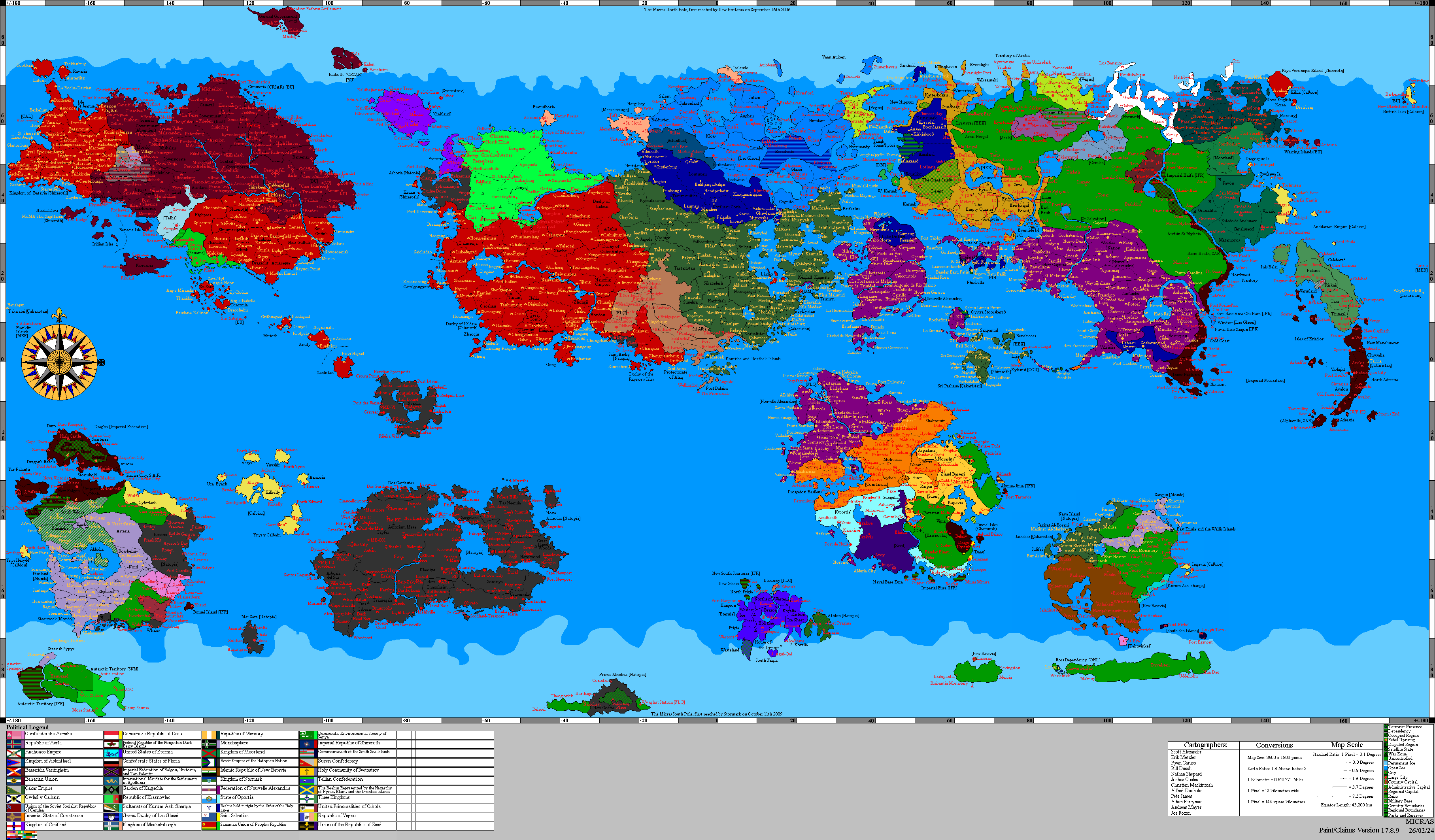
| Passas | |||
| |||
| Motto: Del hed Sanáos aji Ämóntáinos (Of the Seas and Mountains) | |||

| |||
| Map versions | 9.4a-Present | ||
| Capital | Northman | ||
| Largest city | Zidado West
| ||
| Official language(s) | English, Pallisican, Hammish | ||
| Demonym | Pallisican, Passian | ||
| - Adjective | Passian | ||
| Government | Theocratic Monarchy | ||
| - Queen Esper I | Crown of Passio-Corum | ||
| - Pallisico Sitre | Duke of Northman | ||
| - Legislature | Houses of Corum | ||
| Establishment | Simia 29, 364 WG (7/29/06) | ||
| Area | N/A | ||
| Population | 4,781,142 (893 WG) | ||
| Active population | N/A | ||
| Currency | Poli (P)
| ||
| National website | Pallisican Website | ||
| National forum | Pallisican Forum | ||
| National animal | White-Faced Ferret
| ||
| Abbreviation | PAS | ||


History
Government
Geography
Zibertian Societies
| Zibertian Societies - | |||
| |||

| |||
| Capital | Zidü Wéazde | ||
| Major cities | Zidü Wéazde, Zibigt | ||
| Demonym | Zibertian | ||
| - Adjective | Zibertian | ||
| Area | 246,384 km² | ||
| - Ranked | |||
| Population | 2,511,023 (37.20 PSSC) | ||
| - Ranked | |||
| Density | 10.19/km² | ||
| Abbreviation | ZI | ||
History
Established in 15.42 PSSC, the communities which constitute the Zibertian Societies are collectively regarded as the birthplace of the Pallisican nation, which in Era 16 toppled the burgeoning Republic of Passas in the conflict known as the Passasian Civil War. It is furthermore the birthplace of the Pallisican Religion, which - since as early as the 22nd Era - has defined the cultural world-view of the people of Passas. Formally annexed by Passio-Corum in [36.59 PSSC] following a prolonged period of foreign rule, the Zibertian Societies are today the home of the Passasian capital, Zidado West, and of the West Keltian Trade Association, which represents Passas and its neighbors on the Port of Vines.
Geography
Climate and Topography
| Climate V|Topography > | |||||
|---|---|---|---|---|---|
| Sea Level | Coastal Plains | High Plains | Highlands | Mountains | |
| Cwa | X | X | |||
| Cwb | X | X | |||
| Cwc | X | ||||
| Cfa | X | X | X | ||
| Cfc | X |
Demographics
Region Statistics
| Year | Population | Growth (Growth %) | Food Imports (/Person) | Fuel Imports (/Person) | Other Imports (/Person) | Immigration Modifier (%) | Seats in Regional Government | Seats in Houses of Corum
|
|---|---|---|---|---|---|---|---|---|
| 37.80 PSSC | 2,494,763 | -16,111 (-.65%) | 1,254,702 (.5) | 13,960,571 (5.59) | 1,416,483 (.567) | .15 | 25 | 100 |
| 37.60 PSSC | 2,510,875 | 42,169 (1.68%) | 1,264,572 (.5) | 13,958,900 (5.55) | 1,515,698 (.6) | .15 | 25 | 100 |
| 37.40 PSSC | 2,468,706 | -42,328 (-1.71%) | 1,203,090 (.487) | 13,844,746 (5.6) | 1,336,945 (.54) | .15 | 25 | 99 |
| 37.20 PSSC | 2,511,035 | -51,261 (-2.04%) | 1,083,000 (.431) | 12,350,362 (4.91) | 1,272,097 (.5) | .17 | 25 | 100 |
| 37.00 PSSC | 2,562,297 | 34,672 (1.35%) | 1,199,720 (.468) | 13,869,390 (5.41) | 873,119 (.34) | .16 | 26 | 102 |
| 36.80 PSSC | 2,527,625 | 20,189 (.8%) | 1,150,835 (.455) | 13,668,175 (5.4) | 905,300 (.358) | .16 | 25 | 101 |
| 36.60 PSSC | 2,507,436 | 72,181 (2.88%) | 1,184,115 (.472) | 13,728,142 (5.47) | 590,427 (.235) | .16 | 25 | 100 |
| 36.40 PSSC | 2,435,255 | -21,921 (-.9%) | 1,265,658 (.519) | 185,812 (.07) | 157,198 (.064) | .14 | 24 | 97 |
| 36.20 PSSC | 2,457,177 | 47,584 (1.94%) | 1,986,954 (.8) | 291,900 (.11) | 231,719 (.09) | .09 | 25 | 98 |
| 36.00 PSSC | 2,409,593 | 75,043 (3.11%) | 1,118,164 (.46) | 161,150 (.06) | 159,199 (.06) | .46 | 24 | 96 |
| 35.80 PSSC | 2,334,550 | 26,090 (1.12%) | 2,144,948 (.91) | 306,950 (.13) | 246,215 (.1) | .46 | 23 | 93 |
| 35.60 PSSC | 2,309,460 | 6,008 (.26%) | 1,440,112 (.62) | 205,987 (.08) | 176,537 (.07) | .66 | 23 | 92 |
| 35.42 PSSC | 2,303,452 | 76,664 (3.33%) | 1,641,871 (.71) | 232,337 (.1) | 214,343 (.09) | .6 | 23 | 92 |
Transportation
The primary mode of transportation in the Zibertian Societies is rail. Railways in the region are maintained by the West-Trinity Keltian Railway Corporation. Other modes of transportation include air travel and sail. Settlements located in the region are interconnected by a highly developed system of roadways.
Military Installations
While there are no major military installations located in the Zibertian Societies, the region is defended by the New Zimian War League, as well as by local authorities]].
Protected Areas
Protected areas in the Zibertian Societies include the Zidado Societies, and the Zibertian Society for which the region at large is named.
| |||||||||||

Zimian Societies
| Zimian Societies - | |||
| |||

| |||
| Capital | Zíamaía | ||
| Major cities | Zíamaía, Nuncréazde | ||
| Demonym | Zimian | ||
| - Adjective | Zimian | ||
| Area | 222,048 km² | ||
| - Ranked | |||
| Population | 2,019,400 (37.20 PSSC) | ||
| - Ranked | |||
| Density | 9.09/km² | ||
| Abbreviation | ZM | ||
The Zimian Societies serve as the administrative headquarters of Southern Passas.
The Regional Investor of the Zimian Societies represents the cities of Nuncrest and Zimia.
History
Geography
Climate and Topography
| Climate V|Topography > | |||||
|---|---|---|---|---|---|
| Sea Level | Coastal Plains | High Plains | Highlands | Mountains | |
| BWk | X | X | X | ||
| Csb | X | X | |||
| Cwa | X | X | |||
| Cwb | X | X | |||
| Cfa | X | X |
Demographics
Region Statistics
| Year | Population | Growth (Growth %) | Food Imports (/Person) | Fuel Imports (/Person) | Other Imports (/Person) | Immigration Modifier (%) | Seats in Regional Government | Seats in Houses of Corum
|
|---|---|---|---|---|---|---|---|---|
| 37.80 PSSC | 1,943,985 | -24,863 (-1.28%) | 795,562 (.4) | 8,577,045 (4.41) | 1,427,310 (.73) | .18 | 19 | 78 |
| 37.60 PSSC | 1,968,849 | -43,124 (-2.19%) | 804,302 (.4) | 804,332 (4.35) | 1,559,197 (.79) | .18 | 20 | 79 |
| 37.40 PSSC | 2,011,974 | -7,425 (-.37%) | 763,302 (.37) | 8,633,743 (3.75) | 1,237,337 (.61) | .19 | 20 | 80 |
| 37.20 PSSC | 2,019,400 | -18,739 (-.93%) | 699,353 (.34) | 7,585,244 (3.75) | 1,291,861 (.63) | .21 | 20 | 81 |
| 37.00 PSSC | 2,038,140 | 2,185 (.11%) | 762,222 (.373) | 8,534,936 (4.187) | 838,972 (.411) | .2 | 20 | 82 |
| 36.80 PSSC | 2,035,955 | 10,139 (.5%) | 109,267 (.348) | 8,544,108 (4.19) | 388,034 (.19) | .21 | 20 | 81 |
| 36.60 PSSC | 2,025,816 | 25,813 (1.27%) | 733,342 (.361) | 8,575,028 (4.23) | 360,311 (.177) | .19 | 20 | 81 |
| 36.40 PSSC | 2,000,003 | 6,272 (.31%) | 769,712 (.384) | 113,542 (.056) | 81,120 (.040) | .19 | 20 | 80 |
| 36.20 PSSC | 1,983,731 | -12,487 (-.63%) | 1,208,605 (.6) | 178,365 (.08) | 126,824 (.06) | .12 | 20 | 79 |
| 36.00 PSSC | 1,996,219 | 43,953 (2.20%) | 679,239 (.34) | 98540 (.04) | 82,977 (.04) | .66 | 20 | 80 |
| 35.80 PSSC | 1,952,266 | -4,436 (-.23%) | 1,304,986 (.66) | 187,550 (.09) | 135,594 (.06) | .66 | 20 | 78 |
| 35.60 PSSC | 1,956,703 | 14,327 (.73%) | 873,657 (.44) | 125,262 (.06) | 92,926 (.04) | 1 | 20 | 78 |
| 35.42 PSSC | 1,942,376 | 46,857 (2.4%) | 1,000,739 (.51) | 142,037 (.07) | 116,875 (.06) | .87 | 19 | 78 |
Transportation
Military Installations
Protected Areas
| |||||||||||
Passasian Societies
| Passasian Societies - | |||
| |||

| |||
| Capital | Northamäl | ||
| Major cities | Northman, Koneslaji | ||
| Demonym | Passasian | ||
| - Adjective | Passasian | ||
| Area | 237,168 km² | ||
| - Ranked | |||
| Population | 1,222,571 (37.20 PSSC) | ||
| - Ranked | |||
| Density | 5.15/km² | ||
| Abbreviation | PS | ||
The Passasian Societies serve as the administrative headquarters of Eastern Passas.
The Regional Investor of the Passasian Societies represents the cities of Northman and Kingsland.
History
Geography
Climate and Topography
| Climate V|Topography > | |||||
|---|---|---|---|---|---|
| Sea Level | Coastal Plains | High Plains | Highlands | Mountains | |
| Cfa | X | X | |||
| Cfb | X | X | |||
| Cfc | X | X |
Demographics
Region Statistics
| Year | Population | Growth (Growth %) | Food Imports (/Person) | Fuel Imports (/Person) | Other Imports (/Person) | Immigration Modifier (%) | Seats in Regional Government | Seats in Houses of Corum
|
|---|---|---|---|---|---|---|---|---|
| 37.80 PSSC | 1,159,832 | -17,204 (-1.48%) | 547,937 (.472) | 5,631,325 (4.85) | 1,069,688 (.92) | .16 | 12 | 46 |
| 37.60 PSSC | 1,177,037 | -20,860 (-1.77%) | 556,714 (.472) | 5,629,714 (4.78) | 1,170,294 (.994) | .17 | 12 | 47 |
| 37.40 PSSC | 1,197,898 | -24,672 (-2.06%) | 520,732 (.43) | 5,526,141 (4.61) | 967,228 (.8) | .17 | 12 | 48 |
| 37.20 PSSC | 1,222,571 | 28,819 (2.36%) | 477,417 (.39) | 4,981,270 (4.074) | 946,376 (.774) | .19 | 12 | 49 |
| 37.00 PSSC | 1,193,752 | 24,844 (2.08%) | 523,267 (.438) | 5,565,994 (4.662) | 51,0823 (.42) | .18 | 12 | 48 |
| 36.80 PSSC | 1,168,908 | 30,981 (2.65%) | 484,568 (.414) | 5,260,835 (4.5) | 716,664 (.61) | .18 | 12 | 47 |
| 36.60 PSSC | 1,137,927 | 400 (.04%) | 477,642 (.419) | 5,278,609 (4.638) | 258,126 (.226) | .16 | 11 | 46 |
| 36.40 PSSC | 1,137,527 | 25,335 (2.23%) | 513,003 (.45) | 73,860 (.064) | 95,395 (.083) | .16 | 11 | 46 |
| 36.20 PSSC | 1,112,192 | -16,754 -1.51%) | 804,414 (.73) | 115,721 (.1) | 126,916 (.11) | .1 | 11 | 44 |
| 36.00 PSSC | 1,128,947 | 85 (.01%) | 465,080 (.41) | 64,427 (.05) | 101,563 (.08) | .18 | 11 | 45 |
| 35.80 PSSC | 1,128,862 | -2,167 (-.19%) | 865,799 (.76) | 121,600 (.1) | 131,975 (.11) | .48 | 11 | 45 |
| 35.60 PSSC | 1,131,030 | 2,910 (.26%) | 588,021 (.51) | 81,306 (.07) | 103,863 (.09) | .65 | 11 | 45 |
| 35.42 PSSC | 1,128,120 | 42,686 (3.78%) | 671,039 (.59) | 92,637 (.08) | 124,557 (.11) | .64 | 11 | 45 |
Transportation
Military Installations
Protected Areas
| |||||||||||
Carol Stream Societies
| Carol Stream Societies - | |||
| |||

| |||
| Capital | Cäol Stranama | ||
| Major cities | Cäol Stranama | ||
| Demonym | Carolinian | ||
| - Adjective | Carolinian | ||
| Area | 251,568 km² | ||
| - Ranked | |||
| Population | 4,555,478 (37.20 PSSC) | ||
| - Ranked | |||
| Density | 18.18/km² | ||
| Abbreviation | CS | ||
TBA
History
Geography
Climate and Topography
| Climate V|Topography > | |||||
|---|---|---|---|---|---|
| Sea Level | Coastal Plains | High Plains | Highlands | Mountains | |
| Csb | X | X | |||
| Cwb | X | X | X | ||
| Cfa | X | X | |||
| Cfb | X | X | |||
| Cfc | X | X | |||
| Dsb | X | X |
Demographics
Region Statistics
Note: The Carol Stream Societies are represented on the Port of Vines by the Regional Investor of Passas.
| Year | Population | Growth (Growth %) | Food Imports (/Person) | Fuel Imports (/Person) | Other Imports (/Person) | Immigration Modifier (%) | Seats in Regional Government | Seats in Houses of Corum
|
|---|---|---|---|---|---|---|---|---|
| 37.80 PSSC | 4,854,377 | -55,655 (-1.15%) | 1,259,714 (.259) | 9,621,121 (1.98) | 1,902,842 (.391) | N/A | N/A | N/A |
| 37.60 PSSC | 4,910,033 | 47,158 (.96%) | 1,338,655 (.272) | 8,270,631 (1.684) | 2,081,269 (.423) | N/A | N/A | N/A |
| 37.40 PSSC | 4,862,875 | 307,397 (6.32%) | 1,284,107 (.26) | 4,506,891 (.92) | 1,540,611 (.31) | N/A | N/A | N/A |
| 37.20 PSSC | 4,555,478 | TBA (TBA%) | 1,236,844 (.27) | 3,989,745 (.87) | 1,688,272 (.37) | N/A | N/A | N/A |
Transportation
Military Installations
Protected Areas
| |||||||||||
Bel-Air Societies
| Bel-Air Societies - | |||
| |||

| |||
| Capital | Bel Air | ||
| Major cities | Bel Air | ||
| Demonym | Bellisician | ||
| - Adjective | Bellisician | ||
| Area | 246,240km² | ||
| - Ranked | |||
| Population | 5,857,044 (37.20 PSSC) | ||
| - Ranked | |||
| Density | 23.78/km² | ||
| Abbreviation | BA | ||
TBA
History
Geography
Climate and Topography
| Climate V|Topography > | |||||
|---|---|---|---|---|---|
| Sea Level | Coastal Plains | High Plains | Highlands | Mountains | |
| Cwa | X | ||||
| Cwb | X | ||||
| Cwc | X | ||||
| Cfa | X | X | |||
| Cfc | X | X | X | X | |
| Dsb | X | X |
Demographics
Region Statistics
Note: The Bel-Air Societies are represented on the Port of Vines by the Regional Investor of Passas.
| Year | Population | Growth (Growth %) | Food Imports (/Person) | Fuel Imports (/Person) | Other Imports (/Person) | Immigration Modifier (%) | Seats in Regional Government | Seats in Houses of Corum
|
|---|---|---|---|---|---|---|---|---|
| 37.80 PSSC | 6,241,343 | -71,556 (-1.15%) | 1,619,633 (.259) | 12,358,441 (1.98) | 2,446,511 (.391) | N/A | TBA | TBA |
| 37.60 PSSC | 6,312,900 | 60,632 (.96%) | 1,721,128 (.272) | 10,633,669 (1.68) | 2,675,917 (.423) | N/A | TBA | TBA |
| 37.40 PSSC | 6,252,268 | 395,224 (6.32%) | 1,650,995 (.26) | 5,794,574 (.92) | 1,980,786 (.31) | N/A | TBA | TBA |
| 37.20 PSSC | 5,857,044 | TBA (TBA%) | 1,590,228 (.27) | 5,129,672 (.87) | 2,170,636 (.37) | N/A | TBA | TBA |
Transportation
Military Installations
Protected Areas
| |||||||||||
Springville Societies
| Springville Societies - | |||
| |||

| |||
| Capital | Spronevandíe | ||
| Major cities | Spronevandíe | ||
| Demonym | Springolian | ||
| - Adjective | Springolian | ||
| Area | 121,968 km² | ||
| - Ranked | |||
| Population | 2,603,130 | ||
| - Ranked | |||
| Density | 21.34/km² | ||
| Abbreviation | SV | ||
TBA
History
Geography
Climate and Topography
| Climate V|Topography > | |||||
|---|---|---|---|---|---|
| Sea Level | Coastal Plains | High Plains | Highlands | Mountains | |
| Cfa | X | X | |||
| Cfc | X | X | X | ||
| Dsb | X | X |
Demographics
Region Statistics
Note: The Springville Societies are represented on the Port of Vines by the Regional Investor of Passas.
| Year | Population | Growth (Growth %) | Food Imports (/Person) | Fuel Imports (/Person) | Other Imports (/Person) | Immigration Modifier (%) | Seats in Regional Government | Seats in Houses of Corum
|
|---|---|---|---|---|---|---|---|---|
| 37.80 PSSC | 2,773,930 | -31,802 (-1.15%) | 719,837 (.259) | 5,492,640 (1.98) | 1,087,338 (.391) | N/A | TBA | TBA |
| 37.60 PSSC | 2,805,733 | 26,948 (.96%) | 764,946 (.272) | 4,726,075 (1.684) | 1,189,296 (.423) | N/A | TBA | TBA |
| 37.40 PSSC | 2,778,785 | 175,655 (6.32%) | 733,775 (.26) | 2,575,366 (.92) | 880,349 (.31) | N/A | TBA | TBA |
| 37.20 PSSC | 2,603,130 | TBA (TBA%) | 706,768 (.27) | 2,279,854 (.87) | 964,727 (37) | N/A | TBA | TBA |
Transportation
Military Installations
Protected Areas
| |||||||||||