Maps of Whales: Difference between revisions
From MicrasWiki
Jump to navigationJump to search
No edit summary |
No edit summary |
||
| (13 intermediate revisions by one other user not shown) | |||
| Line 1: | Line 1: | ||
This article collects maps of [[Whales]]. | This article collects '''maps of [[Whales]]'''. | ||
[[Category:Whales]] | [[Category:Whales]] | ||
| Line 5: | Line 5: | ||
[[File:Whales map.png|thumb|left|Note distortion in the left marginal]] | [[File:Whales map.png|thumb|left|Note distortion in the left marginal]] | ||
[[File:Whales map blank.png|thumb|left|Blank version of above, i.e. no labels of placenames. Note distortion in the left marginal]] | [[File:Whales map blank.png|thumb|left|Blank version of above, i.e. no labels of placenames. Note distortion in the left marginal]] | ||
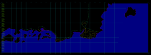
[[File:Shintakushima and Light.png|thumb|left|[[Shintakushima]] and the [[Islands of Light]]. Adjusted for distortion, 1 pixel = 45 x 45 metres]] | [[File:Shintakushima and Light.png|thumb|left|100px|[[Shintakushima]] and the [[Islands of Light]]. Adjusted for distortion, 1 pixel = 45 x 45 metres]] | ||
[[File:Gallen and Chur.png|thumb|left|100px|[[Chur]] and [[Gallen]]. Adjusted for distortion, 1 pixel = 46 x 46 metres]] | |||
[[File:Berne and Köniz.png|thumb|left|100px|[[Berne]] and [[Köniz]]. Adjusted for distortion, 1 pixel = 46 x 46 metres]] | |||
[[File:Genf, Freiburg und Luzern.png|thumb|left|100px|[[Genf]], [[Freiburg]] and [[Luzern]]. Adjusted for distortion, 1 pixel = 46 x 46 metres]] | |||
[[File:Cape Monovia (South).png|thumb|left|100px|Cape Monovia (except for the far north-west). Adjusted for distortion, 1 pixel = 42 x 42 metres]] | |||
[[File:Sitten and Uster.png|thumb|left|100px|Northern part of Cape Monovia ([[Sitten]] and [[Uster]]). Adjusted for distortion, 1 pixel = 44 x 44 metres]] | |||
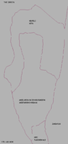
[[File:Northern Bulb.png|thumb|left|100px|Northern Bulb ([[Andelarion an den Neurändern]] and [[Airo]]. Adjusted for distortion, 1 pixel = 48 x 48 metres]] | |||
[[File:Asara Eliana and Volksburg BLANK.png|thumb|left|300px|. Asara Eliana and Volksburg. Blank unlabelled map. Adjusted for distortion, 1 pixel = 43 x 43 metres]] | |||
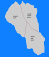
[[File:Asara Eliana and Volksburg lordships labelled.png|thumb|left|300px|. Asara Eliana and Volksburg. Lordships are labelled. Adjusted for distortion, 1 pixel = 43 x 43 metres]] | |||
[[Category:Maps]] | |||
Latest revision as of 17:52, 13 September 2020
This article collects maps of Whales.

Northern Bulb (Andelarion an den Neurändern and Airo. Adjusted for distortion, 1 pixel = 48 x 48 metres


