Category:Maps
From MicrasWiki
Jump to navigationJump to search
Subcategories
This category has the following 8 subcategories, out of 8 total.
Pages in category "Maps"
The following 5 pages are in this category, out of 5 total.
Media in category "Maps"
The following 124 files are in this category, out of 124 total.
-
 1660.II.17-Grunwald-Ulrich.png 1,491 × 1,268; 2.9 MB
-
 Agra detailedmap.png 161 × 189; 8 KB
-
 AlKhadra map.png 405 × 530; 26 KB
-
 Amity political.png 598 × 450; 35 KB
-
 Banhnam.png 217 × 200; 9 KB
-
 BAT-BU-CKR-FRC-GAS.png 10,675 × 6,920; 1.87 MB
-
 BAT-detailed map.png 3,107 × 2,980; 644 KB
-
 Bat8.png 5,912 × 5,903; 1.82 MB
-
 Benacia Terrain & Transport Map.png 4,413 × 3,510; 3.23 MB
-
 Benacian Reconquest.png 960 × 956; 117 KB
-
 BrookshireCircles.png 200 × 150; 7 KB
-
 BU detailed map.png 8,500 × 5,328; 1.92 MB
-
 BU Normark .png 1,278 × 715; 54 KB
-
 Cakari Azure Sea.png 902 × 894; 83 KB
-
 Cakari Dyre Islands.png 1,741 × 1,769; 278 KB
-
 Calbion map.png 1,478 × 1,364; 111 KB
-
 Calbion World Map.png 1,930 × 1,590; 35 KB
-
 Cerulea reps blank.png 964 × 752; 10 KB
-
 Cerulea reps labelled.png 964 × 752; 17 KB
-
 Claim 1707 Shiro-Kildare.png 1,080 × 754; 84 KB
-
 Claim5map.png 1,539 × 1,109; 36 KB
-
 CPoK Wards.png 840 × 720; 143 KB
-
 CrowsilverMap1.png 1,000 × 832; 334 KB
-
 CTP Map1.png 784 × 373; 31 KB
-
 Dawn Over Karamakhi.png 614 × 336; 132 KB
-
 DG 1687AN.png 300 × 235; 10 KB
-
 Dioceses of nidaros.png 1,553 × 1,059; 72 KB
-
 Duchy Guttuli 1688.png 1,000 × 801; 192 KB
-
 Duchy Guttuli Circles.png 1,000 × 801; 157 KB
-
 Elwcircles.png 1,417 × 1,363; 803 KB
-
 Elwynn bailiwicks.png 2,490 × 1,458; 209 KB
-
 FRC-detailed map.png 2,199 × 2,781; 388 KB
-
 GAS-detailed map.png 2,525 × 2,542; 356 KB
-
 GulfofStephanus.png 500 × 410; 22 KB
-
 Haritdesh detailed map.png 2,117 × 1,990; 384 KB
-
 Hurmu 1705.png 771 × 326; 23 KB
-
 Hurmu 1727 update.png 223 × 312; 7 KB
-
 Hurmu 1728 blue and gold 2.png 2,098 × 914; 274 KB
-
 Hurmu 20-3-1720.png 754 × 495; 23 KB
-
 Hurmu expo proposal 1704 1b.png 743 × 301; 39 KB
-
 IRS Puritania.png 140 × 108; 5 KB
-
 Islest.png 520 × 528; 12 KB
-
 Jaihabar 1719.png 300 × 210; 3 KB
-
 Jaihabar 1722.png 300 × 210; 5 KB
-
 Jaihabar 1725.png 300 × 210; 6 KB
-
 Jaihabar climate.png 300 × 210; 8 KB
-
 Jaihabar physical.png 300 × 210; 4 KB
-
 Kaartje.png 540 × 548; 22 KB
-
 Kantisha and Nortak Islands detailedmap.png 1,167 × 833; 72 KB
-
 Karnamark map.png 1,235 × 668; 48 KB
-
 Karnamarkamalandmod 2.png 267 × 435; 10 KB
-
 Kezan commands.png 800 × 640; 112 KB
-
 Khordad Floods map.png 2,117 × 1,990; 384 KB
-
 Korhalistan detailledmap.png 1,147 × 1,309; 149 KB
-
 Lake District constituencies.png 1,553 × 824; 113 KB
-
 LakeCherusken.png 252 × 176; 4 KB
-
 Leng detailed map.png 690 × 1,110; 23 KB
-
 Leyl Sadarya detailedmap.png 236 × 277; 7 KB
-
 Loc map ash.png 964 × 752; 10 KB
-
 Loc map Beregozeria.png 964 × 752; 10 KB
-
 Loc map caledonia.png 964 × 752; 11 KB
-
 Loc map cecna.png 964 × 752; 10 KB
-
 Loc map livland.png 964 × 752; 11 KB
-
 Loc map sec.png 964 × 752; 10 KB
-
 Loc map skjarskaja.png 964 × 752; 10 KB
-
 Loc map south cerulea.png 964 × 752; 10 KB
-
 Loc map Stol K .png 964 × 752; 10 KB
-
 Loc map wm.png 964 × 752; 10 KB
-
 Location of Yakka (Claim).png 225 × 130; 3 KB
-
 Map of the Dervenian Autonomous People's Republic.png 331 × 371; 152 KB
-
 Map of the People's Republic of Graecia (Micras Claims).png 258 × 157; 14 KB
-
 MapofCakariclimate.png 690 × 628; 60 KB
-
 MapofCakaridivisions.png 691 × 628; 54 KB
-
 MapofCakariEastSkerries.png 2,267 × 1,716; 130 KB
-
 MapofCakaristanEquatorPrimemeridian.png 752 × 563; 50 KB
-
 MapofCakaritimezones.png 690 × 627; 61 KB
-
 MapofÇakaristan.png 691 × 628; 52 KB
-
 Mirioth-political.png 597 × 449; 31 KB
-
 Modan update 1714.png 300 × 220; 34 KB
-
 Moorland changes.png 195 × 106; 2 KB
-
 Naudia'Diva detailed map.png 1,500 × 600; 11 KB
-
 New (Dis)Order.png 948 × 986; 62 KB
-
 NewMegaMap.png 4,414 × 3,929; 432 KB
-
 Nidaros 1736 election to conclave.png 1,062 × 1,059; 15 KB
-
 Nidaros map 1723.png 167 × 87; 1 KB
-
 Nidaros towns and roads.png 1,217 × 1,059; 70 KB
-
 Niijima division.png 1,065 × 735; 233 KB
-
 Normandie 1685.png 274 × 253; 4 KB
-
 Normandie Summer 1744 map.png 1,200 × 1,565; 98 KB
-
 Normark elections 1703.png 1,609 × 1,170; 41 KB
-
 Nuristan detailledmap.png 636 × 563; 22 KB
-
 Old amaland bailiwicks.png 1,032 × 976; 72 KB
-
 Oportia claimsmap.png 350 × 247; 36 KB
-
 Oportia road map 1716.png 1,539 × 1,109; 46 KB
-
 Oystra stoorskerid blank.png 679 × 770; 33 KB
-
 Oystra stoorskerid marked.png 679 × 770; 47 KB
-
 Physical Cakari region.png 691 × 628; 42 KB
-
 Polonias map.png 163 × 199; 5 KB
-
 Poorajangal detailedmap.png 1,393 × 1,245; 214 KB
-
 Provinces of Shireroth.png 2,994 × 1,700; 411 KB
-
 Purification of Normandie Gothic Line map.png 1,200 × 1,565; 103 KB
-
 Reucapitas.jpg 283 × 278; 64 KB
-
 Samhold and Karnamark map.jpeg 216 × 201; 31 KB
-
 Shimmygis.png 3,507 × 2,480; 505 KB
-
 Shirekeepmap.png 1,000 × 800; 56 KB
-
 Shireroth 1707AN.png 2,500 × 1,000; 99 KB
-
 Shireroth 1717AN.png 2,994 × 1,700; 435 KB
-
 Shireroth Current States 6337.png 3,616 × 1,816; 194 KB
-
 Shireroth test map.svg 2,994 × 1,700; 7.42 MB
-
 ShirerothExpansion 1699AN.png 622 × 710; 70 KB
-
 Skylaislands.png 1,024 × 1,012; 97 KB
-
 Subdivisions Elwynn2.png 3,949 × 2,166; 264 KB
-
 Suqutra detailedmap.png 1,175 × 694; 57 KB
-
 Svetostrov claim.png 144 × 133; 4 KB
-
 Svetostrov ohl.png 95 × 32; 327 bytes
-
 Svetostrov redimensioned (3).png 2,618 × 7,784; 592 KB
-
 Sylvania detailedmap.png 1,287 × 1,473; 229 KB
-
 Takaatui.png 1,100 × 960; 11 KB
-
 Topographborder1.png 803 × 407; 81 KB
-
 Transfer-BAT-CKR-IRS.png 3,600 × 990; 442 KB
-
 Update ohl 1750.png 510 × 1,178; 49 KB
-
 Valesia detailedmap.png 430 × 340; 17 KB
-
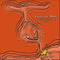 Valley of Mors.png 700 × 700; 267 KB
-
 What if Shireroth unites again.png 3,616 × 1,816; 234 KB


.png)

.png)


Order.png)


.png)