Category:Maps of Natopia
From MicrasWiki
Jump to navigationJump to search
Media in category "Maps of Natopia"
The following 33 files are in this category, out of 33 total.
-
 ARB map.png 622 × 293; 17 KB
-
 Asara Eliana and Volksburg BLANK.png 4,450 × 5,270; 543 KB
-
 Asara Eliana and Volksburg lordships labelled.png 4,450 × 5,270; 664 KB
-
 Baudrix1741.png 308 × 405; 19 KB
-
 Berne and Köniz.png 909 × 709; 27 KB
-
 Cape Monovia (South).png 1,257 × 1,040; 67 KB
-
 Cibola-Modification-1711.png 361 × 411; 11 KB
-
 Dos-Gardenias1741.png 386 × 167; 26 KB
-
 Eastern Natopia map.png 499 × 412; 23 KB
-
 Egale River.png 206 × 175; 7 KB
-
 Flaventia Map 2018.png 390 × 379; 21 KB
-
 Gallen and Chur.png 934 × 1,300; 42 KB
-
 Genf, Freiburg und Luzern.png 521 × 600; 21 KB
-
 Klaasiya map.png 172 × 243; 6 KB
-
 Mandatory Providence and new Transegale cities.png 318 × 350; 11 KB
-
 MSUMap6-16-192.png 503 × 512; 19 KB
-
 Natopia1500AN.png 551 × 466; 24 KB
-
 Neridia-Mod-1711.png 361 × 295; 3 KB
-
 New goetia map.png 405 × 134; 5 KB
-
 New Map 2017.png 873 × 722; 56 KB
-
 NewApollonianExpress1702.png 3,000 × 1,721; 1.69 MB
-
 Shintakushima and Light.png 730 × 1,400; 55 KB
-
 Sitten and Uster.png 468 × 1,080; 28 KB
-
 St lazaros.png 179 × 71; 2 KB
-
 Tapfer Geo New.png 718 × 534; 51 KB
-
 Tapfer-Modification-1711.png 546 × 592; 15 KB
-
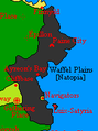 Waffel Plains.png 143 × 192; 4 KB
-
 West Tapfer map.png 190 × 198; 4 KB
-
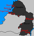
 Western Natopia.png 570 × 722; 40 KB
-
 Whales map blank.png 3,090 × 1,120; 169 KB
-
 Whales map.png 3,090 × 1,120; 211 KB
-
 WTF map 2020.png 246 × 202; 6 KB
-
 Ziegeland map.png 185 × 190; 5 KB


.png)


