Category:Maps of Shireroth
From MicrasWiki
Jump to navigationJump to search
Media in category "Maps of Shireroth"
The following 142 files are in this category, out of 142 total.
-
 1660.II.17-Grunwald-Ulrich.png 1,491 × 1,268; 2.9 MB
-
 1665p20.png 305 × 217; 9 KB
-
 1685-Western Benacian Revolutions.png 545 × 707; 84 KB
-
 1692.VI Elwynn.png 1,121 × 486; 40 KB
-
 Agnesian map.png 1,914 × 1,469; 323 KB
-
 Ai raikoth II.png 1,300 × 1,284; 1.6 MB
-
 Amity physical.png 598 × 413; 19 KB
-
 Amity political.png 598 × 450; 35 KB
-
 Amity- physcial- PNG.png 598 × 413; 19 KB
-
 Amok map.png 1,914 × 1,469; 327 KB
-
 Amokoliaairesea.png 431 × 318; 26 KB
-
 Amokoliansea.png 392 × 427; 20 KB
-
 An early Jasonian map of Amity.png 1,635 × 1,076; 339 KB
-
 Angularis bailiwicks.png 500 × 432; 13 KB
-
 Automatica map.png 1,914 × 1,469; 308 KB
-
 Autonomous rep map.png 1,953 × 1,575; 350 KB
-
 Babkhi map.png 1,914 × 1,469; 330 KB
-
 BAT-detailed map.png 3,107 × 2,980; 644 KB
-
 Bat8.png 5,912 × 5,903; 1.82 MB
-
 Batavclaim 2009.png 298 × 416; 17 KB
-
 Batavclaim.gif 269 × 254; 6 KB
-
 Batavia in new colors.png 739 × 443; 37 KB
-
 Batavian Blackrock.png 118 × 88; 2 KB
-
 Batavie departements.png 500 × 645; 127 KB
-
 Battle Batavia.png 2,300 × 2,342; 207 KB
-
 Battle of Sabatini.png 912 × 664; 53 KB
-
 Benacia Terrain & Transport Map.png 4,413 × 3,510; 3.23 MB
-
 Benacian Reconquest.png 960 × 956; 117 KB
-
 BrookshireCircles.png 200 × 150; 7 KB
-
 Cape farewell seas.png 363 × 278; 15 KB
-
 Cimmeria.png 1,280 × 672; 81 KB
-
 Cimmerian map.png 1,914 × 1,469; 322 KB
-
 Cimmerian sea.png 452 × 297; 29 KB
-
 Claim 1707 Shiro-Kildare.png 1,080 × 754; 84 KB
-
 Continental elwynn ar.png 2,346 × 2,043; 359 KB
-
 County of Z.png 763 × 569; 46 KB
-
 CPoK Wards.png 840 × 720; 143 KB
-
 CrowsilverMap1.png 1,000 × 832; 334 KB
-
 Dawn Over Karamakhi.png 614 × 336; 132 KB
-
 DG 1687AN.png 300 × 235; 10 KB
-
 Dravotihiker mcs update.png 217 × 145; 4 KB
-
 Duchy Guttuli 1688.png 1,000 × 801; 192 KB
-
 Duchy Guttuli Circles.png 1,000 × 801; 157 KB
-
 Elw map.png 1,914 × 1,469; 334 KB
-
 Elwcircles.png 1,417 × 1,363; 803 KB
-
 Elwynn amok.png 1,914 × 1,469; 222 KB
-
 Elwynn bailiwicks named.png 2,346 × 2,043; 555 KB
-
 Elwynn bailiwicks.png 2,490 × 1,458; 209 KB
-
 Elwynn benacia ar.png 2,346 × 2,043; 360 KB
-
 Elwynn map 1690.png 1,121 × 486; 88 KB
-
 Elwynn railway.png 1,624 × 1,363; 339 KB
-
 Elwynn update okt 31.png 654 × 491; 37 KB
-
 Elwynn1679.png 659 × 503; 63 KB
-
 Elwynn1682.png 811 × 503; 64 KB
-
 Elwynnsea.png 1,786 × 792; 194 KB
-
 Falwawoud1.png 889 × 903; 70 KB
-
 Franco-Batavian modification.png 502 × 378; 38 KB
-
 FRC-detailed map.png 2,199 × 2,781; 388 KB
-
 Free Elwynn Claimsmap.png 391 × 153; 5 KB
-
 GAS-detailed map.png 2,525 × 2,542; 356 KB
-
 Greater Elwynn Region.png 1,541 × 1,469; 314 KB
-
 Hell Map.png 4,413 × 3,510; 834 KB
-
 Highpass Map.png 1,507 × 1,113; 353 KB
-
 HP detail.png 2,362 × 2,362; 996 KB
-
 IRS Puritania.png 140 × 108; 5 KB
-
 Istvanistani map.png 1,914 × 1,469; 326 KB
-
 Kezan commands.png 800 × 640; 112 KB
-
 KingsriseMap.png 331 × 306; 39 KB
-
 Leng exp.png 51 × 37; 1 KB
-
 Leng settlements.png 162 × 515; 14 KB
-
 Majority language elwynn.png 1,914 × 1,469; 320 KB
-
 Map Batavia provinces.png 4,976 × 5,400; 571 KB
-
 Map Batavia wiki.png 399 × 536; 11 KB
-
 Map Brookshire.png 1,747 × 1,288; 279 KB
-
 Map Draconia.png 677 × 687; 27 KB
-
 Map Guttuli Protectorate.png 1,000 × 801; 205 KB
-
 Map Guttuli.png 1,613 × 1,336; 261 KB
-
 Map Imperial County.png 460 × 630; 56 KB
-
 Map Kildare Conglacio.png 1,222 × 833; 392 KB
-
 Map Modan.png 2,571 × 1,874; 326 KB
-
 Map Sathrati.png 3,655 × 2,640; 203 KB
-
 Map So-Sara.png 977 × 1,100; 63 KB
-
 MapofFrankfort.png 334 × 239; 12 KB
-
 MapofKoningenbaai.png 1,132 × 852; 86 KB
-
 MapofRavaria.png 701 × 669; 40 KB
-
 MapofVinandy.png 919 × 862; 67 KB
-
 Mirioth-physical-PNG.png 598 × 413; 22 KB
-
 Mishalanese map.png 1,914 × 1,469; 324 KB
-
 Modan update 1714.png 300 × 220; 34 KB
-
 New (Dis)Order.png 948 × 986; 62 KB
-
 Nice EAH.png 862 × 520; 37 KB
-
 Nieuwbatavie4.png 477 × 343; 27 KB
-
 Norse map.png 1,914 × 1,469; 326 KB
-
 Plurality language elwynn.png 1,914 × 1,469; 318 KB
-
 Population map elwynn.png 1,914 × 1,469; 327 KB
-
 Praeta map.png 1,914 × 1,469; 324 KB
-
 Provinces of Shireroth.png 2,994 × 1,700; 411 KB
-
 Raynor isles map.png 1,000 × 967; 43 KB
-
 RouteOrientExpress.png 920 × 785; 37 KB
-
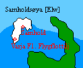 Samholdsøya map.png 134 × 111; 1 KB
-
 Shimmygis.png 3,507 × 2,480; 505 KB
-
 Shirekeep map 2.svg 9,173 × 7,680; 6.81 MB
-
 Shirekeepmap.png 1,000 × 800; 56 KB
-
 Shireroth 1707AN.png 2,500 × 1,000; 99 KB
-
 Shireroth 1717AN.png 2,994 × 1,700; 435 KB
-
 Shireroth Current States 6337.png 3,616 × 1,816; 194 KB
-
 Shireroth test map.svg 2,994 × 1,700; 7.42 MB
-
 ShirerothExpansion 1699AN.png 622 × 710; 70 KB
-
 SKoningenwaarde.png 430 × 444; 22 KB
-
 Skylaislands.png 1,024 × 1,012; 97 KB
-
 So Sara- physical- PNG.png 598 × 486; 21 KB
-
 Subdivisions Elwynn2.png 3,949 × 2,166; 264 KB
-
 Subdivisions of Cimmeria and Raikoth.png 1,864 × 796; 44 KB
-
 TLNgovs.png 2,480 × 3,507; 381 KB
-
 Transfer-BAT-CKR-IRS.png 3,600 × 990; 442 KB
-
 Waarderwoud3.png 326 × 198; 11 KB
-
 What if Shireroth unites again.png 3,616 × 1,816; 234 KB
-
 Wiki alalehzamin.png 2,994 × 1,700; 338 KB
-
 Wiki amokolia.png 2,994 × 1,700; 337 KB
-
 Wiki audentior.png 2,994 × 1,700; 338 KB
-
 Wiki batavia.png 2,994 × 1,700; 336 KB
-
 Wiki blackrock.png 2,994 × 1,700; 337 KB
-
 Wiki brookshire.png 2,994 × 1,700; 339 KB
-
 Wiki dalmacija.png 2,994 × 1,700; 338 KB
-
 Wiki francia.png 2,994 × 1,700; 338 KB
-
 Wiki gascony.png 2,994 × 1,700; 336 KB
-
 Wiki gong.png 2,994 × 1,700; 339 KB
-
 Wiki highpass.png 2,994 × 1,700; 339 KB
-
 Wiki imperial county.png 2,994 × 1,700; 339 KB
-
 Wiki jingdao.png 2,994 × 1,700; 339 KB
-
 Wiki jinkeai.png 2,994 × 1,700; 339 KB
-
 Wiki kezan.png 2,994 × 1,700; 339 KB
-
 Wiki khaz modan.png 2,994 × 1,700; 339 KB
-
 Wiki kildare.png 2,994 × 1,700; 337 KB
-
 Wiki outer antya.png 2,994 × 1,700; 339 KB
-
 Wiki periphery.png 2,994 × 1,700; 336 KB
-
 Wiki sathrati.png 2,994 × 1,700; 338 KB
-
 Wiki talenore.png 2,994 × 1,700; 338 KB
-
 Wiki upper elwynn.png 2,994 × 1,700; 337 KB
-
 Wiki xianbei.png 2,994 × 1,700; 338 KB
-
 Wiki yardistan.png 2,994 × 1,700; 339 KB
-
 Yardpolit.png 715 × 527; 52 KB


Order.png)


