Category:Hurmu maps
From MicrasWiki
Jump to navigationJump to search
For maps related to Hurmu
Pages in category "Hurmu maps"
The following 5 pages are in this category, out of 5 total.
Media in category "Hurmu maps"
The following 78 files are in this category, out of 78 total.
-
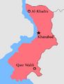 AlKhadra map.png 405 × 530; 26 KB
-
 Claimsmap Plazas de Irian.png 94 × 70; 2 KB
-
 Claimsmapforajasaki.png 209 × 88; 4 KB
-
 CTP Map1.png 784 × 373; 31 KB
-
 Cyberaya Special Self-Governing City in Phinbella.svg 439 × 198; 5.86 MB
-
 Dindings in Phinbella.svg 439 × 198; 5.86 MB
-
 Drusselstein in Phinbella.svg 439 × 198; 5.34 MB
-
 EastBarrowIsland map.png 312 × 320; 9 KB
-
 Forajasaki labeled map (10-2023).svg 185 × 83; 2.24 MB
-
 Halim in Phinbella.svg 439 × 198; 5.89 MB
-
 Holy Lakes blank.png 541 × 365; 2 KB
-
 Holy Lakes named.png 541 × 365; 7 KB
-
 Htt claim 1689.png 373 × 71; 6 KB
-
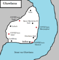
 Hurmu 1477.png 223 × 118; 5 KB
-
 Hurmu 1705.png 771 × 326; 23 KB
-
 Hurmu 1727 update.png 223 × 312; 7 KB
-
 Hurmu 1728 blue and gold 2.png 2,098 × 914; 274 KB
-
 Hurmu 20-3-1720.png 754 × 495; 23 KB
-
 Hurmu apollonia railway.png 601 × 257; 18 KB
-
 Hurmu expo proposal 1704 1b.png 743 × 301; 39 KB
-
 Hurmu2.png 656 × 439; 14 KB
-
 HurmuRepublik1476.png 582 × 527; 67 KB
-
 Islands of Dong Ping in Phinbella.svg 439 × 198; 5.94 MB
-
 Kaartje.png 540 × 548; 22 KB
-
 Karnamark map.png 1,235 × 668; 48 KB
-
 Kernevonia map.svg 863 × 739; 16 KB
-
 Khanabad mod.png 73 × 44; 660 bytes
-
 Lake District constituencies.png 1,553 × 824; 113 KB
-
 Lake district highways and railways.png 1,553 × 824; 166 KB
-
 Lake district municipal names.png 1,553 × 824; 137 KB
-
 Lake district rail.png 1,553 × 824; 94 KB
-
 Lontinien map.png 2,500 × 2,251; 299 KB
-
 LontinienRekozemjle.png 296 × 177; 9 KB
-
 Lyrica1706an-nax-hurmu.png 333 × 371; 10 KB
-
 Map of Sussax Island.png 756 × 600; 246 KB
-
 Maritime Kachi Kochi in Phinbella.svg 439 × 198; 5.86 MB
-
 Moorland changes.png 195 × 106; 2 KB
-
 Moorland.png 122 × 40; 3 KB
-
 New claim eura.png 197 × 105; 2 KB
-
 New claim eura2.png 197 × 105; 4 KB
-
 Niijima division.png 1,065 × 735; 233 KB
-
 Normandie 1685.png 274 × 253; 4 KB
-
 Normandie climate map.png 311 × 384; 9 KB
-
 Normandie ethnic map.png 608 × 600; 78 KB
-
 Normandie locator map (7).svg 1,260 × 1,670; 2.1 MB
-
 Normandie locator map.svg 1,236 × 1,656; 2 MB
-
 Normandie lordship names.png 1,175 × 1,178; 171 KB
-
 Normandie Summer 1744 map.png 1,200 × 1,565; 98 KB
-
 Normandiekarum terror.png 181 × 236; 3 KB
-
 OHL Lake district.png 1,608 × 1,124; 107 KB
-
 Old amaland bailiwicks.png 1,032 × 976; 72 KB
-
 Operation-Enduring-Alliance-1720.png.png 1,000 × 485; 256 KB
-
 Orange Free State in Phinbella.svg 439 × 198; 5.94 MB
-
 Oriental Hispanioéire Taemhwan in Phinbella.svg 439 × 247; 17 MB
-
 Oystra stoorskerid blank.png 679 × 770; 33 KB
-
 Oystra stoorskerid marked.png 679 × 770; 47 KB
-
 PFFE-NB.png 353 × 200; 5 KB
-
 Ph-NT.png 3,596 × 2,432; 548 KB
-
 Ph-PM.png 3,596 × 2,432; 515 KB
-
 Phinbella Map 202003.png 465 × 347; 23 KB
-
 PhysicalForajasaki.png 80 × 57; 939 bytes
-
 PortEsther.png 144 × 88; 2 KB
-
 Province Wellesley and Suyaj-Ardab in Phinbella.svg 439 × 198; 5.88 MB
-
 Purification of Normandie Gothic Line map.png 1,200 × 1,565; 103 KB
-
 Ross Dependency in Phinbella.svg 439 × 247; 17 MB
-
 Samhold and Karnamark map.jpeg 216 × 201; 31 KB
-
 Svetostrov claim.png 144 × 133; 4 KB
-
 Svetostrov ohl.png 95 × 32; 327 bytes
-
 Svetostrov redimensioned (3).png 2,618 × 7,784; 592 KB
-
 Tanah Baharu in Phinbella.svg 439 × 247; 17 MB
-
 Tanintʃhourim in Phinbella.svg 439 × 247; 17 MB
-
 Templearea zpsac0fedff.png 626 × 408; 80 KB
-

-
 Territory of Flower in Phinbella.svg 439 × 198; 5.86 MB
-
 Territory of Soccsksargen in Phinbella.svg 439 × 198; 5.87 MB
-
 Tri-State Area in Phinbella.svg 439 × 198; 5.94 MB
-
 Turku and Hōri in Phinbella.svg 439 × 247; 17.67 MB
-
 Update ohl 1750.png 510 × 1,178; 49 KB


.svg)


.svg)


.png)