Phinbellan Expressway System: Difference between revisions
| Line 63: | Line 63: | ||
The [[Bandar MEC-Tampines Broadcasting Highway]] is the first toll-free highway in the unincorporated territory, which was completed in {{RP year|2004}}, connecting [[Bandar MEC]], [[Hulu Teming]] town center (where the old [[Keopuchean Broadcasting System]] headquarters is located), [[Dimmsdale]] town and the city of [[Tampines]] along 28 kilometers. The [[Dimmsdale-Port Juoh Expressway]] is a tolled expressway connecting the town of Dimmsdale and the [[Port Juoh]] which is the main gateway to the [[Skypiea Islands]], and it was built as a two-lane highway. The [[Karnarartakert Niigatavas Bridge]] is the first bridge to be part of the Broadcasting Highway, is the first toll bridge, but two years after its opening, the toll on the bridge was abolished in {{RP year|2008}}. | The [[Bandar MEC-Tampines Broadcasting Highway]] is the first toll-free highway in the unincorporated territory, which was completed in {{RP year|2004}}, connecting [[Bandar MEC]], [[Hulu Teming]] town center (where the old [[Keopuchean Broadcasting System]] headquarters is located), [[Dimmsdale]] town and the city of [[Tampines]] along 28 kilometers. The [[Dimmsdale-Port Juoh Expressway]] is a tolled expressway connecting the town of Dimmsdale and the [[Port Juoh]] which is the main gateway to the [[Skypiea Islands]], and it was built as a two-lane highway. The [[Karnarartakert Niigatavas Bridge]] is the first bridge to be part of the Broadcasting Highway, is the first toll bridge, but two years after its opening, the toll on the bridge was abolished in {{RP year|2008}}. | ||
The [[Elphinstone Islands]], a remote archipelago in the Phinbellan Unincorporated Territory with a relatively dense area and large population density, has seven expressways connecting several settlements and towns on its main islands such as [[Padang Polo Exchange]], [[Telipod]], [[Pasio Hur, Elphinstone Islands|Pasio Hur]], [[Pertengahan Gong]] and [[Kamelia Hill]]. | |||
==Features== | ==Features== | ||
Revision as of 15:45, 27 July 2021

|
This article or section is a work in progress. The information below may be incomplete, outdated, or subject to change. |
| Phinbellan Expressway System Sistem Lebuh Raya Ekspres Phinbella 핀벨라 고속도로 체계 Phinbella Gosokdoro Chegye | |
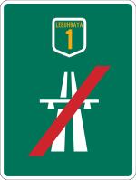
  Symbol and highway shield of the Phinbellan expressways | |
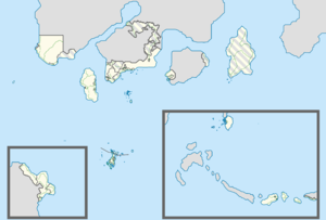
 Map of Phinbellan expressway network as of today. | |
| System information | |
|---|---|
| Maintained by respective concessionaire companies; numbers and routings assigned by Phinbella Expressway Authority (PHXA) | |
| Length | 1,799 km |
| Formed | -4BP |
| Highway names | |
| Expressways |
|
| System links | |
|
Expressways · Federal · SAT · Territory · Tourist | |
The Phinbellan Expressway System (Phineaner: Sistem Lebuh Raya Ekspres Phinbella; Taesongean: 핀벨라 고속도로 체계; RR: Phinbella Gosokdoro Chegye) or known as the Federal Expressway (Phineaner: Lebuh Raya Ekspres Persekutuan; Taesongean: 연방 고속도로; RR: Yeonbang Gosokdoro) is a network of controlled-access expressways in the Federal Republic of Phinbella. All expressways in Phinbella are dual carriageway with access to level isolation via a multi-storey intersection. Each highway in Phinbella has 6 lanes (3 for each direction of travel) but some also have 8 lanes to accommodate high traffic flow rates. The network began with the construction of the Pan Islands Expressway in -4BP which connects several urban and enclaved areas in the Maritime Kachi Kochi. All Phinbellan expressways are built by the Phinbellan Expressway Corporation and several other concessions are under the supervision of the Phinbellan Expressway Authority (PHXA or LLP). Phinbellan expressways have a length of 1,799 kilometers across Phinbella.
History
Interstate
Before the toll expressway was introduced in the early -2BPs, many Phinbellans traveled throughout the Phinbella area using existing roads.
Among the main reasons for building a new expressway in Phinbella are the increase in population in major cities and towns, land exploration, and the opening of new settlements, major ports and airports.
In -10BP, the Highway Planning Unit was established under the Public Works Authority.
On January 20, -4BP, the Pan Islands Expressway was built, this 69.1 kilometer expressway was built in two phases; the first phase is from Ume Momo to San Fransōkyō, while the second phase is across Territory of Halim area and the enclaved collectivities of the Maritime Kachi Kochi from San Fransōkyō to the city of Cyborges. This expressway was completed in RP 2603. The Pan Islands Expressway also built a third phase route connecting San Fransōkyō to Rintis Island, it was first built in RP 2605 and completed in RP 2609. It also facilitated travel from Ume Momo, Cyborges and San Fransōkyō to Rintis Island. This expressway is an interstate highway that connects the dependent territory area (Maritime Kachi Kochi) with a territory within the free area of the Federation (Territory of Halim).
The Trans-Southwest Coastal Expressway began construction in RP 2612, it started with the construction of the toll section of the Serambi–Jambil Expressway from Sungai Selamangan to the North Jambil toll plazas, and it was opened in early RP 2613. The project continued with the next section, where the stretch of Iñderaqonır–Telok Melangar, Kediros–Sungai Mitsubishi and Jambil–Nunukawan was opened in September RP 2613. Meanwhile, the stretch of Sungai Sibugak–Tenowar and Air Kumbahan–Lening was opened to traffic in December RP 2613. The stretch of Iñderaqonır–Tushkardan was opened in mid-RP 2614 to facilitate the journey back to the hometown during the Aidilfitri celebration. Meanwhile, the Dezek–Kijal stretch will open at the end of RP 2614. In early RP 2615, the closed toll system will take effect along the stretch of Telok Melangar–Air Kumbahan and Sungai Sibugak–Jambil.
Negara Awan and New Territories area
Since Negara Awan was rebuilt and abandoned areas upgraded, and made the new capital of Phinbella in RP 2616 replacing Bandar Baru Fatin, the Phinbellan government has planned to build a new airport and port nearby as the main gateway to the capital, as well as plan to connect the capital with the Rimba Raya and the rural areas of the New Territories. As a result, the federal government has planned to build a first expressway linking the new airport and the capital, and the project has started in early RP 2617. The expressway will pass through the residential areas of The Istana and the Hangang Strait.
At the same time, the federal government also plans to build an expressway to connect the Negara Awan, New Territories and the Orange Free State. Since Negara Awan has just been occupied, it is likely that there will be an increase in indigenous population in the New Territories and a lot of township construction plans around it, it would be reasonable to build new highways in this territory.
Plazas de Irian development area

Phinbellan Maritime Territories, Permata Mutiara and Ross Dependency
Phinbellan Unincorporated Territory
The history of the highway in Phinbellan Unincorporated Territory began in the RP 2600s (most likely it began in -4BP) when the government proposed to connect several settlements or towns in main remote archipelagos in the west and interior area in the eastern part of its territory.
The Bandar MEC-Tampines Broadcasting Highway is the first toll-free highway in the unincorporated territory, which was completed in RP 2600, connecting Bandar MEC, Hulu Teming town center (where the old Keopuchean Broadcasting System headquarters is located), Dimmsdale town and the city of Tampines along 28 kilometers. The Dimmsdale-Port Juoh Expressway is a tolled expressway connecting the town of Dimmsdale and the Port Juoh which is the main gateway to the Skypiea Islands, and it was built as a two-lane highway. The Karnarartakert Niigatavas Bridge is the first bridge to be part of the Broadcasting Highway, is the first toll bridge, but two years after its opening, the toll on the bridge was abolished in RP 2604.
The Elphinstone Islands, a remote archipelago in the Phinbellan Unincorporated Territory with a relatively dense area and large population density, has seven expressways connecting several settlements and towns on its main islands such as Padang Polo Exchange, Telipod, Pasio Hur, Pertengahan Gong and Kamelia Hill.
Features
Expressway standards
The construction, standardization, maintenance and use of expressways in Phinbella are subject to the Expressway Private Management Act 2615. Expressways in Phinbella have six lanes (three lanes each direction) and two lanes for motorcycles and bicycles. The expressway at Phinbella is very special as it can be traversed by all types of traditional vehicles, private vehicles (including motorcycles and bicycles) and other public vehicles such as buses and taxis.
Expressways are constructed as high-speed highways with LKRP LB6 highway standards, with almost all expressways having six lanes (three lanes each direction), and most having four lanes (two lanes each direction), and all expressways having full access control. It also has a separate grade intersection and a high speed limit design. All expressways are administered by the Phinbella Expressway Authority and several concession companies respectively under this board.
Phinbellan expressways set a maximum high speed limit of 110 kilometers per hour on almost all of them and a maximum of 80 to 90 kilometers per hour on urban expressways and highland expressways.
Route numbering
At the beginning of the construction of the first expressway, there was no expressway specific numbering system, but in RP 2610, as many expressways were built, the expressway numbering system was introduced and accepted on all expressways. The expressway has been labeled with the name "LEBUHRAYA" followed by the designated number as it appears on its highway shield or route marker, for example, the Pan-Islands Expressway connecting Ume Momo through the territory of Halim is designated as "LEBUHRAYA 1".
Auxiliary expressways such as spur, parallel and city ring expressways are allocated with main expressway routes with additional two-digit number suffixes. The first digit of the number suffix is allocated with the number “1” for spur highways, the number “2” for parallel highways and “0” for inner and outer loop or ring expressways, such as Tanjung Baruk-Bukit Melapoh Expressway which is part of the Trans-Southwest Coastal Expressway (E12), allocated under the name "Expressway 12-13" (E12-13), and another example, the Tampines Outer Ring Road Expressway is designated as the Expressway 48-02 (E48-02).
Exit numbering
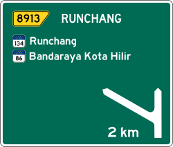
The expressway exit ramp numbering system is formatted xxnn, where "xx" is the expressway code number, and "nn" is the two -digit number assigned to each highway lane. For example, is the exit number 0348, where "03" is the expressway route number 3, and the other two digits "48" are the assigned exit number. Another example, exit number 3208, where number "32" is expressway route 32 and number "08" is the eighth exit. The expressway at Phinbella has distance markers in white with a green background, and is placed every 100 meters.
Pavements
Almost all expressways in Phinbella are paved with cold asphalt, and there are some expressways that are paved with tarmac (a mixture of tar and fine stone chip fragments). Where almost all road sections are paved with asphalt, some sections of the road are paved with tarmac. Meanwhile, highway routes at tunnels, intersections and toll plazas have been paved with concrete, or using bricks.


