Fatehpur Sikri (people's republic): Difference between revisions
From MicrasWiki
Jump to navigationJump to search
No edit summary |
No edit summary |
||
| Line 6: | Line 6: | ||
| largecity = [[Palë City]], [[Alto Siccre]], [[Menura]], [[Brackenridge]] | | largecity = [[Palë City]], [[Alto Siccre]], [[Menura]], [[Brackenridge]] | ||
| population = 14,263,673 (1714) | | population = 14,263,673 (1714) | ||
| density = | | density = 5,990 | ||
| rankpop = 2 | | rankpop = 2 | ||
| area = 2, | | area = 2,381 | ||
| rankarea = 15 | | rankarea = 15 | ||
| govex = [[Government of Fatehpur Sikri PR|Executive Council (15)]] | | govex = [[Government of Fatehpur Sikri PR|Executive Council (15)]] | ||
Revision as of 00:04, 19 February 2023
| Fatehpur Sikri | |
| Administrative divisions | |
| '
| |
|
| |
| Capital | Fatehpur Sikri |
| Largest cities | Palë City, Alto Siccre, Menura, Brackenridge |
|
| |
| Population | |
|
14,263,673 (1714) |
|
5,990 per km2 |
|
2 of 17 |
|
| |
| Area | |
|
2,381 km2 |
|
15 of 17 |
|
| |
| Government | |
|
Executive Council (15) |
|
Legislative Council (189) |
|
| |
| Official language(s) | Sanaman, Istvanistani, Babkhi, Cisamarrese |
| Other language(s) | Ashkenatzi, Praeta |
| Local religion | Somanes, Cedrism, Nazarenism |
| Subdivision code | FAS |
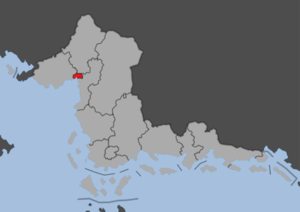
Fatehpur Sikri is a people's republic in western Sanama. The region has a population of 13.5 million people and an area of 2,012 km2, making it the second most populated and smallest people's republic. The republic was formed in 1702 and is coterminous with the former Fatehpur Sikri province. The republic is dominated by the Fatehpur Sikri metropolitan area, the second largest in Sanama after Niyi. It is bordered to the west by Panetira, to the north by Kortilhera, to the east by Indipendensa and to the south by Sikri Bay, a bay of the Cosimo Sea. The capital Fatehpur Sikri is located at the mouth of the Blackwater River.

