Template
:
PhinbellaMap
From MicrasWiki
Revision as of 14:26, 13 November 2021 by
Kemal HagemaruFRP
(
talk
|
contribs
)
(
diff
)
← Older revision
|
Latest revision
(
diff
) |
Newer revision →
(
diff
)
Jump to navigation
Jump to search
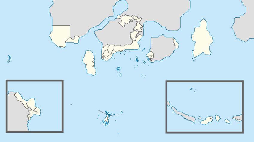
Map of the territories and entities of the Federal Republic of Phinbella
1.
Pinnacle Strip and SSS Islands
2.
Daman and Diu
3.
Territory of Kota Hilir
4.
Orange Free State
5.
Federal Special Capital Territory
6.
Tri-State Area
7.
Province Wellesley and Suyaj-Ardab
8.
Halim
9.
Territory of Extraterritorial Authority
of the Refugee Camp and Immigrant
Settlements Area
10.
Sixty-Four Villages Eastern Islands
Soccsksargen
(Mainland)
Oriental Taemhwan
Permata Mutiara
1
Territory of Flower
CNNPT
Unincorporated Territory
Starits
Settlements
Plazas de Irian
6
Islands of Dong Ping
Nabor Klafterschaft
7
5
Politama
Cyberaya
4
2
3
Soccsksargen
(Dunkinopol Island)
Libertador General
Bernard O'Higgins
Oriental Digital
Sebelah
Westorney
Kamoveropo
Maritime Kachi Kochi
8
9
Niuē i Taman Lawang
10
Western Nijima
Category
:
Image templates
Navigation menu
Page actions
Template
Discussion
Read
View source
History
Page actions
Template
Discussion
More
Tools
Personal tools
Log in
Search
Navigation
Main page
Recent changes
Random page
Help
resources
Forums
Current claimsmap
Claimsmap archive
Tools
What links here
Related changes
Special pages
Printable version
Permanent link
Page information