Cartography of Nouvelle Alexandrie: Difference between revisions
From MicrasWiki
Jump to navigationJump to search
| Line 27: | Line 27: | ||
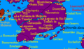
File:Santander1688AN.png|The Region of [[Santander]]. | File:Santander1688AN.png|The Region of [[Santander]]. | ||
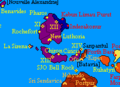
File:South Lyrica.png|The Region of [[South Lyrica]]. | File:South Lyrica.png|The Region of [[South Lyrica]]. | ||
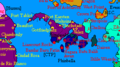
File: | File:NorthLyrica2.PNG|The Region of [[North Lyrica]]. | ||
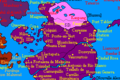
File:NewLuthoria1688AN.png|The Region of [[New Luthoria]]. | File:NewLuthoria1688AN.png|The Region of [[New Luthoria]]. | ||
File:IslesofCaputia1688AN.png|The Region of the [[Isles of Caputia]]. | File:IslesofCaputia1688AN.png|The Region of the [[Isles of Caputia]]. | ||
Revision as of 01:25, 15 October 2020

|
This article or section is a work in progress. The information below may be incomplete, outdated, or subject to change. |
The cartography of Alduria-Wechua is the history of geographical surveys and the creation of maps of the Federation of Alduria and the Wechua Nation.
History
Physical
Political
Bucolos & Fils, Cartographer
-
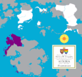 A map nothing the location of the Region of Alduria in the Federation.
 -
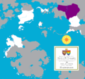 A map noting the location of the Region of the Wechua Nation in the Federation.
 -
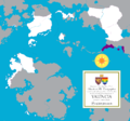 A map noting the location of the Region of Valencia in the Federation.
 -
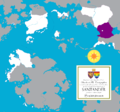
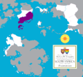 A map noting the location of the Region of South Lyrica in the Federation.
 -
 A map noting the location of the Region of Santander in the Federation.
 -
 A map noting the location of the unincorporated territories of Outremer.
 -
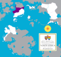 A map noting the location of the Region of North Lyrica in the Federation.
 -
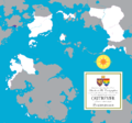
 A map noting the location of the Region of New Luthoria in the Federation.
 -
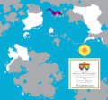 A map noting the location of the Region of Isles of Caputia in the Federation.
 -
 A map noting the location of the Federal Capital District in the Federation.


MCS World Map
-
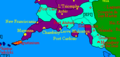
 The Region of Santander.
 -
 The Region of South Lyrica.
 -
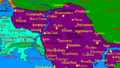
 The Region of North Lyrica.
 -
 The Region of New Luthoria.
 -
 The Region of the Isles of Caputia.
 -
 The Region of Valencia.
 -
 The Region of the Wechua Nation.
 -
-
 The Region of Alduria.
 -
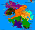
 The Federation of Alduria and the Wechua Nation in its entirety.


