Matbaa (city)
مܬܒܝܐ | |
| Nation: | The Zatriarchate of Matbaa |
| Population: | 825,000 |
| Predominant language: | English |
|
| |
| Main roads: | Ignatios Zakka Iwas Boulevard, 2nd of December Avenue |
| Major districts: | Wadi-el-Deir, Tsipori, Ahhadbarjapasha |
|
| |
| Current mayor: | unknown |

| |
| Map versions: | 8.0.1 - 11.6 |
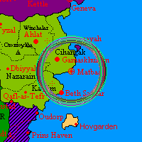
Matbaa was the Capital city of the Zatriarchate of Matbaa. It was located on the Eastern fringes of Cibola in Western Micras. Matbaa, the capital city of the Zatriarchate, was where the Zatriarchal See was located and was the initial centre of Matbaic Orthodoxy before it spread to form the micronation of Matbaa. As such, the city was a very important religious site as well as an economic and political hub.
Dominated by the vast Cathedral of St Tavalouris, the city was one of contrasts, including many different religions and cultures. One could find Copts, Armenians, Jews, Greeks, and Arabs living side by side with the majority Matbaic Assyrians. Other micronational nationalities such as Alexandrian, Monovian, and Stormarker also have their own communities within the city. Affectionately nicknamed by some as the "Constantinople of Micras", the city had a beautiful setting by the sea shore and spreads Northwards and Southwards along the coast, blocked from going inland by the Mountain range which spreads across much of Central Cibola. This makes the Old Town easily defendable, from the vantage point of the Matbaa Wardo (Matbaa Fortress) sitting atop a rocky outcrop above the old city. Effectively, Matbaa City is divided in two by the valley dividing Ahhadbarjapasha Quarter with the Old Town. The valley was dominated by the Patriarch Ignatios Zakka Iwas Highway, named after the current Syriac Orthodox patriarch macronationally. The valley also contains a number of interesting tombs, caves, as well as ruined mosques and churches which could be easily visited from the centre of the city.