Equator: Difference between revisions
From MicrasWiki
Jump to navigationJump to search
No edit summary |
|||
| Line 182: | Line 182: | ||
| [[File:Flanders flag.png|25px|border|Flanders]] Flanders | | [[File:Flanders flag.png|25px|border|Flanders]] Flanders | ||
| | | | ||
|- | |||
| style="background:#b0e0e6;" | 0°N 14.1°W | |||
| style="background:#b0e0e6;" | North Raynor Sea | |||
| style="background:#b0e0e6;" | | |||
|- | |||
| 0°N 13.4°W | |||
| [[File:Batavia flag.png|25px|border|Batavia]] ([[File:Flanders flag.png|25px|border|Flanders]] Flanders) | |||
| Passing north of St. Anne | |||
|- | |||
| style="background:#b0e0e6;" | 0°N 9.2°W | |||
| style="background:#b0e0e6;" | North Raynor Sea | |||
| style="background:#b0e0e6;" | | |||
|- | |||
| 0°N 5.7°W | |||
| [[File:Flanders flag.png|25px|border|Flanders]] Flanders | |||
| Passing south of Zeebruswerpen | |||
|- | |||
| style="background:#b0e0e6;" | 0°N 4.3°W | |||
| style="background:#b0e0e6;" | North Raynor Sea | |||
| style="background:#b0e0e6;" | | |||
|- | |||
| 0°N 1°W | |||
| [[File:Aryasht flag.png|25px|border|Aryasht]] Aryasht | |||
| | |||
|- | |||
| style="background:#b0e0e6;" | 0°N 0.3°W | |||
| style="background:#b0e0e6;" | North Raynor Sea | |||
| style="background:#b0e0e6;" | | |||
|} | |} | ||
Still under construction | Still under construction | ||
Revision as of 19:22, 20 May 2013
Equatorial countries and territories
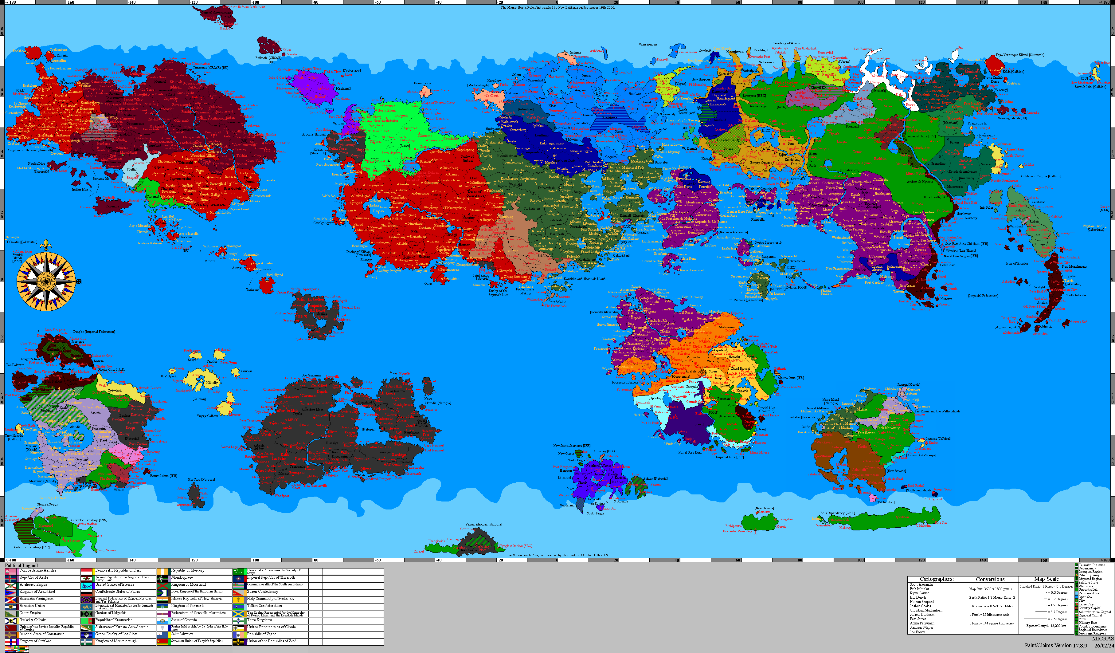
The Equator traverses the land and/or territorial waters of 14 countries. Starting at the Prime Meridian and heading eastwards, the Equator passes through:
| Co-ordinates | Country or sea | Notes |
|---|---|---|
| 0°N 0°E | North Raynor Sea | |
| 0°N 2.7°E |  Aryasht |
Passing just north of MoMA Stn. Chatham |
| 0°N 3°E | North Raynor Sea | |
| 0°N 13.6°E | Dyre Straits | |
| 0°N 32.9°E | Orange Sea | |
| 0°N 62°E |  Ashkenatza |
Jerba Island |
| 0°N 63.5°E | Orange Sea | |
| 0°N 64.2°E |  Mahoz HaSephardim ( Ashkenatza) |
Jerba Island |
| 0°N 69.1°E | Sea of Storms | |
| 0°N 76.2°E |  Dominion |
|
| 0°N 76.7°E | Sea of Storms | |
| 0°N 80.1°E |  Lostisland |
|
| 0°N 80.3°E | Captive Sea | |
| 0°N 91.9°E |  Incontinentia (  Craitland) |
|
| 0°N 92.5°E |  Valencia (  Alexandria) |
Passes south of the city of Mayenne |
| 0°N 93.8°E |  Interland |
Kupców |
| 0°N 94.3°E | Sea of Storms | Passes south of the island of Rybaków |
| 0°N 109.4°E | Interland
|
Passes through the city of Virtus |
| 0°N 119.9°E | Eastern Ocean | |
| 0°N 149.8°E |  Unclaimed Territory |
|
| 0°N 151.5°E | Eastern Ocean | |
| 0°N 152.2°E | Unclaimed Territory
|
|
| 0°N 153°E | Eastern Ocean | |
| 0°N 159.9°E | Unclaimed Territory
|
South Island |
| 0°N 164.9°E | Eastern Ocean | |
| 0°N 97°W |  Shireroth |
Passes through Yardistan City |
| 0°N 92.2°W | Central Sea | |
| 0°N 64.3°W | Gaeos Straight | |
| 0°N 40.4°W | Shireroth
|
Gong Li |
| 0°N 40.1°W | Gaeos Straight | |
| 0°N 39.5°W | Shireroth
|
Gong Li |
| 0°N 38.9°W | Gaeos Straight | |
| 0°N 36.4°W | Shireroth
|
Gong Li |
| 0°N 35.9°W | Gaeos Straight | |
| 0°N 35.4°W | Shireroth
|
Gong Li |
| 0°N 35.9°W | Camara Bay | |
| 0°N 21.9°W | Shireroth
|
|
| 0°N 20.9°W | Camara Bay | |
| 0°N 17.4°W | Shireroth
|
|
| 0°N 16.8°W | North Raynor Sea | |
| 0°N 16.7°W | Shireroth
|
|
| 0°N 16.4°W | North Raynor Sea | |
| 0°N 16.1°W | Shireroth
|
|
| 0°N 14.7°W |  Flanders |
|
| 0°N 14.1°W | North Raynor Sea | |
| 0°N 13.4°W |  ( Flanders) |
Passing north of St. Anne |
| 0°N 9.2°W | North Raynor Sea | |
| 0°N 5.7°W | Flanders
|
Passing south of Zeebruswerpen |
| 0°N 4.3°W | North Raynor Sea | |
| 0°N 1°W | Aryasht
|
|
| 0°N 0.3°W | North Raynor Sea |
Still under construction