Road network of Mercury: Difference between revisions
(Created page with 'The '''Mercury Road Network''' is the system of roads in Mercury and its dependencies. Its roads, as well as sometimes having colloquial names, are named using a system of le…') |
(→Orders) |
||
| (12 intermediate revisions by 3 users not shown) | |||
| Line 1: | Line 1: | ||
{{WIP}} | |||
The '''road network of Mercury''' is the system of roads in [[Mercury]] and its territories. Roads are classified according to capacity and purpose, and the rules governing each classification of road vary between types. Drivers of motor vehicles are required to gain a [[Mercurian driving test|driving licence]] in order to use the road network. | |||
== | ==Classification of roads== | ||
Mercury has five classifications of roads, each with differing rules governing their use. A network of "expressways" spans the nation as a whole, being connected to towns and cities via smaller "dual carriageways" and "carriageways". Within towns and cities, the main routes are classified as "byways" while other roads are deemed as "access roads". | |||
== | {| class="wikitable" style="text-align: center;" | ||
! Road type | |||
!width=350px| Description | |||
!width=100px| Example sign | |||
!width=100px| Speed limit in km/h<br>(maximum) | |||
!width=100px| Speed limit in km/h<br>(residential) | |||
! Number of lanes<br>(each direction) | |||
! Pedestrians/cycles allowed | |||
|- | |||
! Expressway | |||
| High speed, high capacity inter-state roads, primarily used to travel between major cities. | |||
| [[File:Mercury expressway sign.png|150px]]<br>''White text on a dark blue background with white border'' || {{Speed limit|130}} | |||
| {{Speed limit|85}} | |||
| 3 + ||{{Sports table red}}| No | |||
|- | |||
! Dual carriageways | |||
| High speed inter-city roads, used to travel between the expressway network and minor cities, or between two minor cities. | |||
| [[File:Mercury dual carriageway sign.png|150px]]<br>''White text on a dark red background with white border'' || {{Speed limit|115}} | |||
| {{Speed limit|70}} | |||
| 2 – 3 ||{{Sports table yellow}}| Only on pavement | |||
|- | |||
! Carriageways | |||
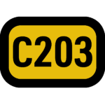
| Medium speed inter-town roads, joining dual carriageways or minor cities to smaller towns. | |||
| [[File:Mercury carriageway sign.png|150px]]<br>''Black text on a yellow background with black border'' || {{Speed limit|100}} | |||
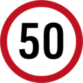
| {{Speed limit|50}} | |||
| 1 – 2 ||{{Sports table green}}| Yes | |||
|- | |||
! Byways | |||
| Low speed inner-city roads. | |||
| [[File:Mercury Road street sign.png|150px]]<br>''Black capitalised text indicating the street name on a white background with black border'' | |||
| {{Speed limit|50}}''Not signed'' | |||
| {{Speed limit|50}}''Not signed'' | |||
| 1 ||{{Sports table green}}| Yes | |||
|- | |||
! Access roads | |||
| Very low speed, low capacity inner-city roads. | |||
| [[File:Parliament Street sign.png|150px]]<br>''Black sentence case text indicating the street name on a white background with black border'' | |||
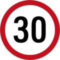
| {{Speed limit|30}} | |||
| {{Speed limit|30}} | |||
| 1 ||{{Sports table green}}| Yes | |||
|} | |||
== | ==Signage== | ||
===Orders=== | |||
Order signs give legally binding instructions to traffic. Failure to adhere to the instructions given is an offence. | |||
<gallery> | |||
Mercury Stop sign.png|Stop | |||
Mercury Give way sign.png|Give way | |||
Mercury No entry sign.png|No entry | |||
Mercury Merge in turn sign.png|Merge in turn | |||
Mercury One way sign.png|One way road ahead | |||
Mercury One way left sign.png|One way road to the left<br>(only at the end of a road) | |||
Mercury One way right sign.png|One way road to the right<br>(only at the end of a road) | |||
Mercury Turn left sign.png|Turn left | |||
Mercury Turn right sign.png|Turn right | |||
</gallery> | |||
== | ===Speed limits=== | ||
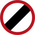
The | All speed limits in Mercury are given in kilometres per hour. The national speed limit is 130km/h. | ||
<gallery> | |||
Mercury 30 kph sign.png | |||
Mercury 50 kph sign.png | |||
Mercury 70 kph sign.png | |||
Mercury 85 kph sign.png | |||
Mercury 100 kph sign.png | |||
Mercury 115 kph sign.png | |||
Mercury NSL sign.png | |||
</gallery> | |||
===Give way advance warnings=== | |||
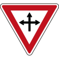
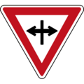
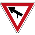
There are several signs that provide advance warning of an upcoming "Give Way" order. | |||
<gallery> | |||
Mercury Give way crossroads with no priority sign.png|Crossroads with no priority | |||
Mercury Give way crossroads against priority sign.png|Crossroads where the road crossing has priority | |||
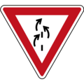
Mercury Give way merging sign.png|Merging onto new road ahead | |||
Mercury Give way roundabout sign.png|Roundabout | |||
Mercury Give way mini roundabout sign.png|Mini roundabout | |||
Mercury Give way T junction sign.png|T-junction | |||
</gallery> | |||
===Warnings=== | |||
Signs giving warnings are predominantly triangular in shape with a red border and black features. The two exceptions to this are the "Level Crossing" warning sign and the "Priority, Take Care" sign. The latter is used at junctions where vehicles are not instructed to give way to side roads, and advises drivers to be aware of other vehicles entering or crossing the road. | |||
<gallery> | |||
Mercury level crossing sign.png|Level crossing | |||
Mercury level crossing without barriers sign.png|Level crossing without barriers | |||
Mercury Priority take care sign.png|Priority, take care | |||
Mercury Turns in road sign.png|Turns in road ahead | |||
Mercury Left hand bend sign.png|Left-hand bend ahead | |||
Mercury Right hand bend sign.png|Right-hand bend ahead | |||
Mercury Crossroads with priority sign.png|Crossroads with priority | |||
Mercury Entrance to left sign.png|Junction with entrance to the left | |||
Mercury Entrance to right sign.png|Junction with entrance to the right | |||
Mercury Road merging from left sign.png|Road merging from left | |||
Mercury Traffic lights sign.png|Traffic lights | |||
</gallery> | |||
==Road markings== | |||
==Regulations governing use== | |||
[[Category:Roads]] | |||
[[Category:Mercury]] | [[Category:Mercury]] | ||
Latest revision as of 10:34, 14 March 2024

|
This article or section is a work in progress. The information below may be incomplete, outdated, or subject to change. |
The road network of Mercury is the system of roads in Mercury and its territories. Roads are classified according to capacity and purpose, and the rules governing each classification of road vary between types. Drivers of motor vehicles are required to gain a driving licence in order to use the road network.
Classification of roads
Mercury has five classifications of roads, each with differing rules governing their use. A network of "expressways" spans the nation as a whole, being connected to towns and cities via smaller "dual carriageways" and "carriageways". Within towns and cities, the main routes are classified as "byways" while other roads are deemed as "access roads".
Signage
Orders
Order signs give legally binding instructions to traffic. Failure to adhere to the instructions given is an offence.
Speed limits
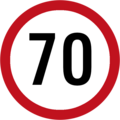
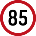
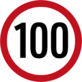
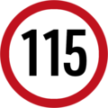
All speed limits in Mercury are given in kilometres per hour. The national speed limit is 130km/h.
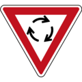
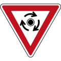
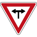
Give way advance warnings
There are several signs that provide advance warning of an upcoming "Give Way" order.
Warnings
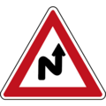
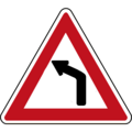
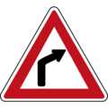
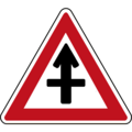
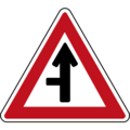
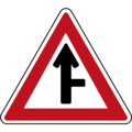
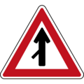
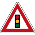
Signs giving warnings are predominantly triangular in shape with a red border and black features. The two exceptions to this are the "Level Crossing" warning sign and the "Priority, Take Care" sign. The latter is used at junctions where vehicles are not instructed to give way to side roads, and advises drivers to be aware of other vehicles entering or crossing the road.
