Sylfystan
From MicrasWiki
Jump to navigationJump to search
| Sylfystan سيلفيستان | |||
| Subah of Çakaristan | |||
| |||
| Subdivision | Subah | ||
| Capital | Šer-Ku-Riž | ||
| Largest cities | |||
| Area | 746,208 km2 | ||
| Population | 12,854,420 | ||
| Subahdar | |||
| Legislature | |||
| Languages | Arboric | ||
| Time Zone | CMT+1:50 | ||
| Driving side | right | ||
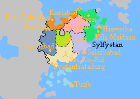
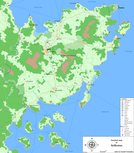
Sylfystan (Arboric: سيلفيستان) is a subah (province) of Çakaristan. Located on a peninsula that separates the Antican Sea and Dyre Straits. The land borders of the subah consist of the Green Border in the west and the national border with the International Mandate for the Settlements in Apollonia. The sarkar Agra is perforated from the subah. Clockwise, the coast is formed by the Antican Sea, Jaris Strait, Herrin Bay, Dyre Straits and Azure Sea.
Chaklas
The chaklas are the districts within the subah. The word "chakla" (Babkhi: چکلہ) means "district".
| Symbol | Chakla | Capital | Map | |
|---|---|---|---|---|
 |
Ardnusur | Merku | 
| |
 |
Faliwrid | Kuriabad | ||
 |
Gevet | Hiawatha | ||
 |
Hasanistan | Šer-Ku-Riž | ||
 |
Kurjek | Shahr | ||
 |
Noganistan | Akyar | ||
 |
Salafulanid | Salafuabad | ||
 |
Tuife | Tuife |
Map
| |||||||||||||||||||||||||||||||||||||||||||||||||||||||||


