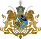
Sikatadesh
From MicrasWiki
Jump to navigationJump to search
| Sikatadesh Rajya सिकतादेशराज्य | |||
| Princely state of Çakaristan | |||
| |||
| Subdivision | Princely state | ||
| Capital | Kalaghar | ||
| Largest cities | Kalaghar | ||
| Area | |||
| Population | |||
| Raja | Amanbir Thahal | ||
| Legislature | |||
| Languages | Adarani | ||
| Time Zone | CMT | ||
| Driving side | {{{drives_on}}} | ||
Sikatadesh, officially the Sikatadesh Rajya (Adarani: सुनेहरा राज्य), is a princely state of Çakaristan, located between the Monalan Parvat (Monlan Mountains) and Saphed Pahade (White Mountain). In the Antican period, the area was part of Mesoun. Later the borders were determined when the area existed as Skiron under Antican flag. After the area reverted to the Green, it became part of Çakaristan as a princely state in 1693 AN.
Etymology
The name " Sikatadesh" is composed of "Sikata" meaning ‘sandy’ and "desh" meaning ‘country’. This is a reference to the desert-like landscape of the area. This is also reflected in the flag of the princely state, which depicts the sand dunes with a dromedary, a common animal in the area.
