This article collects maps of Whales.

Note distortion in the left marginal
Blank version of above, i.e. no labels of placenames. Note distortion in the left marginal

Chur and
Gallen. Adjusted for distortion, 1 pixel = 46 x 46 metres

Berne and
Köniz. Adjusted for distortion, 1 pixel = 46 x 46 metres
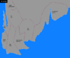
Cape Monovia (except for the far north-west). Adjusted for distortion, 1 pixel = 42 x 42 metres

Northern part of Cape Monovia (
Sitten and
Uster). Adjusted for distortion, 1 pixel = 44 x 44 metres

. Asara Eliana and Volksburg. Blank unlabelled map. Adjusted for distortion, 1 pixel = 43 x 43 metres

. Asara Eliana and Volksburg. Lordships are labelled. Adjusted for distortion, 1 pixel = 43 x 43 metres


.png)


