File:SCMAP.png
From MicrasWiki
Jump to navigationJump to search

Size of this preview: 600 × 599 pixels. Other resolution: 798 × 797 pixels.
Original file (798 × 797 pixels, file size: 70 KB, MIME type: image/png)
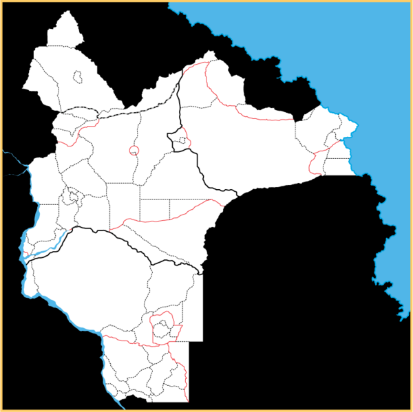
Border Key-
Black solid: state
Black and grey: federated territory
Red: semi-autonomous territory
Black dotted: administrative division
File history
Click on a date/time to view the file as it appeared at that time.
| Date/Time | Thumbnail | Dimensions | User | Comment | |
|---|---|---|---|---|---|
| current | 04:45, 19 February 2020 |  | 798 × 797 (70 KB) | Ryker (talk | contribs) | Okay. Now I really do need to count them again |
| 00:19, 17 August 2019 |  | 796 × 793 (70 KB) | Ryker (talk | contribs) | ||
| 00:17, 17 August 2019 |  | 796 × 793 (70 KB) | Ryker (talk | contribs) | A tweak here and there. Should probably recount the divisions sometime | |
| 02:46, 2 August 2019 |  | 798 × 797 (67 KB) | Ryker (talk | contribs) | Holwinn's feudal lordships are divvied up and regional districts are updated for more representative elections and governance. | |
| 22:38, 2 July 2019 |  | 798 × 797 (62 KB) | Ryker (talk | contribs) |
You cannot overwrite this file.
File usage
There are no pages that use this file.