Uncategorized files
From MicrasWiki
Jump to navigationJump to search
Showing below up to 50 results in range #10,151 to #10,200.
-
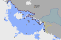 Map Zygus Qamil.png 839 × 550; 73 KB
-
 Map alrig 1667.png 173 × 90; 3 KB
-
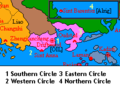 Map alrig 1679.png 229 × 164; 6 KB
-
 Map brookshire.png 615 × 442; 22 KB
-
 Map cabbagefall.png 1,000 × 800; 47 KB
-
 Map criscos.png 146 × 94; 3 KB
-
 Map district V.png 1,000 × 800; 47 KB
-
 Map gong federation.png 131 × 94; 2 KB
-
 Map imperialautobahn.png 793 × 532; 53 KB
-
 Map inner city.png 1,000 × 800; 43 KB
-
 Map members MTO.png 1,000 × 504; 291 KB
-
 Map of Burkland (Micras).png 788 × 512; 14 KB
-
 Map of Celebarad.png 332 × 280; 5 KB
-
 Map of Davignon.png 4,000 × 3,000; 5.4 MB
-
 Map of Davignon draft.png 4,000 × 3,000; 556 KB
-
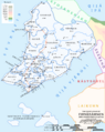 Map of Firnerámnen.png 2,393 × 3,010; 1.31 MB
-
 Map of Gran Islilla.png 300 × 250; 4 KB
-
 Map of Gran Verionia.png 4,992 × 4,144; 413 KB
-
 Map of Hazar.png 4,000 × 3,136; 92 KB
-
 Map of Hergilsey.png 98 × 56; 1 KB
-
 Map of Iselande.png 236 × 76; 3 KB
-
 Map of Krasnarus.png 295 × 308; 13 KB
-
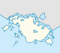 Map of Kunapura.png 1,469 × 1,293; 91 KB
-
 Map of Leylstadt.png 2,836 × 2,905; 1.86 MB
-
 Map of Liman.png 94 × 57; 2 KB
-
 Map of Meckelnburgh.png 174 × 111; 3 KB
-
 Map of Mercury.png 597 × 580; 58 KB
-
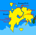 Map of Pacary.png 258 × 246; 7 KB
-
 Map of Plazas de Irian.png 2,500 × 1,678; 152 KB
-
 Map of Salem.png 95 × 44; 771 bytes
-
 Map of Sanpantul 2026 (proposed).svg 757 × 559; 465 KB
-
 Map of Sanpantul Empire 2.png 800 × 1,073; 86 KB
-
 Map of Takatui.png 2,400 × 2,400; 2 KB
-
 Map of Tarsica.gif 900 × 500; 13 KB
-
 Map of Thracistan.png 183 × 151; 7 KB
-
 Map of Victoria.png 681 × 585; 23 KB
-
 Map of kasterburg.png 400 × 331; 73 KB
-
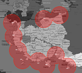 Map of missile reach.png 724 × 644; 89 KB
-
 Map of the Federal Special Capital Territory (no subdivisions).png 6,819 × 5,844; 1.72 MB
-
 Map of the Federal Special Capital Territory 07-2022 (no subdivisions).png 6,819 × 5,844; 1.88 MB
-
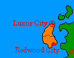 Map of the Lurk Federation.png 107 × 84; 2 KB
-
 Map of the South Sea Islands.png 754 × 809; 93 KB
-
 Map of the Southern Kōkai Railways networks.svg 5,872 × 6,656; 6.32 MB
-
 Map of the Tromelin Atoll with reclaimed areas.png 4,614 × 2,426; 800 KB
-
 Map of the linguistic regions in Oriental Hispanioéire Taemhwan (10-2022).png 6,500 × 4,375; 1.01 MB
-
 Map of the linguistic regions in Oriental Hispanioéire Taemhwan (prior 2019).png 6,000 × 4,038; 946 KB
-
 Map of the most commonly used home language in ROHS.png 3,000 × 1,788; 712 KB
-
 Map of victoria.png 680 × 520; 31 KB
-
 Map of victoria old.png 680 × 520; 29 KB
-
 Map raynors keep.png 1,000 × 800; 47 KB