Federal Survey and Mapping Bureau (Sanama): Difference between revisions
From MicrasWiki
Jump to navigationJump to search
No edit summary |
|||
| Line 43: | Line 43: | ||
<gallery> | <gallery> | ||
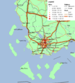
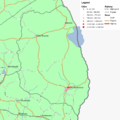
File:Population_density_Sanama.png|Population per km<sup>2</sup>, per canton. 1703. | File:Population_density_Sanama.png|Population per km<sup>2</sup>, per canton. 1703. | ||
File:Population growth Sanama.png|Population growth 1680–1703. | |||
</gallery> | </gallery> | ||
Revision as of 18:56, 10 January 2022
The Federal Survey and Mapping Bureau (Sanama) is the Sanaman national agency responsible for surveys, geology and mapping.

