Federal Survey and Mapping Bureau (Sanama): Difference between revisions
From MicrasWiki
Jump to navigationJump to search
Created page with "{{Sanama Article}} The '''{{PAGENAME}}''' is the Sanaman federal agency responsible for surveys and mapping. == Map repository == <gallery> File:CIS_detail.png File:WAM_d..." |
No edit summary |
||
| Line 4: | Line 4: | ||
== Map repository == | == Map repository == | ||
<gallery> | <gallery> | ||
File: | File:CSA_detail.png|Central Sanilla | ||
File: | File:CIS_detail.png|Cisamarra | ||
File: | File:EAM_detail.png|Eastern Amarra | ||
File: | File:ESA_detail.png|Eastern Sanilla | ||
File: | File:FS_detail.png|Fatehpur Sikri | ||
File: | File:HP_detail.png|Highpass | ||
File: | File:Niyi_detail.png|Niyi | ||
File: | File:THA_detail.png|Thanatos | ||
File: | File:WAM_detail.png|Western Amarra | ||
File: | File:WSA_detail.png|Western Sanilla | ||
File:WSH_detail.png | File:WSH_detail.png|Western Shimmerspring | ||
</gallery> | </gallery> | ||
Revision as of 21:12, 2 July 2020
The Federal Survey and Mapping Bureau (Sanama) is the Sanaman federal agency responsible for surveys and mapping.
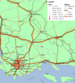
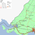
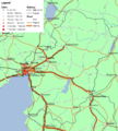
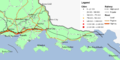
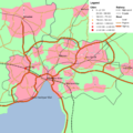
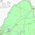
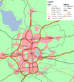
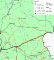
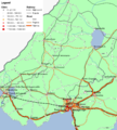
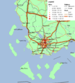
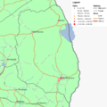
Map repository
-
 Central Sanilla
 -
 Cisamarra
 -
 Eastern Amarra
 -
 Eastern Sanilla
 -
 Fatehpur Sikri
 -
 Highpass
 -
 Niyi
Niyi -
 Thanatos
 -
 Western Amarra
 -
 Western Sanilla
 -
 Western Shimmerspring


