Federal Survey and Mapping Bureau (Sanama): Difference between revisions
From MicrasWiki
Jump to navigationJump to search
No edit summary |
|||
| (One intermediate revision by the same user not shown) | |||
| Line 45: | Line 45: | ||
File:Population growth Sanama.png|Population growth 1680–1703. | File:Population growth Sanama.png|Population growth 1680–1703. | ||
File:Million cantons Sanama.png|Cantons with a million inhabitants, 1680 and 1703. | File:Million cantons Sanama.png|Cantons with a million inhabitants, 1680 and 1703. | ||
File:Dotdensitysnm.png|Dot density map, 100k population per dot, 1703. | |||
</gallery> | |||
=== Electoral maps === | |||
<gallery> | |||
File:SNM 1707 elections.png|Election results per constituency, 1707. | |||
</gallery> | </gallery> | ||
Latest revision as of 12:34, 25 June 2022
The Federal Survey and Mapping Bureau is the Sanaman national agency responsible for surveys, geology and mapping.
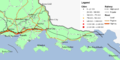
Map repository
National maps
-
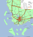
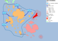
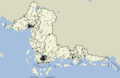
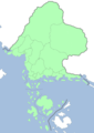 Overview

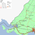
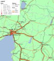
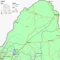
Regional maps
-
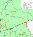
 Central Sanilla
 -
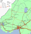
 Cisamarra
 -
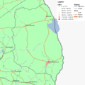
 Eastern Amarra
 -
 Eastern Sanilla
 -
 Fatehpur Sikri
 -
 Highpass
 -
 Niyi
Niyi -
 Thanatos
 -
 Western Amarra
 -
 Western Sanilla
 -
 Western Shimmerspring


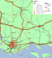
Military maps
-
 Sanaman intervention in So Sara, initial movements

Language maps
-
 Sanaman per province
 -
 Istvanistani per province
 -
 Cisamarrese per province
 -
 Yardistani per province
 -
 Babkhi per province
 -
 Laqi per province
 -
 Praeta per province
 -
 Passikaans per province


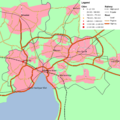
Demographical maps
-
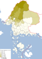
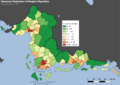 Population per km2, per canton. 1703.
 -
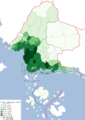
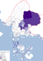
 Population growth 1680–1703.
 -
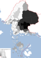
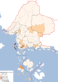
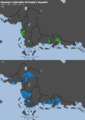 Cantons with a million inhabitants, 1680 and 1703.
 -
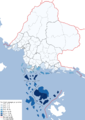
 Dot density map, 100k population per dot, 1703.


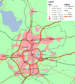
Electoral maps
-
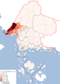
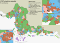 Election results per constituency, 1707.
